
East Canada Offshore
Nova Scotia Offshore
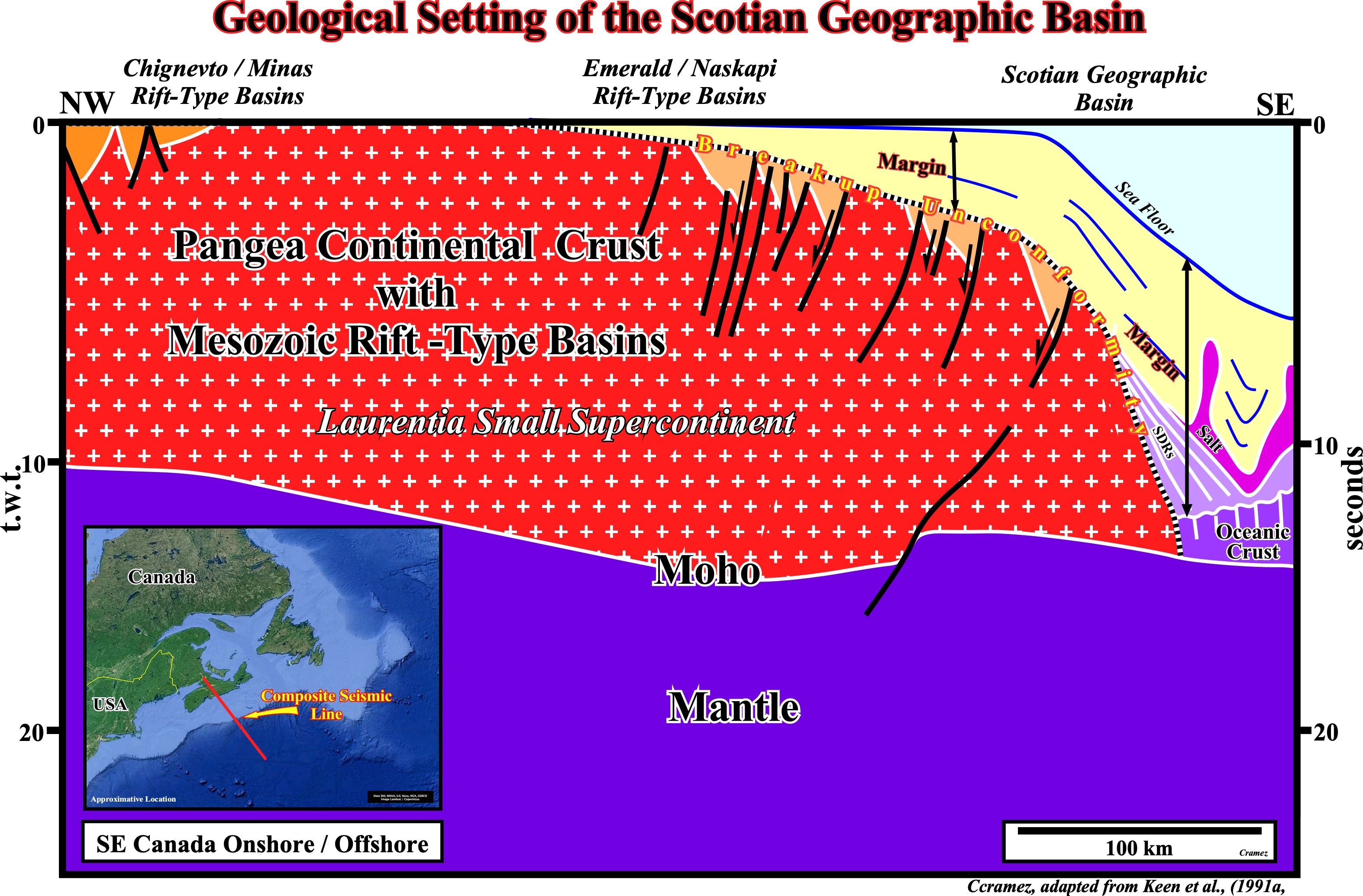
This tentative interpretation of a composite seismic line (see location map), widely changed from the one proposed in https://www.ldeo.columbia.edu/~polsen/ nbcp/basinevolution.html, illustrates the geological setting of the Scotian geographic basin, i.e., of the Nova Scotia Atlantic-type divergent margin, which developed after the breakup of the Pangea supercontinent (North America was continuous with Africa, South America, and Europe). Triassic rift-type basins formed and filled during the lengthening of the Pangea lithosphere, precedes its breakdown. They are well visible under the breakup unconformity as illustrated above. During the Jurassic, the final break between the plates of North America, Africa and Baltica occurred many kilometers to the east of today's coastline at what is now the Mid-Atlantic Ridge. The Atlantic-type divergent margin seems to be formed by two different lithological unities particularly nearby the breakup zone. The lower unity is volcanic and composed, mainly, by sub-aerial lava-flows (SDRs). The upper unity, which can overlie either the basement (in the proximal area of the margin), the lower unity (near the breakup zone) or the oceanic crust (near the distal part of the margin), is clastic and formed of the accretion of sedimentary intervals. In the clastic unity, which often known as post-Pangea continental encroachment stratigraphic cycle, two stratigraphic phases can be recognized taking into account their internal configuration: (i) Transgressive interval with a predominant retrogradational geometry and with a level of salt is deposited at the base, and (ii) Regressive interval characterized by a progradational geometry. The top of the transgressive phase is marked by a diachronic condensation stratigraphic surface, while the base of the regressive phase corresponds to major downlap surface.
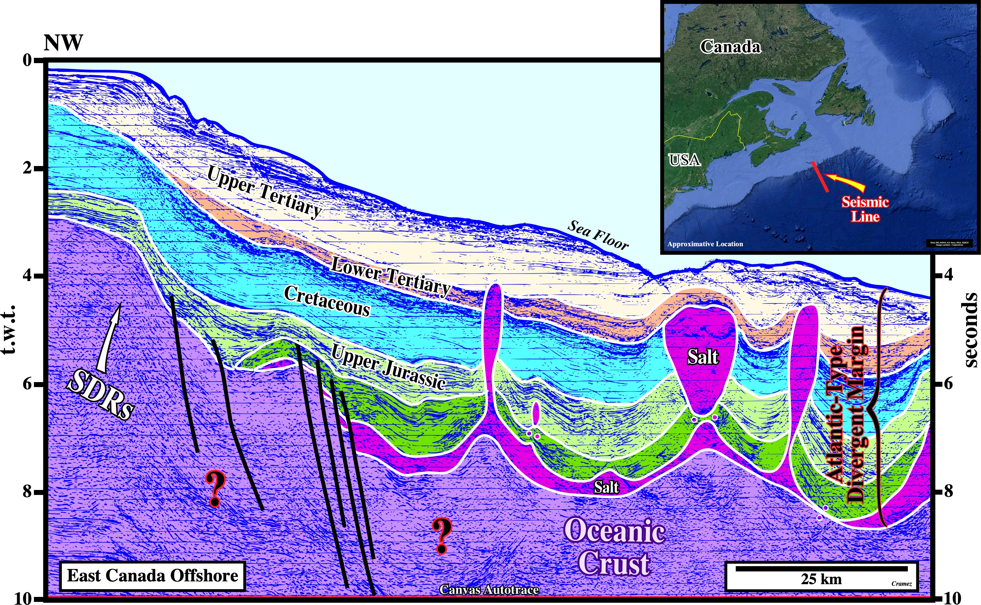
The main characteristic of the Nova Scotia offshore is the presence of a salt layer at the base of the Atlantic-type divergent margin as suggested on this tentative geological interpretation of Canvas autotrace of a dip seismic line of this offshore. In spite of the mediocre quality of the seismic data, the presence of a volcanic sub-aerial crust, i.e. , lava-flows (SDRs), in the left part of the autotrace at the base of the margin, and the oceanic crust below the salt layer is possible. The transition from the SDRs, associated with sub-aerial expansion centers, to the oceanic crust, associated with submerged expansion centers is, here, difficult to recognize. The halokinesis (kind of salt tectonics in which the salt flow is just due to its buoyancy, i.e., due to the release of the potential energy of gravity) is paramount. It seems induced by the lateral and vertical flow of evaporite levels in the absence of any significant compressional tectonic regime. In fact, primary and secondary (vertical) salt welds are frequent. The primary salt welds detach portions of the autochthonous salt and the secondary or vertical salt welds isolate allochthonous salt bodies as illustrated on this tentative interpretation. This intense halokinesis mask a lot the data not only below the salt layer but also between the allochthonous salt bodies as illustrated on the next autotrace.
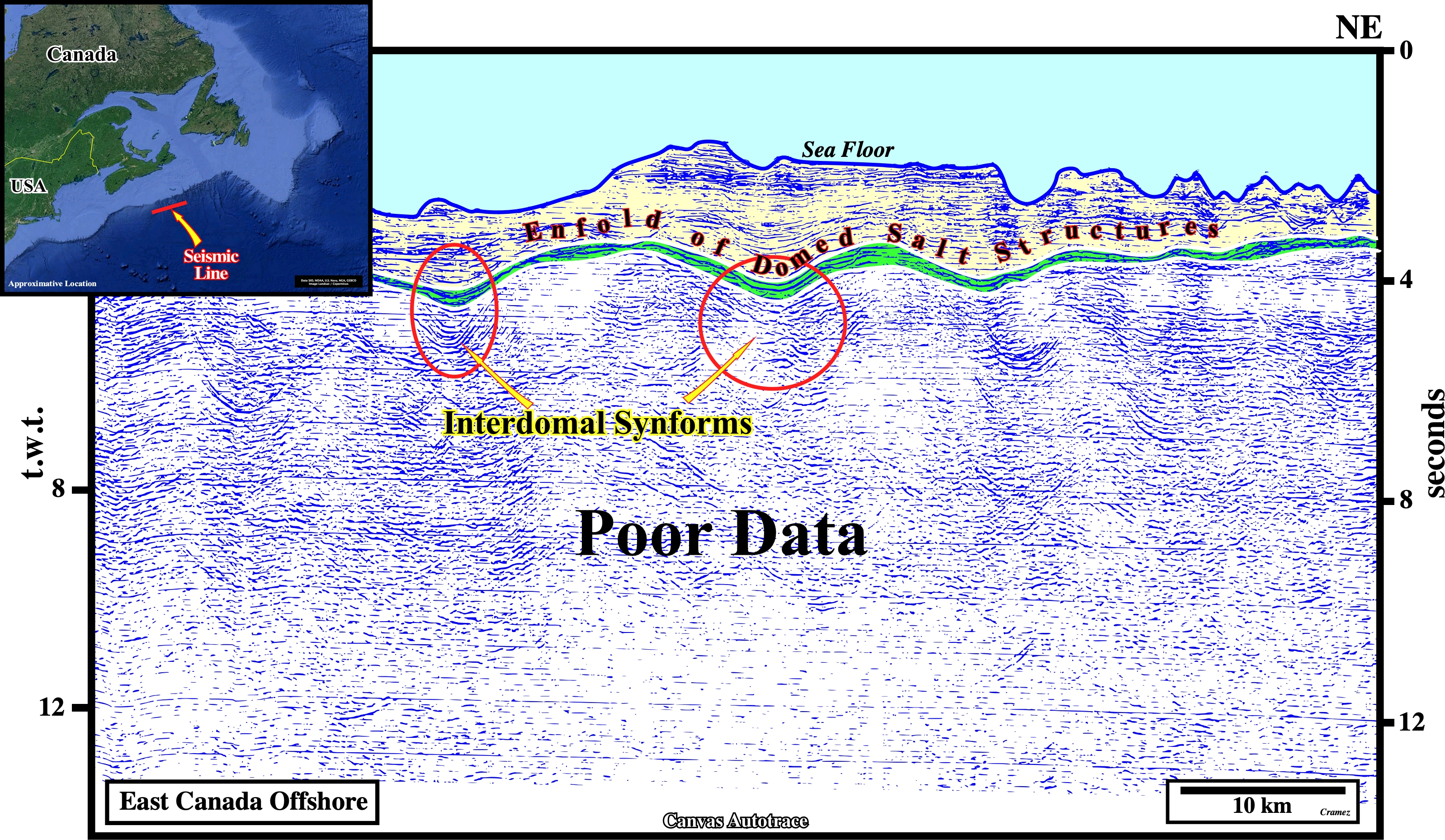
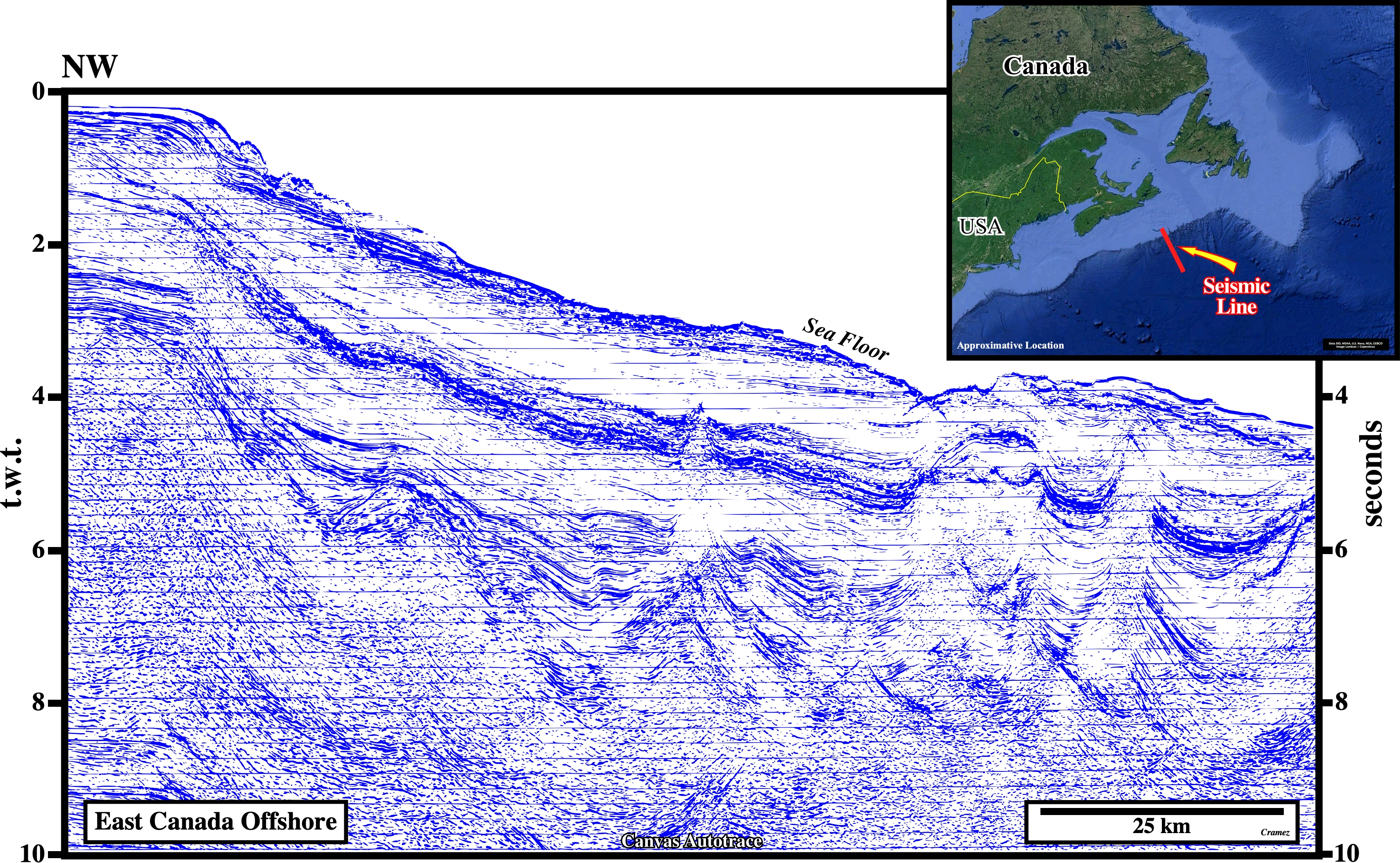
As depicted on this Canvas autotrace of a strike seismic line (shot along by the continental slope) of Nova Scotia offshore, just the data above the discontinuous allochthonous salt bodies, connect or not with the mother salt layer (autochthonous salt), can be interpreted in geological terms. In other words, not only the data below the autochthonous salt, but the interdomal areas, i.e., the area between the allochthonous salt bodies as well, can be correctly interpreted in geological terms. Just some synforms (concave structures, similar to synclines, in which the layers plunge towards the center, but induced by a regional or local extensional tectonic regime), between the domed salt structures, can be detected but not mapped.

![]()
![]()
Send E-mails to carlos.cramez@bluewin.ch with comments and suggestions to improve this atlas.
Copyright © 2001 CCramez
Last update:
2022
![]()