
NE Greenland Offshore
Trail Oer Area Offshore
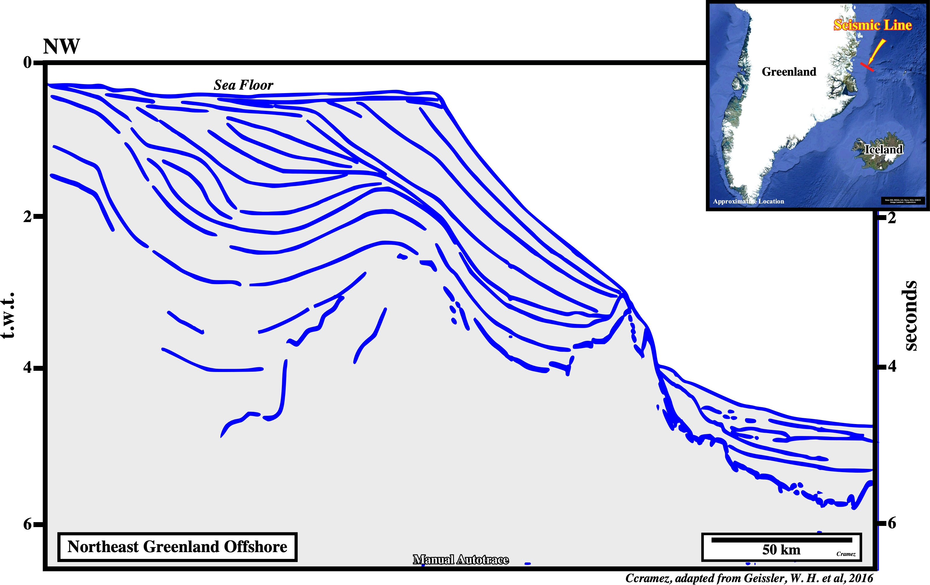
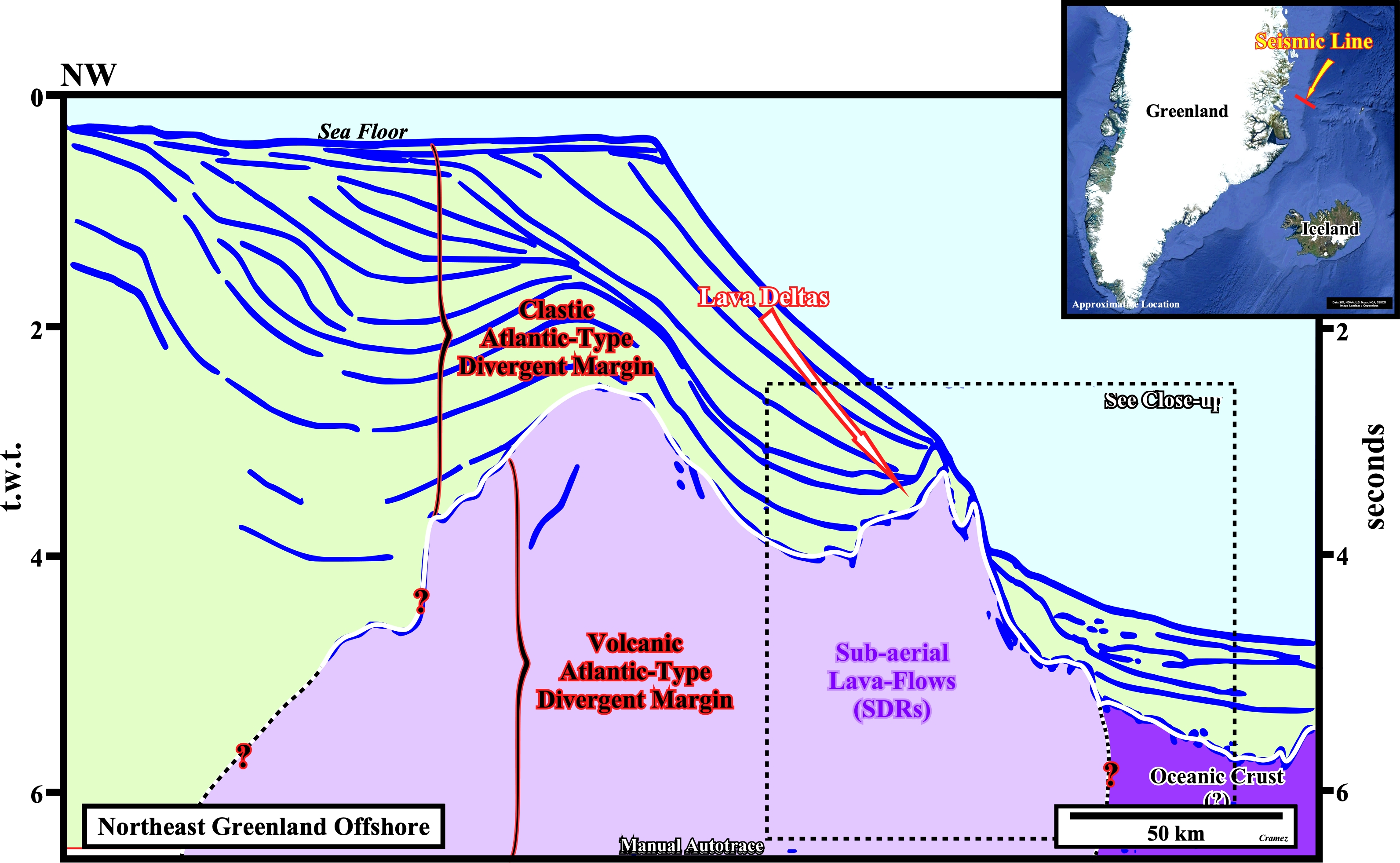
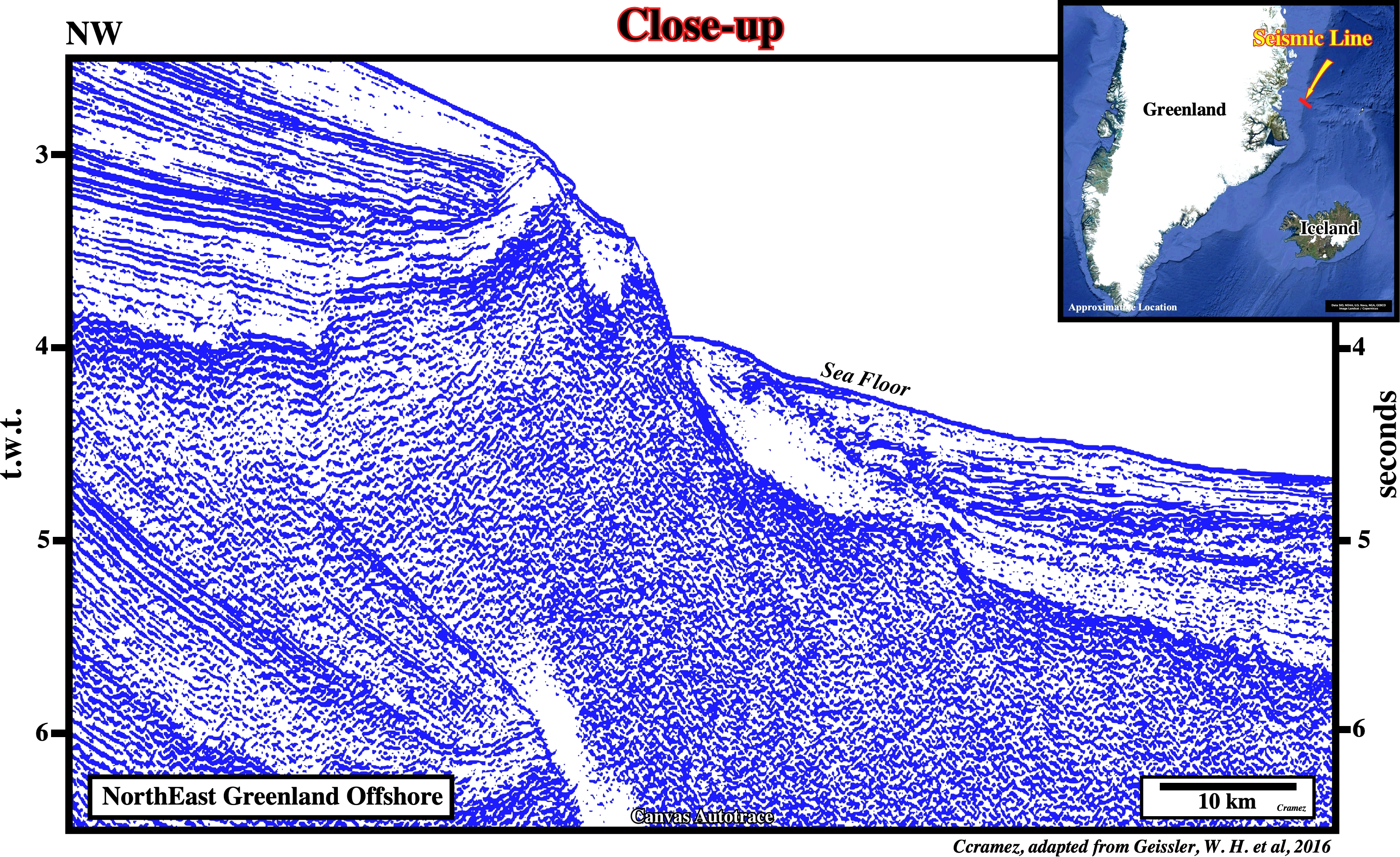
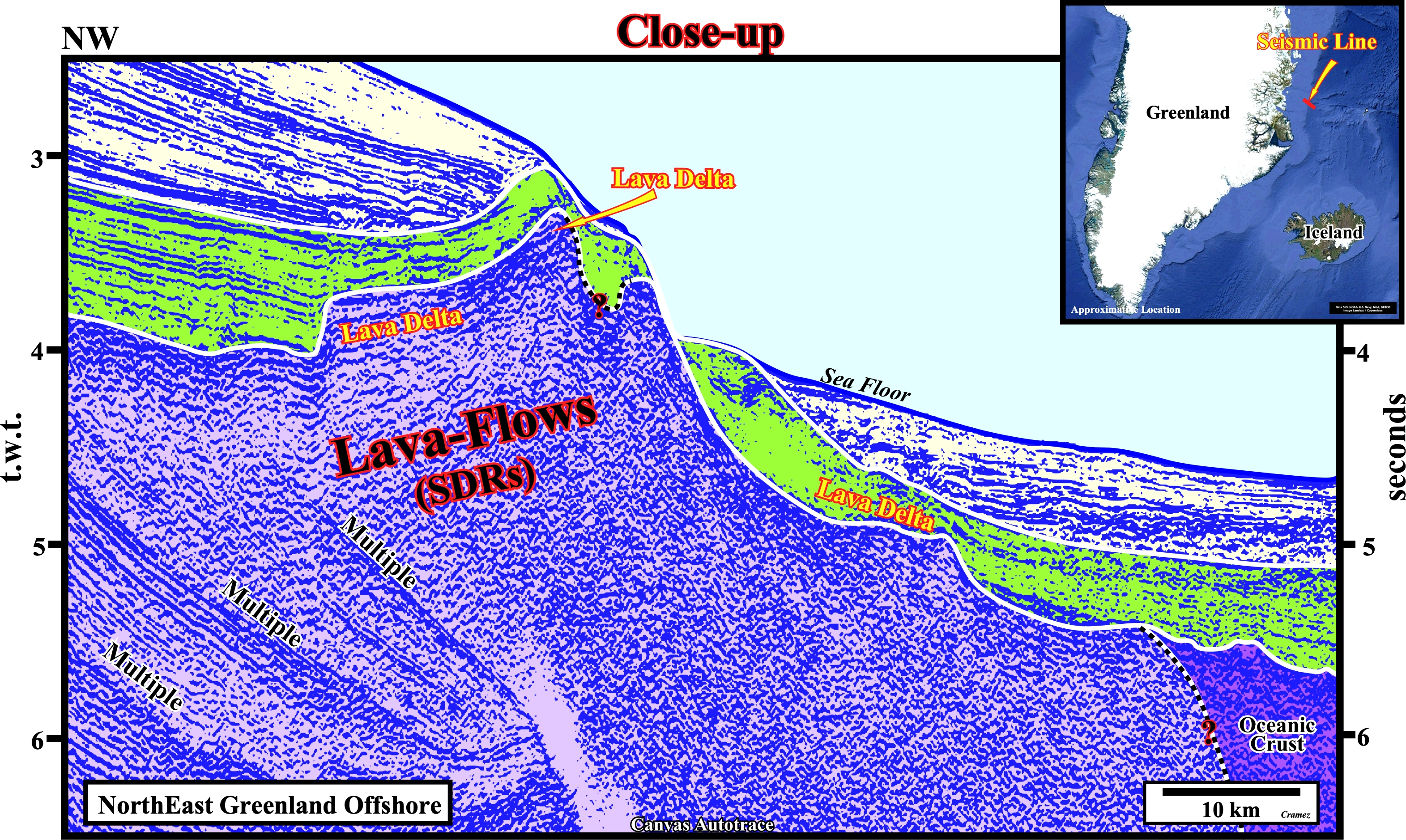
On these tentative interpretations of the autotraces of a seismic line shot in NE Greenland offshore not far from the Oer trail area, the first thing to take into account is not only the seismic pitfall induced by the abrupt change in the water depth, which modifies a lot the geometry of seismic markers horizons, but the presence of a lot of multiples in the western part of the autotrace, as well. This apart, the lower limit of the clastic Atlantic-type divergent margin can be, accurately, picked. However, the limit between the lavas-flows and the oceanic crust is arguable. On the contrary, the evidence of lava deltas along the interface between the volcanic and clastic subdivision of the Atlantic-type divergent margin is easily perceived. Remember that a lava delta is a volcanic formation formed when a lava-flow enters a body of water. In fact, the thermal shock caused between the lava and the water causes its cooling, fragmentation and deposition, more or less, in situ. Lava deltas can have a sharp progradational geometry similar the that of river deltas or a vertical stacking geometry, what is, often, interpreted, erroneously, as a fault.

![]()
![]()
Send E-mails to carlos.cramez@bluewin.ch with comments and suggestions to improve this atlas.
Copyright © 2001 CCramez
Last update:
2022
![]()