
A26- Denmark Offshore (SE Greenland Offshore):
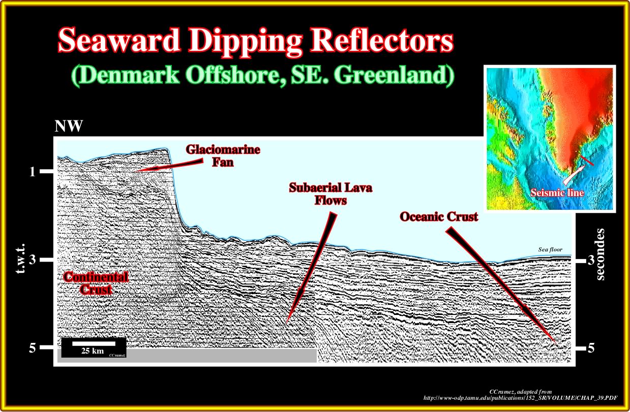
Plate A26.01- In eastern Greenland, the SDRs are known since long time. In 1988, Larsen and Jakoksdottir published this seismic line, in which subaerial lava flows are quite evident as well as the limit with the oceanic crust. The sedimentary interval posterior to the SU unconformity is too thin to develop a generating petroleum sub-system, that is to say, mature source rocks.
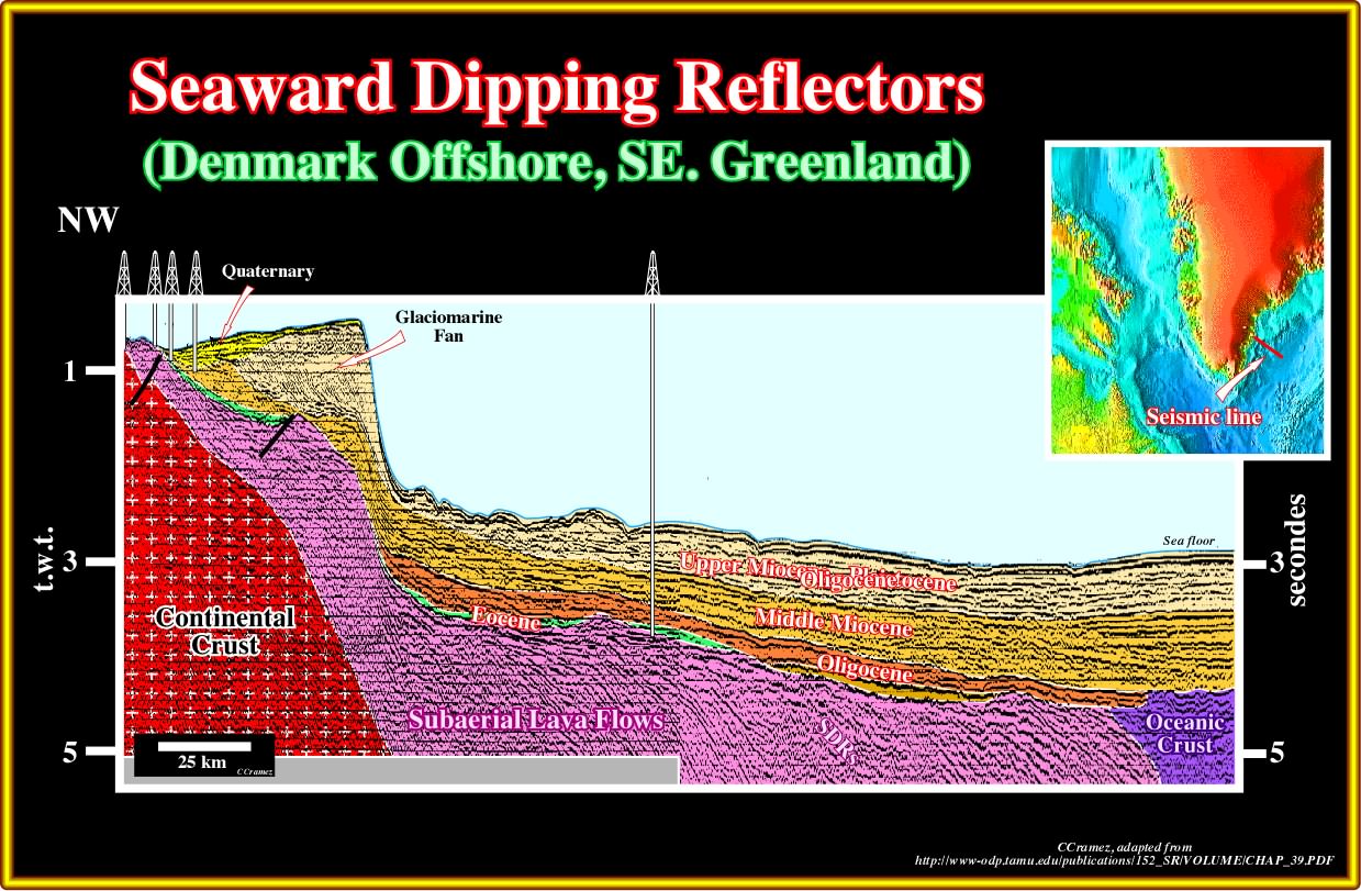
Plate A26.02- In this tentative interpretation of the previous line, it is to recognize the SDRs and, in the eastern end of line the oceanic crust. Notice that the wells drilled westward of the Quaternary glaciomarine fan corroborate the volcanic facies of the SDRs.
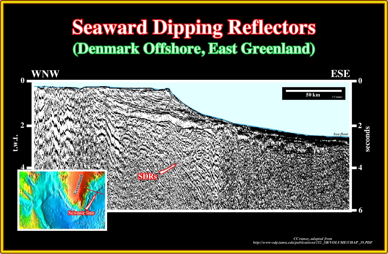
Plate A26.03- On this seismic line, located northward of the previous one, similarly the subaerial lava flows and the oceanic crust are recognized readily below the margin sediments, as illustrated in the tentative interpretation below.
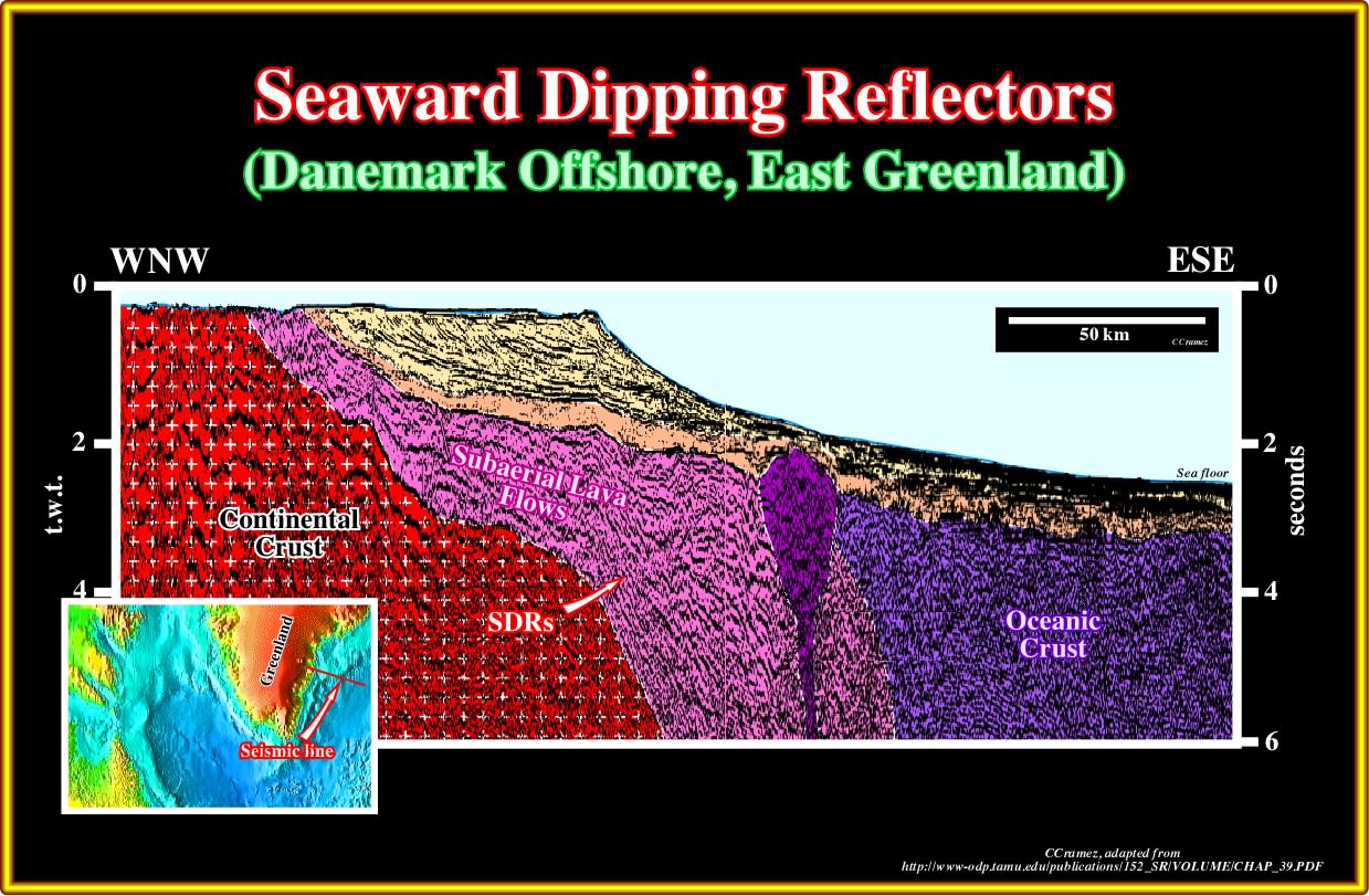
Plate A26.04- On this tentative interpretation, the geometry of the SDRs is quite typical, as well as the top morphology of the oceanic crust. A submarine volcanic plug crossing the SDRs is well seen near the limit SDRs-Oceanic crust. Take note that seeing is not necessary proving. In seismic interpretation, seeing is not just a process of passively receiving sensory data. All philosophers of science agree that seeing is a much more complex process of receiving, selecting and categorizing information. In other words, we see a volcanic plug because we are, probably, influenced by our cultural and educational conditioning. In fact, we see with our brains and when a geoscientist look at a seismic line what he see is an internal representation of the world and not all geoscientists see the same thing.
A27- Norway Offshore (Lofotens Offshore):
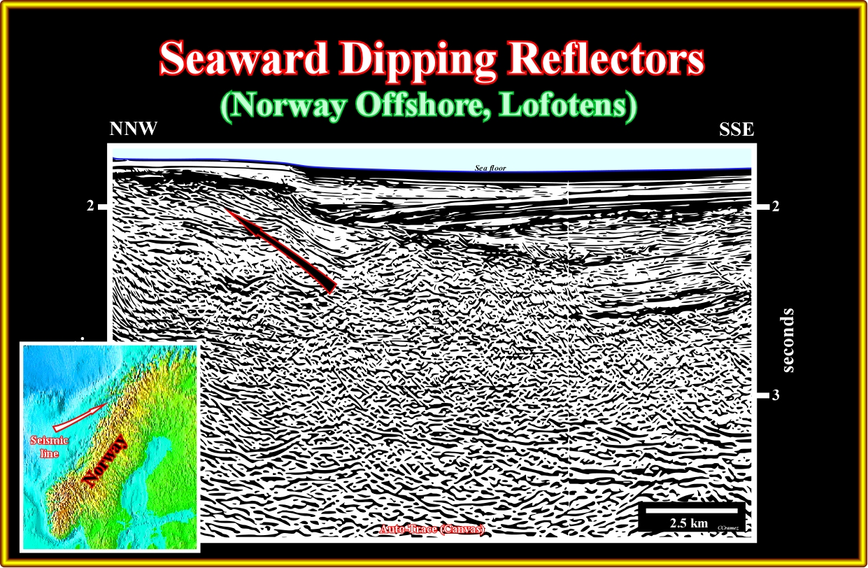
Plate A27.01- On this seismic line the subaerial lava flows eastward toward a standing body of water. Entering in the water they froze building-up a lava-delta. In fact, the lava cools and breaks up as it encounters the water, with the resulting fragments filling in the seabed topography such that the subaerial flow moves further offshore, that is to say progrades.
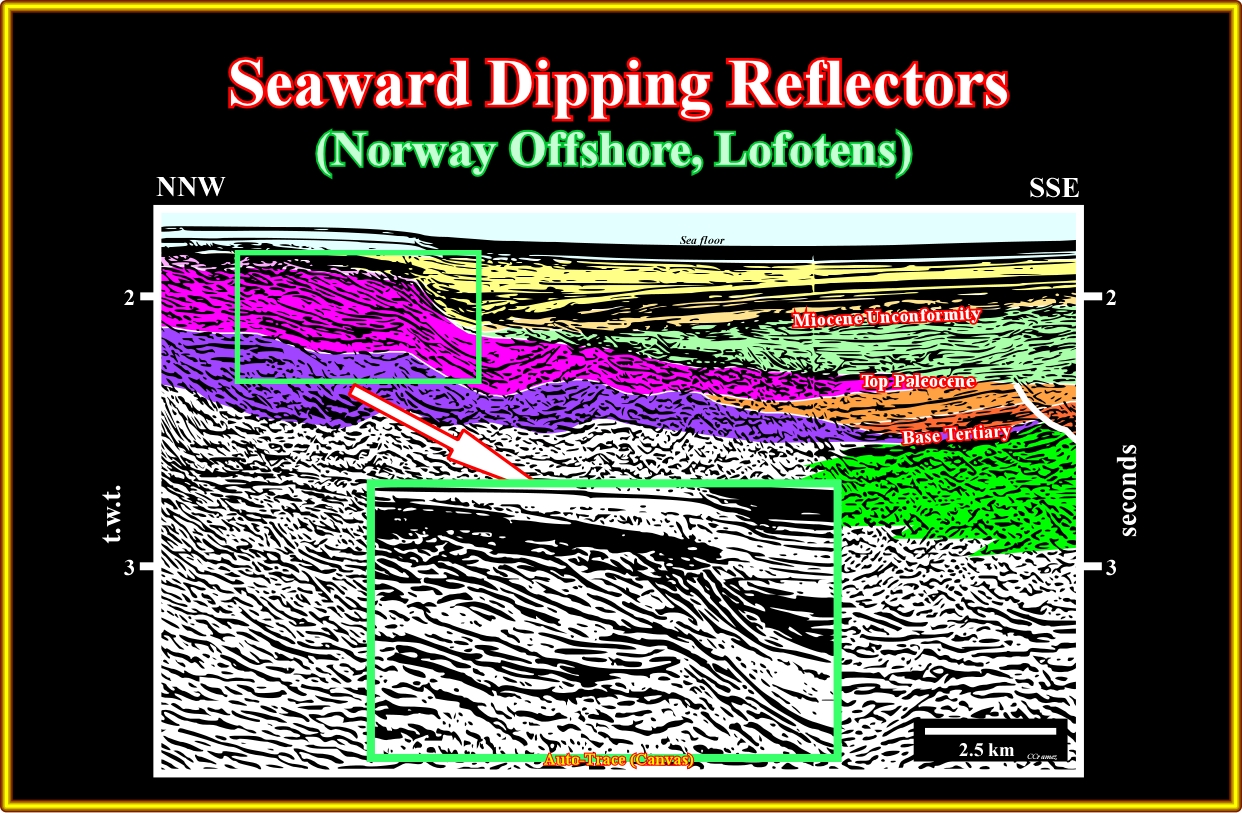
Plate A27.02- In this tentative interpretation of the previous seismic line, it is easy to recognize that the subaerial lava flows prograde into standing water body as a delta progrades into the sea or lake. Certain geoscientists apply the seismic stratigraphic principle to study the lava deltas, in spite of the fact the depositional mechanism is quite different.
A28- Norway Offshore (South Lofotens Offshore):
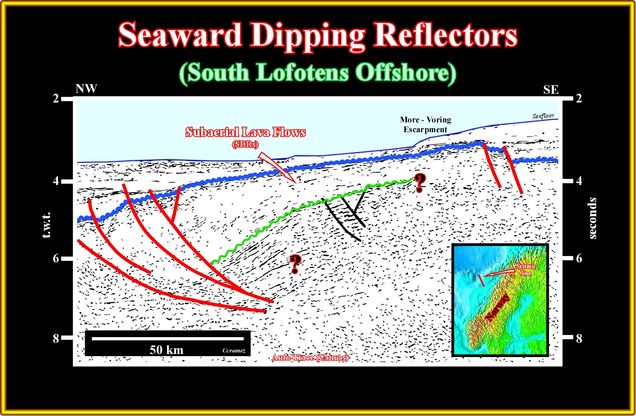
Plate A28.01- As illustrated on this seismic line, seaward of the More-Voring escarpment the SDRs are. They lie above a substratum, which can be a rift-type basin, Paleozoic sediments or Precambrian supracrustal sediments. As depicted, they are affected by a normal faulting dipping landward.
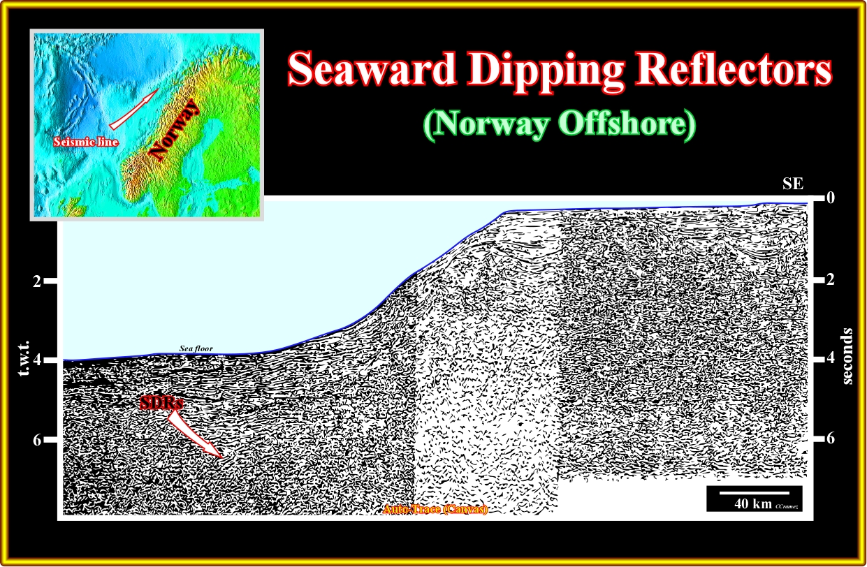
Plate A28.02- In this regional seismic line located southward the previous one, the SDRs are quite obvious on the lower western part of the line. Mesozoic rift-type basin are, also well recognized in the eastern part of line under relative thin margin sediments.
A29- Norway Offshore (Voring Plateau):
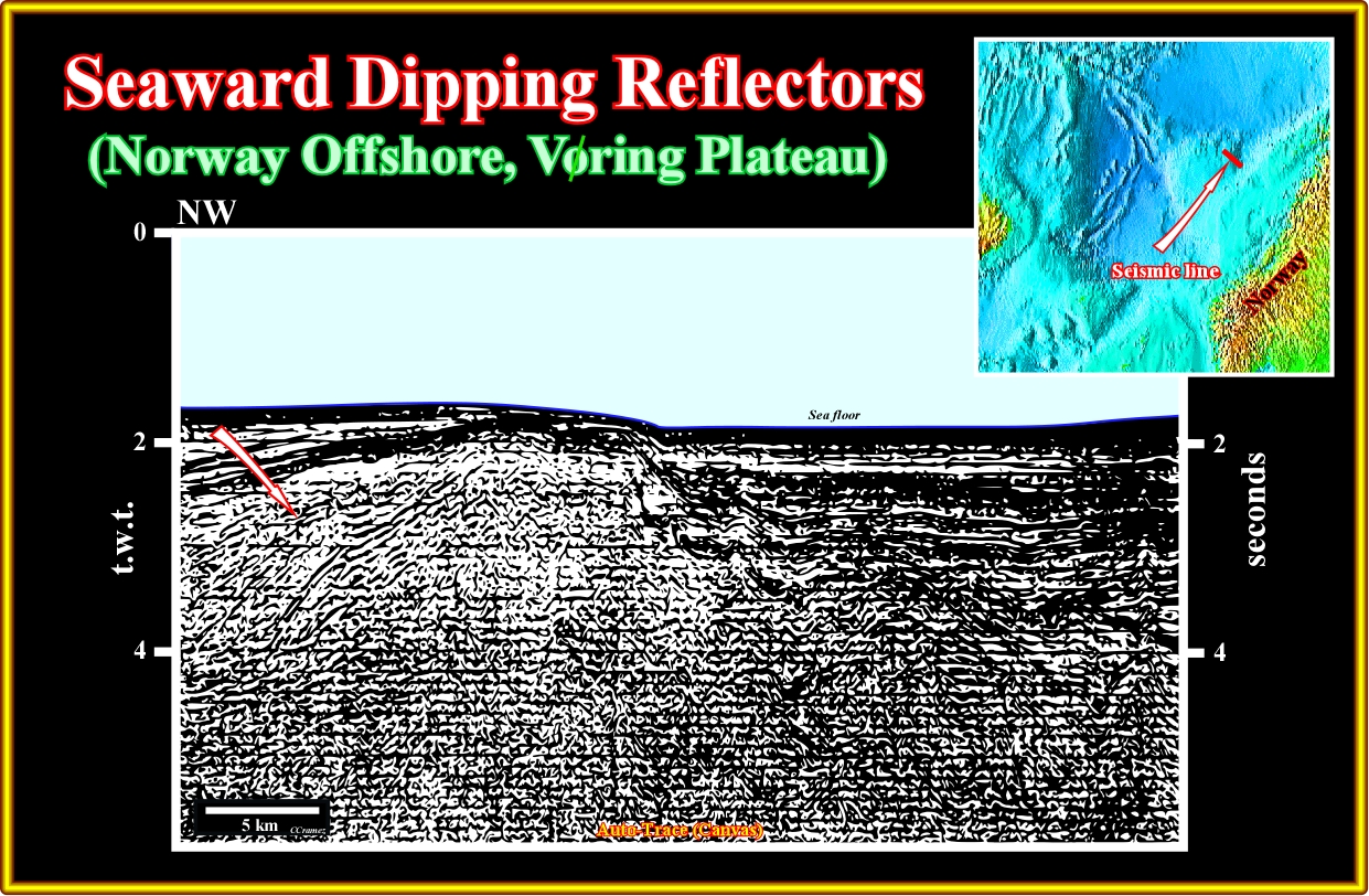
Plate A29.01- On this seismic line, seaward of a basement high, the subaerial lava flows are recognized readily, while landward, a rift-type basin developed during the lengthening of the Pangea lithosphere is obvious. It is interesting to notice that the subaerial lava flows thin toward the continent and cover the distal part of the rift type-basin as depicted in tentative interpretation illustrated in the next plate.
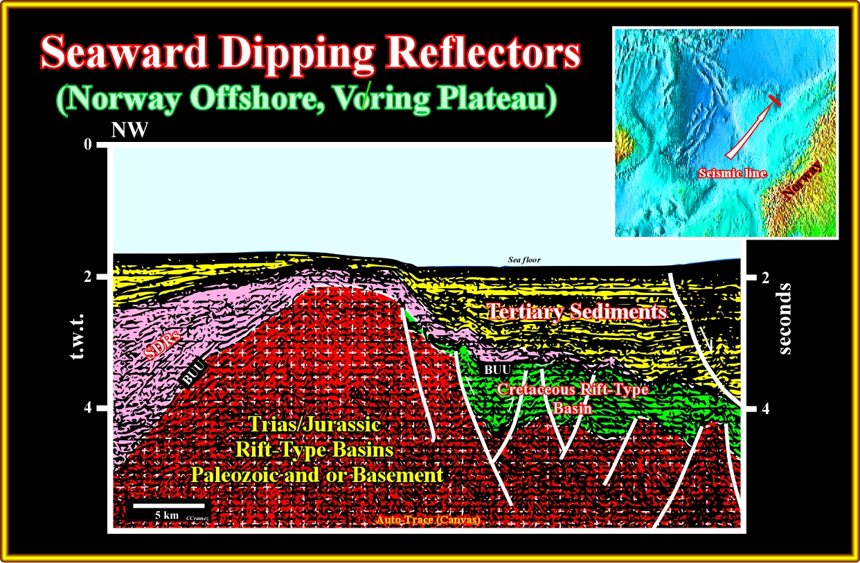
Plate A29.02- On this tentative interpretation of the previous seismic line, the BUU unconformity (breakup unconformity) is easily recognized. This unconformity is marked by the base of the SDRs, in the western and central part of the line and by the top of the rift-type sediments in the eastern part, since the SDRs pinchout (at least seismically speaking). The morphology of the SDRs suggests a compressional tectonic regime, which reactivated the normal faults developed during the lengthening of the Pangea continental crust.
A30- UK Offshore (West Shetlands):
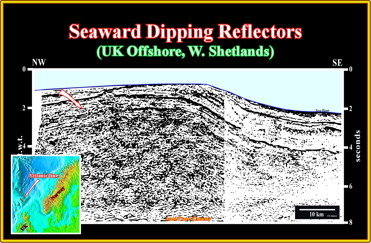
Plate A30.01- On this seismic line, the seaward dipping reflectors thinning landward are easily recognized. Locally, they form lava deltas pro grading landward, which suggest the presence of standing bodies of between the continent and the spreading centres. As in the previous seismic line, the morphology of the SDRs indicates compressional tectonic regime, which shortened not only the SDRS, but one part of the margin sediments.
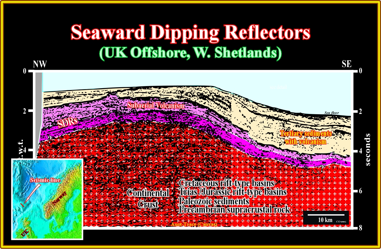
Plate A30.02- This tentative interpretation of the previous seismic line suggests two sequences of seaward dipping reflectors. Several lava-deltas are recognized on the top of the younger sequence. The SDRs overlie a complex substratum formed by Precambrian supracrustal rocks, Paleozoic sediments and Mesozoic rift-type basins. Notice that the there are no evident lava-deltas in the lower sequence of SDRs.
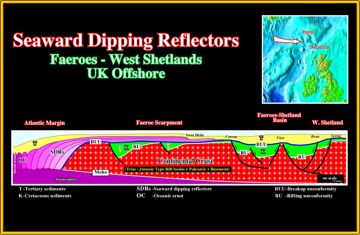
Plate A30.03- This schematic geologic cross-section (based in tentative interpretation of different seismic lines) illustrates the morphology of subaerial lava flows over Mesozoic rift-type before the regional shortening, which take place in this area. Notice the transition between the SDRs and the oceanic crust and the occurrence of lava-deltas near the extremity of the upper SDRs.
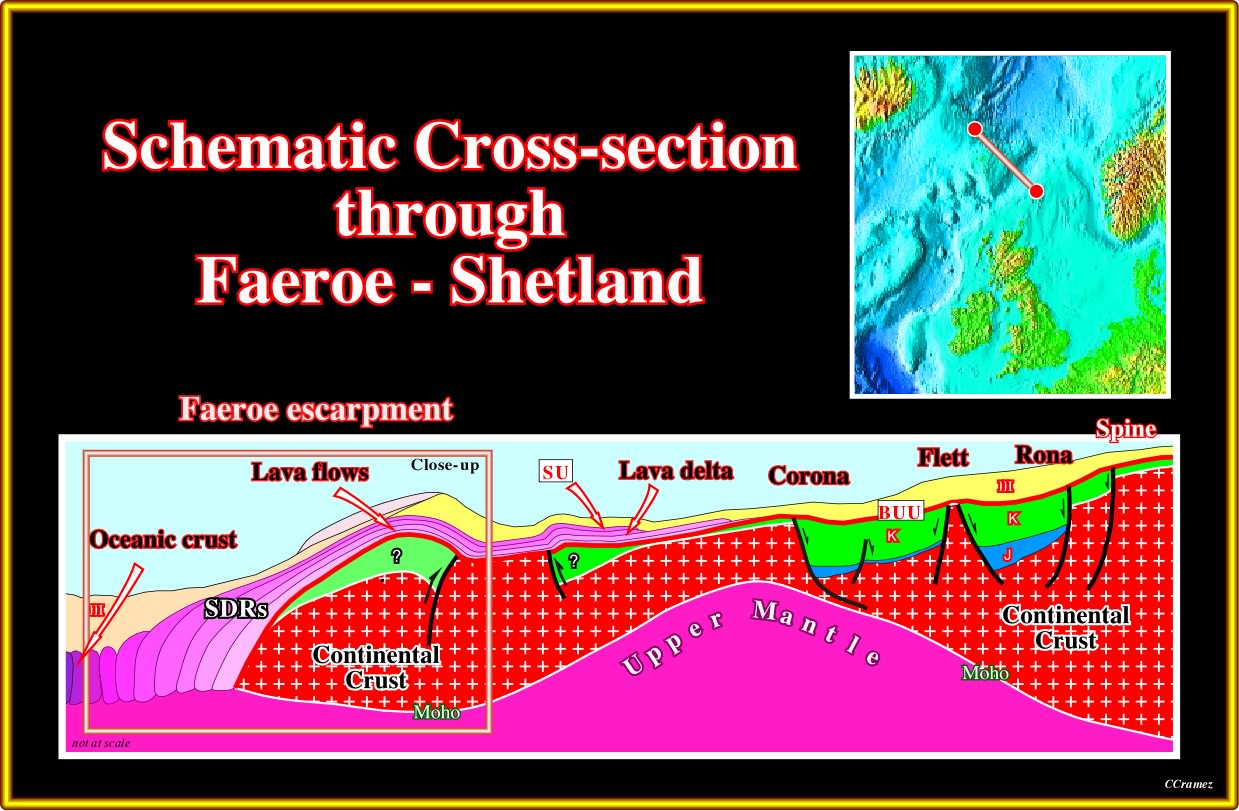
Plate A30.04- In this cross-section of the Faeroe-Shetland offshore (based on seismic lines), the limit between the continental and subaerial (SDRs) crust is well visible, as well as the limit between the subaerial and oceanic crust. Several rift-type basins (some inverted) were recognized in the continental crust, below the breakup unconformity (BUU) and lava deltas are frequent along the SU unconformity (top of the lava-flows). The SDRs are quite shortened (probably in association with the reactivation of the faults bordering the rift-type basin) Let’s see one of the seismic lines in which the western part of this cross-section is based.
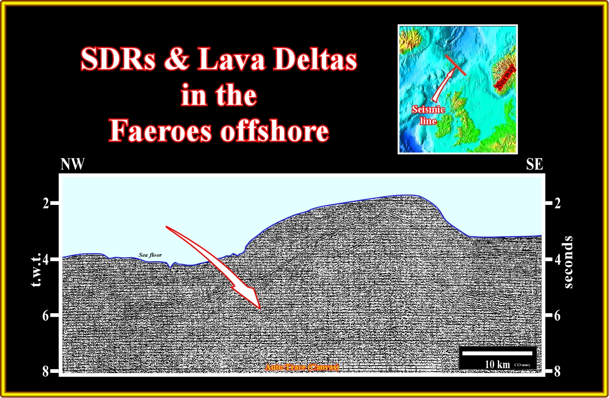
Plate A30.05- This seismic line shows the limit between the oceanic crust and the SDRs on top of which several lava deltas are easily recognized. The shortening of the seaward dipping reflectors is obvious as well as the presence of the several lava deltas. As illustrated in the next plate, the shortening of the SDRs can be associated with the reactivation of the normal faults bordering the rift-type basins. If such a conjecture is not refuted, one can use the anticline structure of the SDRs to put in evidence underlain rift-type basin.
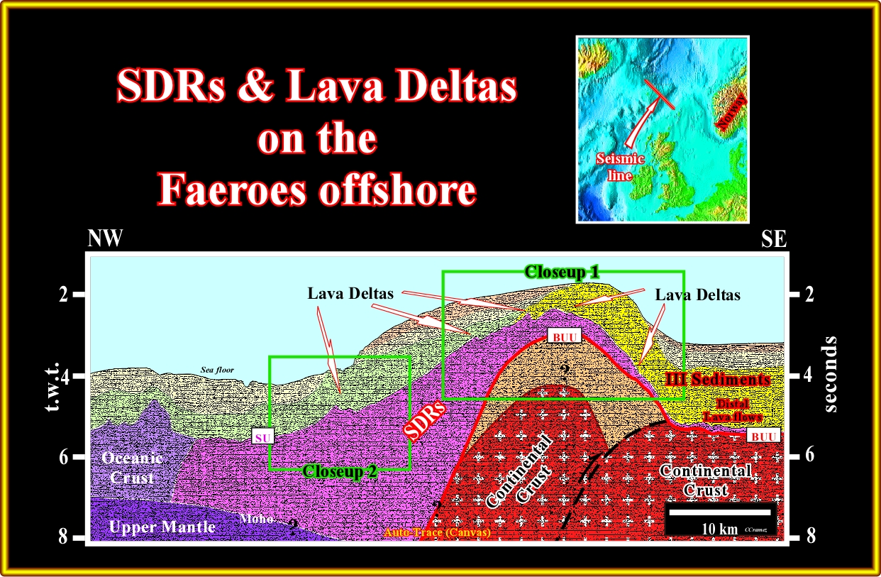
Plate A30.06- On this tentative interpretation of the previous line, the oceanic crust, SDRs, lava-deltas, continental crust and an speculative rift-type basin are rather evident. The close-ups illustrated next are more suggestive.
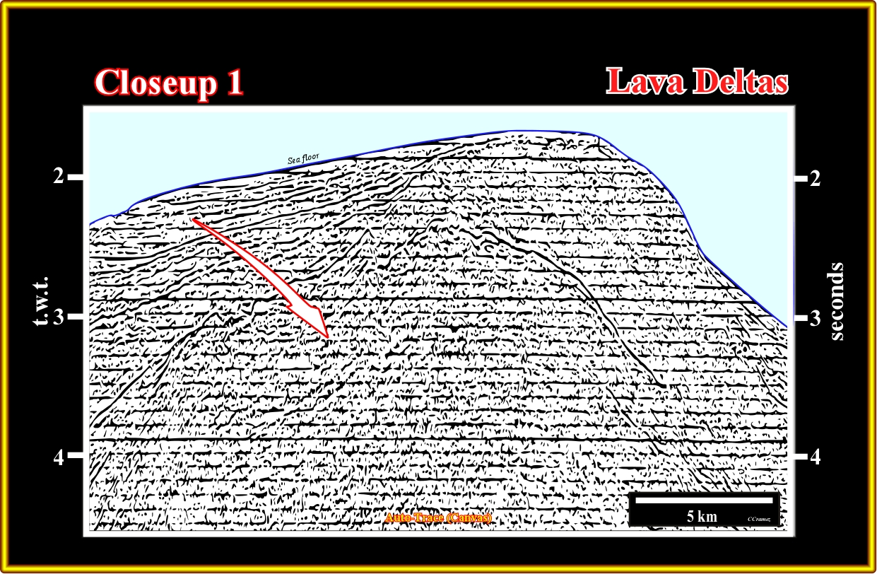
Plate A30.7- Naive inductive seismic interpreters (those refuting that “Theory precedes Observation" never recognise on this seismic line SDRs and lava deltas. However, those knowing the Theory and particularly, the facts that SDRs thick and dip seaward in direction of the associated spreading centres (sheeted dikes) and that volcanic material under water is frozen (cannot flow), easily interpret this line as illustrated next.
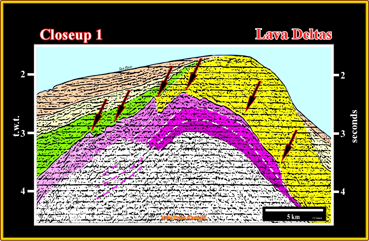
Plate A30.08- In this tentative interpretation the shortening of the SDRs is obvious, as well as the lava-deltas. There is an high probability that under these seaward dipping reflector exist an inverted rift-type basins. The geometry of the SDRs and lava-delta is more characteristic in the close-up 2 the previous seismic line since shortening is less accentuate.
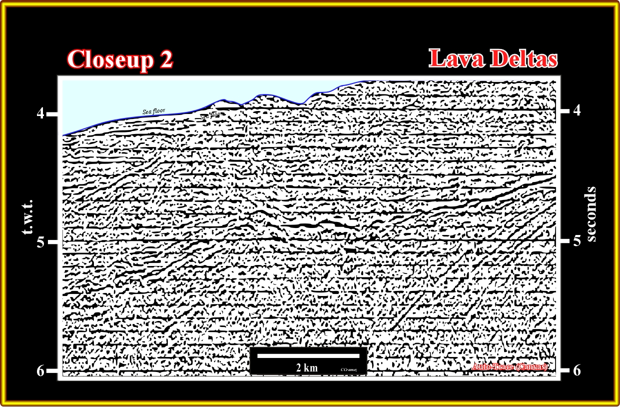
Plate A30.09- The seaward dipping reflectors are obvious on right part of the line, while the lava-deltas (frozen lava flows) are evident in the central part of this line.
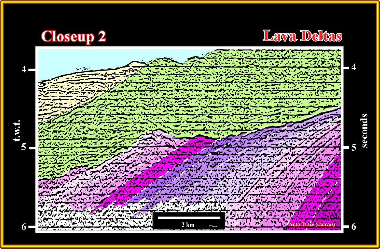
Plate A30.10- This tentative interpretation of the previous line is so evident that any comment is superfluous.
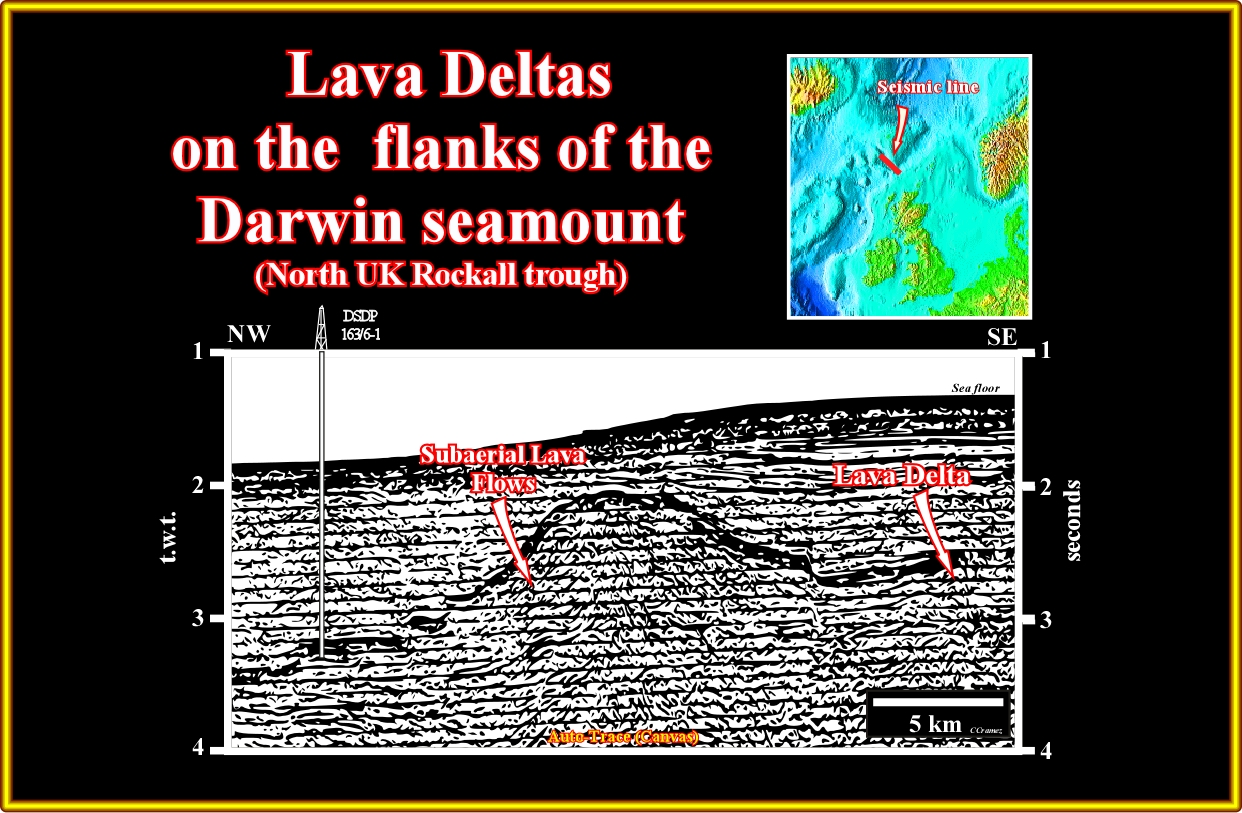
Plate A30.11- The Darwin seamount, illustrated on this seismic line, is a good example to show how the lava-deltas can be developed.
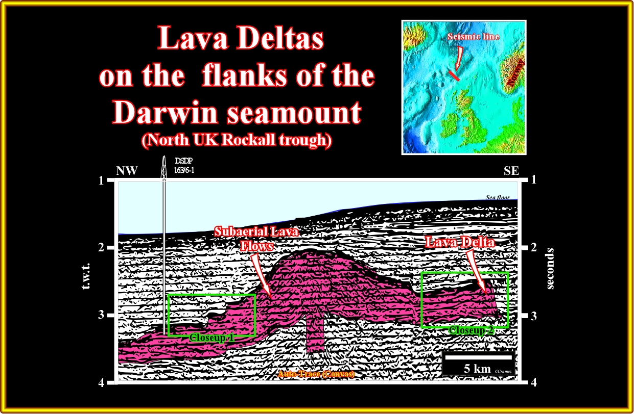
Plate A30.12- For those still doubt, this seismic line through Darwin seamount (offshore North UK) and the results of the DSDP 163/6-1, are going to give them a convincing geological model explaining how lava deltas are formed,. See the close-ups located here above in the next plate.
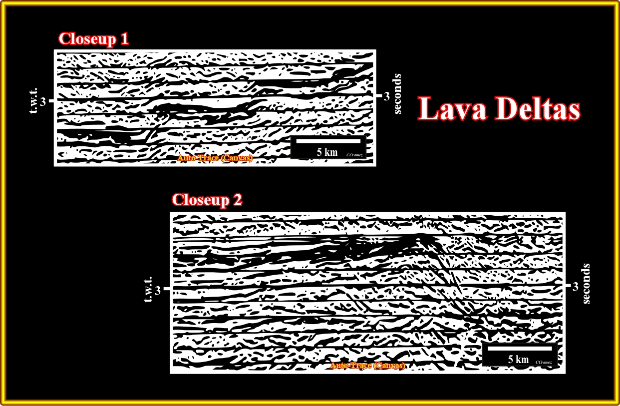
Plate A30.13- These close-ups show of the geometry created by the volcanic material when it enter in a standing body of water. Such a geometry is similar to that of a delta prograding in the sea or lake. However, the slope angle is much higher in a lava-delta. The geometry and particularly the backstepping geometry visible in the close-up 1, in a continuous flowing out of the volcanic material suggest successive relative sea level or lake level rises as subaerial spreading goes on.
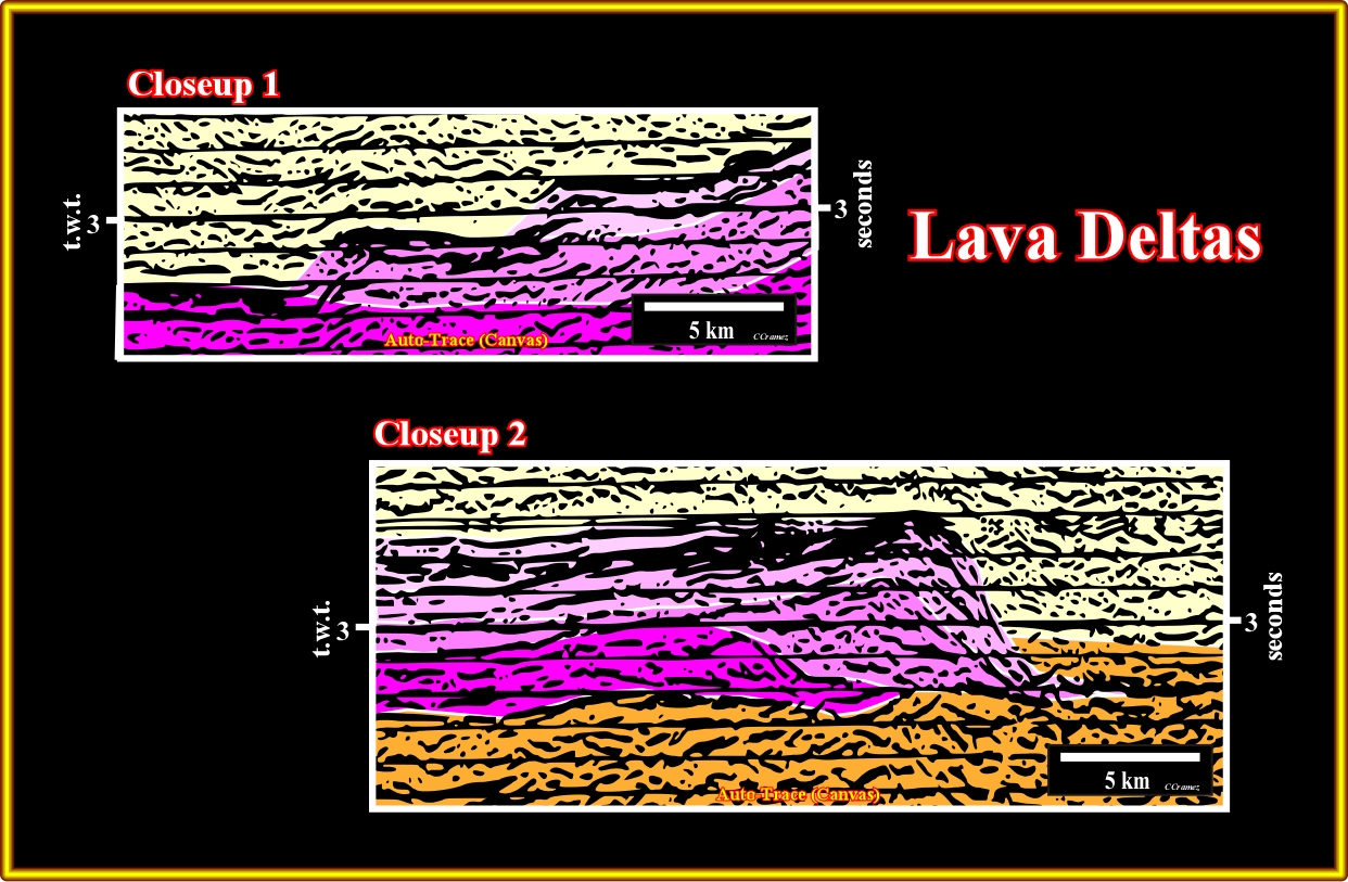
Plate A30.14- In this tentative interpretation of the previous close-ups, we try to pick the different retrogradational (backstepping geometry) and prograding sequences of the subaerial lava flows.
A31- UK Offshore (Rockwall Trough):
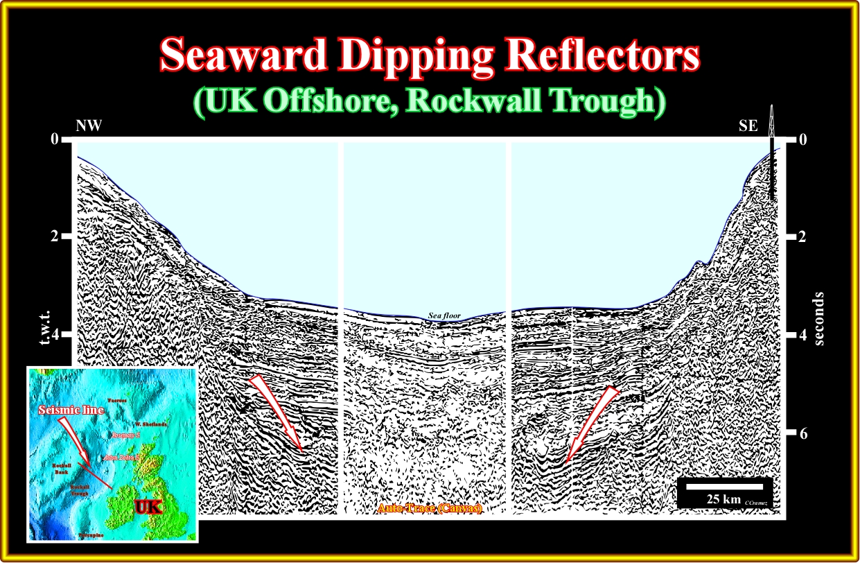
Plate A31.01- On this seismic line the SDRs are recognized easily on both sides of the Rockwall trough. As one can see on the tentatively interpretation proposed on the next plate, the central lower part is highly intruded by matlic material.
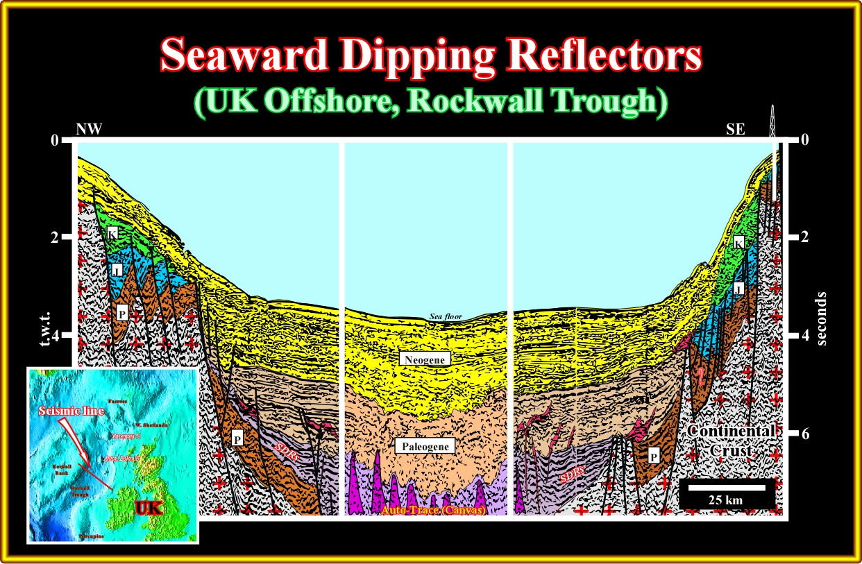
Plate A31.02- On this tentative interpretation, it is suggested that Mesozoic rift-type basins developed, over a Paleozoic substratum, each side of subaerial spreading centres with seaward dipping reflectors thinning outward, before a strong subsidence took place during the Tertiary creating a thick cratonic basin. This tentative interpretation suggests an aborted oceanization since the oceanic crust is not evident.
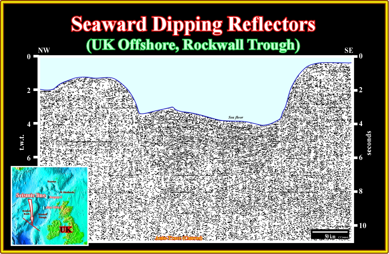
Plate A31.03- This mega-regional seismic line, located southward of the previous line shows the same aborted oceanization. The Mesozoic rift-type basins are visible in the continental crust, which central part subsided, after being highly intruded by mantlic dykes, which poured out seaward dipping reflectors.
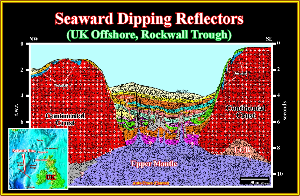
Plate A31.04- The scale of this seismic line is not appropriated to illustrate the seaward dipping reflectors, but to show how the continental crust can be thinned by injection of mantlic material. Such injection creates an thermal anomaly (uplift and clamping of the isotherms) that, later, collapse since the lengthening of the continental ceases or concentrated in another area.
A32- UK Offshore (Porcupine Basin):
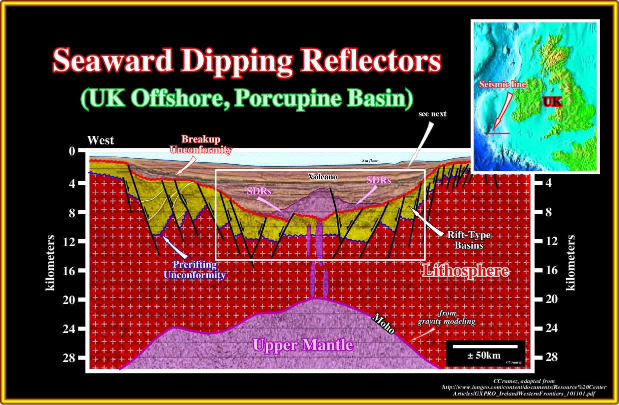
Plate A32.01- This seismic line from Porcupine basin, also, illustrated an aborted breakup of the continental crust. The lengthening (development of normal faults with opposite vergence) of the continental crust created the rift-type basins in the thinner area (where the mantle is higher). Such lengthening allowed the intrusion of the mantlic material and the formation of volcanos with the associated subaerial lava flows, as illustrated in next plates.
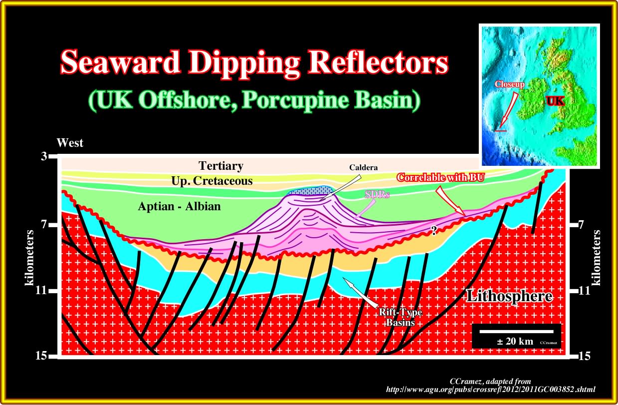
Plate A32.02- In this tentative interpretation one can see above an unconformity (laterally correlable with the breakup unconformity) three volcanic episodes area recognized readily with the associated subaerial lava flows outflowing from the caldera. A reefal interval was later developed above the last caldera, since the volcanism stopped, probably due to a displacement of the zone of thinning of the lithosphere (lengthening of the crust).
to continue press
next

Send E-mail to carloscramez@gmail.com with questions or comments about these notes (Altlantic-type Divergent Continental Margins).
Copyright © 2012 CCramez
Last modification:July, 2014