
Reflection times on seismic traces, recorded on land, have to be corrected for time differences introduced by near-surface irregularities. These irregularities have the effect of shifting reflection events on adjacent traces out of their true time relationships. The two major sources of irregularity are:
1) Elevation differences between individual shots and detectors ;
2) Weathered layer, which are heterogeneous surface layers (a few meters to several tens of meters thick) with abnormally low seismic velocities.
These two major sources of velocity irregularities are sketched in Plate 77.
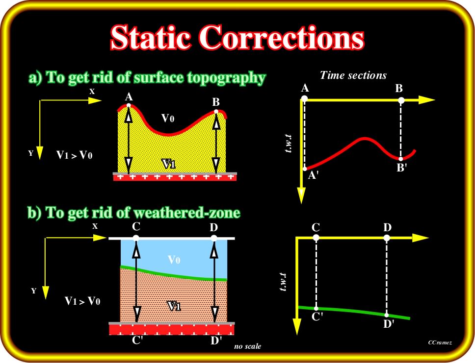
Plate 77- Static corrections (a bulk shift of a seismic trace in time during seismic processing) must take into account the topography and the weathered-zone as pictured above. In the case of a sharp topography (upper sketches), as the velocity interval of the sediments (below red) is higher than the velocity of the seismic waves in the air, in reference to an horizontal datum, the seismic waves spend more time at the vertical of topographic highs than topographic lows. As generally the weathered zones have a low velocity, it is quite obvious than the interface weathered non-weathered sediments will be pull-down in the areas where the weathered zones is thicker.
The static corrections are a combined weathering and elevation correction that removes the effects of low velocity surface layer and reduces all reflections to a common datum. Changes in water depth induce typical parasites, particularly on the distal parts of the seismic lines of continental platforms, and in the upper slope, where, often, submarine canyons are often carved by turbiditic currents (induce by relative sea level falls).
A sharp change in water depth, such as illustrated in Plate 78, induces a lateral variation of the velocity interval (sediments - water - sediments). Subsequently, the seismic waves are retarded progressively in deeper water and the time-traject will be longer. Hence, the associated reflections are pulled-down below greater water depth.
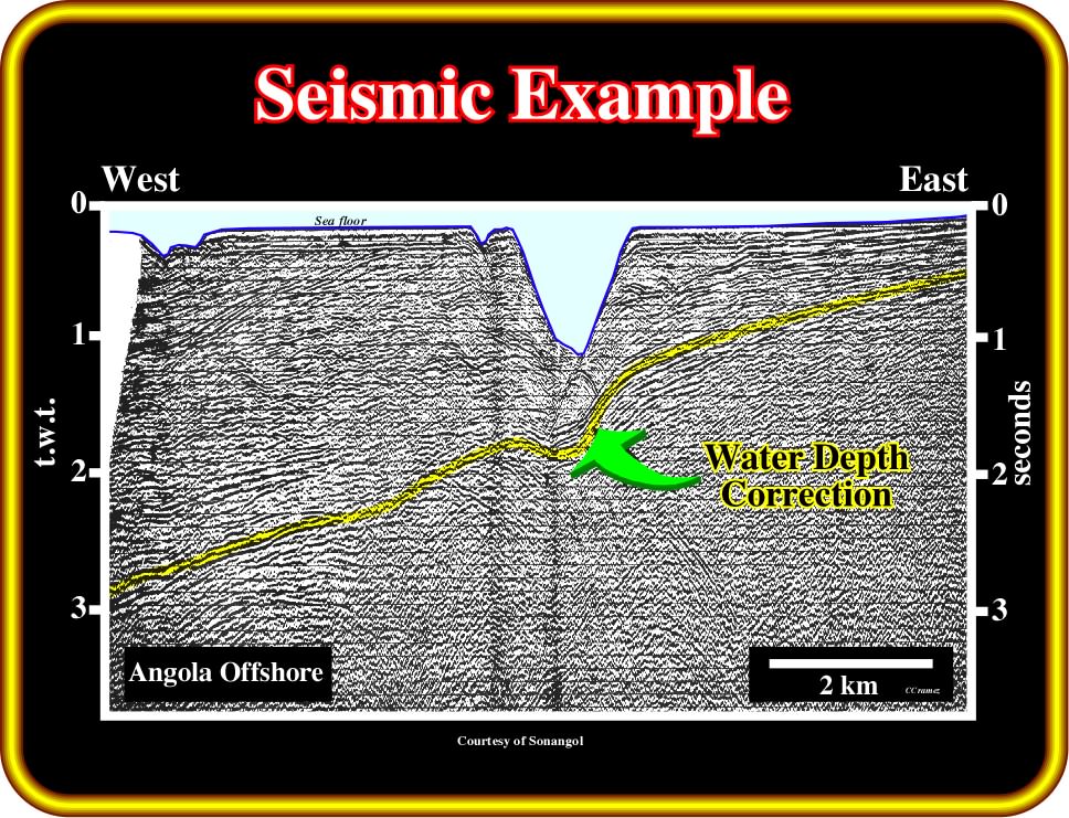
Plate 78- On this seismic line, from the northern offshore Angola, located nearby the mouth of the Congo river, the water-depth variation induces local pull-down of uniformly continuous reflectors, since seismic waves travel slower through water than through sediments. On this seismic line, the pulldown of the reflectors directly below the Congo submarine canyon is obvious. Pull-downs do not have any geological meaning (in terms of geometry). In a depth section version of this seismic line, the yellow reflectors keep the regional seaward dip recognized all along the profile.
to continue press![]()
![]()