.jpg)
Equatorial Guinea Offshore
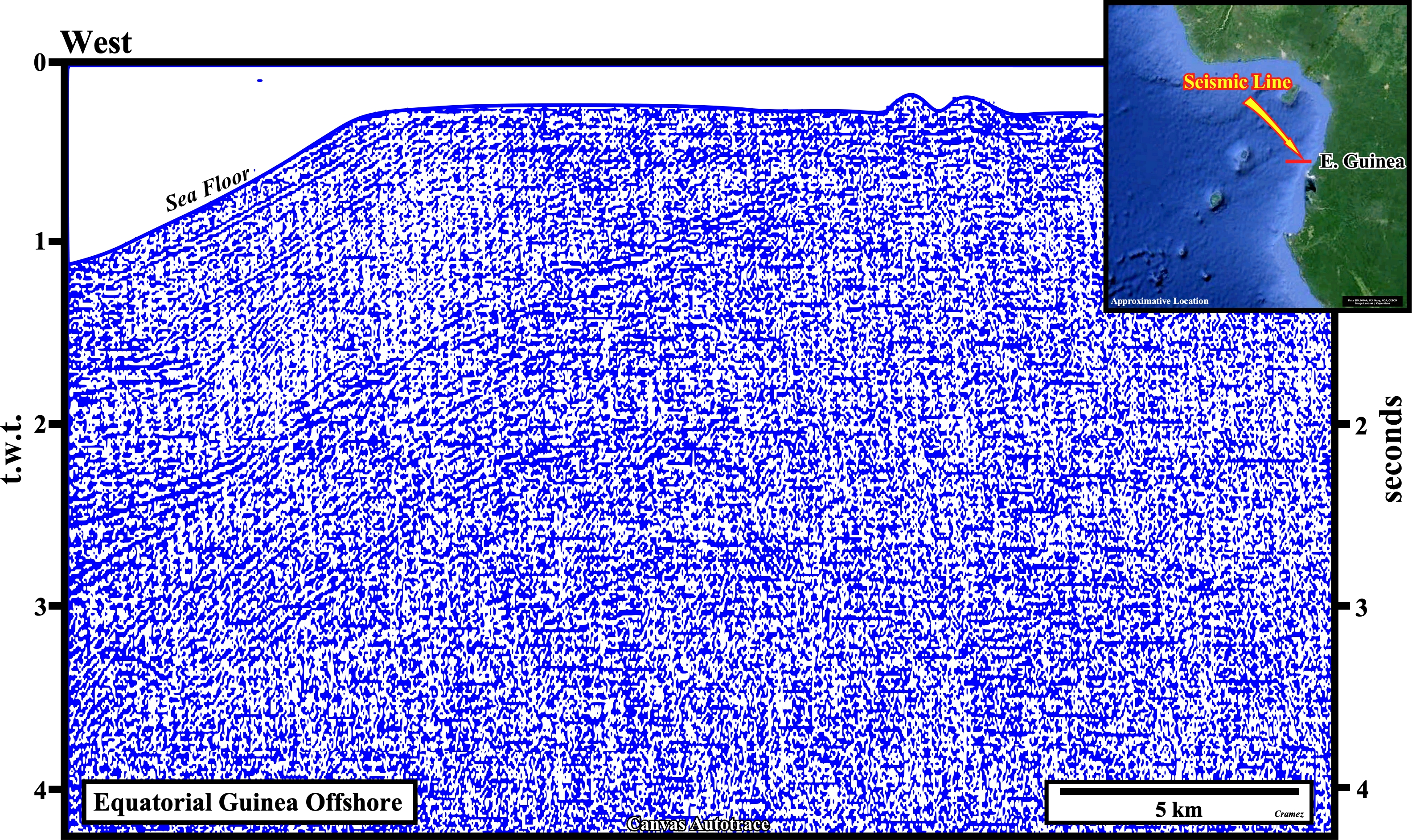
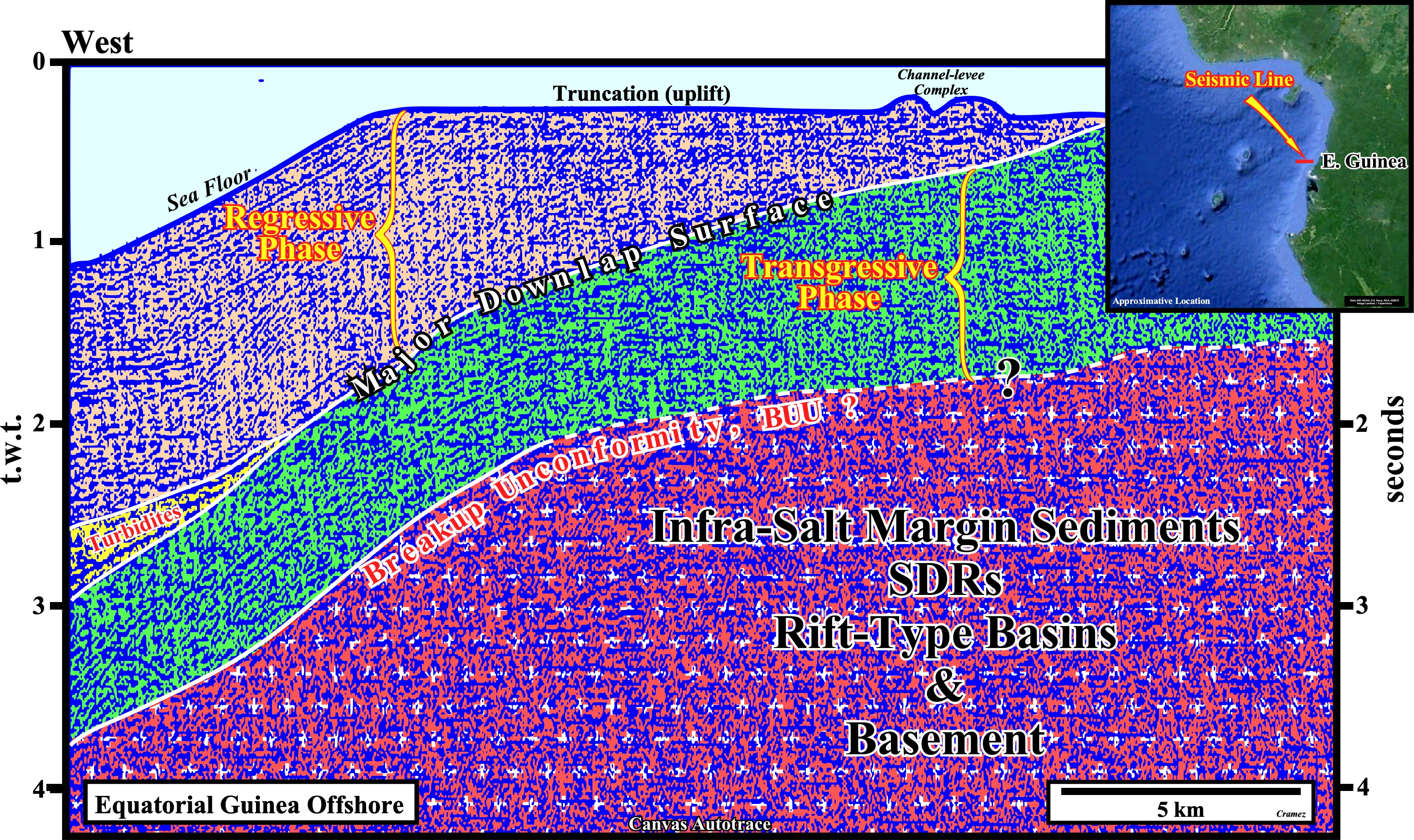
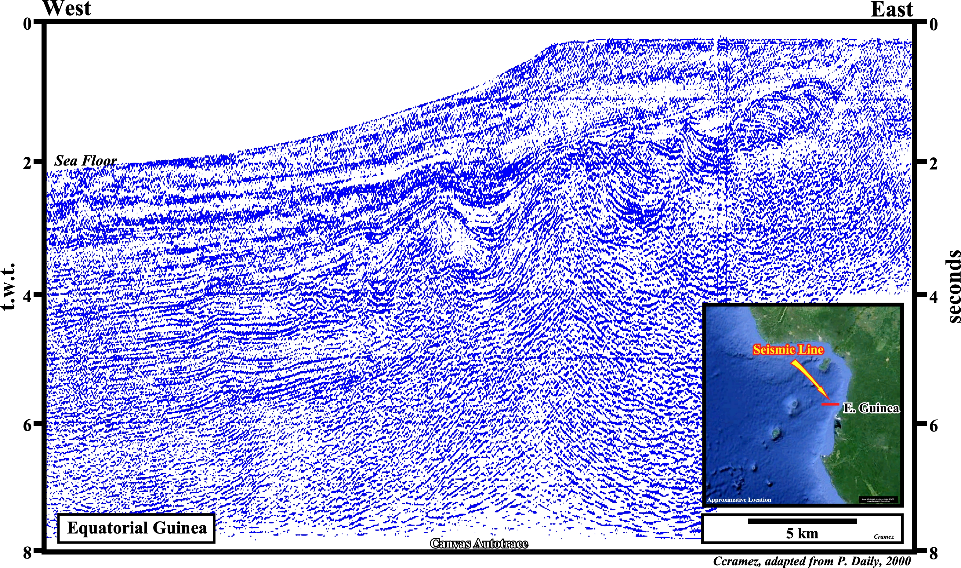
For naive (inductive) geoscientists (those following the erroneously idea that Observation precedes Theory), the proposed tentative geological interpretation of a Canvas autotrace of a old seismic line of Equatorial Guinea offshore is a dishonesty. For them, the mind of the geoscientist in charge of the geological interpretation of the seismic lines of a given area must be a "tabula rasa", i.e., he must have no geological knowledge of the area under study before starting the tentative interpretation, in order to does not deform the observations according them. In reality, as due to the bad quality of the original seismic line, they cannot buildup their own theory (interpretation). They assume that all proposed interpretation is imposed by the model assumed by rationalist geoscientists (all interpretation is theory laden and so must be boldly criticized). Knowing the geological context of the area and how the South Atlantic was opened, it is quite, easy to recognize a substratum including not only the basement but rift-type basins as well. The top substratum is marked by the breakup unconformity. Above the breakup unconformity, the seismic unity colored in green correspond to the transgressive phase of the post-Pangea continental encroachment cycle, while the upper unity, colored in light brown, corresponds to the regressive phase. A major downlap surface (Cenomanian-Turonian) exists between the two stratigraphic phases. The truncation at the sea floor, strongly, suggest, an important Late Tertiary uplift of the conventional offshore and onshore of the area.
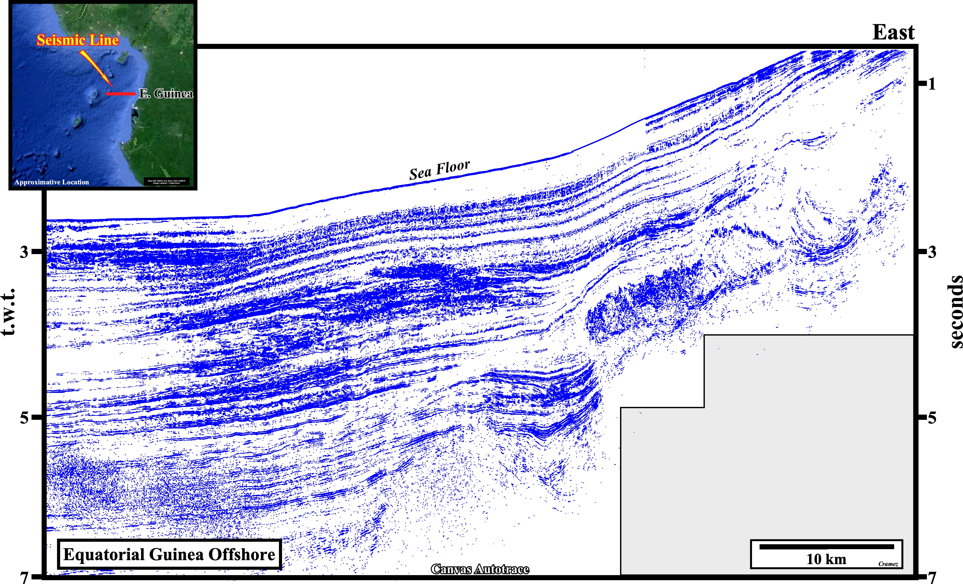
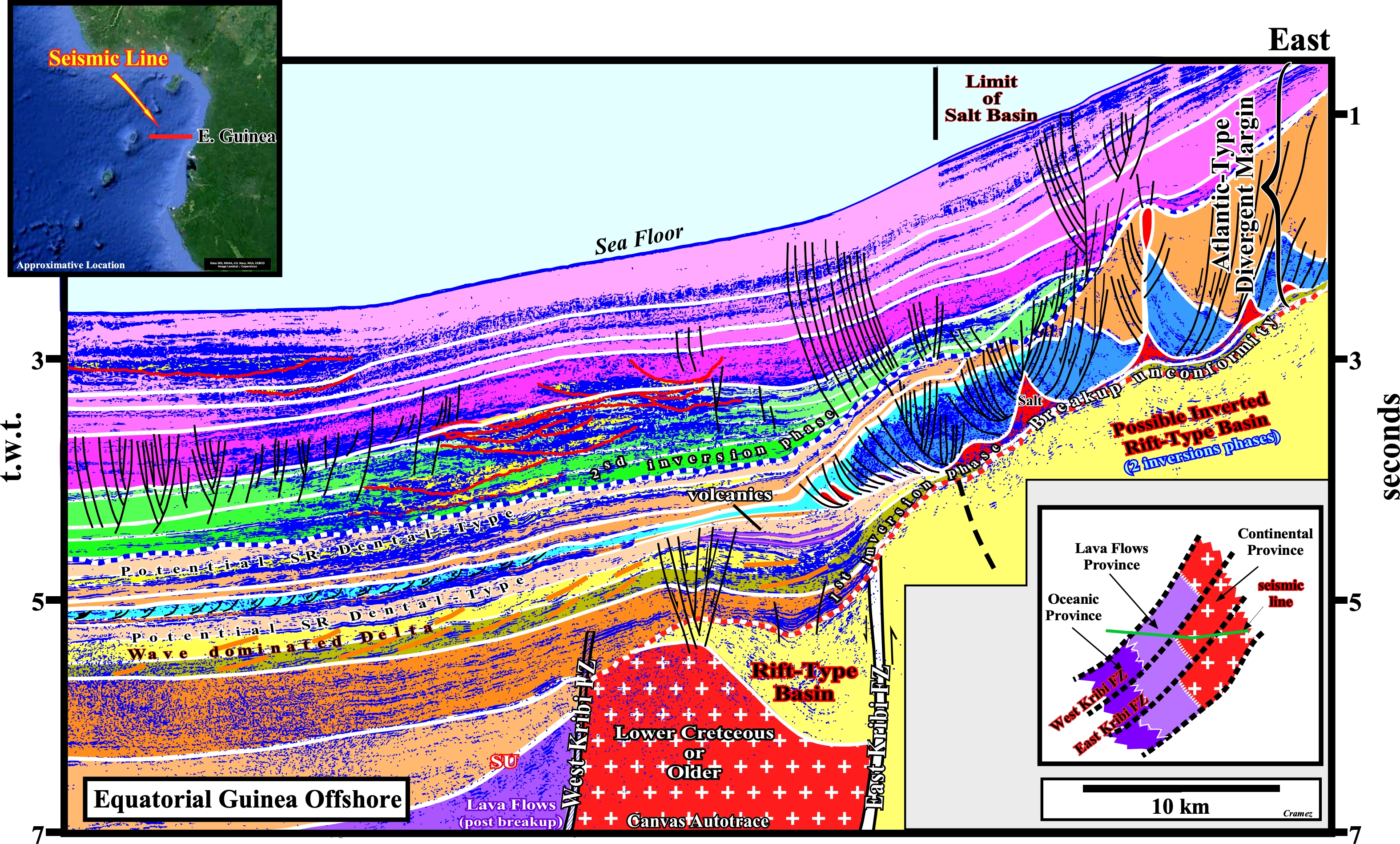
In the Gulf of Biafra, the volcanic islands of São Tomé, Principe and Fernando P (presently named Bioko) underline the volcanic activity along the fracture zones of the Equatorial Guinea. The fracture zones control the petroleum systems (PS), either the generating petroleum sub-system (GPSs), as in Chiba field, either the entrapment-migration sub-systems (EMSs) as in Alba Field. The seismic line of this autotrace is located in the divergent Atlantic-type divergent margin of the West Africa, in deep-water of Equatorial Guinea. The term Atlantic-type, that normally describes a margin where extensional tectonic regimes are predominant (passive margin) should not be taken to strictly, since local compressions, associated with the reactivation of the fracture zones by ridge-push stresses, are well known in the Gulf of Biafra. Theoretically, on the Canvas autotraces of dip regional lines geoscientists must try to recognize the different crustal unities or geological provinces, composing the infrastructure of the margin : (i) Continental crust, which can be Precambrian and or Paleozoic, with Mesozoic rift-type basins, i.e., half-grabens developed during the lengthening phase (often called rifting phase), which predate and announce the breakup of the lithosphere and are, often, filled up by organic rich lacustrine sediments ; (ii) Sub-aerial lava-flows with no more than 10-15% of clastic sediments, which deposited after the break of the lithosphere meanwhile the spreading-centers were sub-aerial ; (iii) Atlantic-type divergent margin with the transgressive and regressive sedimentary phases of the Meso-Cenozoic (or Post-Pangaea) stratigraphic encroachment cycle. Westward of the salt basin, which here is quite limited, the transgressive phase is too condensate (starved conditions), and so, difficult to recognized (above the evaporitic layer, its backstepping geometry is strongly masked by the salt tectonics). Similarly, in ultra deep water the forestepping geometry of the regressive phase is difficult to recognize, since the sediments are deposited in an abyssal environment. Major inversion phases have uplifted the sediments. There are two major tectonic inversion. The first one took place immediately after the breakup of the lithosphere and it could be induced by a readjustment of the transform fault and fracture zones. The major consequence of this inversion was the uplifted of the thick continental rift-type basins (no significant source rocks were found in these basins), and the seaward deposition, immediately above the lava-flows, of organic rich marine sediments, which form the more likely generating petroleum sub-system of the area. The second tectonic inversion is associated with the reactivation of the Kribi fractures zones (several fractures zones with a quit small spacing can be recognized on the seismic lines). It took place mainly during Upper Cretaceous. The subsequent uplift induced a significant sliding tectonics, with listric faults, i.e., normal faults ending seaward as reverse faults, which create potential structural traps. This tectonic inversion induced, also, an important changing in the sediment influx. The uplift created an important barrier to the gravity currents, which were forced to use the NE-SE transfer faults (fracture zones) as terrigeneous path before taking a more longitudinal trajectory in the basin.
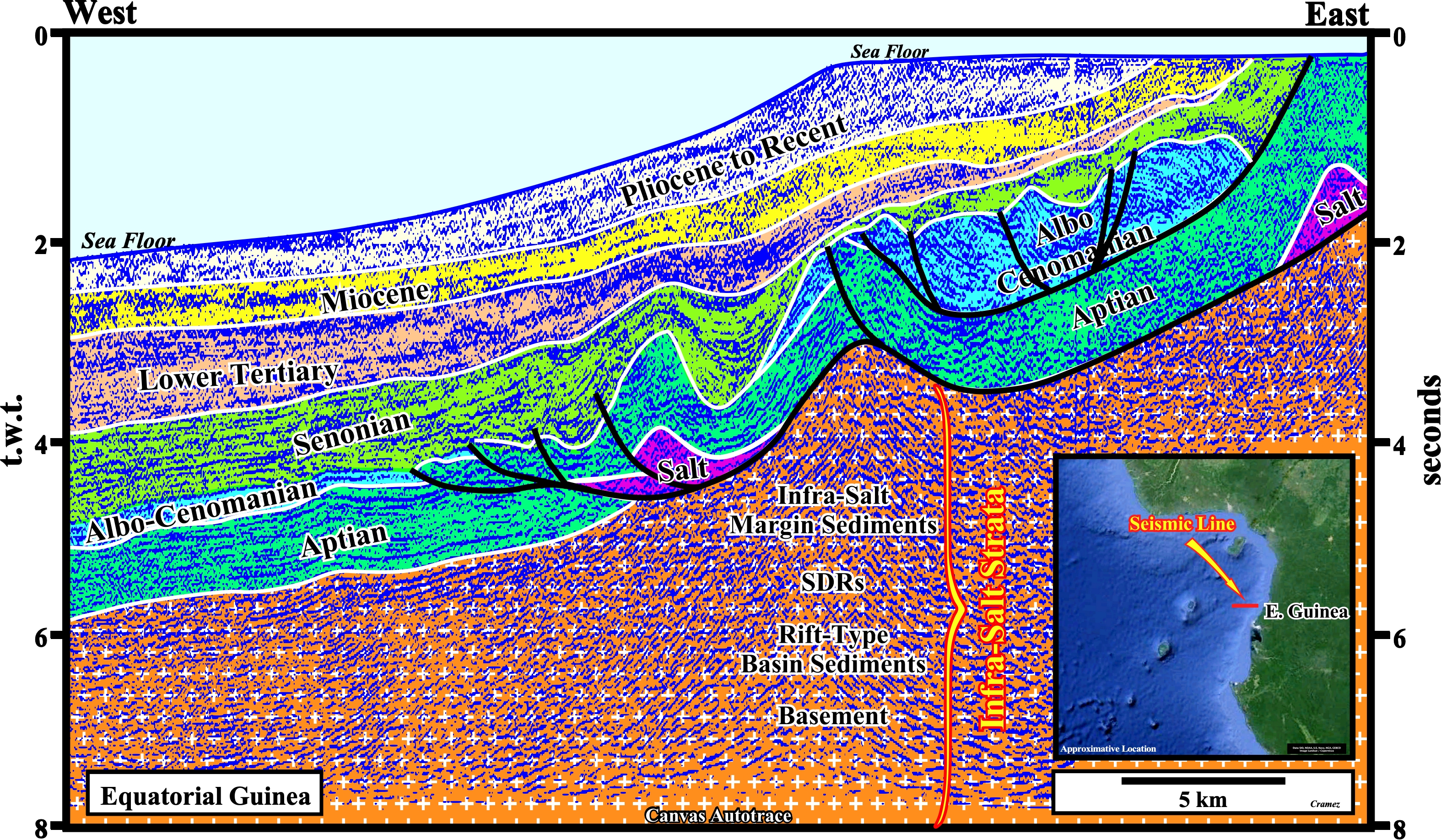
On this tentative geological interpretation of a canvas autotrace of an Equatorial Guinea seismic line (Rio Muni), the visible reflectors underlying the Aptian rocks (salt and carbonates) belong to what we call the infra-salt strata, in which are included: (i) The infra-salt margin sediments ; (ii) SDRs (seaward dipping reflectors), i.e., post-breakup lava flows ; (iii) Rift-type basin sediments, which filled the half-graben developed during the lengthening of the Gondwana lithosphere, i.e., before the breakup of the lithosphere and (iv) Basement, which can be formed by Paleozoic or Precambrian rocks. Strictly speaking, in the margin (salt + overburden), its is easy to notice the sediments were shortened and uplifted, not only during the during the Albo-Cenomanian, but recently as well. The toplaps visible at the sea floor of the conventional offshore emphasized a late Tertiary uplift of the continent.
In very deep offshore, where the margin sediments lay down over the oceanic crust, the shortening of the distal sediments of the margin still is quite evident. Such a shortening can be the counteract of the up-dip extensional tectonic regime (lengthening), in which the associated antiforms form the majority of the morphological by juxtaposition hydrocarbon traps (non-structural traps). In this part of the deep offshore, as illustrated on this tentative interpretation, structural traps exist (four way dips anticlines), however the presence of a generating petroleum sub-systems (mature source rocks) is hypothetical.

![]()
![]()
Send E-mails to carlos.cramez@bluewin.ch with comments and suggestions to improve this atlas.
Copyright © 2001 CCramez
Last update:
2022
![]()