.jpg)
Morocco Offshore
Morocco Offshore
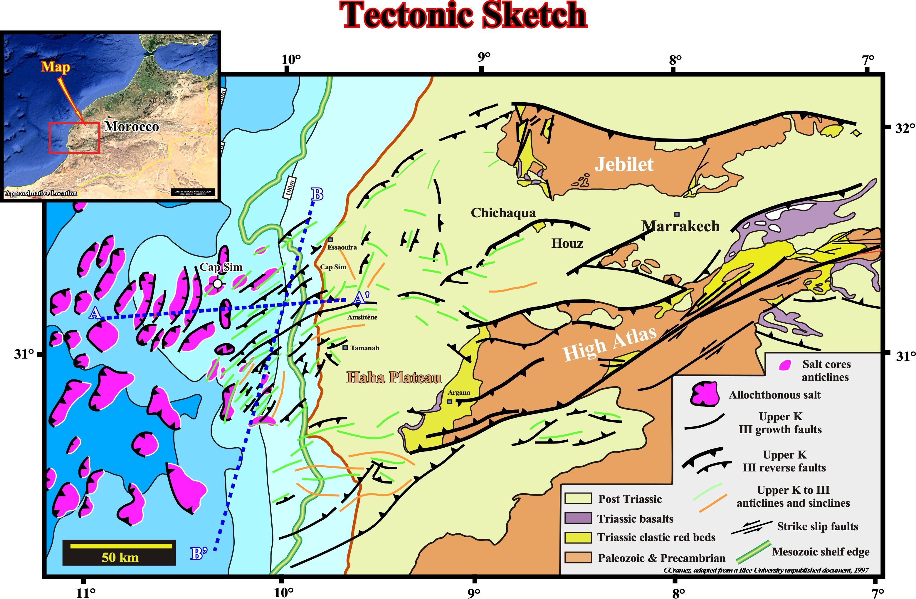
The regional geological context of south Morocco Offshore is depicted on this geological map. Two regional Canvas autotraces, A-A' and B-B, more or less perpendicular, of two seismic lines shot not far from Cap Sim well, illustrated next show better not only the sedimentary shortening (compressionala tectonic regime) but the seismic stratigraphy as well.
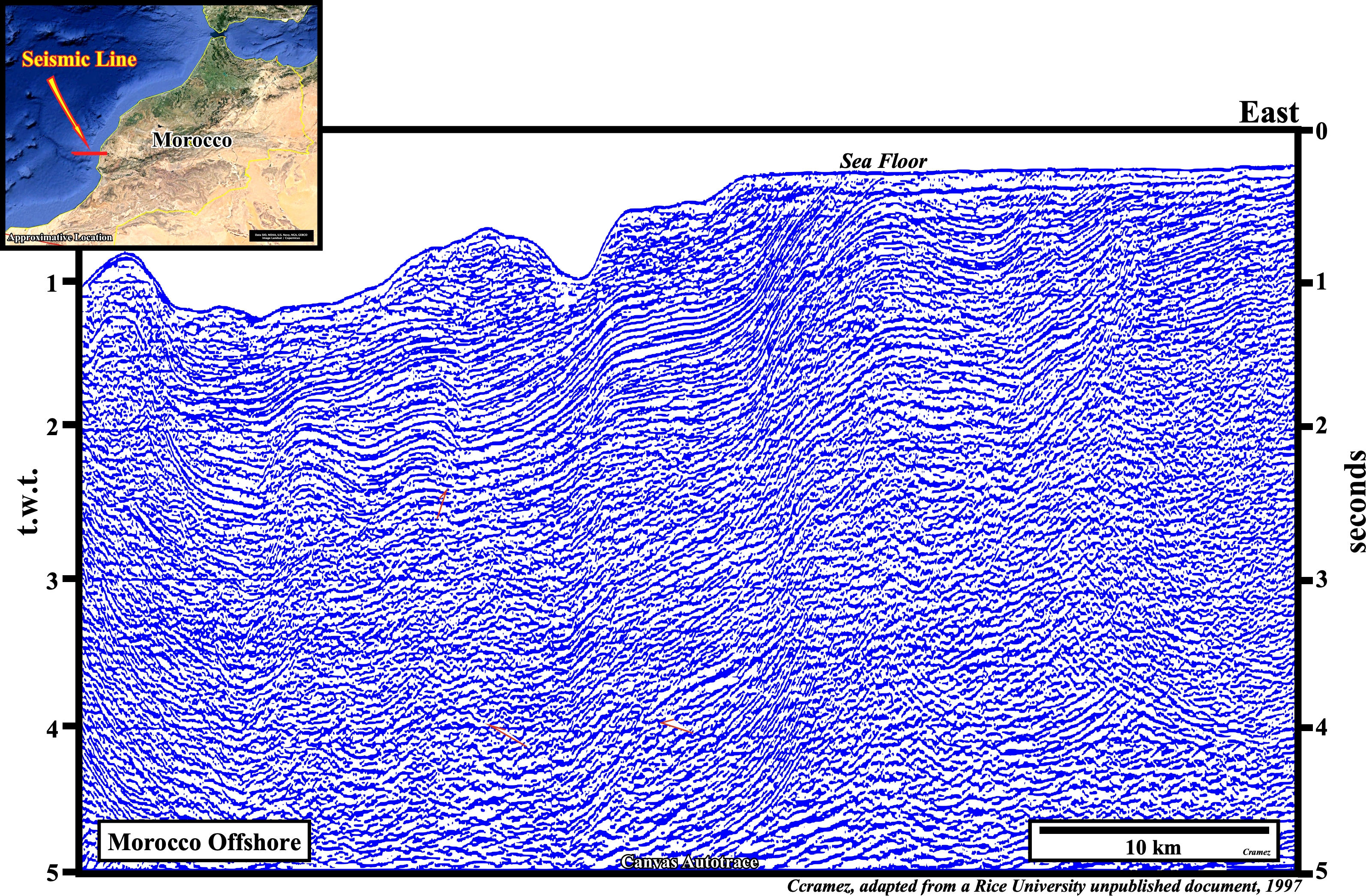
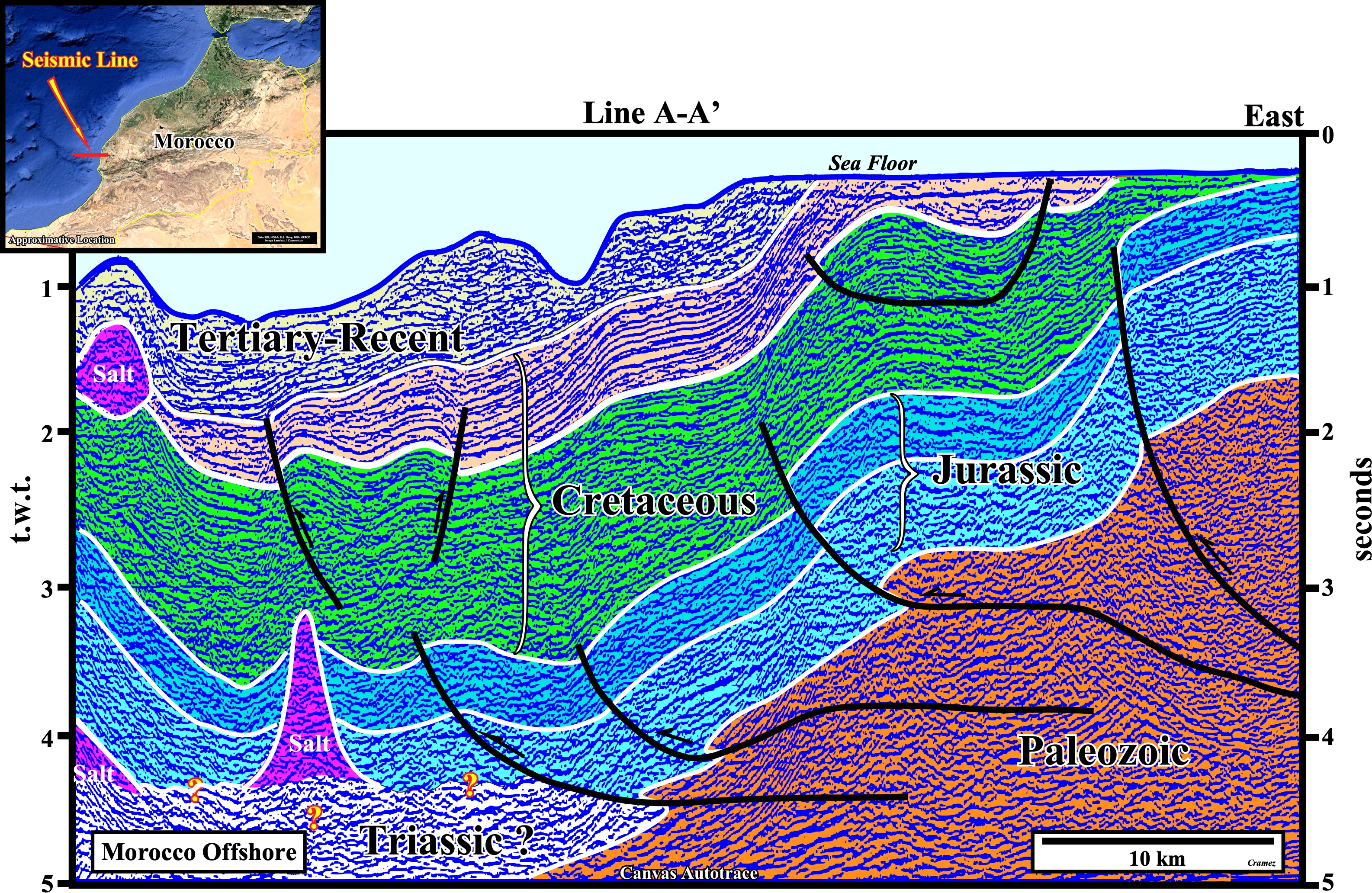
All sedimentary column was shortened by a compressional tectonic regime, characterized by a σ1 horizontal and striking, roughly W-E, and a σ3 vertical. The shortening was, mainly, by thrust faults that affect all intervals include the Triassic fault as illustrated on the next Canvas autotrace.
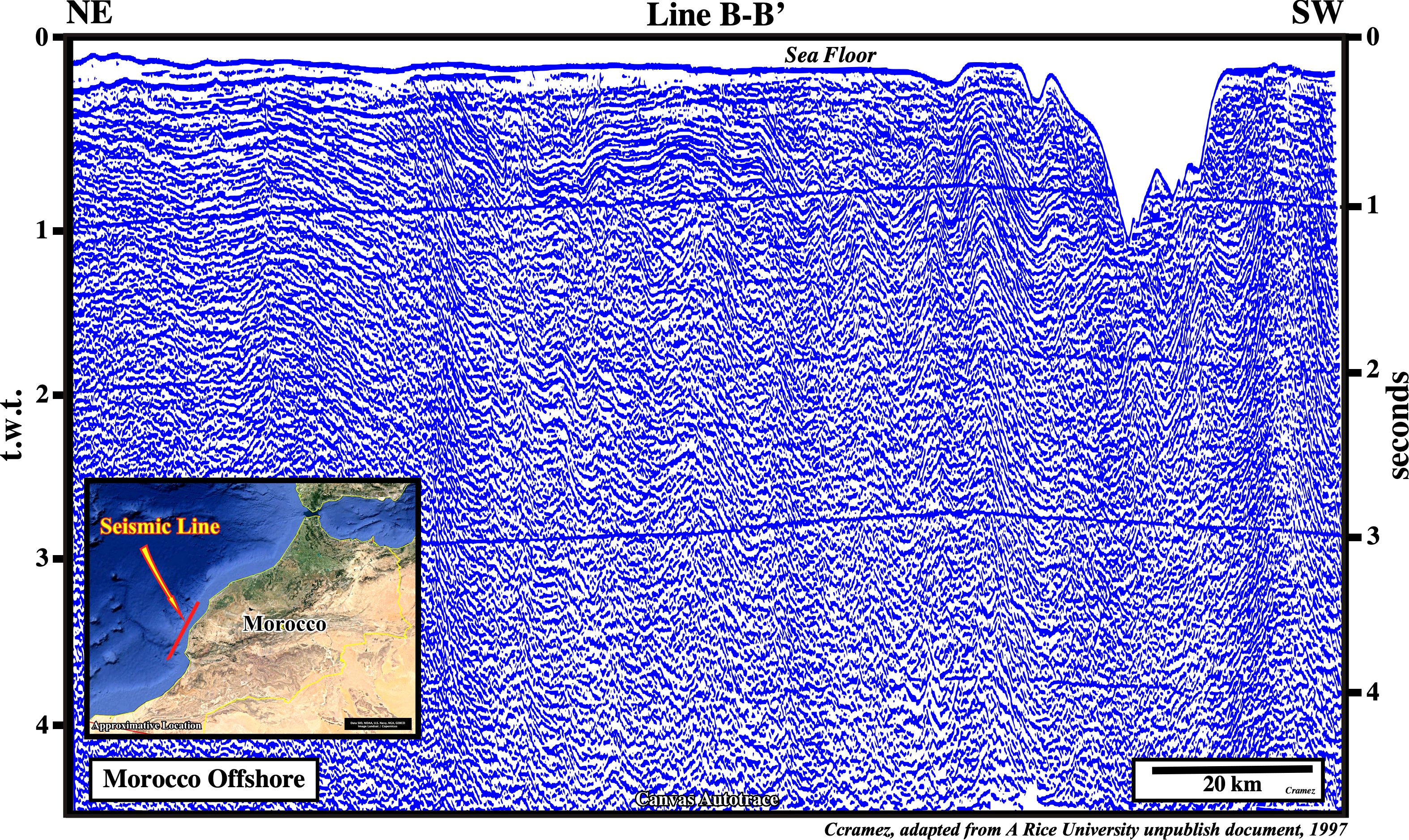
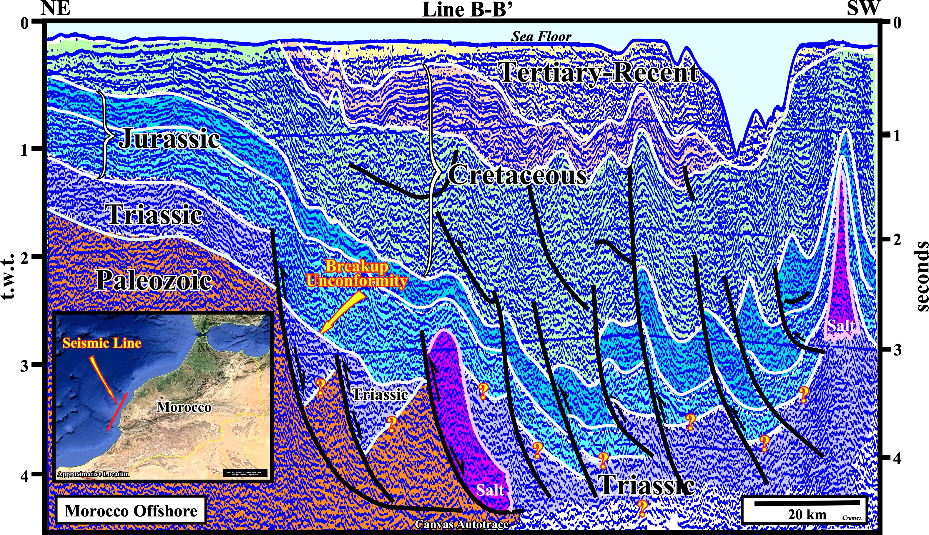
On this Canvas autotrace of a seismic line, more or less parallel to the shoreline, the sedimentary shortening is, also, well recognized. Note the salt interval, as well as, all other stratigraphic intervals, is shortened (see also the above Tectonic Sketch). However, the salt was also deformed by halokinesis or halotectonics (form of salt tectonics, in which salt flow is powered by buoyancy, i.e., by release of gravity potential energy alone, in absence of significant lateral tectonic forces, σt = 0) as suggested by the diapiric structures. This tentative interpretation suggest also a breakup unconformity at the top Triassic. In fact some of the Triassic normal faults developed during the lengthened of the Gondwana continental crust, although reactivated as reverse faults during the compressional tectonic regime, still keep a normal geometry.
![]()
![]()
Send E-mails to carlos.cramez@bluewin.ch with comments and suggestions to improve this atlas.
Copyright © 2001 CCramez
Last update:
2022
![]()