.jpg)
Morocco Offshore
Rharb Geographic Basin
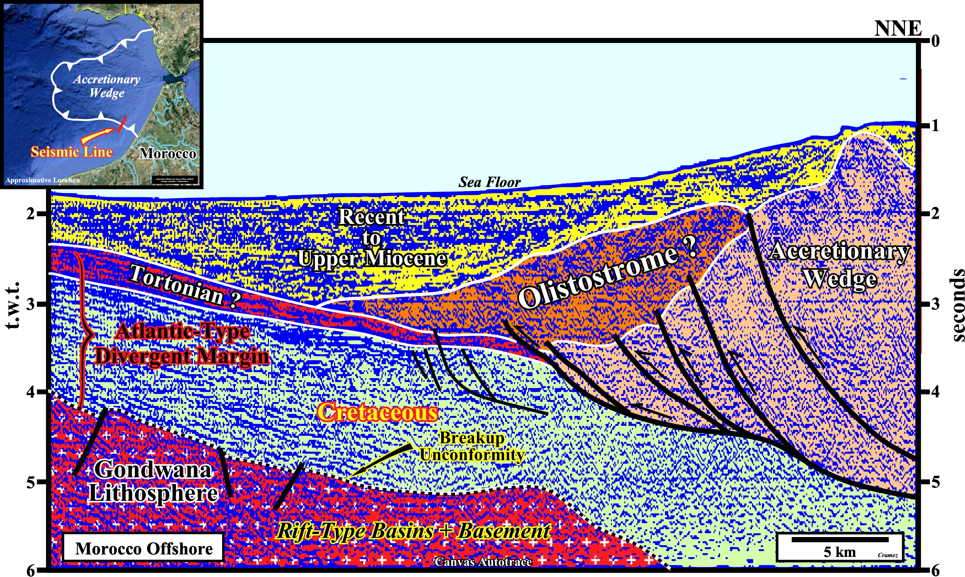
On this tentative geological interpretation of a Canvas autotrace of a multichannel line of NW Morocco offshore (Rharb Geographic Basin), the accretionary wedge, associated with the Africa-Europe collision, is, clearly, recognized by its characteristic tectonic regime (σ1 horizontal and σ3 vertical) with their thrust fault initiated at a basal decollement surface over the Atlantic-type divergent margin (see next geological cross-section). The presence of a possible olistostrome cannot be exclude. Let's just remember than an olistostrome ("olistomai" means slide in Greek and "stroma" accumulation is a sedimentary deposit composed by chaotic mass of heterogeneous material that accumulates as a semi fluid body by submarine gravity sliding or slumping of unconsolidated sediments (https://en.wikipedia.org/wiki/Olistostrome), The seismic interval nominated "Gondwana Lithosphere" corresponds, here, to the thinning lithosphere, in which Triassic rift-type basins developed as a consequence of the lengthening event of the basement that precedes the breakup.
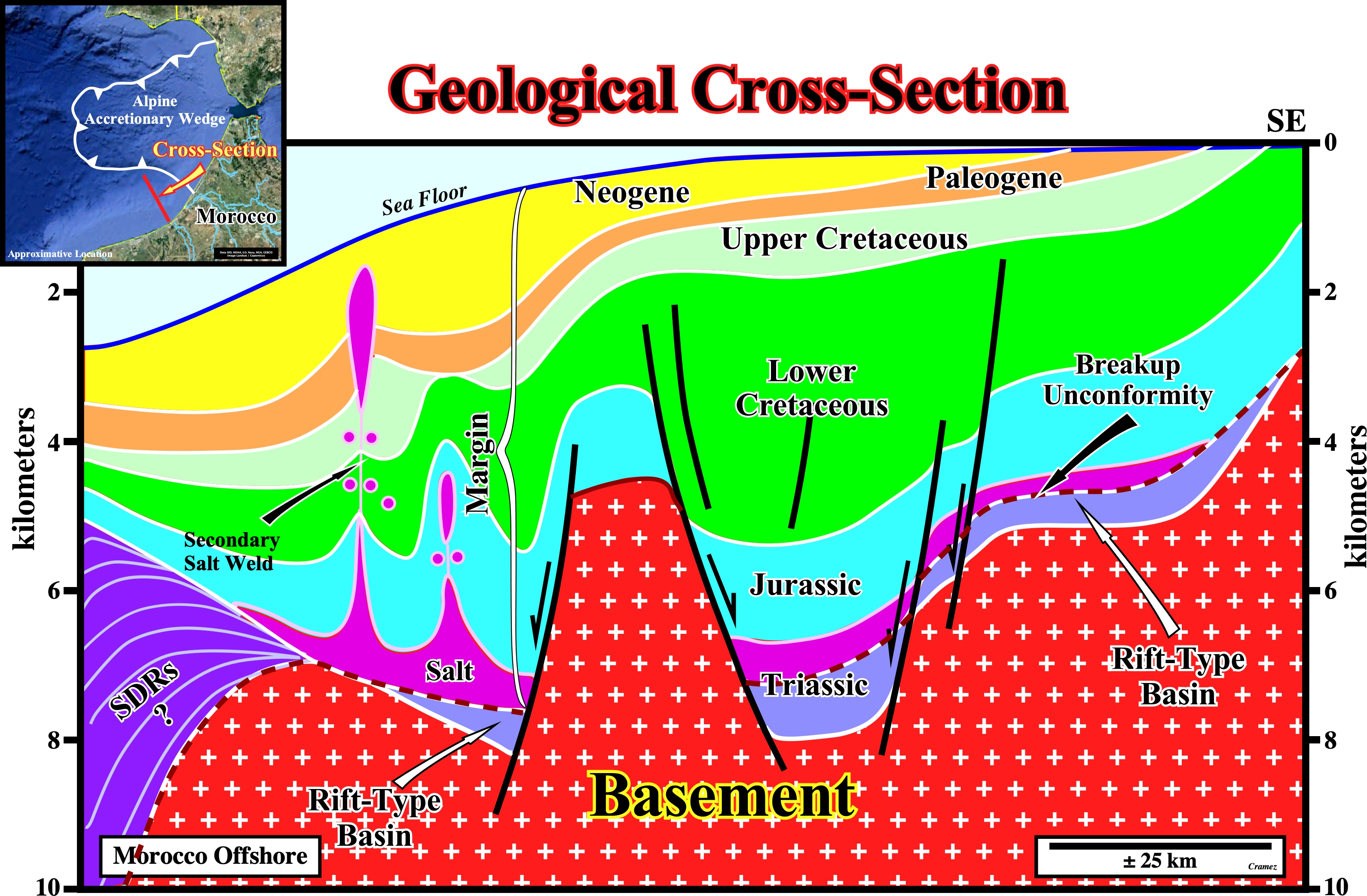
This geological cross-section of NW Morocco offshore (see location map, on the upper left corner of the figure) is based on a tentative geological interpretation of a seismic line, located southward of the Cadiz Gulf accretionary wedge, i.e., southward of the sediments accreted onto the non-subducting tectonic plate of the Alpine Ampferer subduction zone. It represents the Gondwana rifting associated with the Atlantic opening, which should not be taken as the Tethys rifting (see next figure).
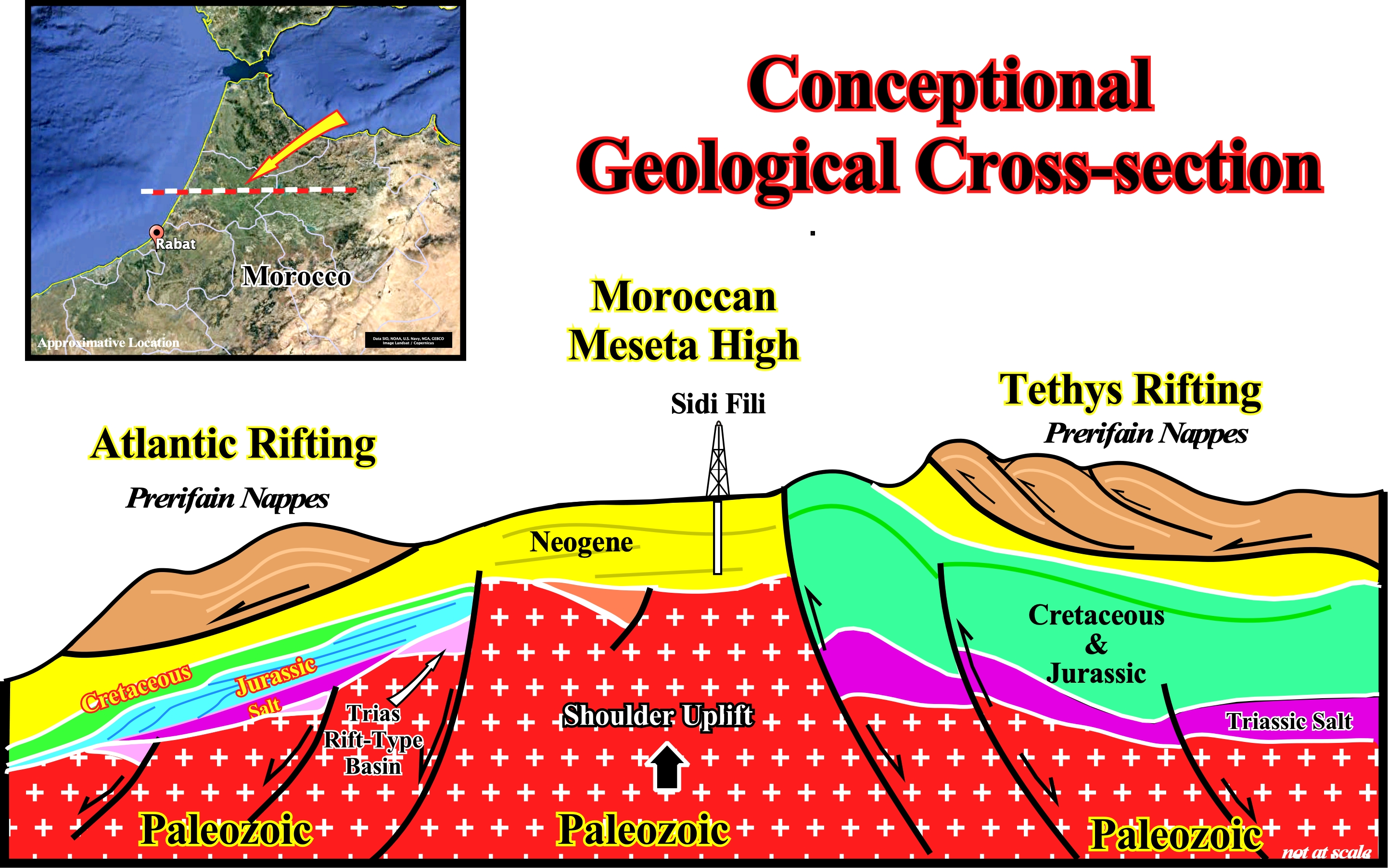
This conceptional geological cross-section illustrates the Tethys riftting in the eastern area of the Morocan Meseta High, under the Prerifain nappes, and the rifting predating the development of the Atlantic-type divergent margin in the western area. The normal faults created during the Tethys rifting were. later, reactivated in reverse faults as illustrated on the next Canvas autotrace.
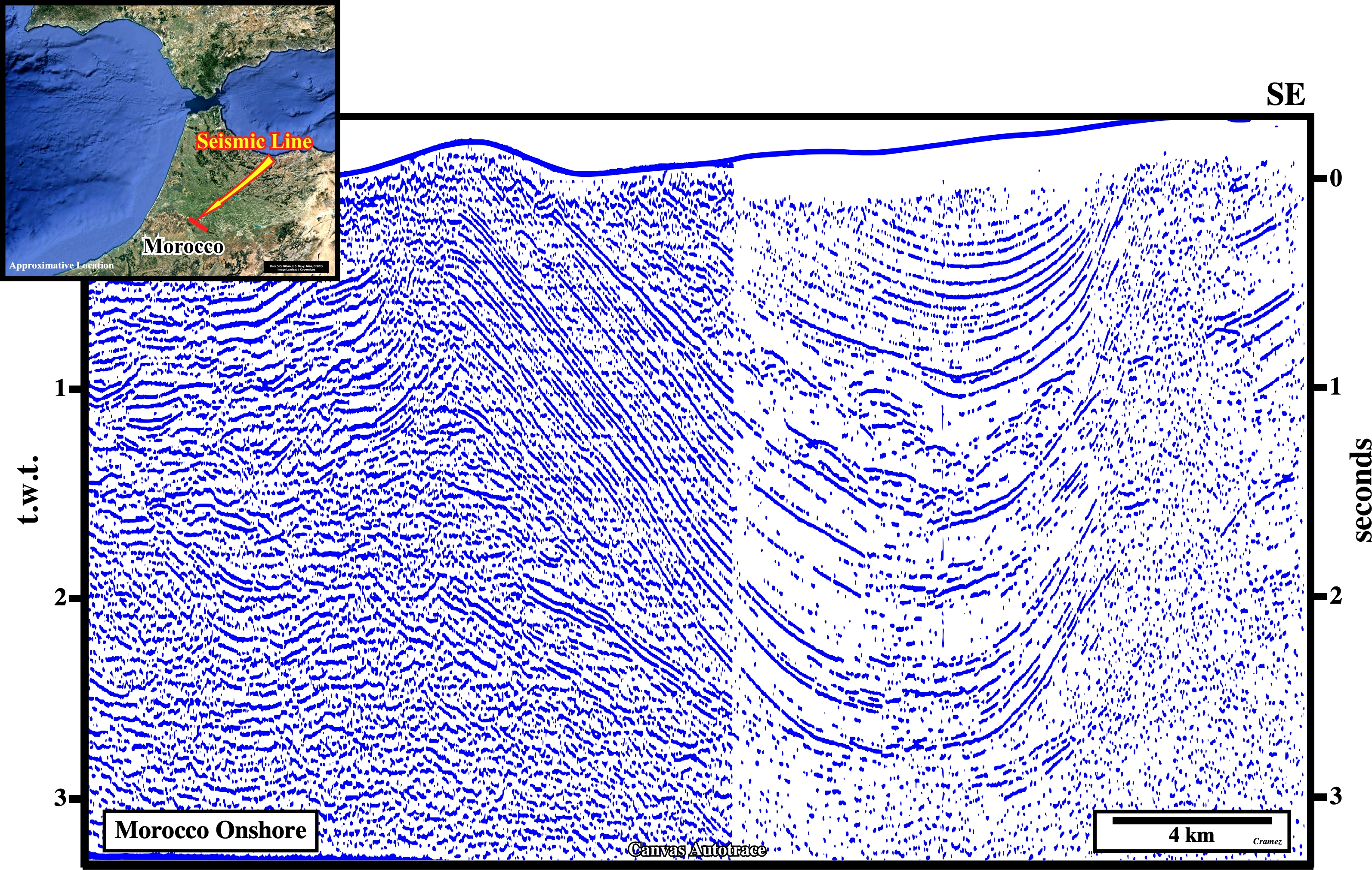
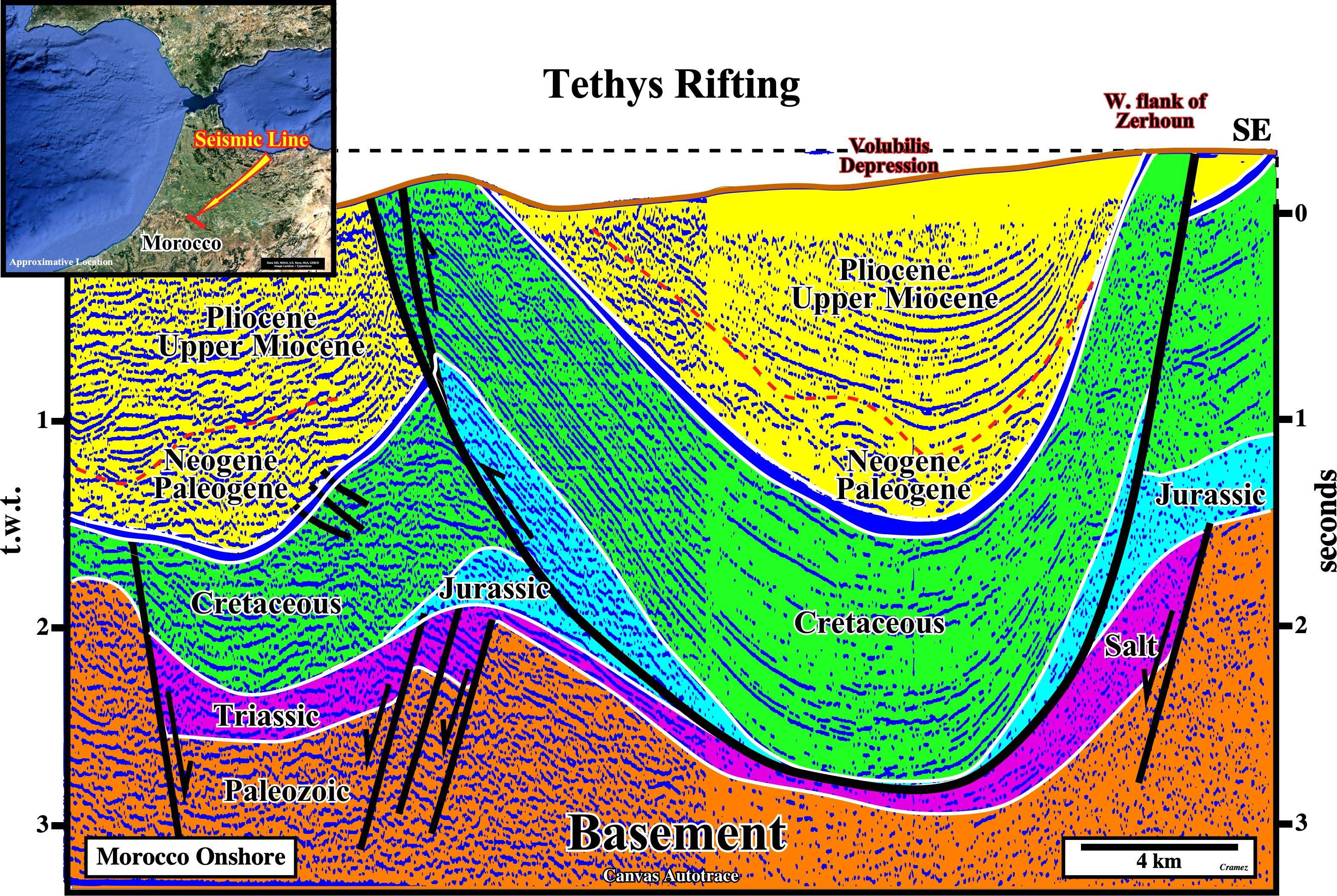
On this autotrace of a Morocco onshore seismic line, in winch the evidence of a sedimentary shortening is paramount, the reactivation of the old normal faults developed during the Tethys rifting is, quite, evident in spite of the fact that their geometer still is that of normal faults. That means that the reverse movement along the normal fault planes was not enough to invert the geometry or, in other words, the "null point" is in the lower sector of the fault plane. Remind, the null point is a point on the fault plane with no apparent displacement: (i) Above the “null point”, the fault has a reverse geometry and (ii) Below the "null point", the geometry of the fault is normal, in spite of fact that the fault is reverse (the last movement was reverse, but not enough to change the geometry).

![]()
![]()
Send E-mails to carlos.cramez@bluewin.ch with comments and suggestions to improve this atlas.
Copyright © 2001 CCramez
Last update:
2022
![]()