.jpg)
NW Madagascar Offshore
Majunga Geographic Basin
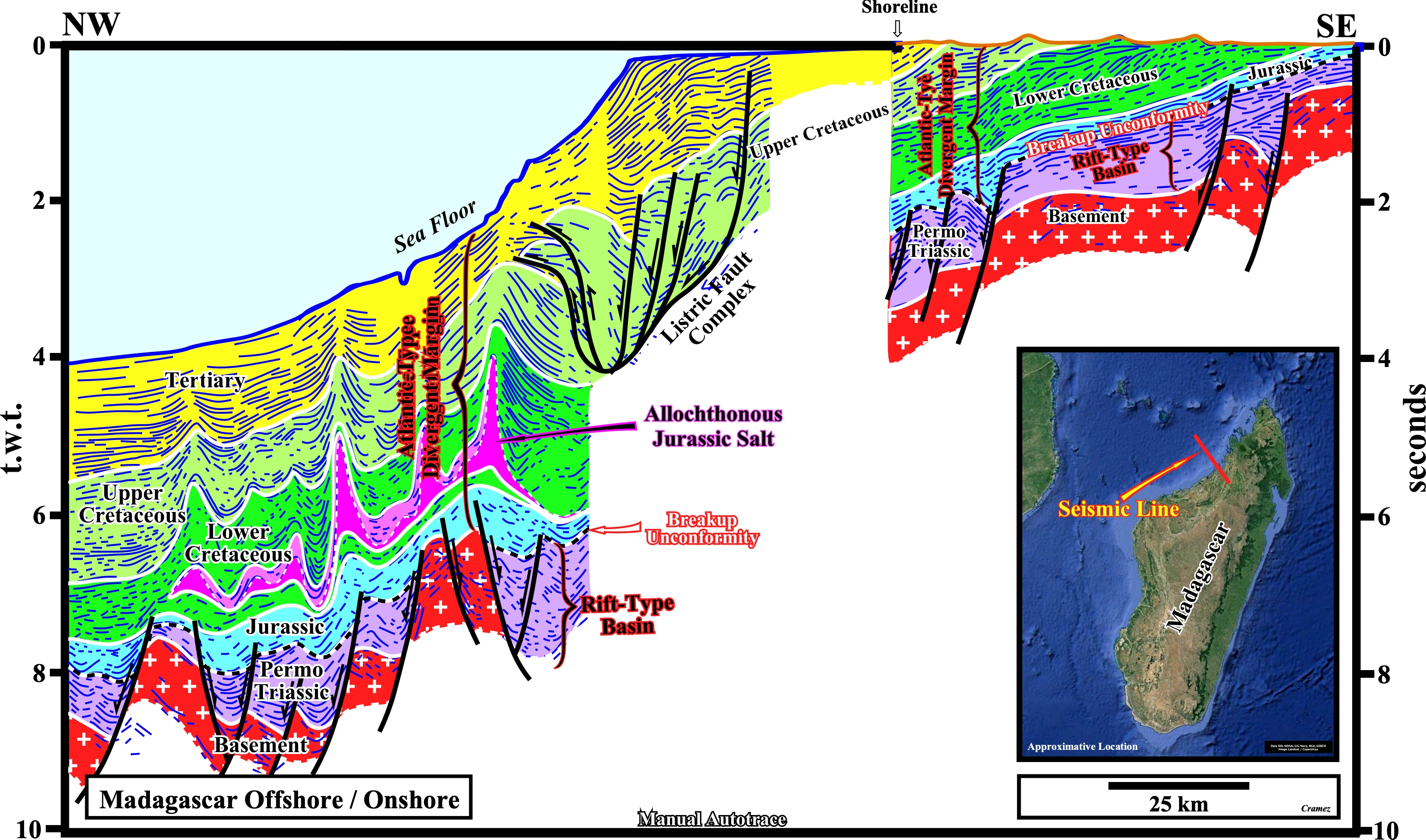
Take into account the abrupt change in water depth, i.e., the seismic horizons under the present continental slope in a depth version are higher and the bottom of the salt layer is less dipping seaward. The rift-type basins, developed during the lengthening of the Gondwana lithosphere, are, probably, of Permo-Triassic age. The breakup unconformity, which limits the rift-type basins from the Atlantic-type divergent margin, is Late Triassic / Early Jurassic. During the Jurassic stage of the Atlantic-type margin, some of the old rifting faults can replay creating small depocenters. In one a this depocenters, the environmental conditions were favorable to the deposition of evaporites. On this tentative geological interpretation of a manual autotrace of a seismic line of Majunga geographic basins, the evaporitic layer is not in its real stratigraphic position, that is to say, it corresponds to allochthonous Jurassic salt. On the other hand, it is interesting to notice the evaporitic layer can be subdivided in massif and inter-stratified salt, which have different rheological characteristic as illustrated on the next Canvas autotrace. Notice the development of the real listric faults near the Cretaceous hinge zone.
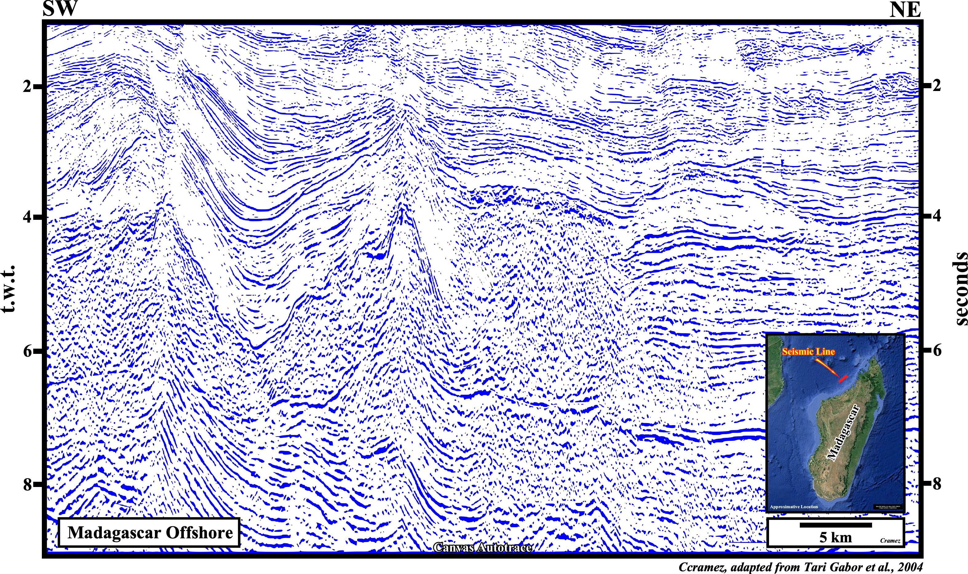

On this tentative geological interpretation, the massif and the inter-stratified salt layers are easily recognized. The massif salt layer is less brittle than the inter-stratified salt package, i.e., it is almost not affected by faulting, which is not the case of the inter-stratified salt, in which faulting is quite developed. The bottom of the salt is, seismically, well marked and it is emphasized by a salt induced tectonic disharmony. The salt and overburden are folded, mainly, by halokinesis, while the margin infra-salt sediments (above the breakup unconformity) are not. Take into account the seismic pitfall induced by the lateral changes in salt thickness, which creates (in a time line) a pull-up of the bottom of the salt when the salt column is higher.
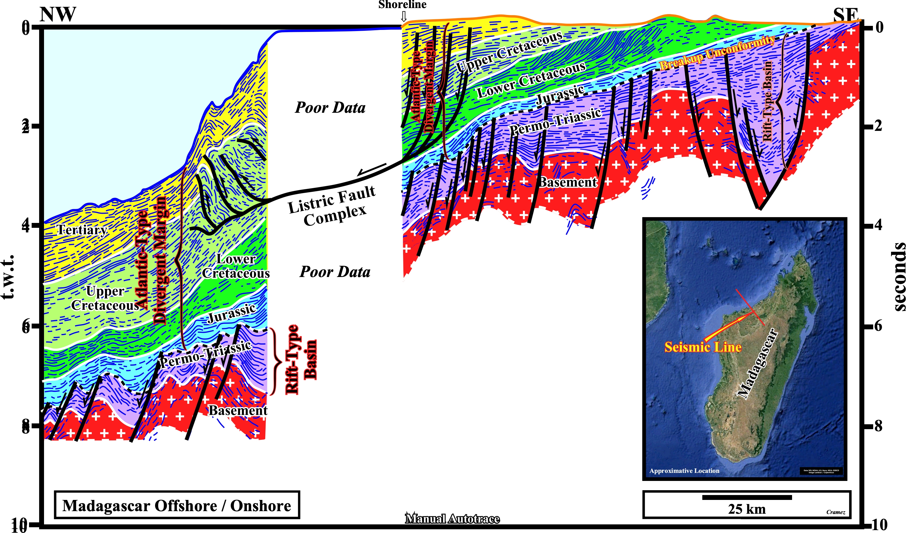
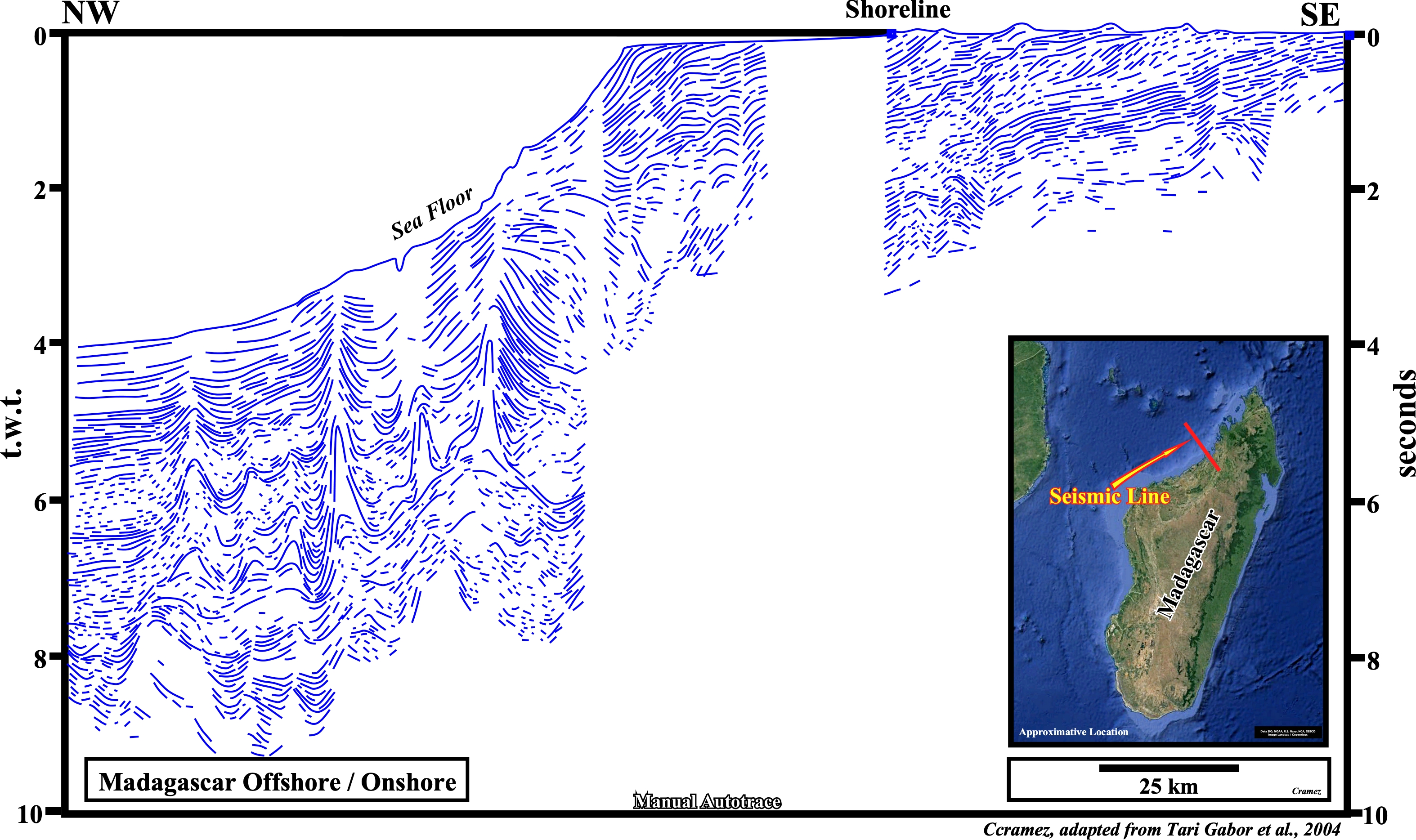
The original seismic lines composing this manual autotrace are located southward of the evaporitic Jurassic depocenter. Indeed, as illustrated on the tentative interpretation, even taken into account the area of poor data, it can be said there is no salt in this area. The Permo-Triassic rift-type basins, predating the breakup of the Gondwana lithosphere, are well recognized, as few small Jurassic depocenters, which suggest certain old normal rifting faults have played, locally, during the first stages of the margin. It is interesting to notice the presence of a listric fault complex, i.e., curvilinear faults playing as normal up-dip and as reverse down-dip. In fact, the extension (lengthening) induced by the normal faults (there is just one way to length the sediments, i.e., by normal faulting) is compensated, down-dip, by a shortening (reverse faulting). Contrarily to an abusive use of the term listric (coming from the Greek "listron"), which etymologically, in geology, means a fault with a spoon movement, it cab be said all listric faults are curvilinear but not all curvilinear faults are listric.

![]()
![]()
Send E-mails to carlos.cramez@bluewin.ch with comments and suggestions to improve this atlas.
Copyright © 2001 CCramez
Last update:
2022
![]()