.jpg)
SW Seychelles Offshore
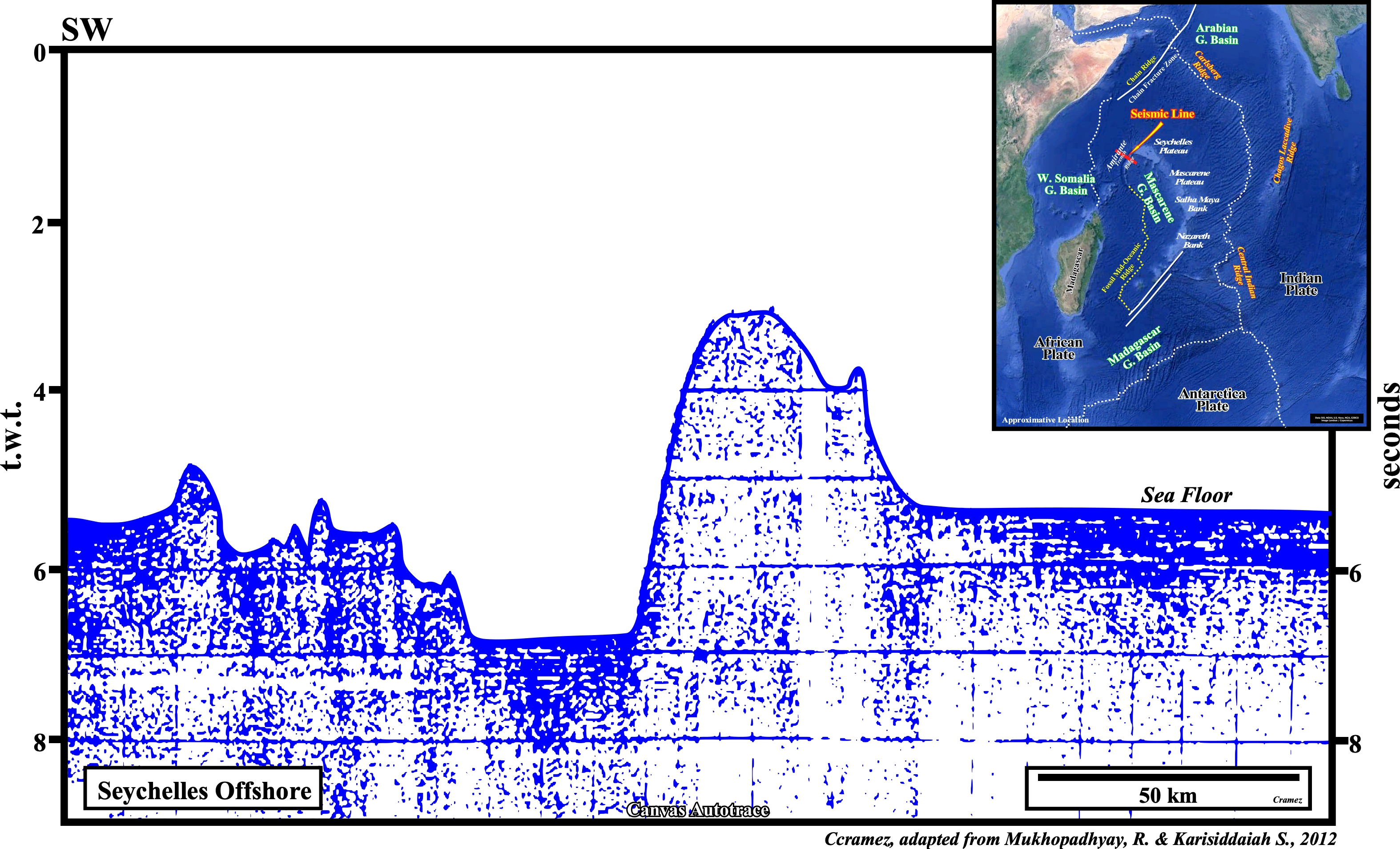
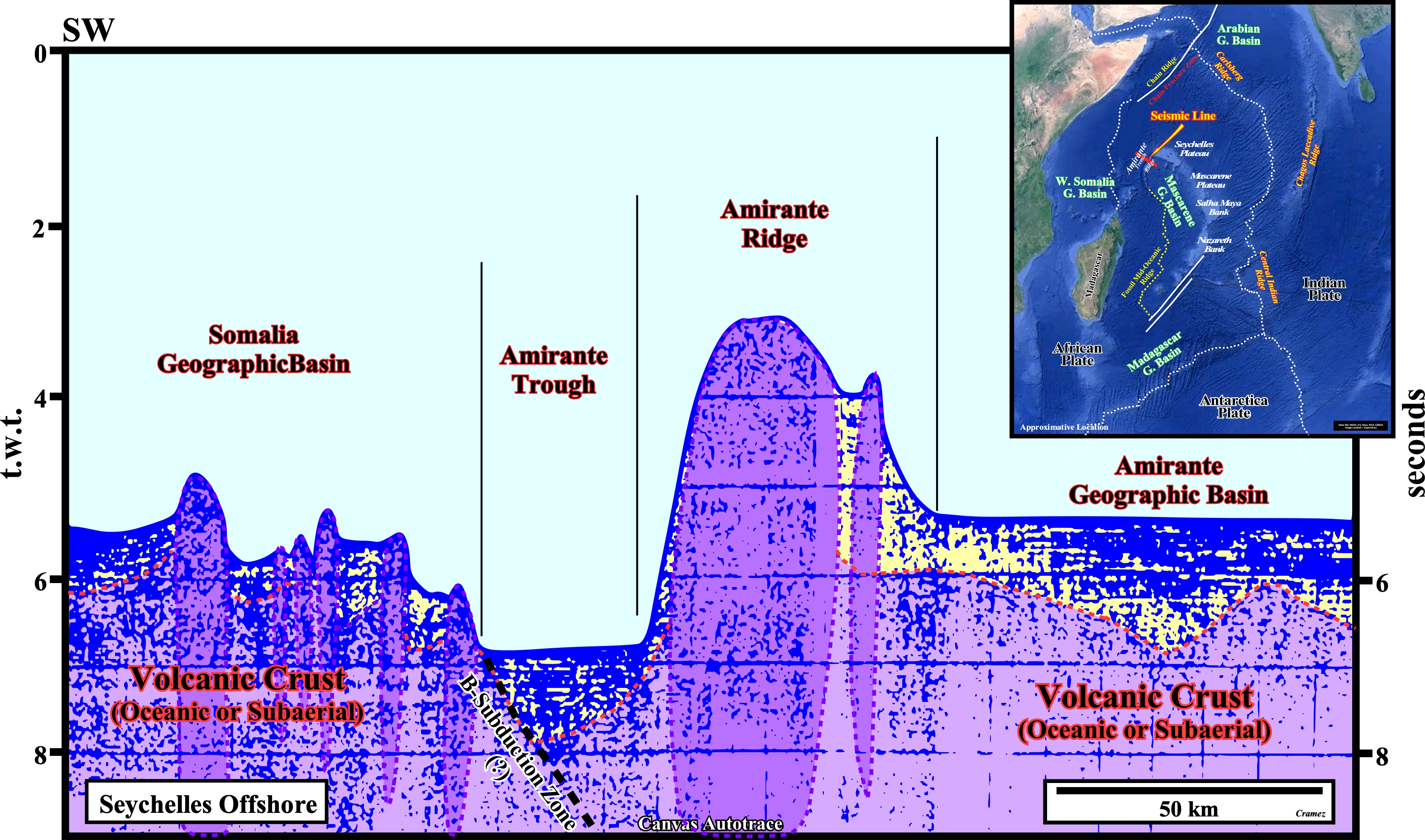
This Canvas autotrace and its tentative geological interpretation of a seismic line from the SW Seychelles offshore crosses the crosses the Amirante Ridge and Trench System (a ridge is a long, narrow elevation of earth and a trench is a long, deep depression in the ocean floor), which is, probably, the southward termination of a subduction zone running along the NW Indian margin during the Late Cretaceous–Paleocene. As illustrated on the location map, the Seychelles Islands are the highest portions of an undersea plateau (a large region that is higher than the surrounding area and relatively flat), which can rise 1-2 km above the surrounding seafloor. However, it can be subdivided, from north to south, into Seychelles and Mascarene plateaus and Salha de Maya and Nazareth banks (a bank is part of the seabed that is shallow compared to its surrounding area that can be of volcanic, carbonate or terrigeneous nature and/or a submerged atoll without outside source of sediments ; a carbonate bank is typically a platform, rising from the ocean depths, whereas a terrigeneous bank is an elevated sedimentary deposits that can reaches the surface of the water and form an island). It is the high area of the Madagascar plate and was formed from India, which left behind continental fragments when it separated from Gondwana small supercontinent (southern part of the Pangea supercontinent) by the opening of the Carlsberg Ridge. Taking into account the Late Precambrian granites outcropping in Seychelles Islands and the Amoco's well results (1980's), which found indications of hydrocarbons in Triassic/Jurassic sediments, there is a probability of continental crust in that undersea plateau.
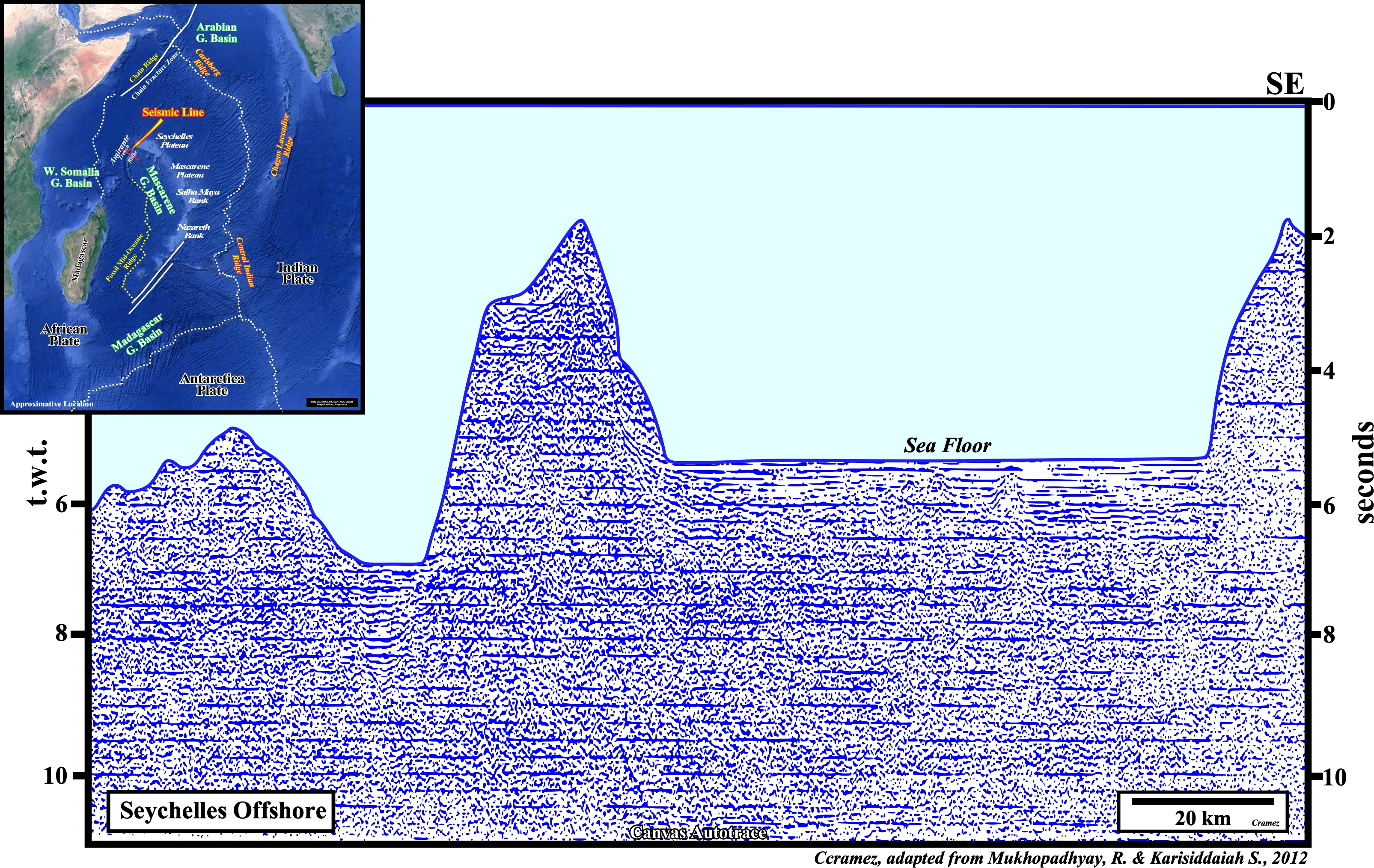
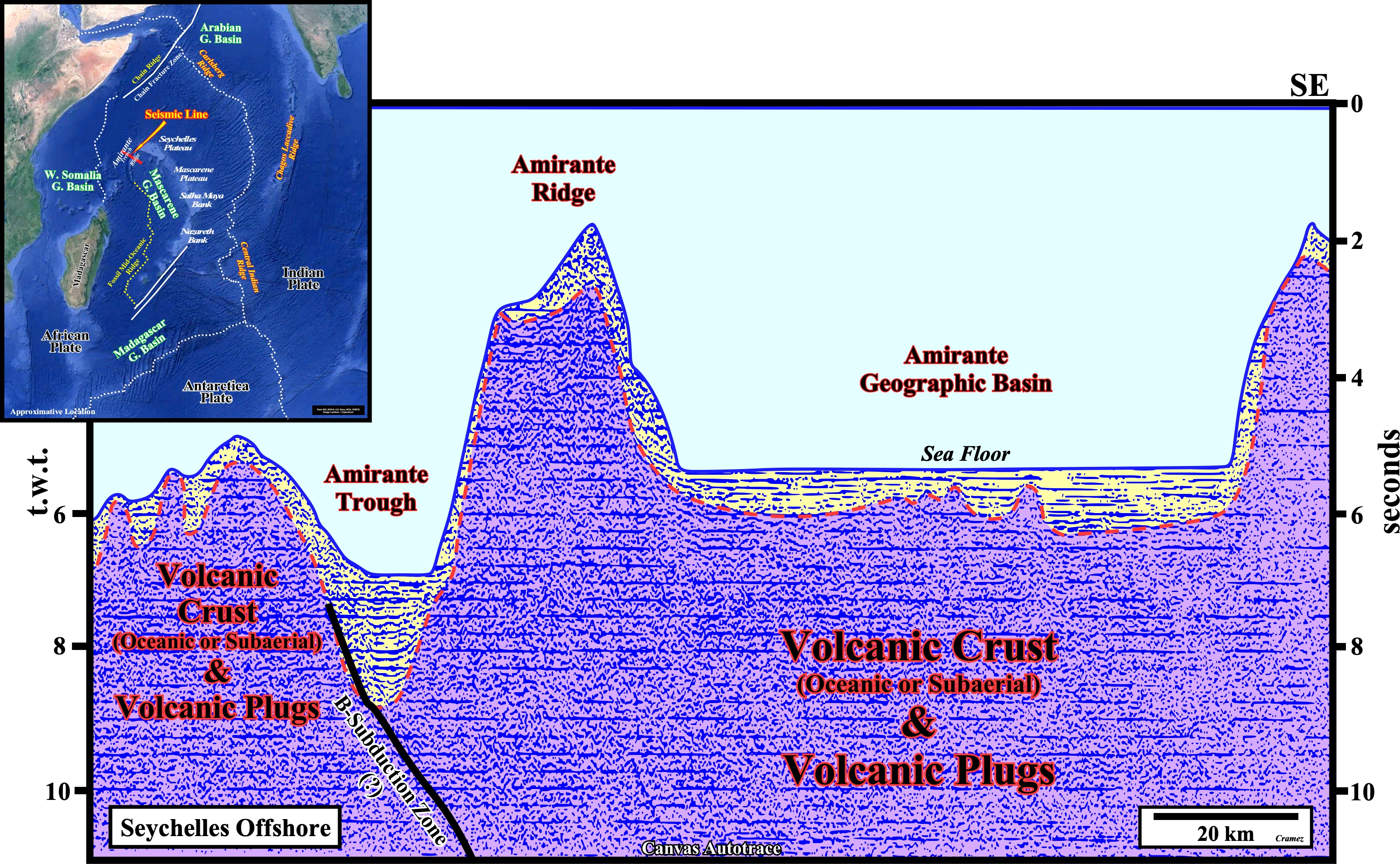
On this tentative geologic interpretation of a Canvas autotrace of an old seismic line of SW Seychelles offshore not far from the previous one, we find the same bathymetric morphology, i.e., (i) The Amirante trough, which is supposed to emphasize the trench of a fossilized B-subduction zone ; (ii) The Amirante ridge interpreted as the volcanic arc induced by the subduction the East Somalia geographic plate and (iii) The Amirante geographic basin, which is, roughly, the northern part of Mascarene geographic basin bounded,westward, by a fossil mid-oceanic ridge and by the undersea continental plateaus (Seychelles, Mascarene) and banks (Salha da Maya and Nazareth).

![]()
![]()
Send E-mails to carlos.cramez@bluewin.ch with comments and suggestions to improve this atlas.
Copyright © 2001 CCramez
Last update:
2022
![]()