.jpg)
.jpg)
Liberia Offshore
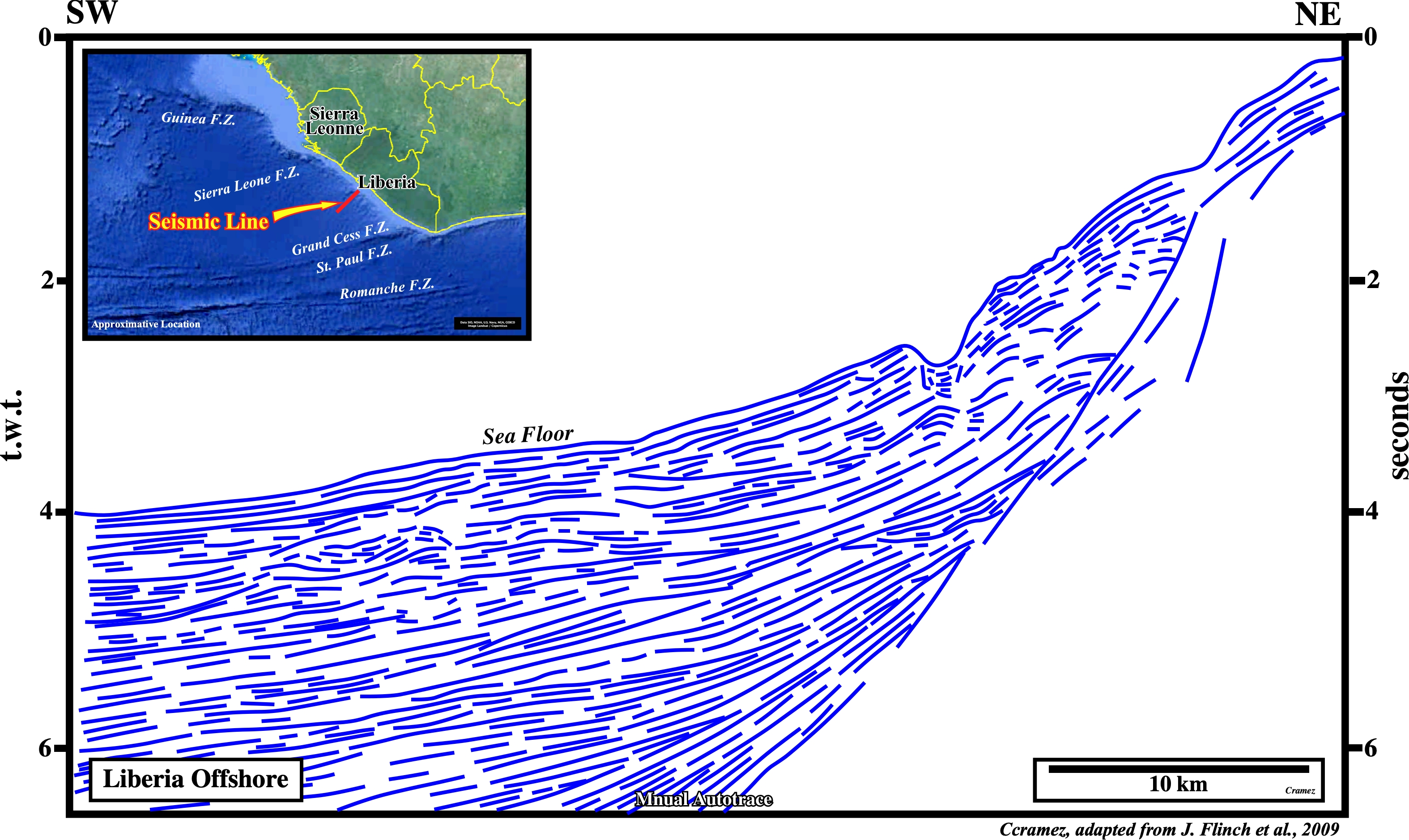
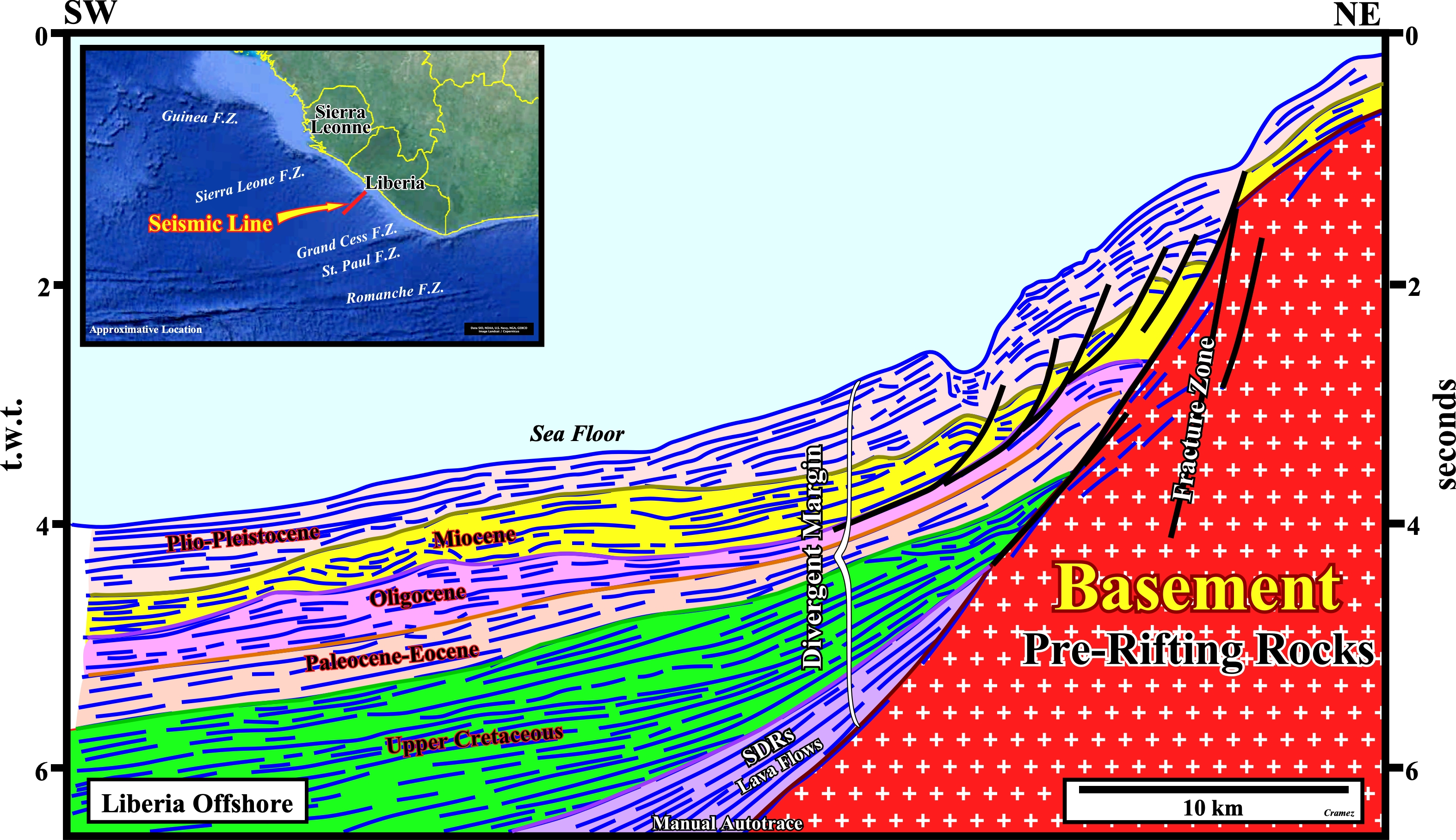
The geological interpretation of this manual autotrace is quite simples and coherent with the tentative interpretation of the autotrace of this area (see Page 53). The interpretation of the lowermost seismic interval as sub-aerial lava flows (sorry by the pleonasm, but a lot of geoscientist forget, often, volcanic material cannot flow under the water) implies not only a seaward dipping but a continentward thinning, i.e., a landward pinchout. In other words, we can say, basinward the sub-aerial lava-flows (SDRs), are connected with vertical set of sheeted dikes capped with pillow lava, which is extruded along marine hotspot volcano chains and the constructive plate boundaries of mid-ocean ridges. The proposed tentative interpretation, as well as, the advanced geological hypotheses must be submitted to falsification tests. Regional seismic lines of this offshore, must shows the lateral change of the volcanic sub-aerial crust into the oceanic crust, as well as, the expansion centers, i.e., hotspot volcano chains. Such a lateral change seems to be recognized on the next regional Canvas autotrace.
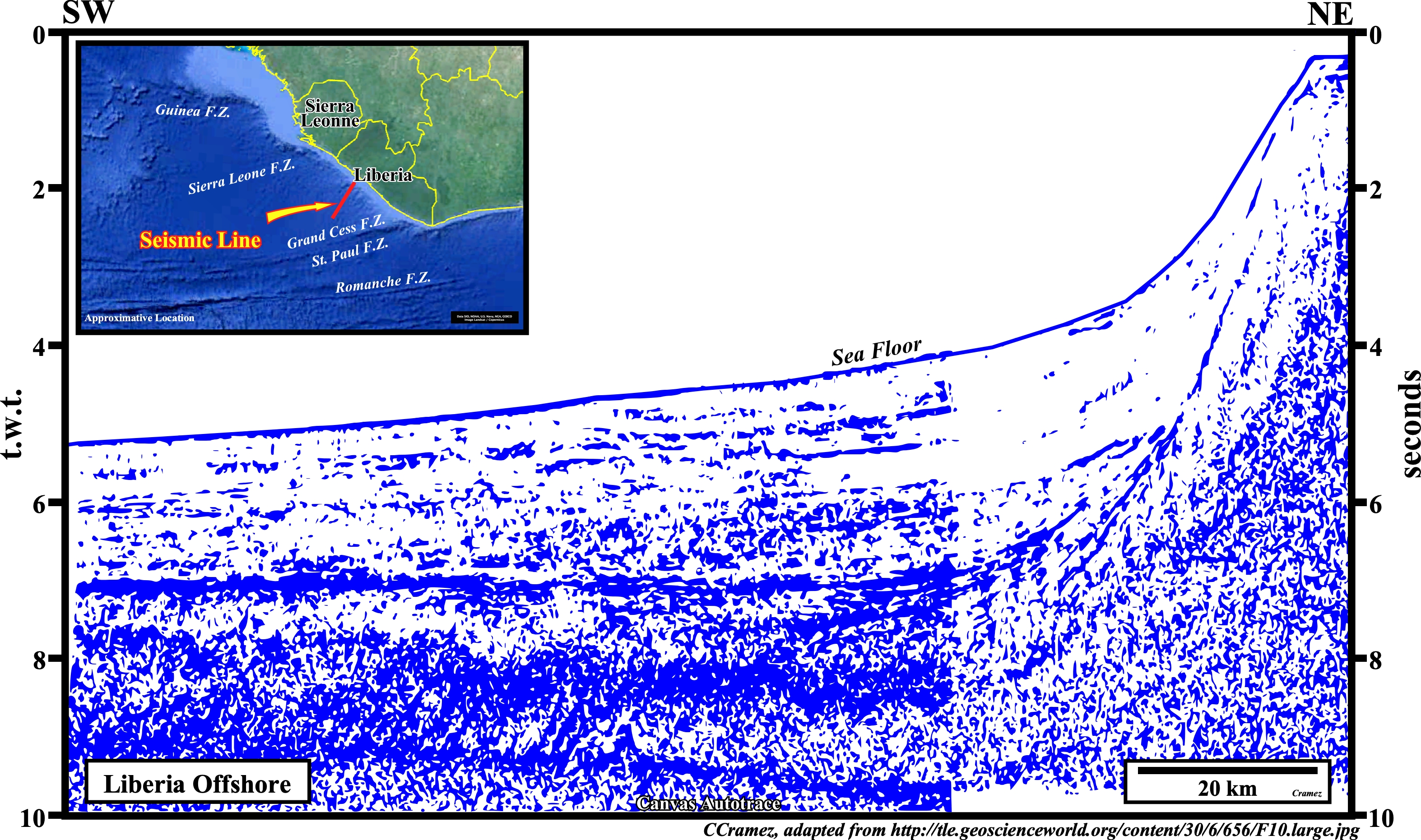
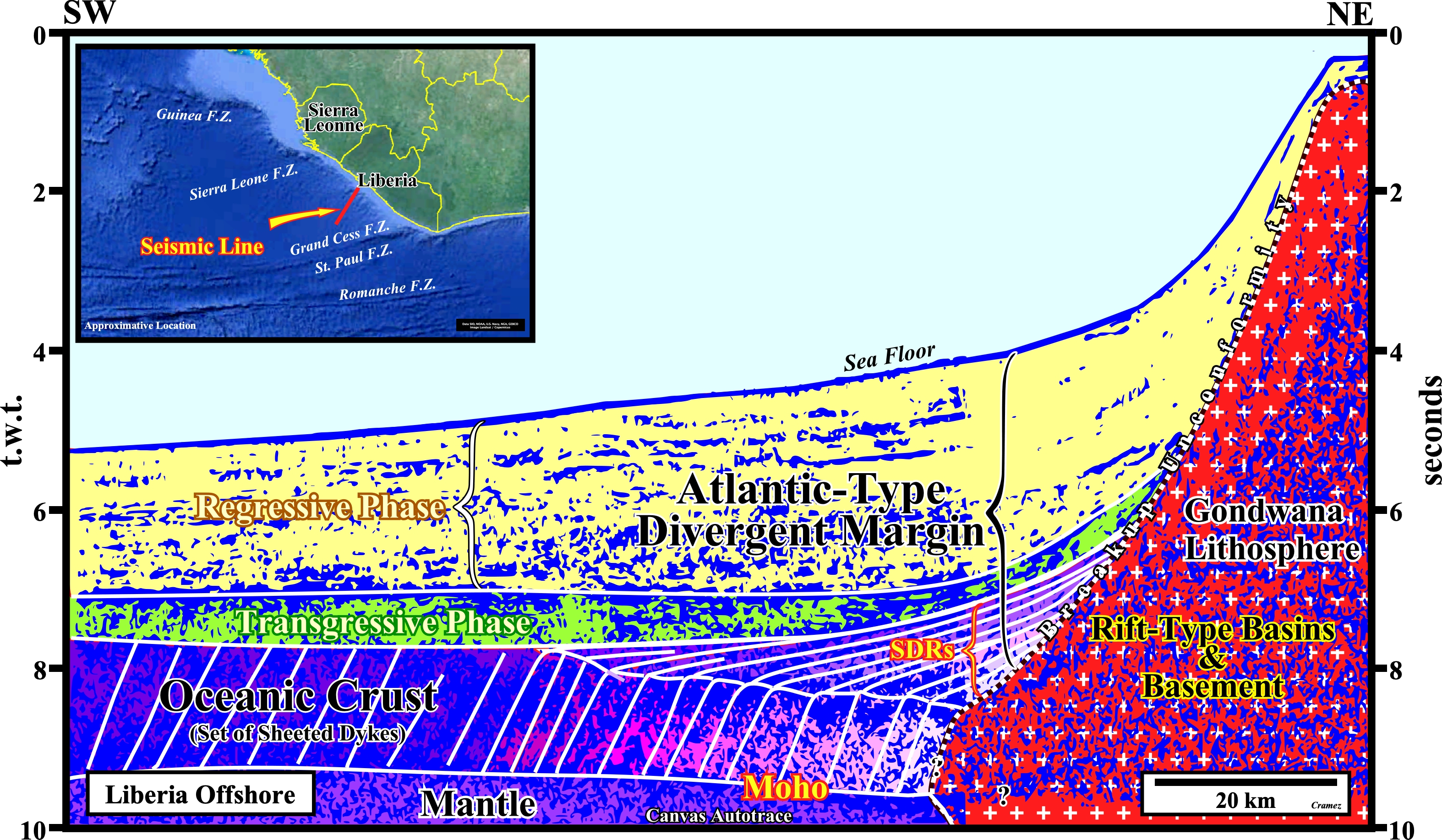
Taking into account the hypotheses assumed in the previously autotrace, i.e., basinward the sub-aerial lava-flows (SDRs) are connected with vertical set of sheeted dikes capped with pillow lava extruded along marine hotspot volcano chains and the constructive plate boundaries of mid-ocean ridges, this Canvas autotrace of an old regional seismic line can be, tentatively, interpreted as depicted. Obviously such tentative interpretaion must be critized and tested by new seismic data. However, new reprocessed seismic lines of the area do not falsifiy the proposed interpretation, on the contrary they seems to coroborate it as illsutarted on the next plates.
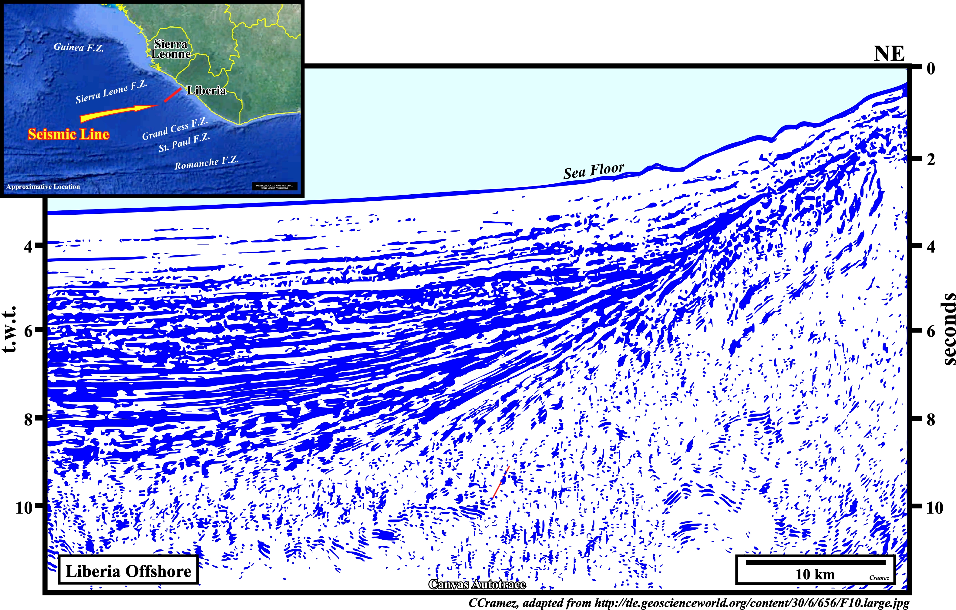
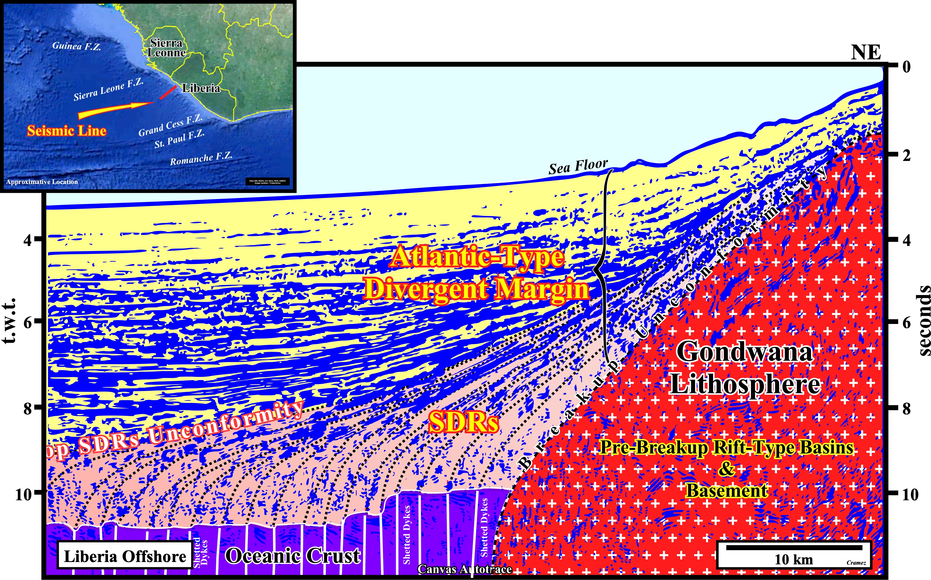
On this Canvas autotrace the connection of the sub-aerial volcanic crust (SDRs interpreted as post breakup lava-flows) with the expansion centers of the oceanic crust is difficult refuted assuming that the oceanic crust is formed by three layers. Layer 1 (around 0.4 km thick), formed of unconsolidated or semi-consolidated sediments, usually, not present near the mid-oceanic ridges. Layer 2, which can be subdivide into two parts: layer 2A with a thickness around 0.5 km thick is the uppermost volcanic layer of glassy to finely crystalline basalt, usually, in the form pillow lava and layer 2B with an average thickness of 1.5 km and composed of diabase dykes (sheeted dykes). Layer 3 formed by slow cooling of magma beneath the surface and consists of coarse grained gabbros and cumulate ultramafic rocks (https://en.wikipedia.org/ wiki/Oceanic_crust).
Send E-mails to carlos.cramez@bluewin.ch with comments and suggestions to improve this atlas.
Copyright © 2001 CCramez
Last update:
2022