.jpg)
Saudi Arabia Offshore
Red Sea Offshore
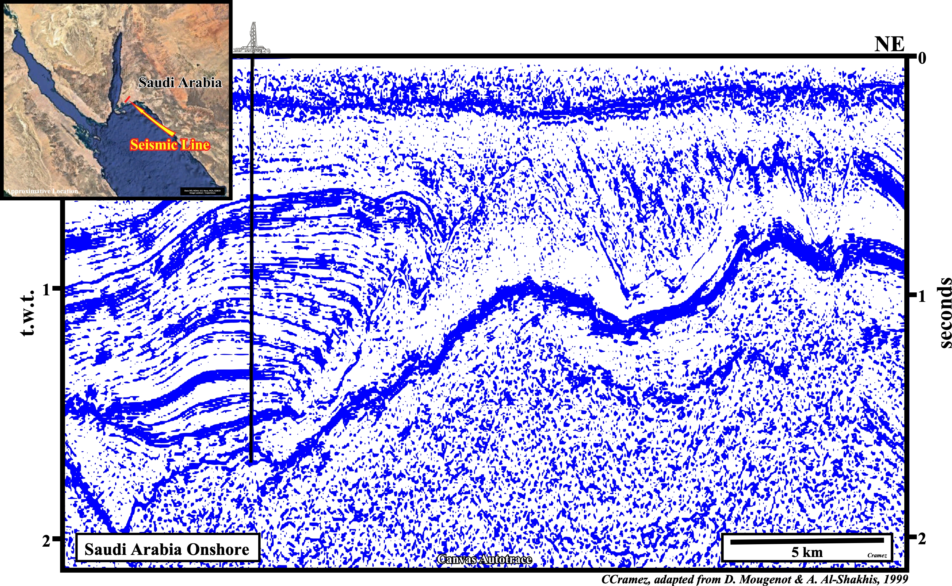
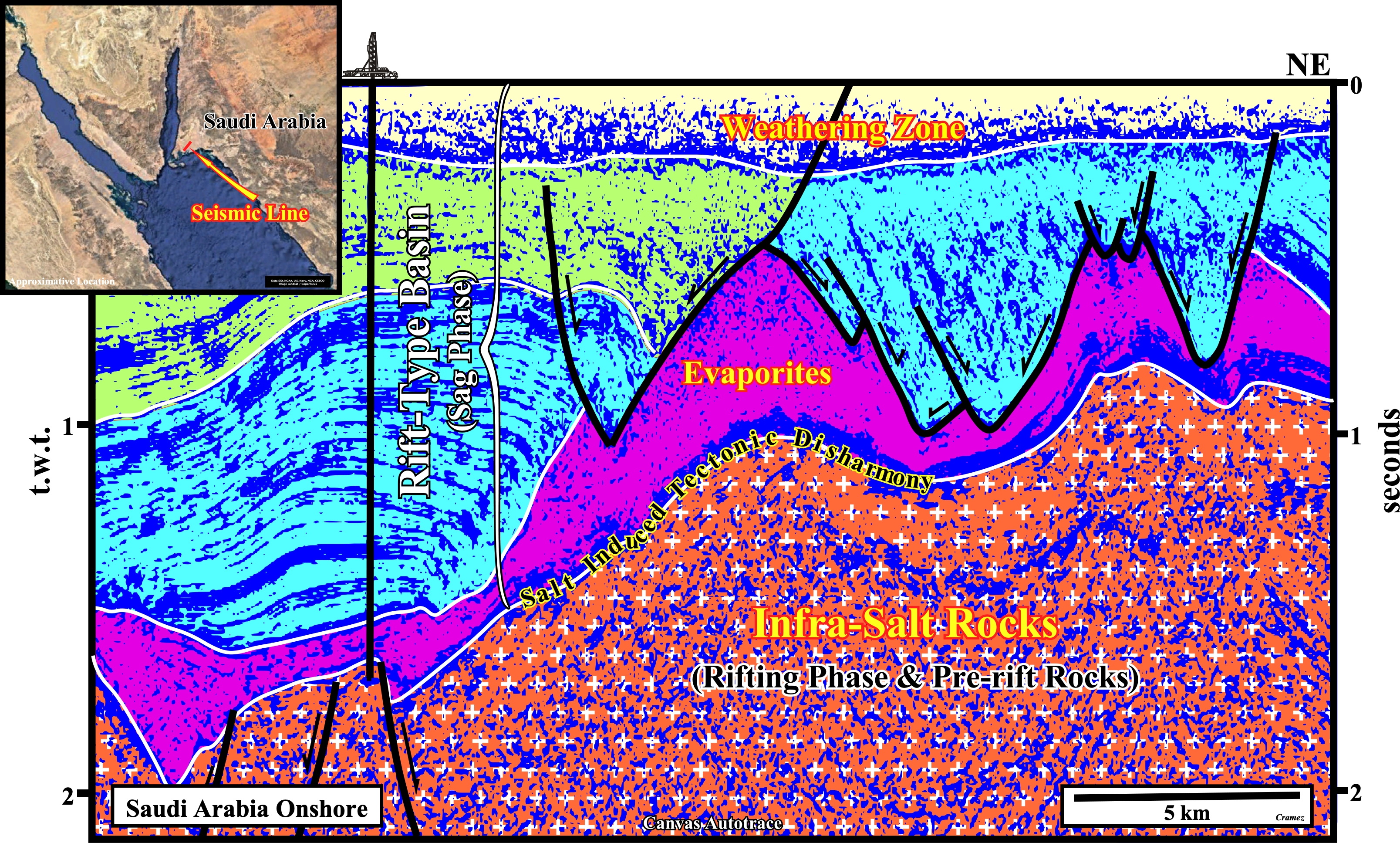
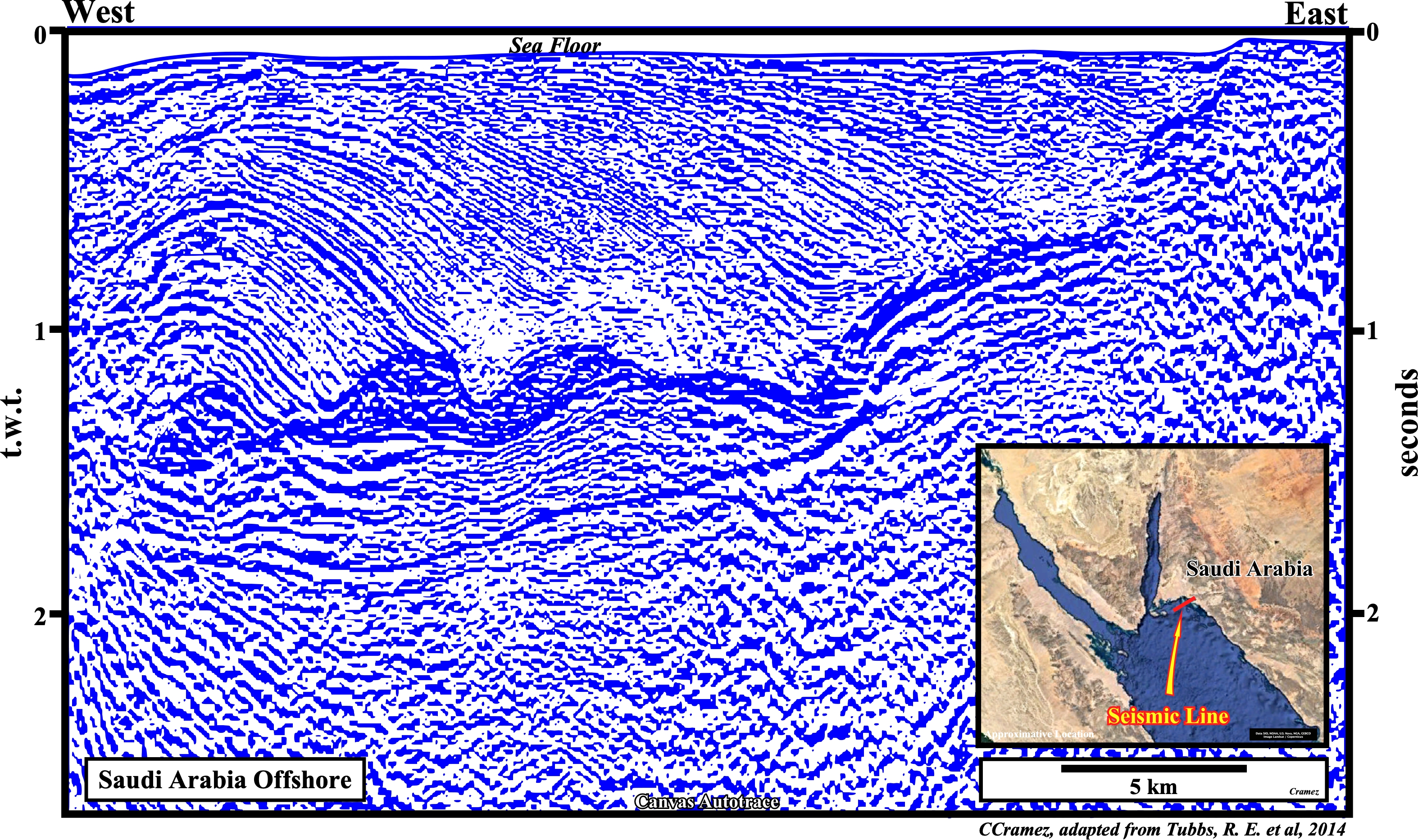
This tentative geological interpretation of a Canvas autotrace of a seismic line of the Saudi Arabia onshore (Midyan geographic basin at junction between Red Sea and Gulf of Aqaba) gives an idea of what we can expect on a seismic line of the offshore of this area, where the breakup of the continental crust seems unlikely. The basin corresponds to a rift-type basin, in which two tectono-sedimentary phase can be individualized: (i) The rifting phase, characterized by a differential subsidence and (ii) The sag or thermal phase, characterized by a predominant thermal subsidence, in which a significant Miocene salt was deposited. The halokinesis seems to be quite important in the salt tectonics visible on this area. On this tentative interpretation just the sag phase sediments are considered, particularly, those above of the salt induced tectonic disharmony (salt + overburden).
On this tentative geological interpretation of a Canvas autotrace both tectono-sedimentary phases od rift-type basin area considered (rifting phase and sag phase). The rifting phase, characterized by differential subsidence, is represented by half-grabens filled by non marine sediments with a parallel internal configuration what suggest they can form a significant generating petroleum sub-system. The limit between the rifting and sag phase is emphasized by an unconformity tectonically enhanced (angular unconformity). In the sag phase, characterized by a thermal subsidence, a salt interval was deposited above a clastic interval. The salt tectonics (tectonic deformation involving salt or other evaporites, as a mobile layer) and halokinesis deforms not only the salt layer but the overburden as well. Notice, salt tectonics is not a synonym of halokinesis, which labels a sedimentary deformation powered entirely by gravity, i.e., by buoyancy, in absence of significant tectonic stress (σt = 0), that is to say., in an equilibrium tectonic regime. Halokinesis is, often, associated with an extensional tectonic regime (lengthening, σ1 vertical), but rarely with a compressional tectonic regime (shortening, σ1 horizontal).
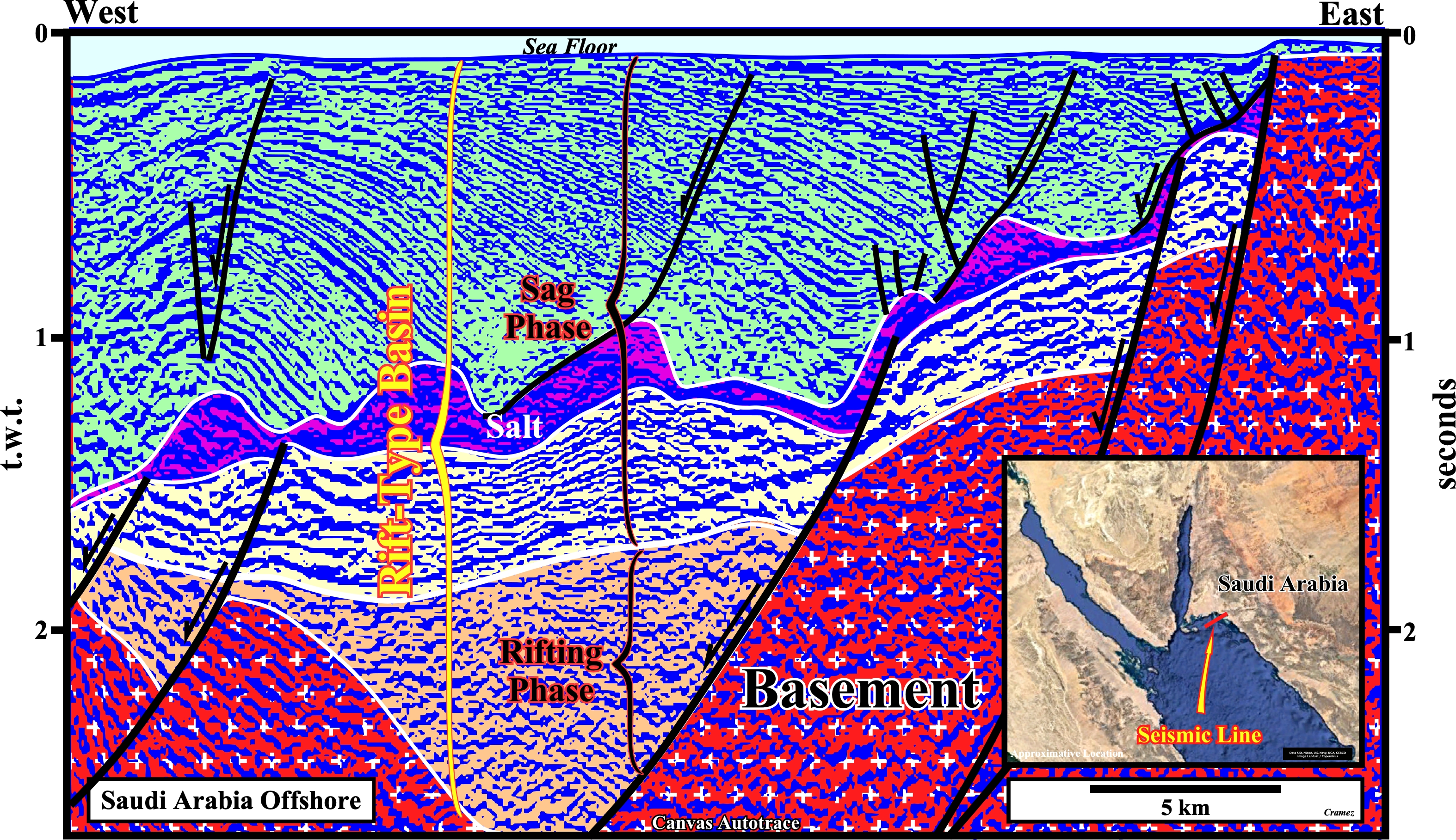
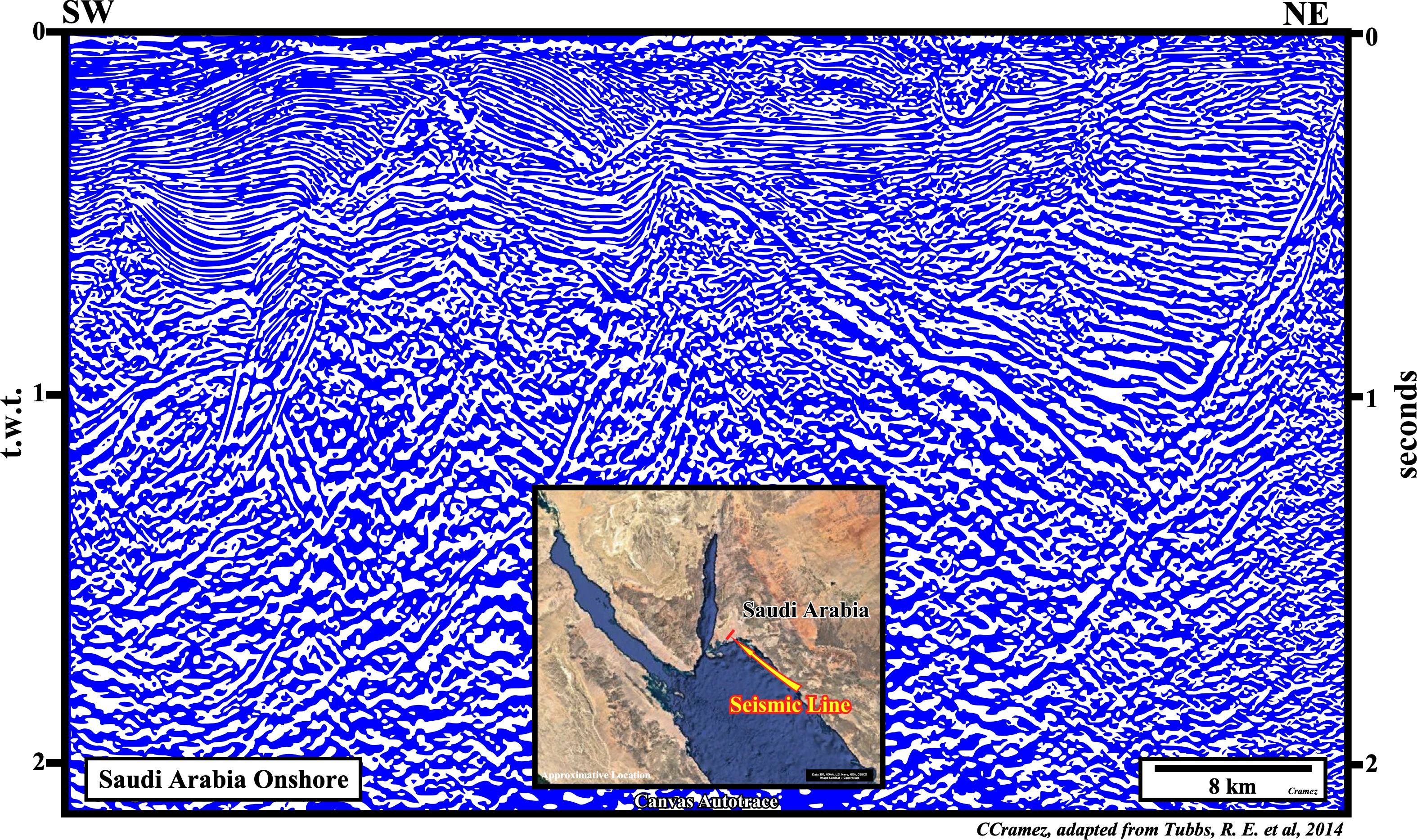
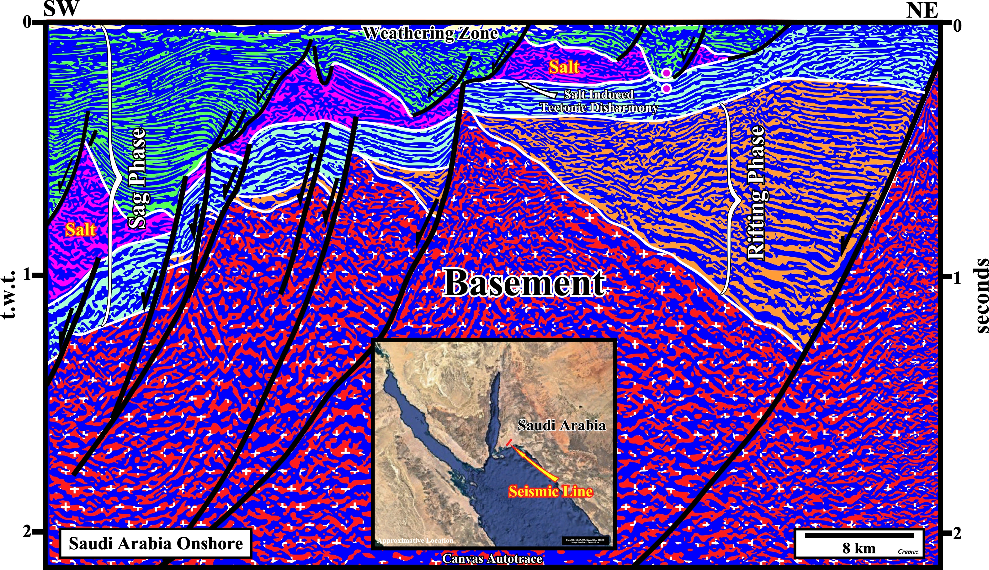
On this Canvas autotrace of an offshore seismic line not far from the previous autotrace, we recognize the same geological events that characterize a rift-type basin. The pre-rifting rocks, here considered as a basement, are easily recognized, particularly, on the lower left corner of the autotrace by their strong dip. Two half-grabens of the rifting phase are also identified without major difficulty. In the sag phase, three main intervals are recognized: (i) A clastic infra-salt interval (colored in pink) ; (ii) A salt layer (colored in violet) and (iii) A clastic overburden (colored in green). The limit between the rifting and sag phase is emphasized by an unconformity, locally, tectonically enhanced, while the bottom of the salt is emphasized by a salt induced tectonic disharmony (geological surface individualizing two realms of deformation). The rocks overlying the tectonic disharmony (salt + overburden) were lengthened by an extensional tectonic regime, while the sediments below the salt induced disharmony are mainly undeformed. Thus, all structure developed above the tectonic disharmony are antiforms and synforms, which means the potential hydrocarbon traps are non-structural, but morphological, mainly, morphological by juxtaposition (erroneously called "traps against a fault" by certain geoscientist that forget that a fault never traps, what traps is a sealing rock located in the other side of the fault zone or by the fault gauge ( tectonite, i.e., a rock formed by tectonic forces, inducing a brittle deformation, with a very small grain size).
![]()
![]()
Send E-mails to carlos.cramez@bluewin.ch with comments and suggestions to improve this atlas.
Copyright © 2001 CCramez
Last update:
2022
![]()