
North Curaçao Offshore
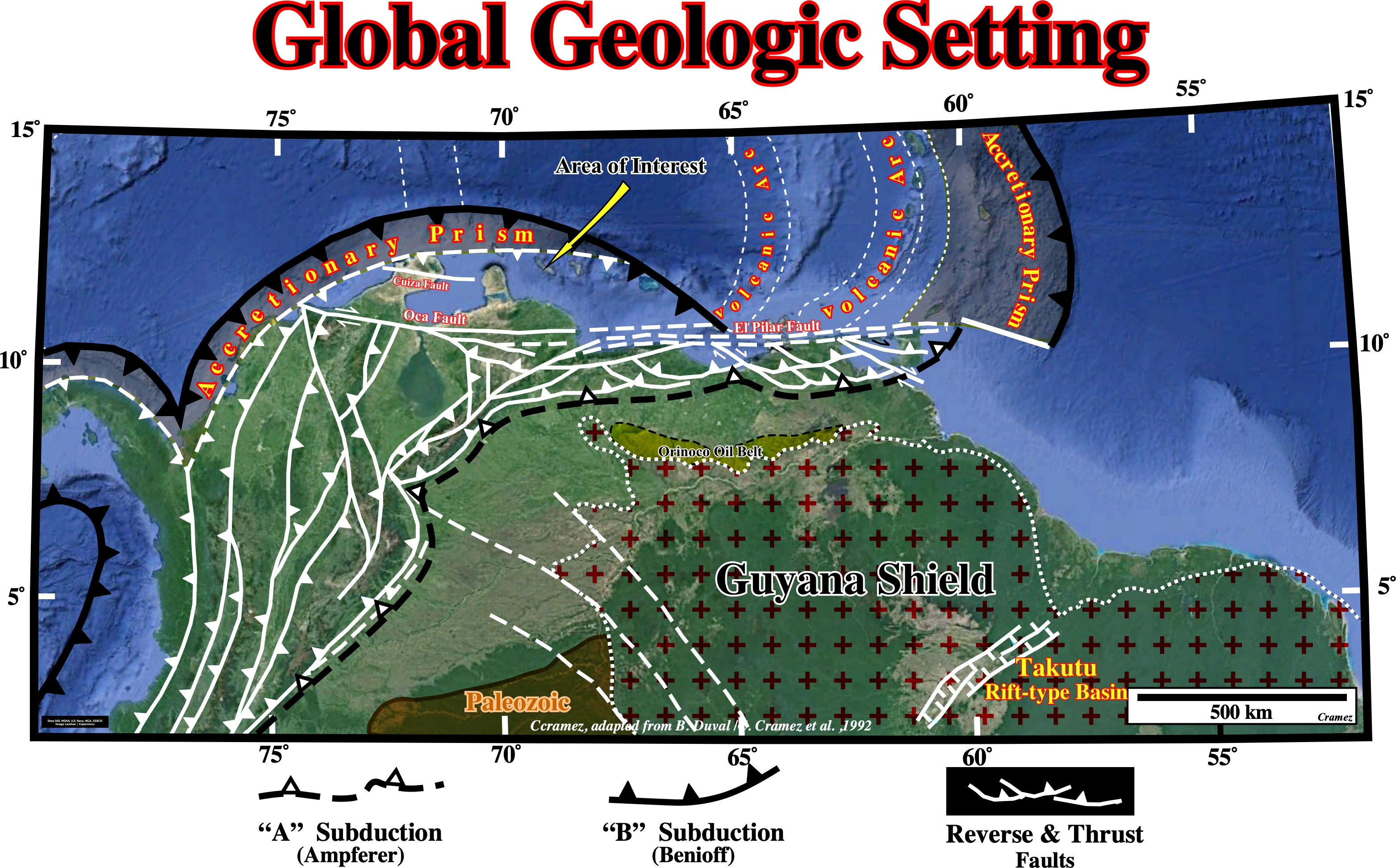
This tectonic sketch is a tentative representation of the global geological setting of the South America lithospheric plate, in which two main subduction zones are clearly visible, which bound the Meso-Cenozoic megasuture. The northern subduction zone is a B-Type subduction (Benioff type), in which the descending plate is oceanic. B-type subductions are highlighted by an: (i) Oceanic trench ; (ii) Alignment of volcanoes and (iii) Deformation in the overriding plate, which often causes the formation of mountains. The southern subduction zone is A-type subduction zone (Ampferer type), in which the descending plate is continental. A-type subduction are characterized by a foreland basin (foredeep). The area of interest (Cariaco and Margarita Platform), located westward of Trinidad, lies within the Meso-Cenozoic megasuture. It is highly shortened, as depicted on the N-S geological cross-section illustrated below.. The presence of W-E smyajor shears, as El Pilar fault complex, creates, mainly, two types of sedimentary basins : (i) "Great Basin" Type and (ii) California-Type. The "Great Basin"-Type Basins are dominated by a complex tectonics linked to a pair of mega-shears where tilted blocks individualize a large number of small basins (e.g., Vela and Falcon geographic basins). This tilting geometry contrasts with that of Californian-type basins which are most often uniform and very flat. The Californian-type basins are similar to the continental backarc basins of Pannonian-type. Both develop over a thinned continental crust in association with normal listric faults or shears, having a strong thermal flux. In Venezuela, the Gulf of Paria and Falcon geographic basins and the Cariaco geographic basin are good examples of California-type basins.

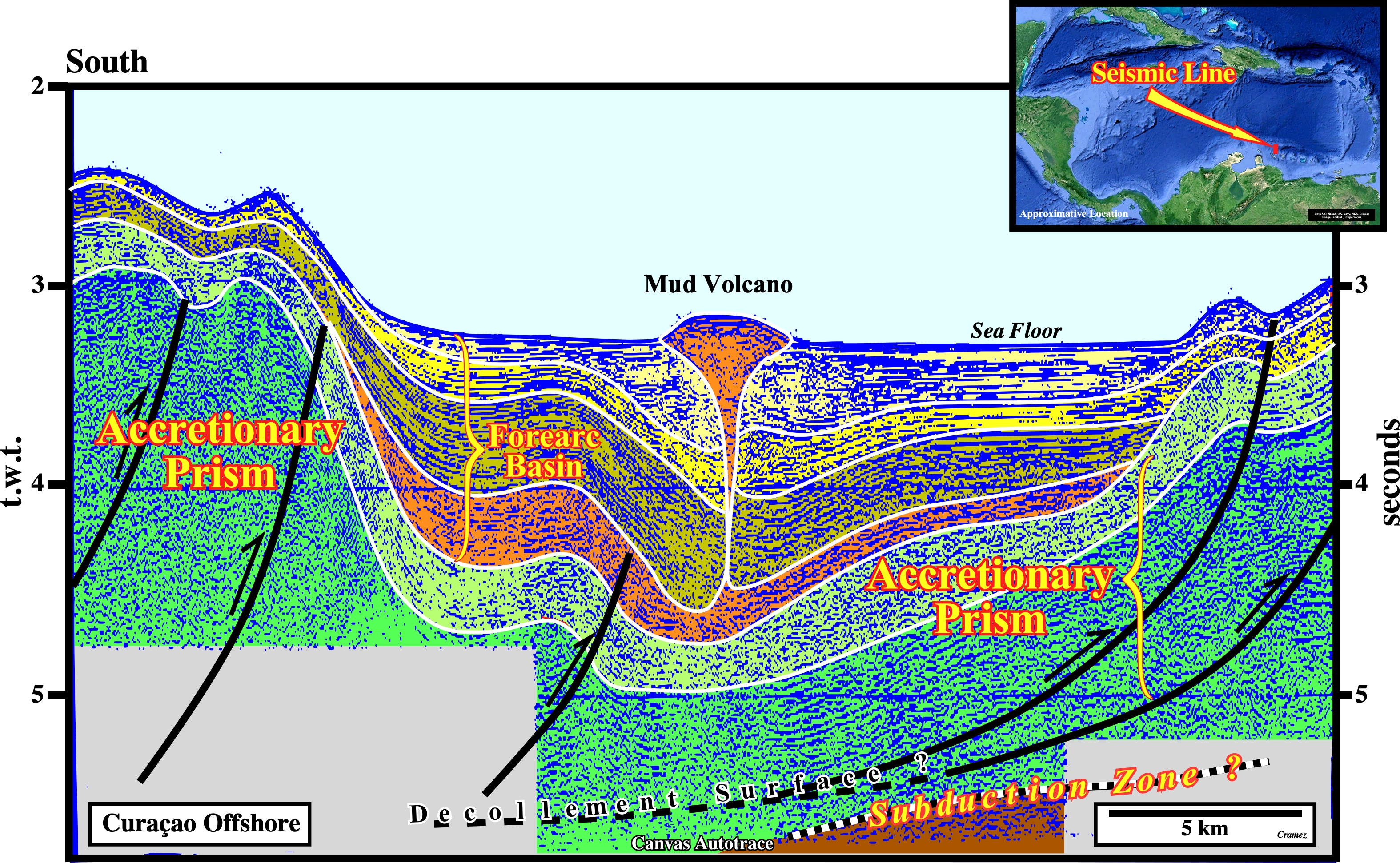
On this preliminary tentative geological interpretation of a Canvas autotrace of a composite seismic line of the Curacao north offshore, taking into account the tectonic context of the area summarized above, it is possible to speculate a subduction zone along which the Caribbean lithospheric plate plunging under the South America plate, with the development in the overriding plate of an accretionary prism in the top of which a forearc basin was build up. A basal shaly interval of the forearc basin can be the responsible of the mud volcano (land-form created by the eruption of mud or slurries, water and gases) outcropping on sea floor .

![]()
![]()
Send E-mails to carlos.cramez@bluewin.ch with comments and suggestions to improve this atlas.
Copyright © 2001 CCramez
Last update:
2022
![]()