
GOM Offshore
Deep Gulf of Mexico
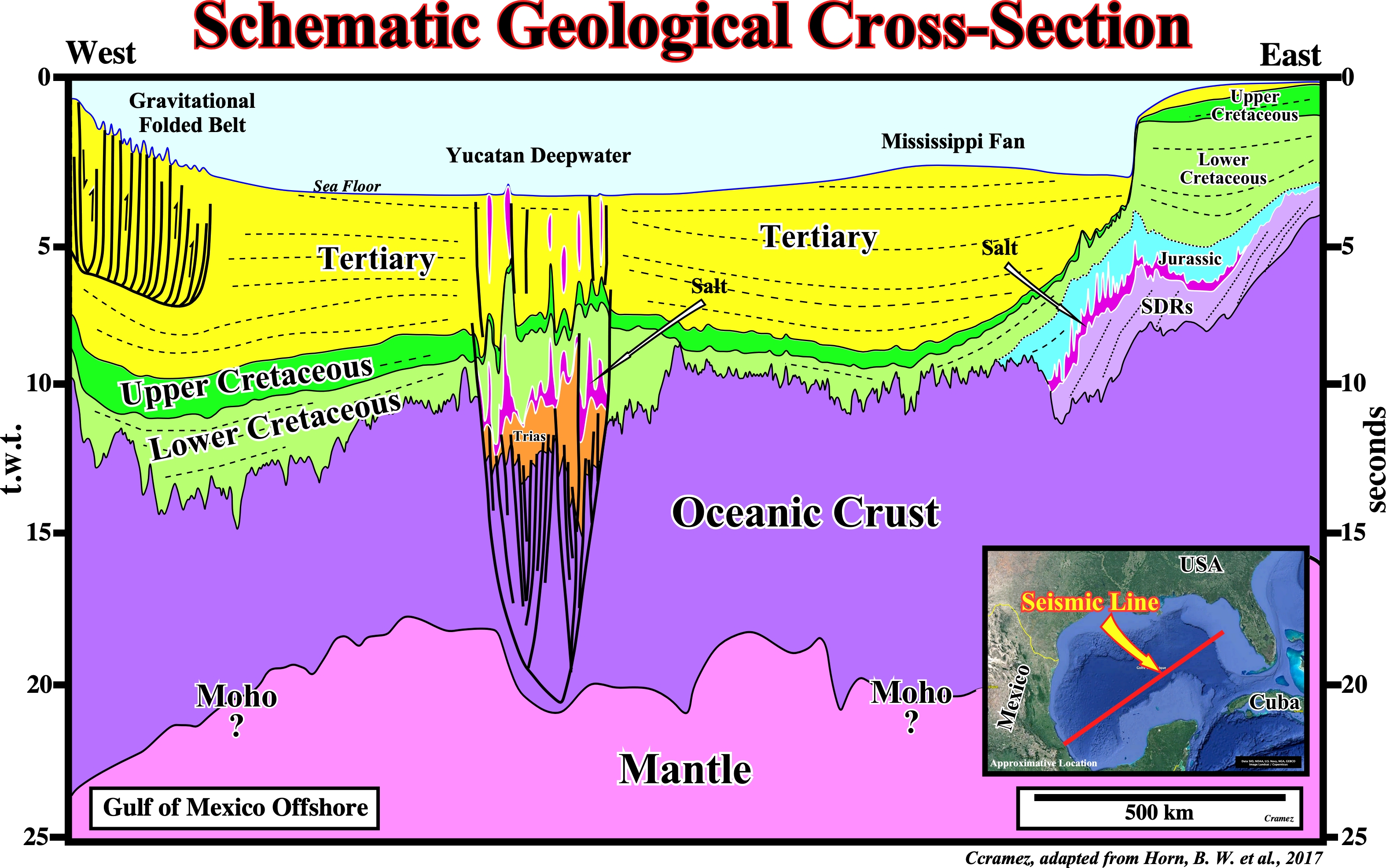
This geological interpretation of a composite seismic line crossing the Gulf of Mexico shows the regional geological context of this marginal sea. In Geology, the term marginal sea means a quite different thing that in Geography and Oceanography. In Geology, the term marginal sea means (according Karig, D. E, 1971) is a sea bordering a continent, semi-isolated from open ocean by island arc or land ridge and underlain by oceanic crust. In fact, in the Bally and Snelson's classification of the sedimentary basins, the Gulf of Mexico corresponds to a Mesozoic Mediterranean-type basin (episutural basin, associated with a subduction A, with oceanization). Actually, the Gulf of Mexico developed over a lengthened folded belt (Appalaches), in which the extension has been big enough to give an oceanization, as suggested corroborated by the next autotraces.
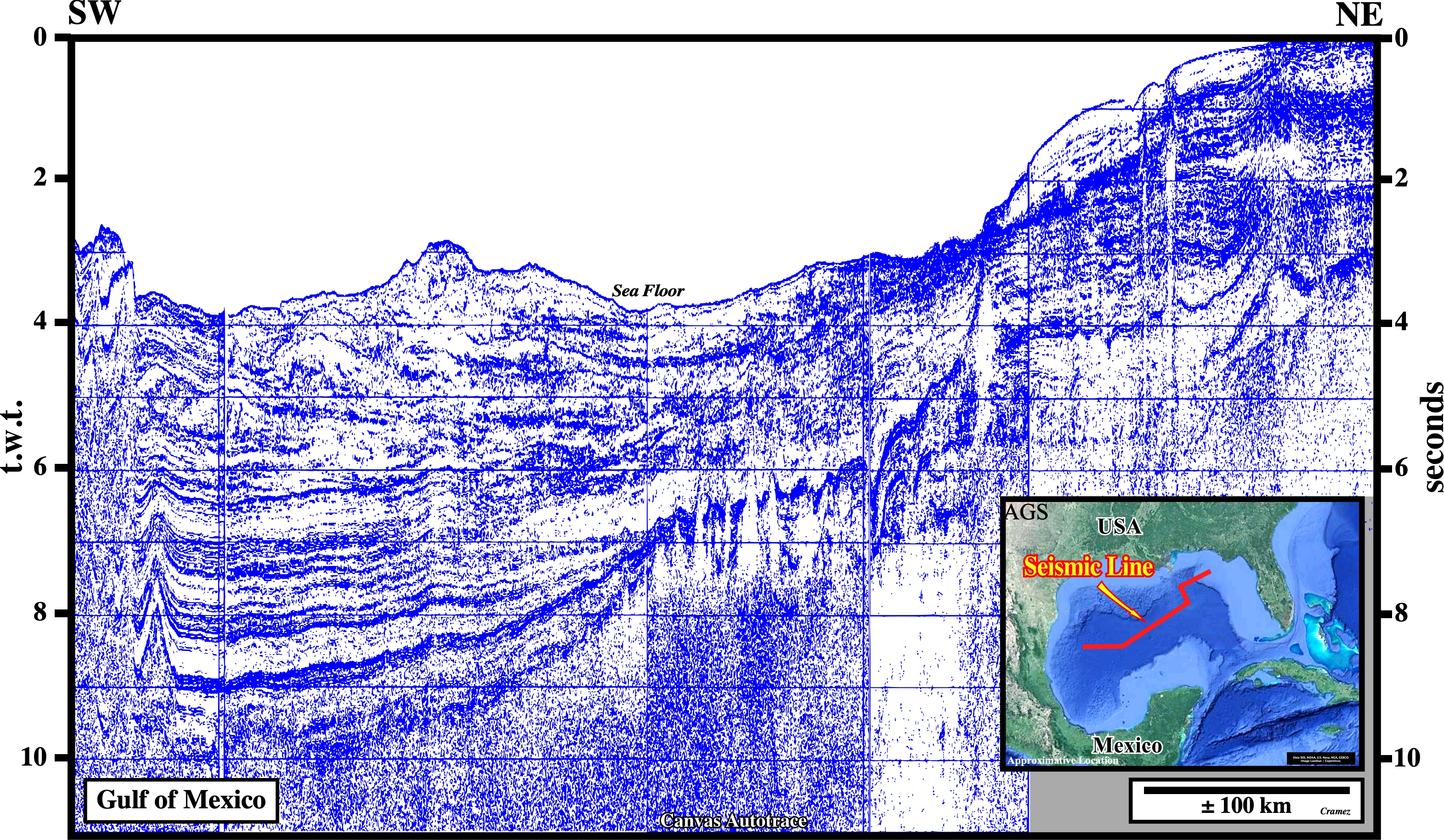
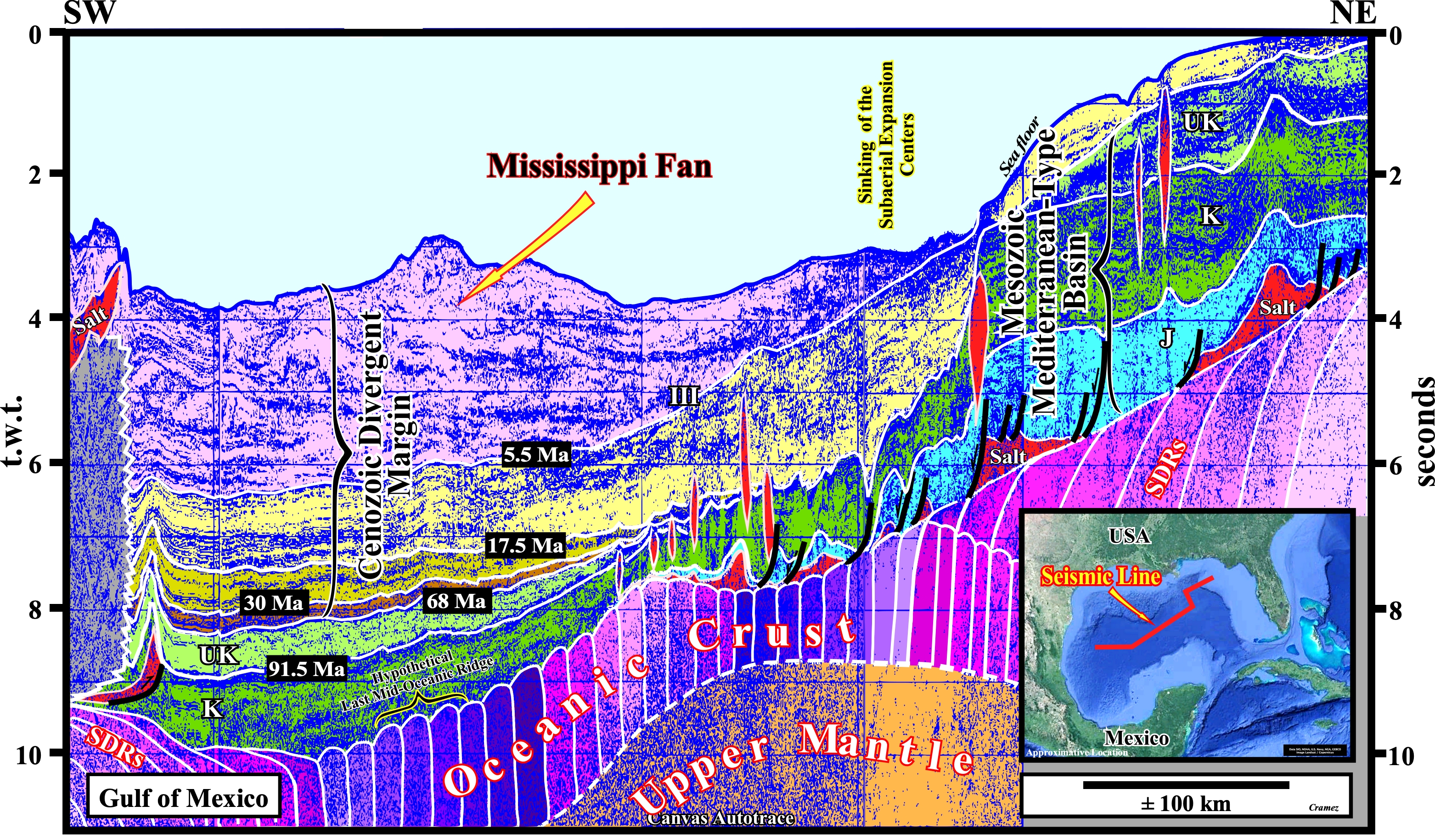
On this tentative geo0logical interpretation of a Canvas autotrace of a composite seismic line crossing part of the Gulf of Mexico, we can see : (i) A Ceno-Mesozoic Mediterranean-type basin above a the oceanic crust which overlies the Upper Mantle ; (ii) In the ends of the line, i.e., each side of the middle oceanic ridge, which highlights, in this area, the breakup zone of the Pangea supercontinent, the oceanic crust, buildup by sets of sheeted dykes, pass landward and vertically, to SDRs (seaward dipping reflectors), which represent the deposit of lava flows (see basement's evolution on next plate and also Page 19) ; (iii) Before the sinking and submergence of the sub-aerial expansion centers (sheeted dykes), each side of sub-aerial valley-rift, evaporites were deposited at the base of the Ceno-Mesozoic Mediterranean-type basin ; (iv) After the sinking and submergence of the expansion centers, as the mantle material pouring out by the dykes cannot flow under the water it forms the pillow-lava (oceanic crust) over which the post Pangea continental encroachment stratigraphic cycle was deposited ; (v) In the top of the continental encroachment stratigraphic cycle there is, in the Quaternary, deposition of the Mississippi fan composed several elongated fan-lobes.
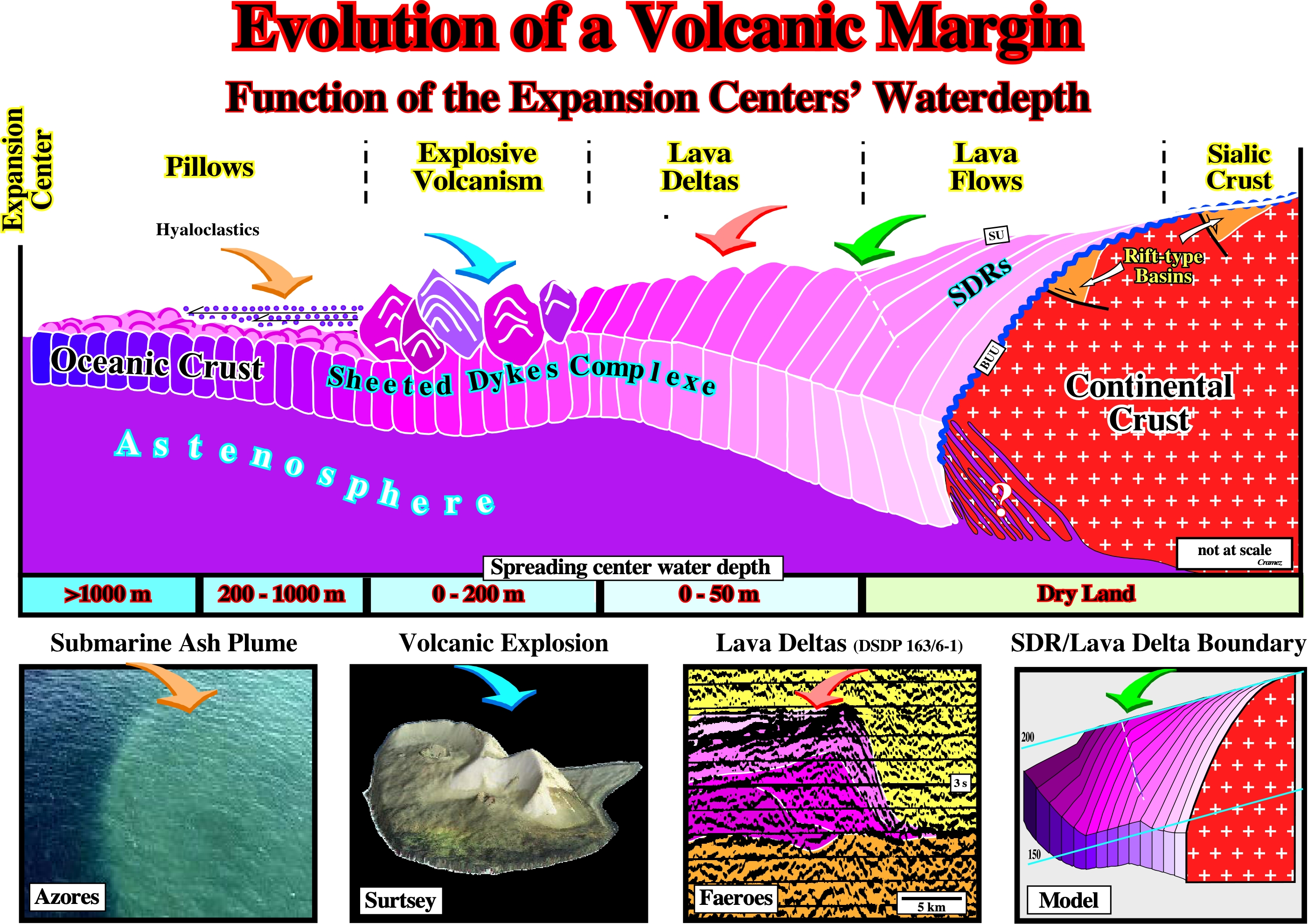
With my colleague Patrick Imbert we proposed, several years ago, a geological model to explain the different volcanic bodies found in the volcanic interval of Atlantic-type divergent margins and Mediterranean-type basins, in function of the water-depth of the expansion center, using the Gulf of Mexico as reference. In dry land, i.e., when the expansion centers (generally volcanoes or volcanoes chains that we call sheeted dykes) outcrop there is formation of lava flows (SDRs, i.e. seaward dipping reflectors). As said, the term sheeted dykes is used, here, to highlight the presence of sub-aerial or immersed expansion centers and not just the dykes forming the upright columns magma does not reach surface or the sea floor. When the expansion centers reach the sea floor or are immersed there is formation of basaltic formations, which function of the water depth can be: (i) Lava delta (spreading center between 0 and 50 m of water depth) ; (ii) Explosive volcanism (spreading center between 0 and 200 m of water depth) ; (iii) Pillow lava (spreading center between 200 and 100 meters of water depth), which can be covered by hyaloclastics (quench lava's fragments, often, associated with explosive eruptions). These different volcanic bodies are illustrated on the following Canvas autotraces of GOM's seismic lines.
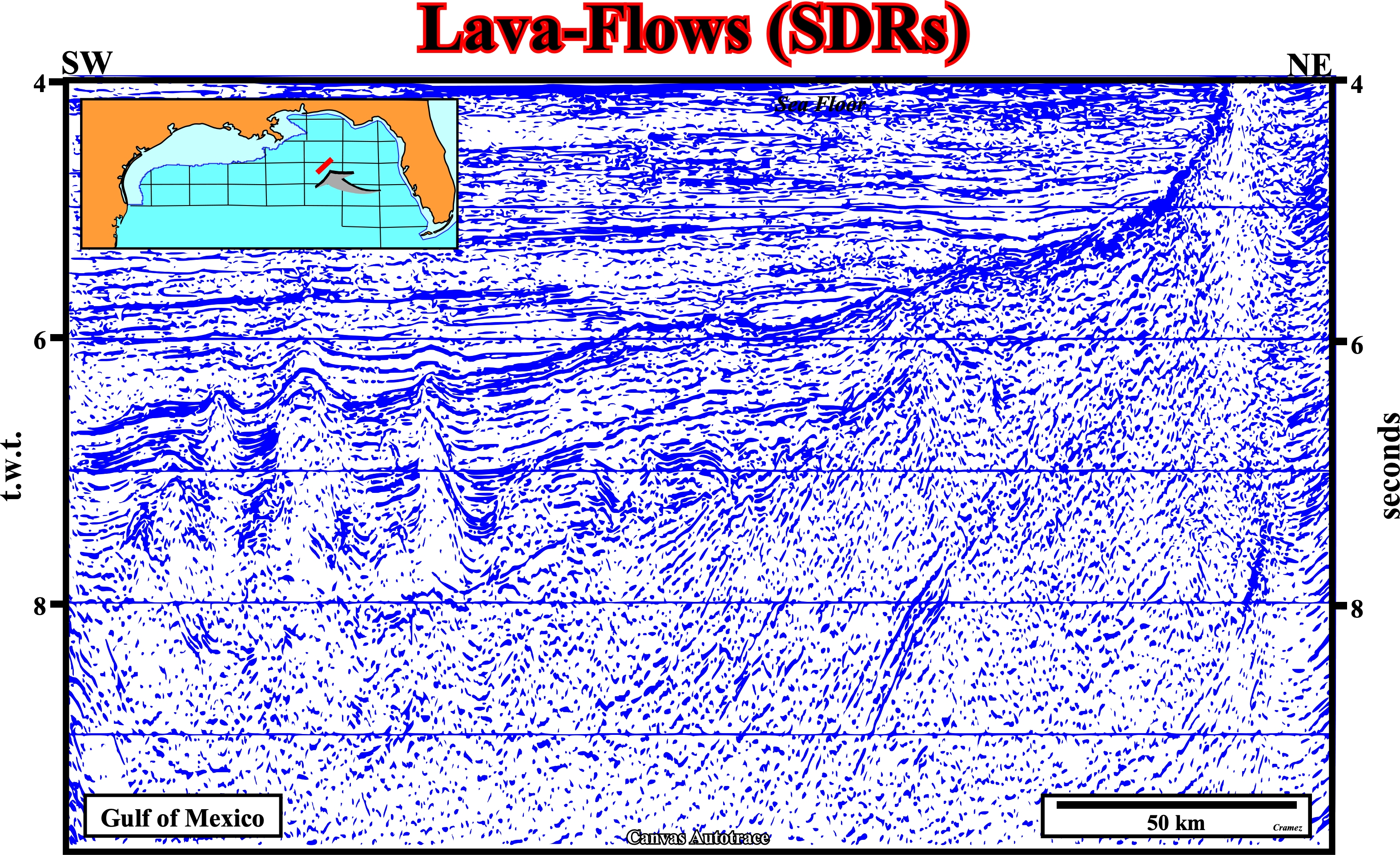
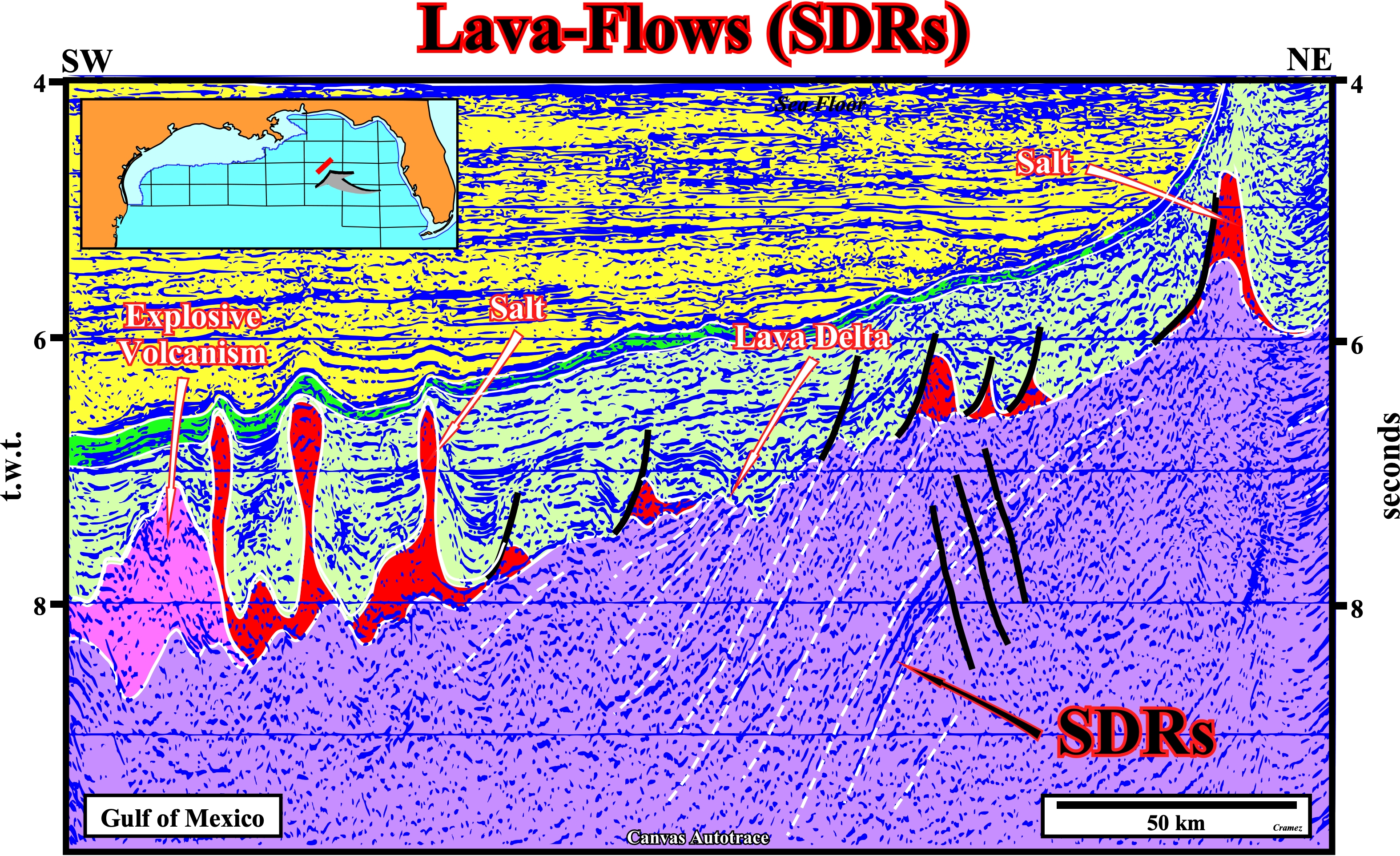
On this Canvas autotrace, the lava flows, i.e., seaward dipping reflectors are more than evident. Similarly, on the top of the SDRs, lava deltas, fossilized by Jurassic sediments due lateral flowing of the salt-layer (colored in red). In front of the salt layer an outer high induced, by explosive volcanism is also easily recognized.
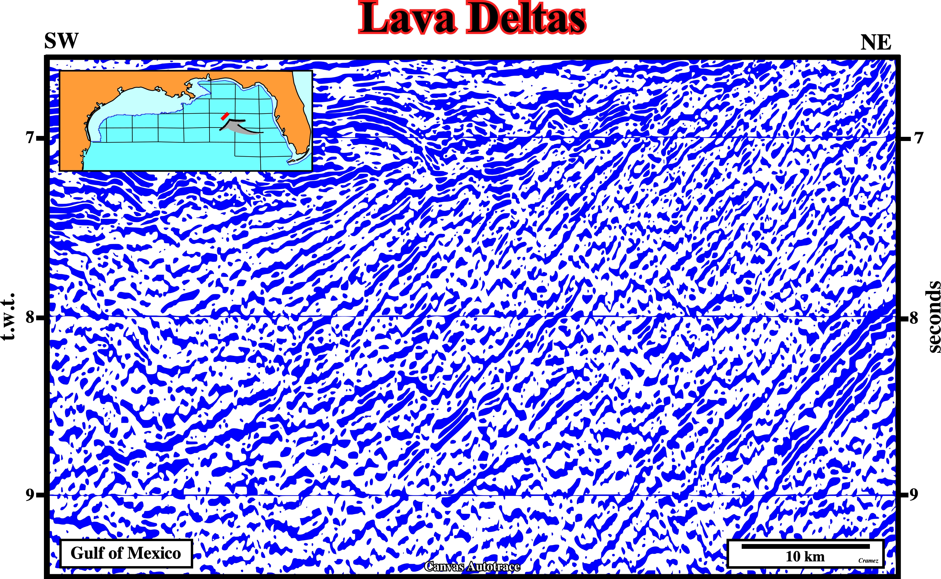
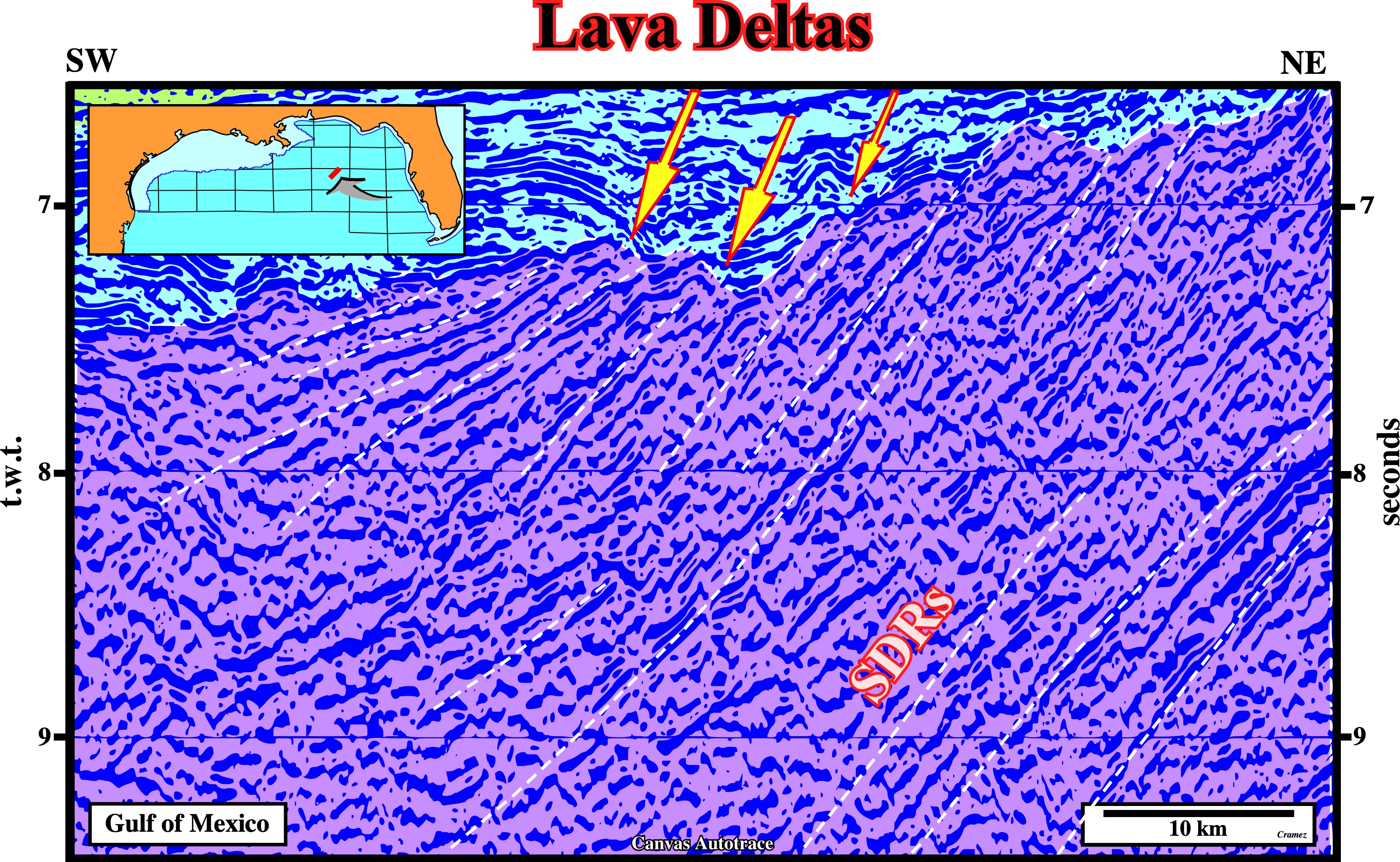
On this detail of the previous Canvas autotrace, several lava deltas are recognized on the top of the seaward dipping reflectors, what means the lava flowing from the spreading center (synonym of expansion center) continentward it solidified, rapidly, by entering an aquatic environment, probably, an epicontinental sea or proto-ocean, because lava cannot flow under water. The progradational geometry of a lava delta is similar to that of a river delta, but the mechanism of deposition obey to completely different geological principles.
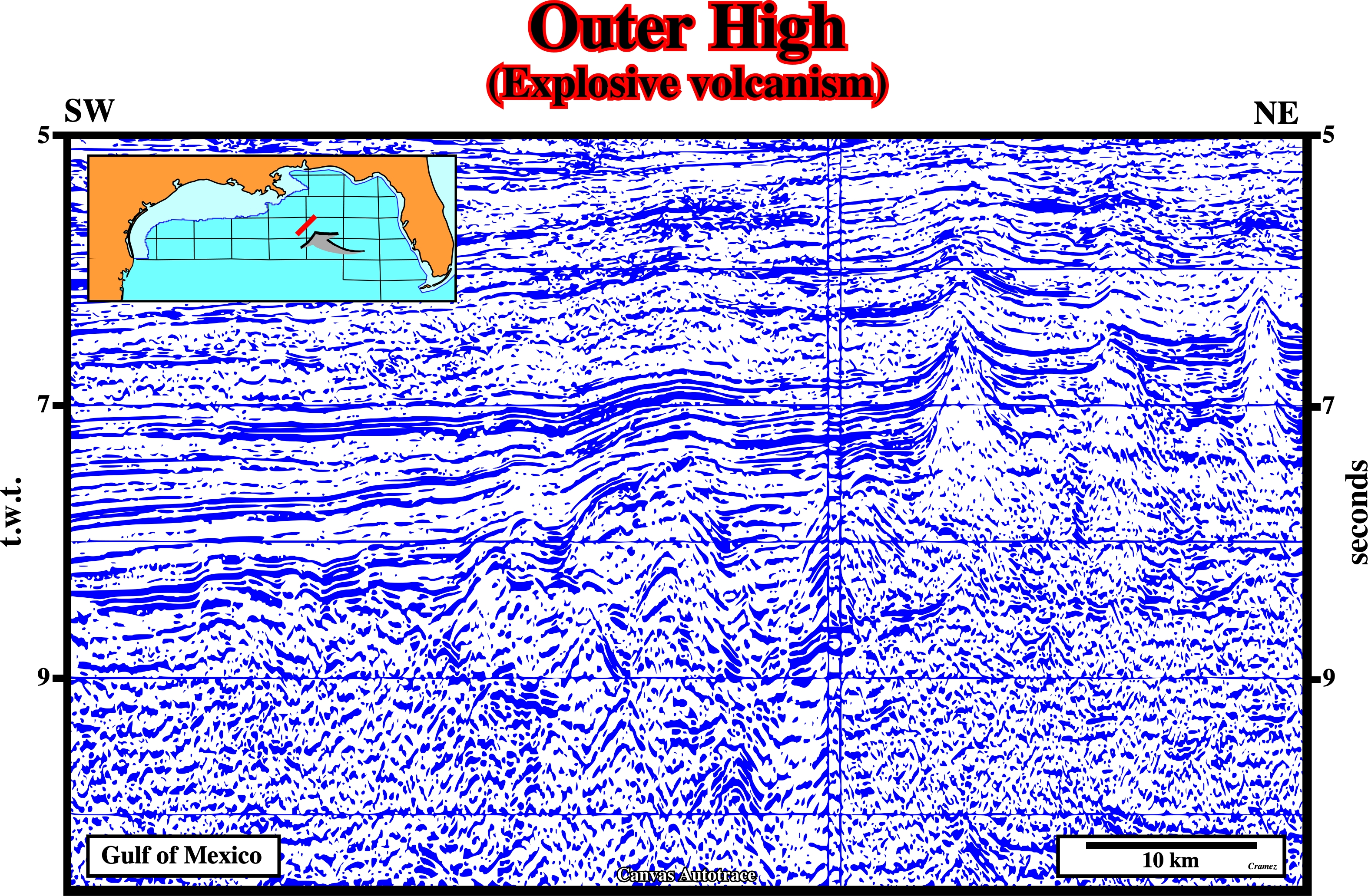
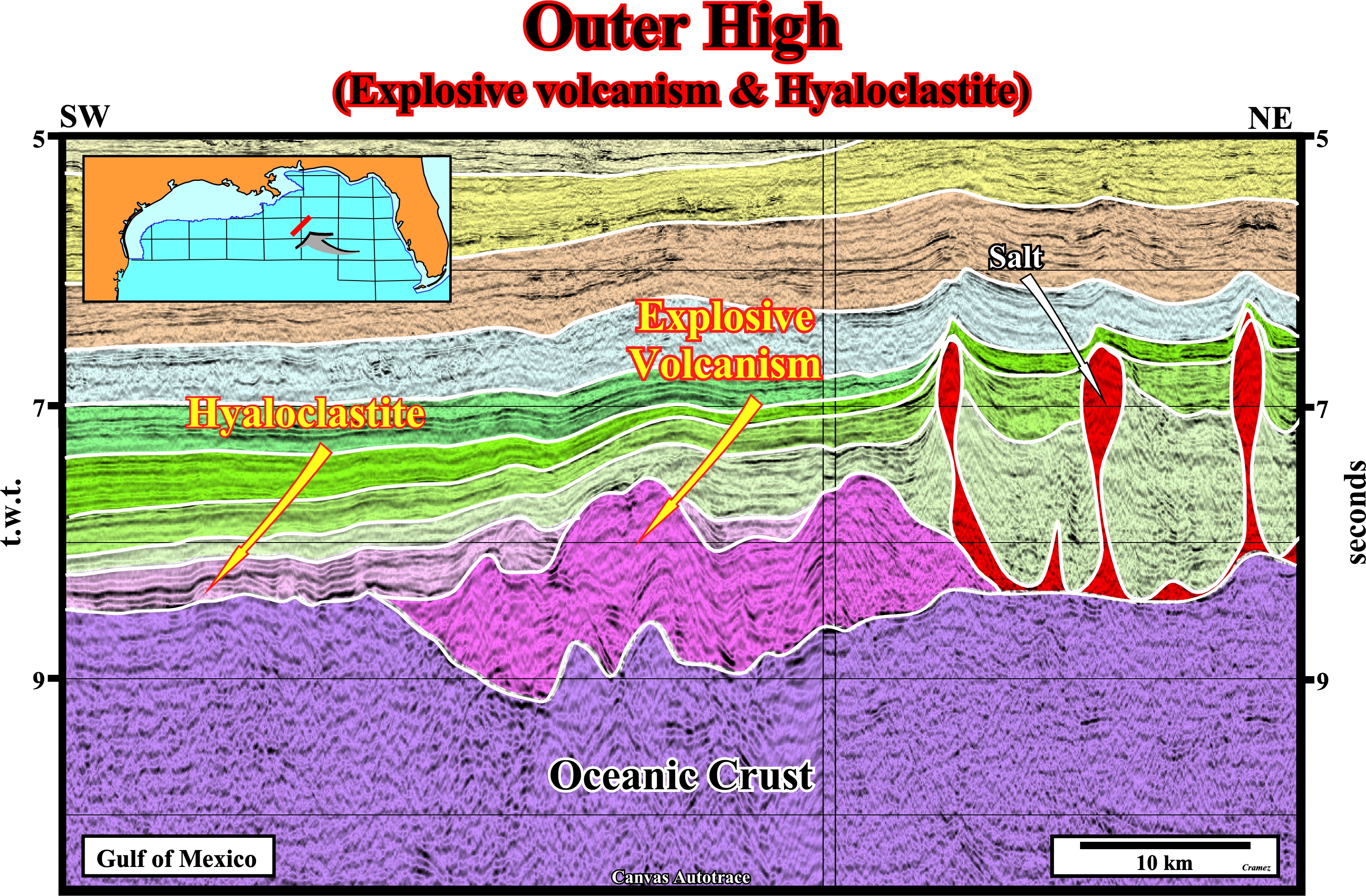
On this Canvas autotrace, on the top of the oceanic crust, the outer high, down-dip of the salt layer, can easily be interpreted as induced by a Surtesyan eruption (explosive style of volcanic eruption occurring, generally, in a shallow sea when rapidly rising and fragmenting hot magma interacts, explosively, with water and with water-steam-tephra slurries, according Wikipedia). The geometry of the bottom and the internal configuration of such a volcanic anomaly prevents confusion with adjacent salt bodies.
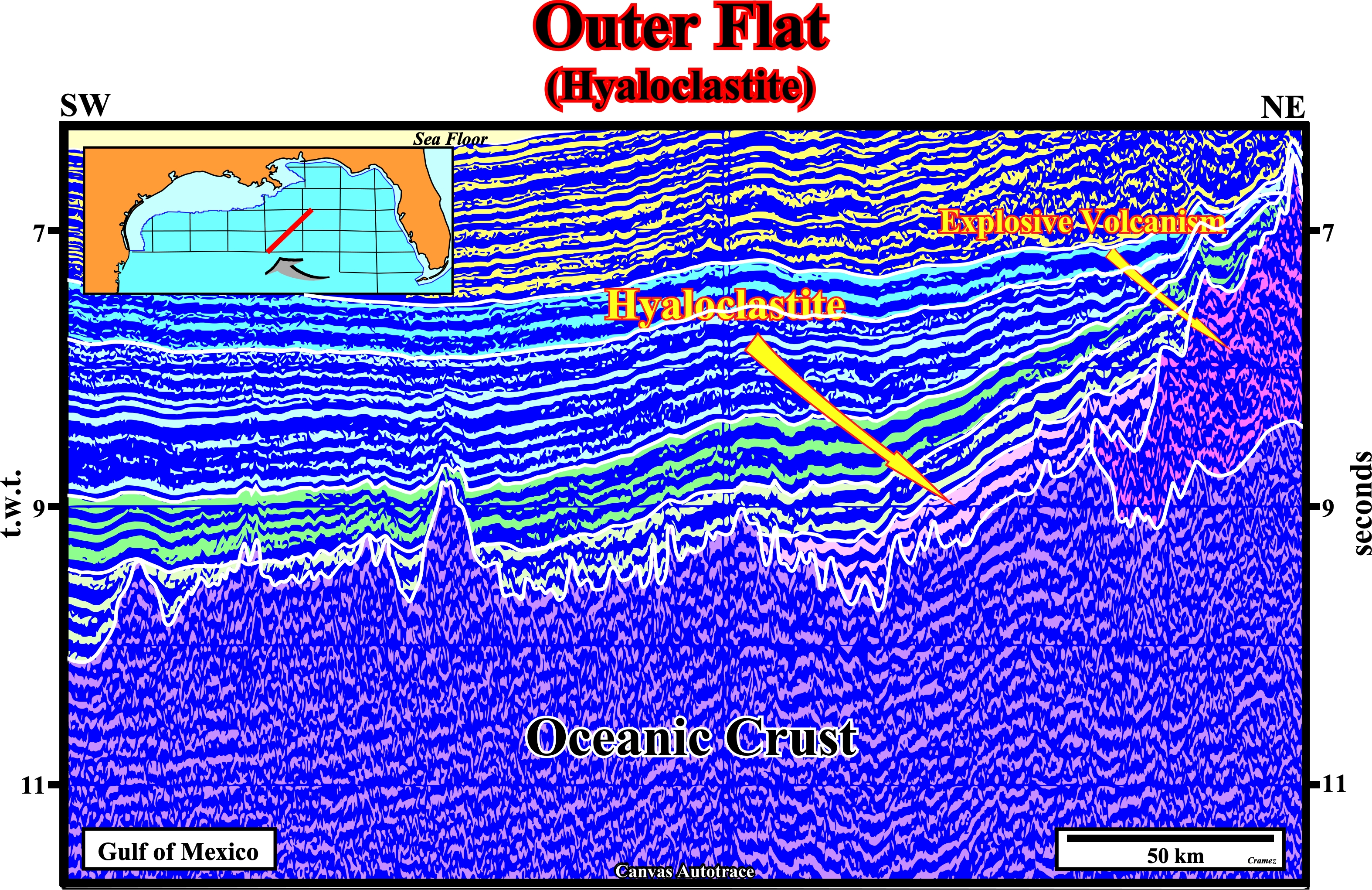
The volcanic structure created by an explosive eruption style Surtesian is, seaward, fossilized, in onlapping, by lobes of hyaloclastite, that is to say, by a volcanoclastic accumulation or breccia consisting of glass clast formed by quench fragmentation of lava flow surfaces during submarine extrusion (Wikipedia source).
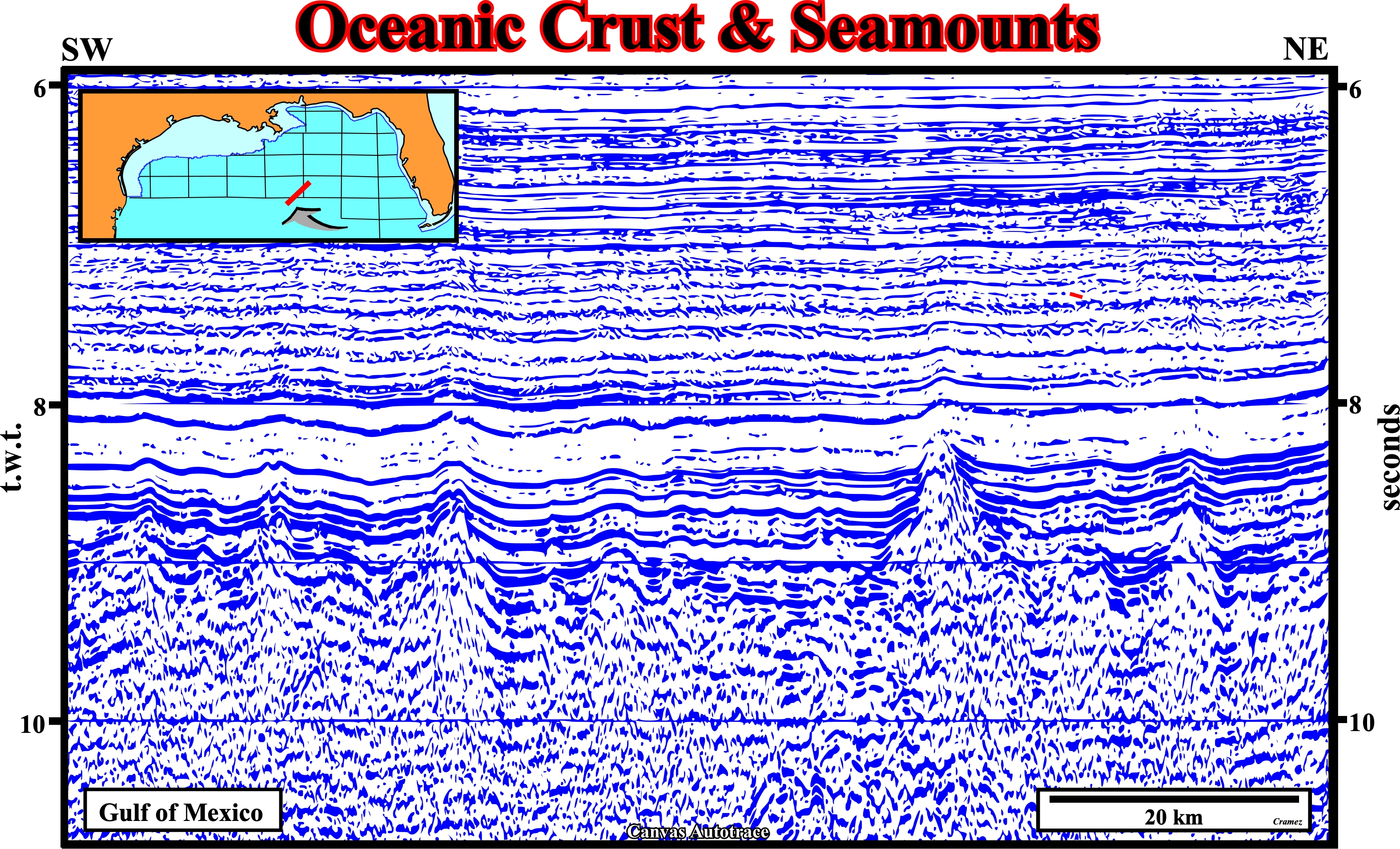
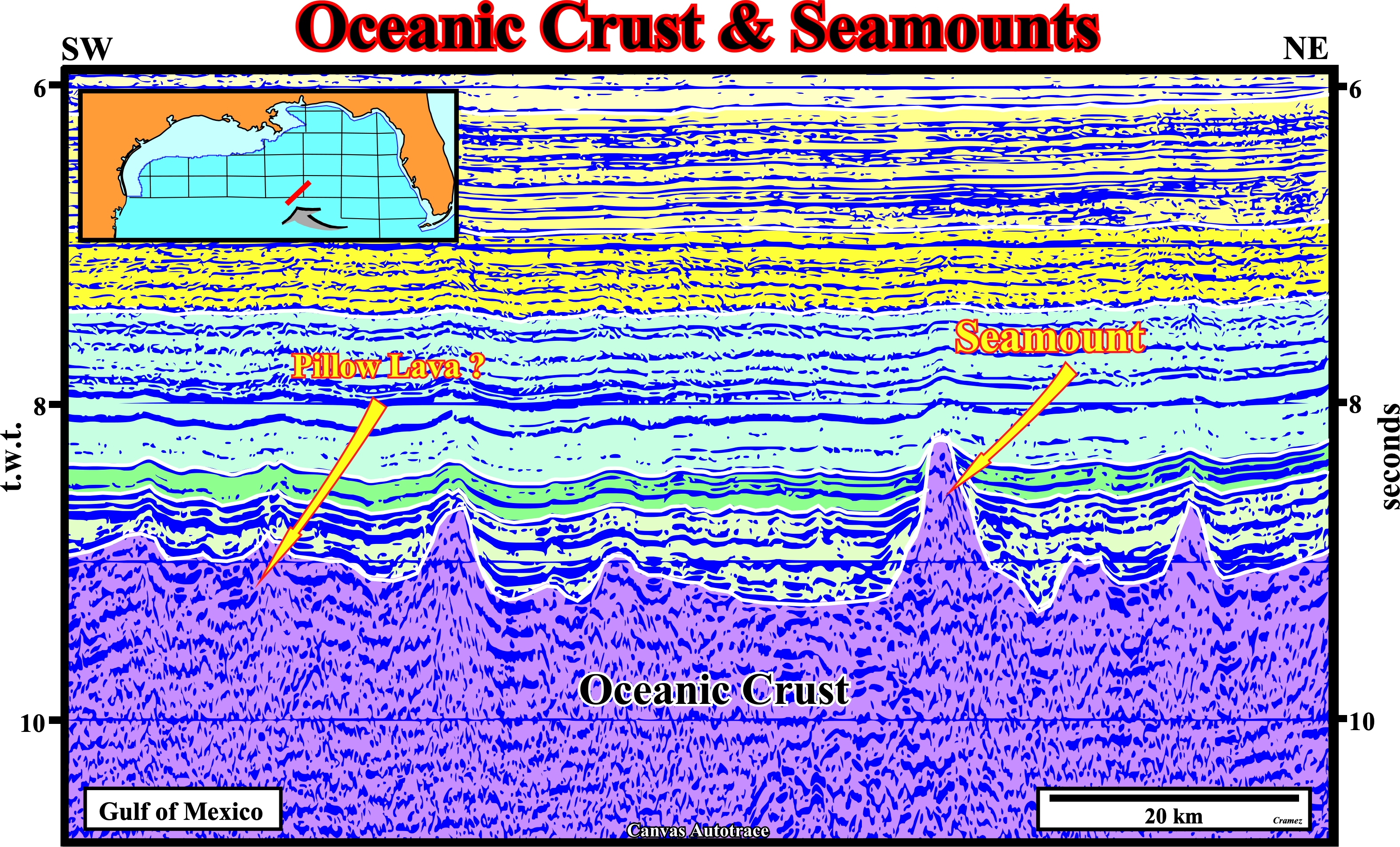
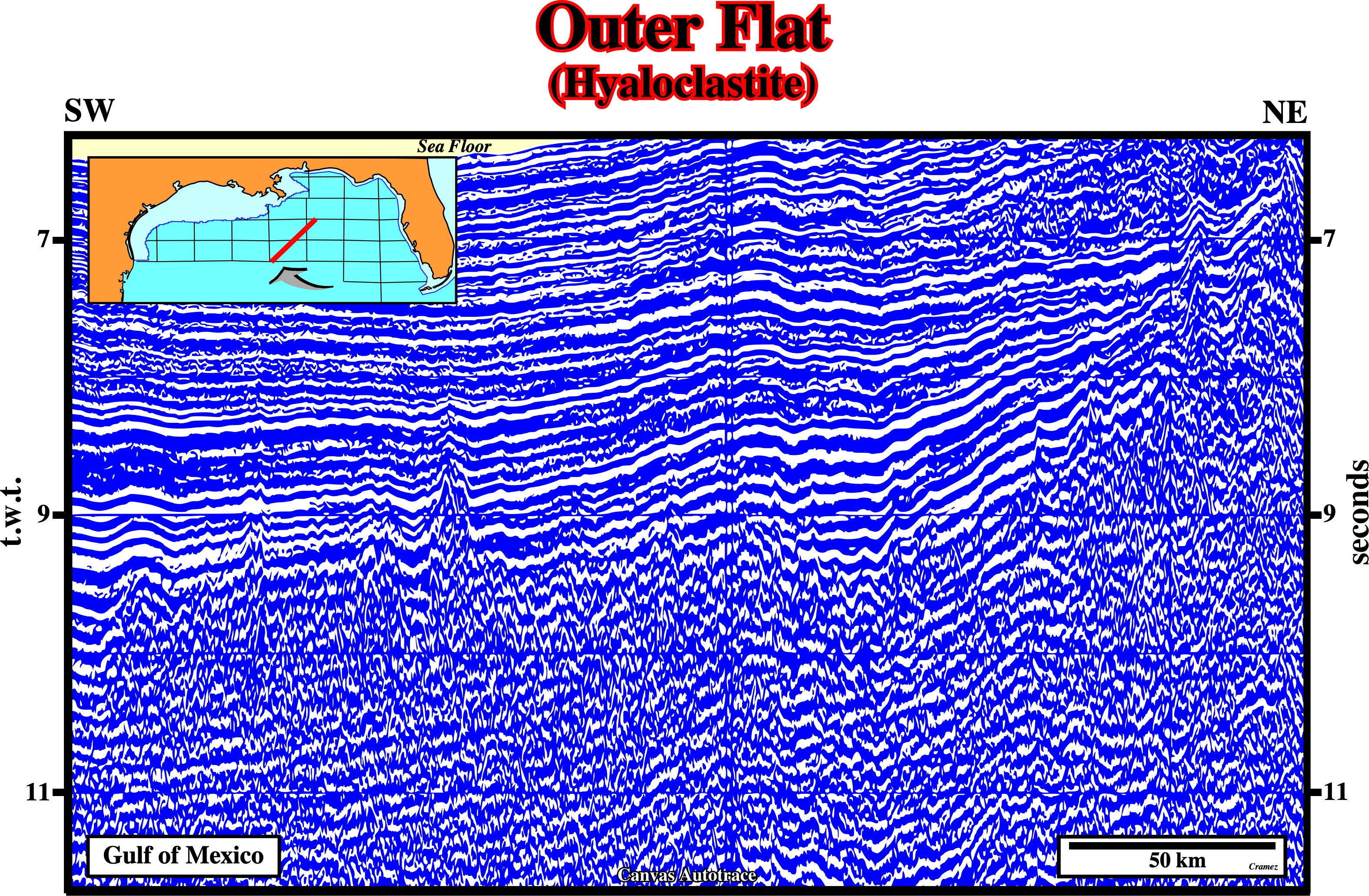
This autotrace illustrates the oceanic crust, which with the solid mantle layer constitute the oceanic lithosphere. The upper oceanic crust is formed by pillow lavas, characterized by thick sequences of discontinuous pillow-shaped masses (± 1m in diameter) that form the upper part of the layer 2 of a normal oceanic crust, and dyke complexes. The lower oceanic crust is composed of troctolites, gabbros and ultramafic rocks. The land-forms rising from the top of the oceanic crust without reaching reaching the sea level, which are, generally, called seamounts, seem to be remnants of extinct volcanoes. Such underwater mountain seem to have a big influence in the organism, often, endemic species that lives on and above them.

![]()
![]()
Send E-mails to carlos.cramez@bluewin.ch with comments and suggestions to improve this atlas.
Copyright © 2001 CCramez
Last update:
2022
![]()