
GOM Offshore
Mexican Ridges
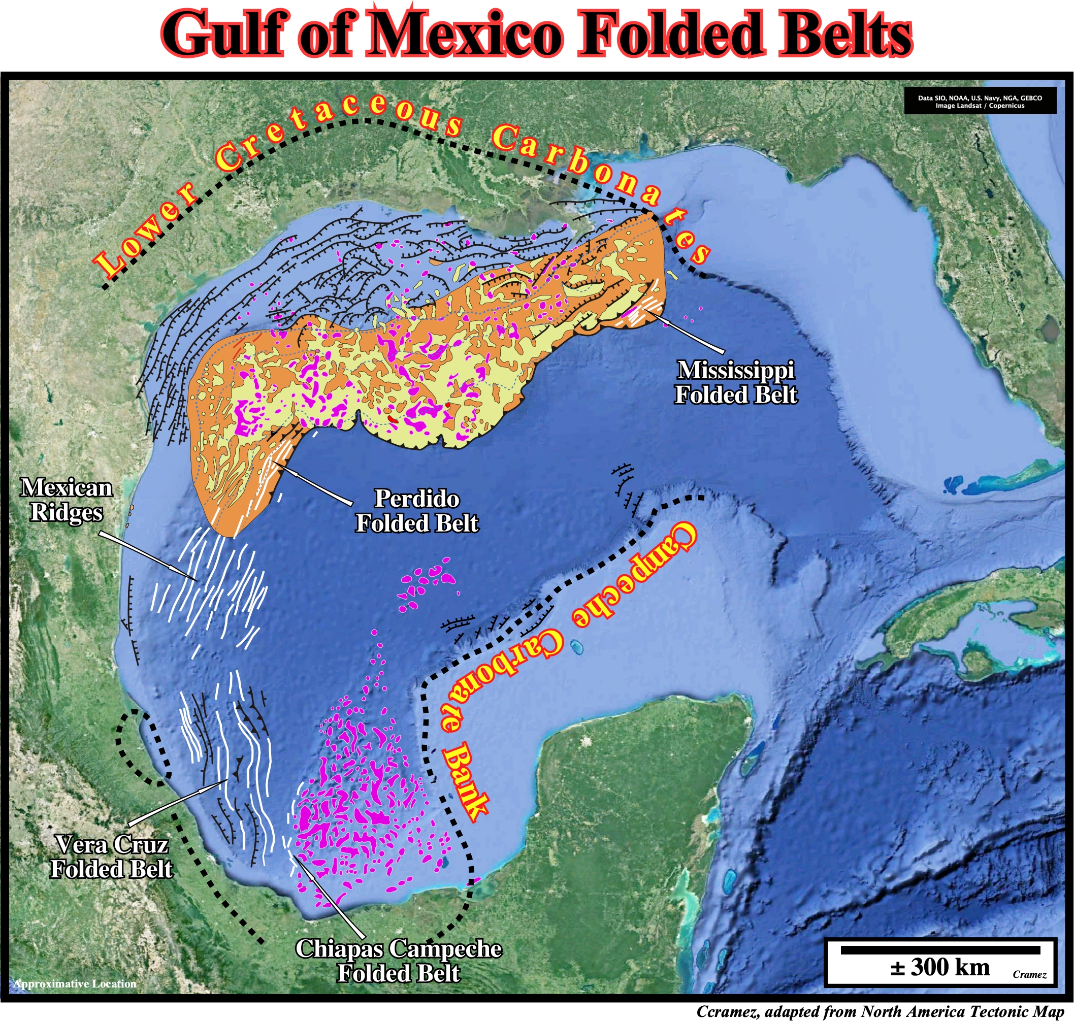
As illustrated on this schematic geological map, in the Gulf of Mexico, which was originated in Late Triassic time as the result of the breakup of the Pangea supercontinent along weakness and old sutures zones (collision of the Laurentia (North American Craton), South America and African lithospheric plates), there are several folded belt induced by gravity and salt tectonics : (i) Mississippi Folded Belt ; (ii) Perdido Folded Belt ; (iii) Mexican Ridges ; (iv) Vera Cruz Folded Belt and (v) Chiapas Campeche Folded belt. The Perdido Fold Belt (PFB) is a prominent salt-cored deep water structure characterized by symmetric, kink-banded folds of a more or less 4.5 km thick pre-kinematic layer and its vicinity to the extensive Sigsbee Salt Canopy. The Mexican Ridges fold belt is a Neogene contractional system, located on the western continental slope of the Gulf of Mexico, was formed in response to gravitational slide processes affecting continental shelf deposits (Quetzalcoatl extensional system). Let's see some Canvas autotraces of seismic lines shot in Perdido Folded Belt their tentative geological interpretation.
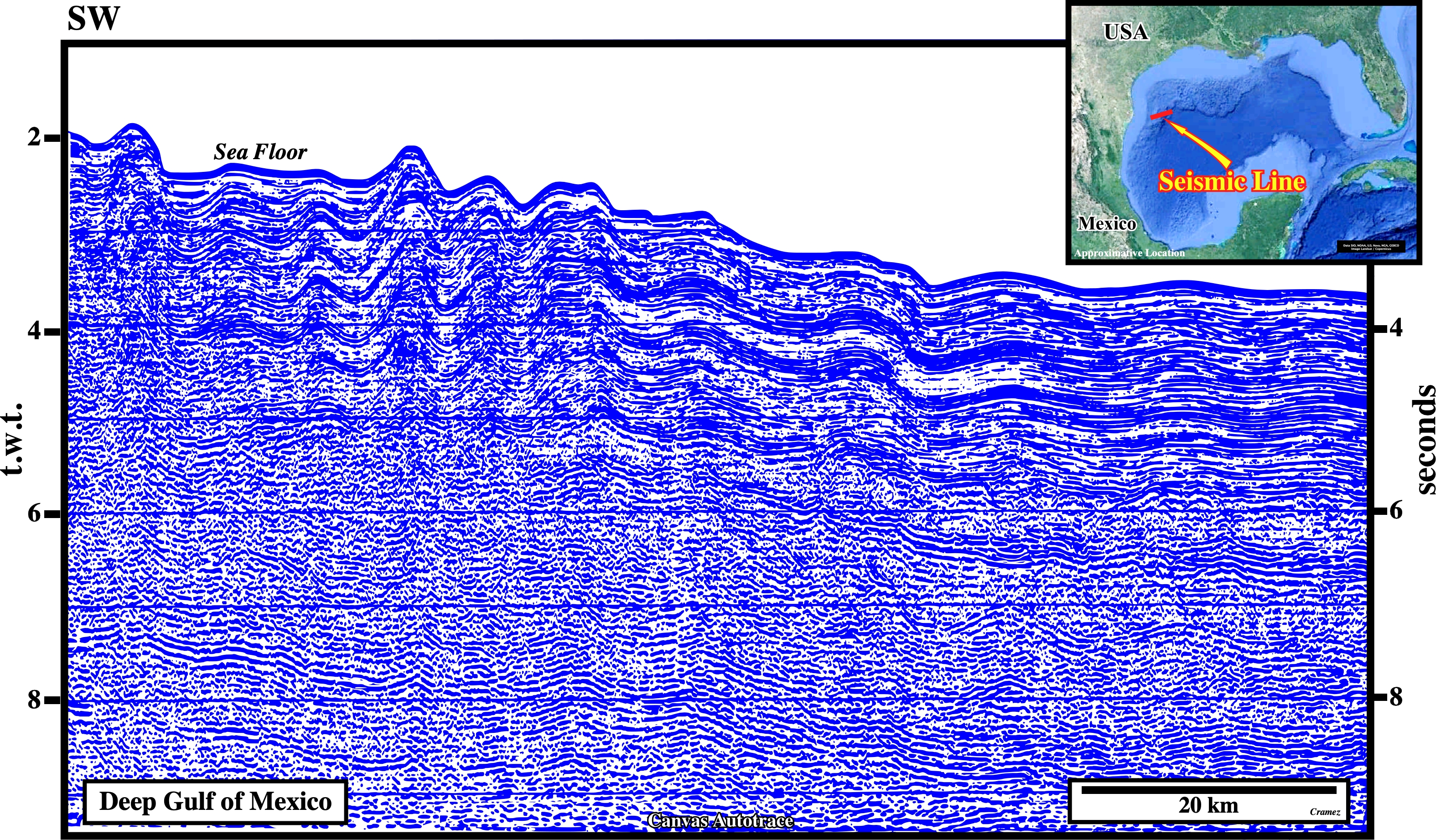
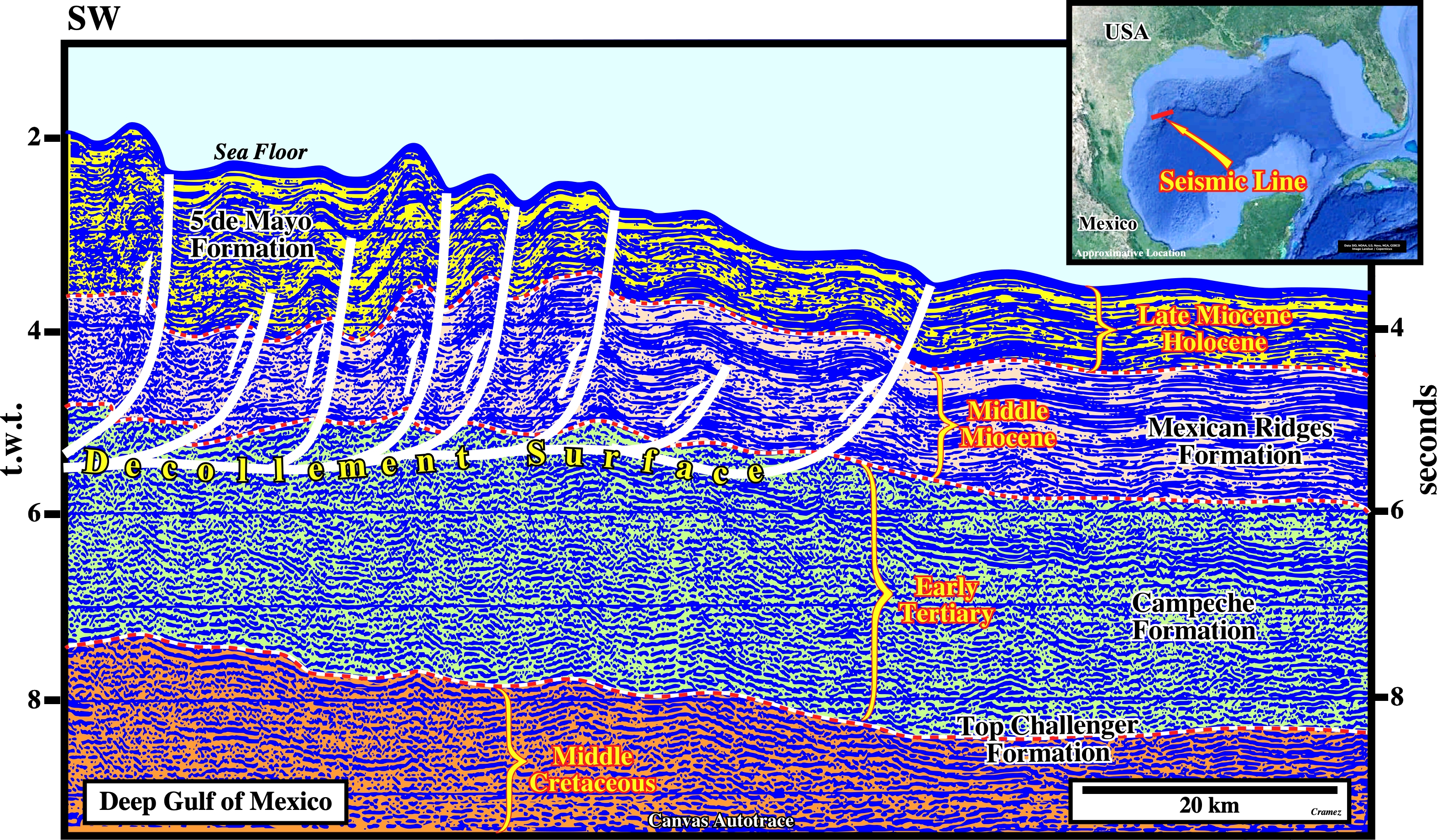
The Gulf of Mexico folded belts, as the one illustrated on this Canvas autotrace (Perdido Fold Belt), seems to be the counterbalance of an up-dip down-slope gravity gliding occurring during the Oligocene, which followed the Laramide orogenic mountain-building event in the latest Cretaceous to Paleogene, as illustrated in the next autotrace.
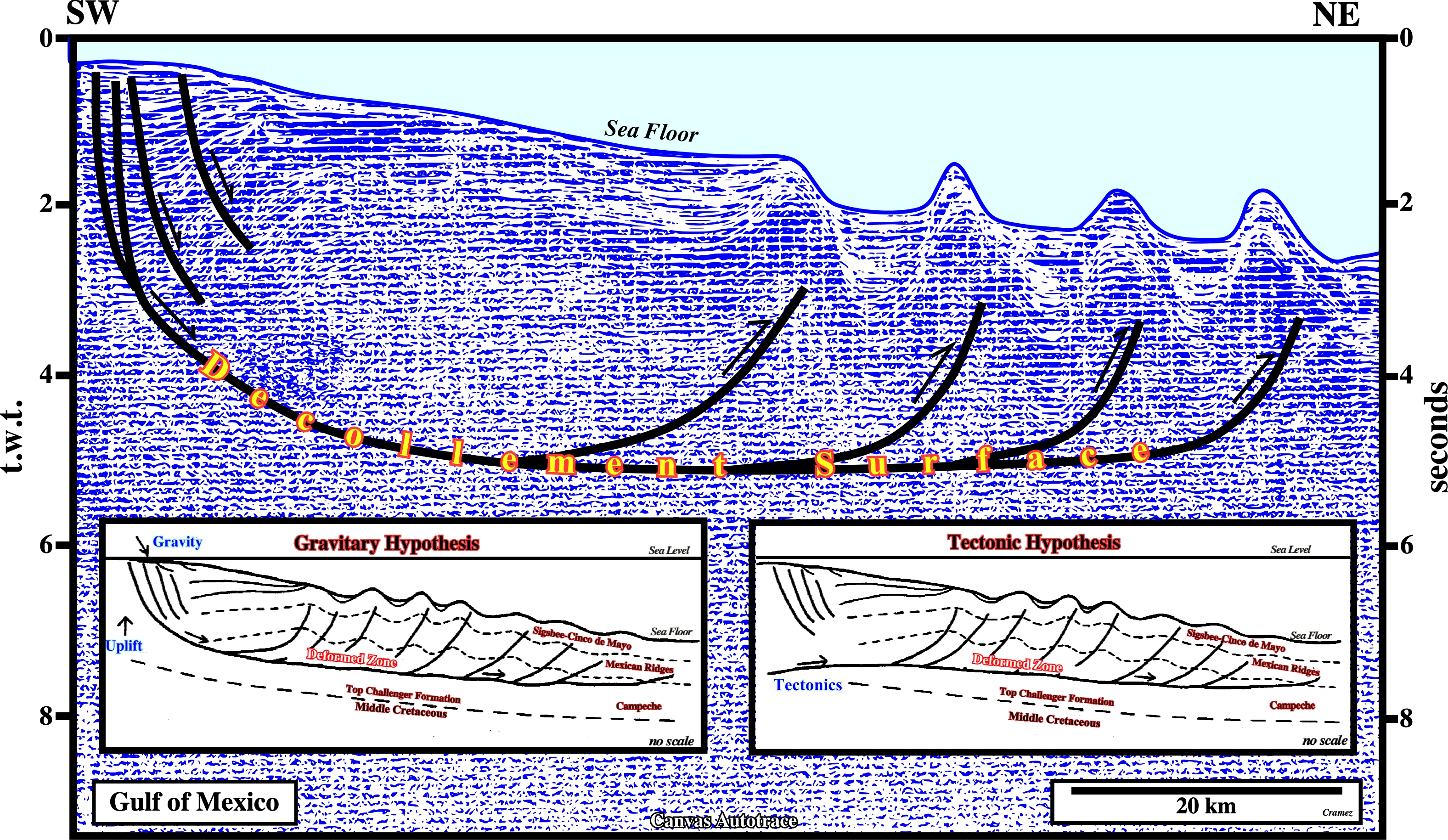
In spite of the fact that this folded belt can be explained by two hypotheses: (i) Gravitary and (ii) Regional compressional tectonic regime, I guess the gravitational hypothesis is more difficult to falsify. As the down-dip shortening (reverse faulting) seems to be the compensating equivalent of an up-dip extension (normal faulting), the basal decollement surface works a large slump fault, i.e., a curvilinear fault (in a plane and in a profile), which as a normal geometry up-dip that progressively (in depth and down-dip) change to a reverse geometry, that Selley named listric fault (faults with a spoon movement). As the fault plane of a listric fault is curved, many geoscientists call all faults that have a flat curved fault plane as listric. However, following Selley, we can say that all listric faults have a curved plane, but not all faults with a curved fault plane are listric.
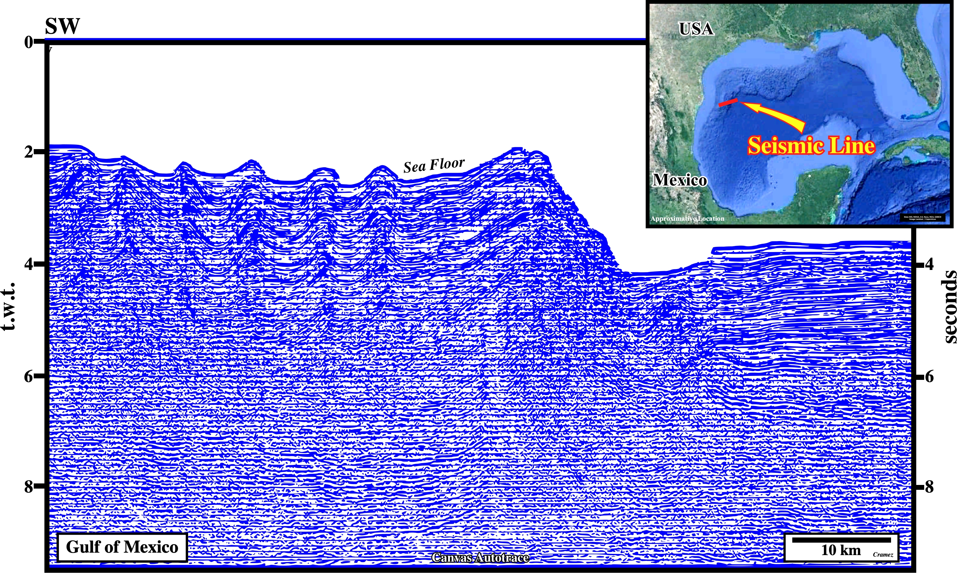
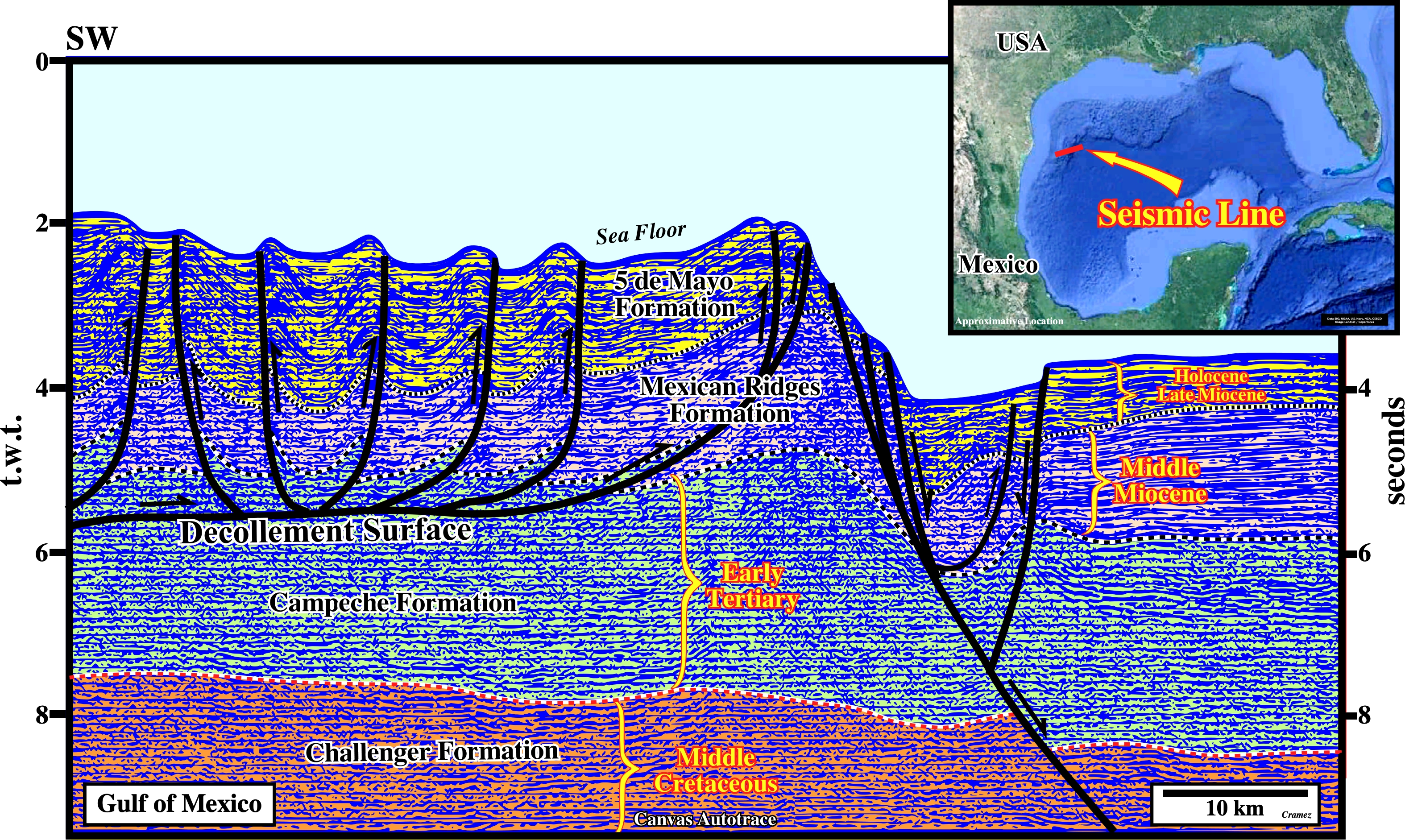
On this Canvas autotrace of an offshore seismic line shot not far from the border between USA and Mexico, it is interesting to notice that some of the faults of the folded belt of an opposite vergence, defining , almost, triangular zones. On the other hand, the graben developed in front of the folded belt, can highlight the limit of the salt basin.

![]()
![]()
Send E-mails to carlos.cramez@bluewin.ch with comments and suggestions to improve this atlas.
Copyright © 2001 CCramez
Last update:
2022
![]()