
East Canada Offshore
Davis Strait
 .
.
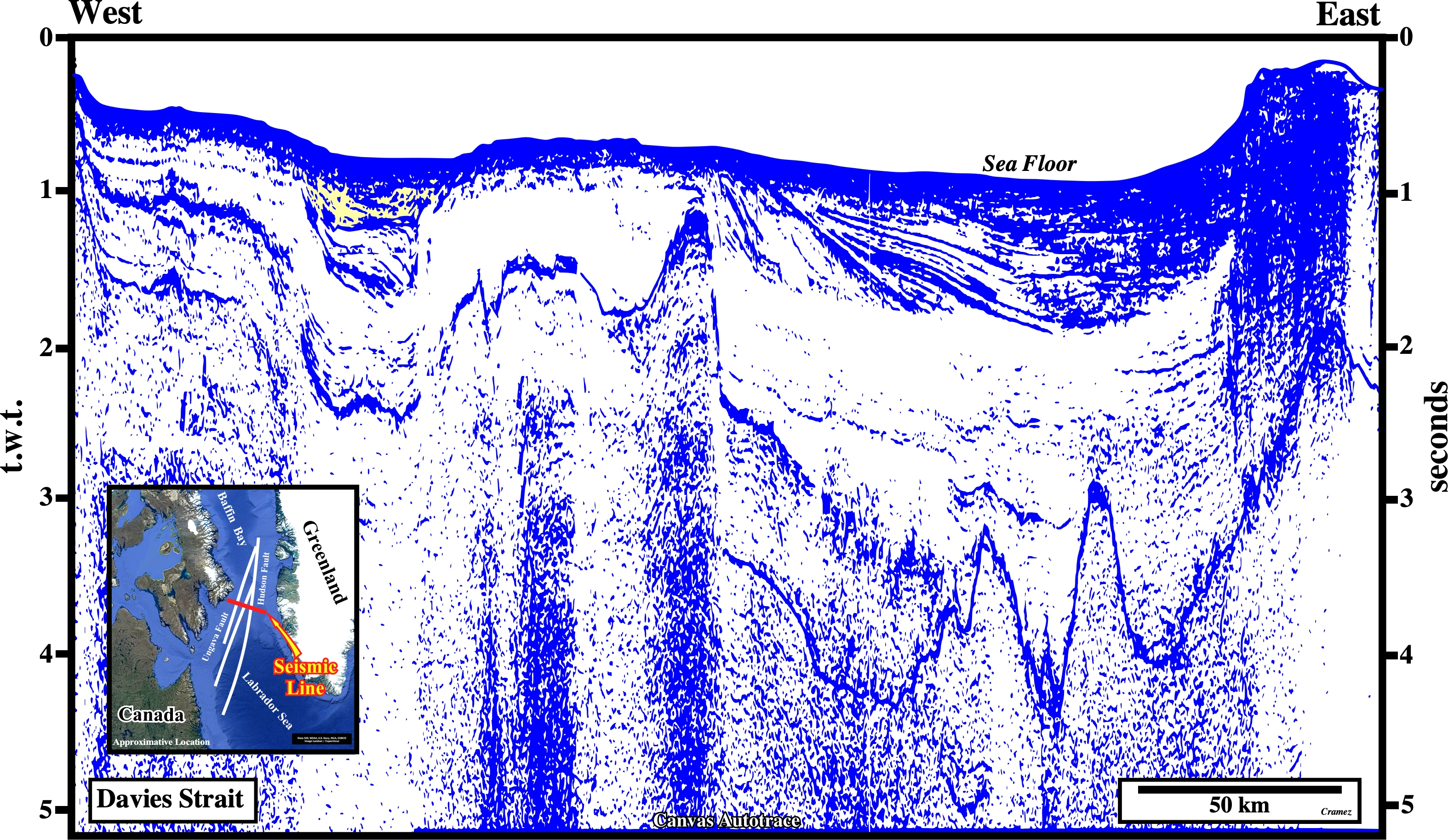
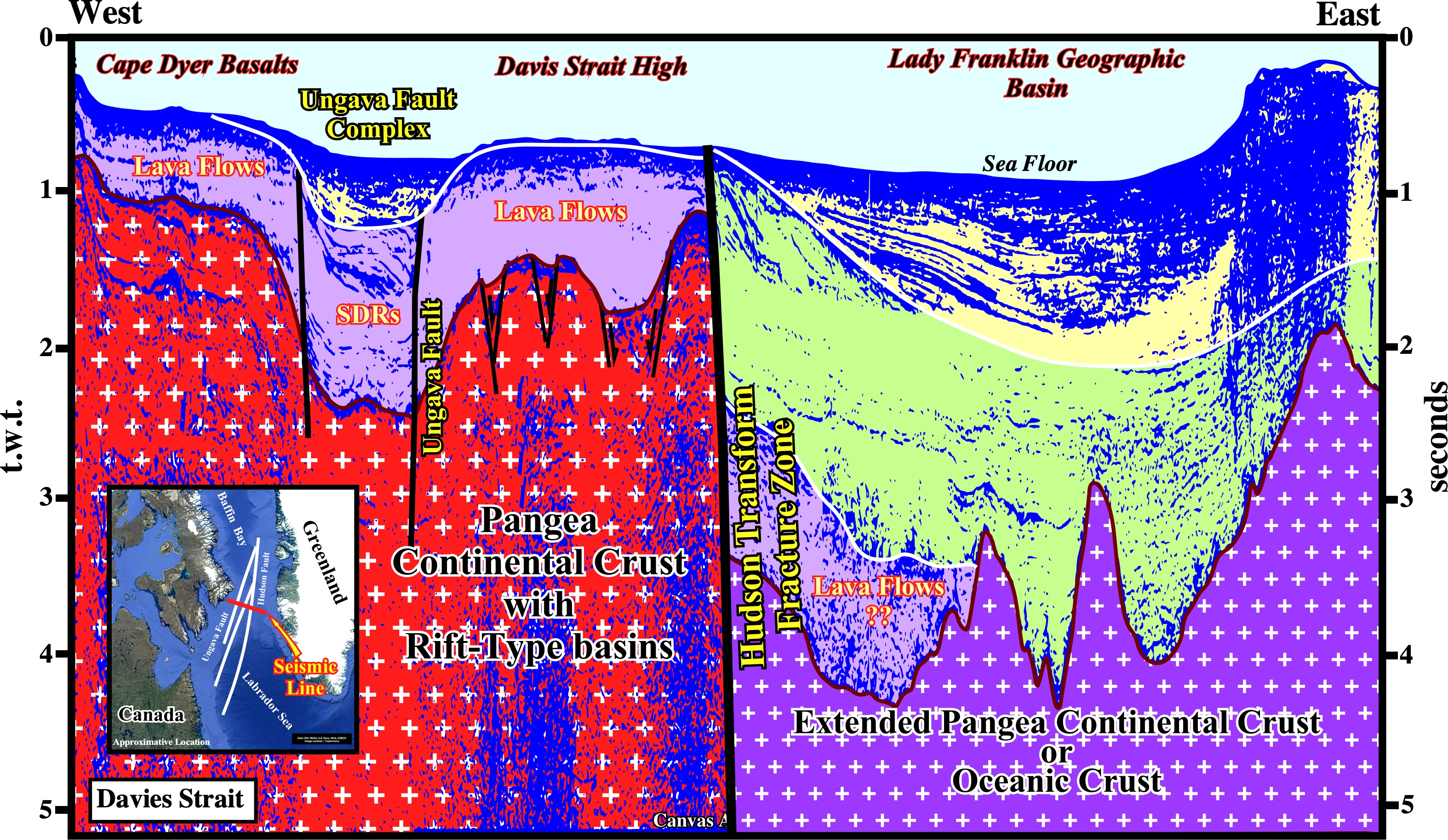
The original composite seismic line of this Canvas autotrace is located in Davies Strait, which separates the Labrador Sea from the Baffin Bay formed during Cretaceous / Eocene time in association with the seafloor spreading following the breakup of the Pangea supercontinent and, particularly, with the breakup of the Laurasia small supercontinent, which was formed by the collision of Laurentia, Avalonia, Baltica and other smaller terranes (Caledonian orogeny). According several geoscientists, the mid-oceanic ridges of the Labrador Sea and Baffin Bay seem to separated by a complex transform fracture zone, in which the Hudson and the Ungava fault systems can be, easily, recognized as illustrated in this tentative geological interpretation, which does not falsified the presence of a complex transform fracture zone, westward of the Hudson transform fracture, post-breakup lava flows (Cape Dyer Basalt) were deposited above an extended (lengthened) Pangea continental in which rift-type basins developed. Seaward of the Hudson transform fracture zone, the facies (lithology) of the infrastructure of the recent clastic intervals is more difficult to conjecture. It can be the extended Pangea continental crust or just the oceanic crust.
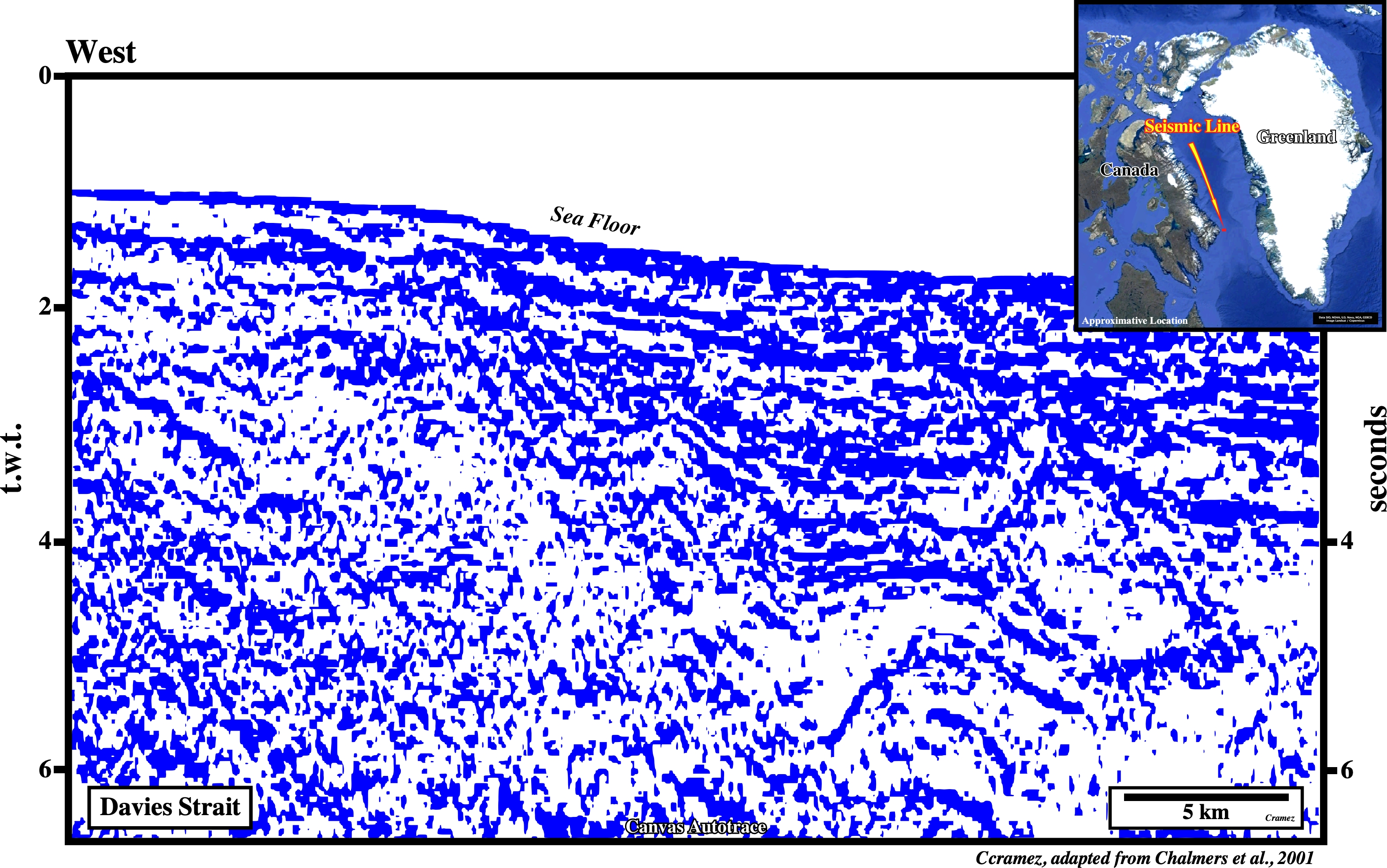
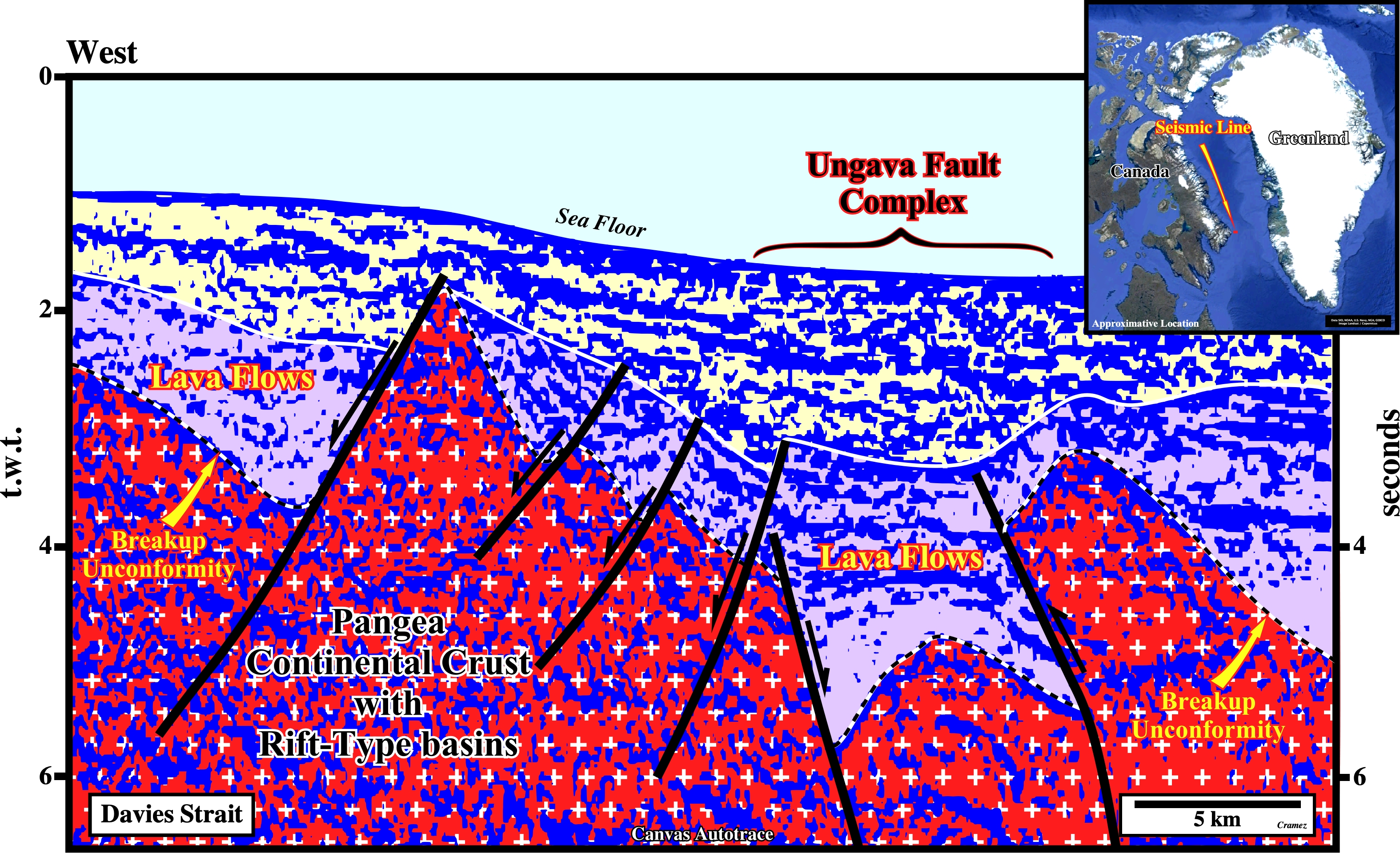
On this tentative interpretation of a Canvas autotrace of a seismic line shot in the western part of the Davies Strait, not far from Cape Dyer, it is easy to recognize the transpression movement certain faults of the Ungava fault complex. Such a movement, strongly, shortened the breakup unconformity, which separates the lengthened Pangea continental crust and its rift-type basins, from the lava flows that form the volcanic a sector of the Atlantic-Type Divergent Margin.

![]()
![]()
Send E-mails to carlos.cramez@bluewin.ch with comments and suggestions to improve this atlas.
Copyright © 2001 CCramez
Last update:
2022
![]()