Antarctic Offshore
Clicking on a red dot, a page is opened with the more interesting Canvas autotraces of the area. Often a tentative geological interpretation of the original seismic lines is proposed. Due to confidential reasons, the original seismic lines, used for the tentative interpretations are not shown. By the same token, their locations, on the Google maps, are not, strictly, exact. Knowing that falsification is the demarcation line between a scientific and pseudoscientific geological interpretation (K. Popper's philosophy), using the uninterpreted Canvas autotraces, you must try to falsify the proposed tentative interpretations. If you refute a tentative interpretation, please, send me the new tentative to improve this atlas. Thank you
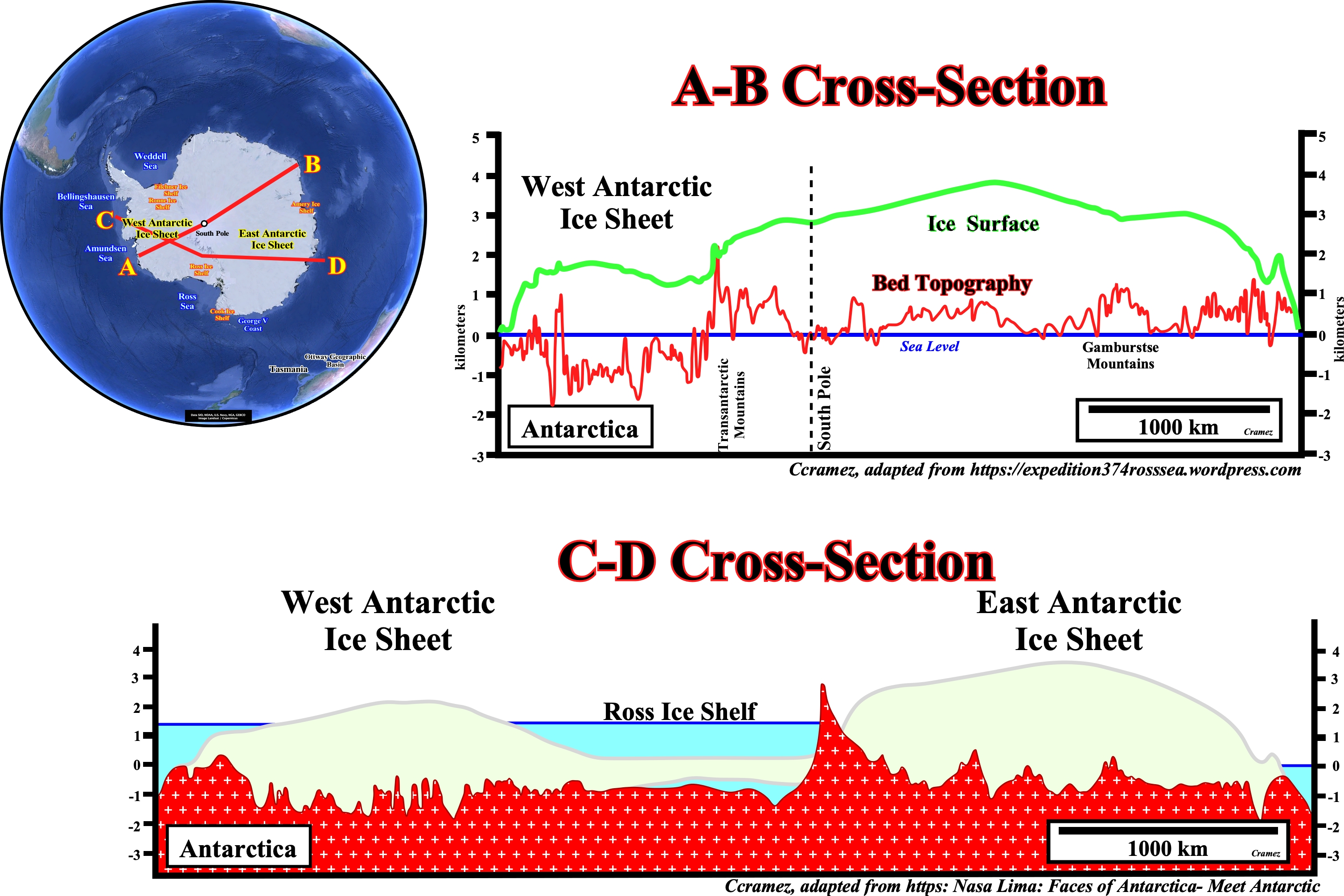
These two cross-section show that the East Antarctic Ice Sheet is thicker that the Western Ice Sheet, on the other hand, most of the West Antarctic Ice Sheet is grounded below sea level, in places over 2.5 kilometers below sea level. The lower cross-section shows how the West Antarctic Ice Sheet is grounded below sea level. Actually, it seems that West Antarctic sheet is melting, what certain geoscientists explain by changes in air circulation patterns, which led to increased upwelling of warm, deep ocean water along the coast of Antarctica and that this warm water has increased melting of floating ice shelves at the edge of the ice sheet.
![]()
![]()
Send E-mails to carlos.cramez@bluewin.ch with comments and suggestions to improve this atlas.
Copyright © 2001 CCramez
Last update:
2022![]()