
Onshore Bangladesh
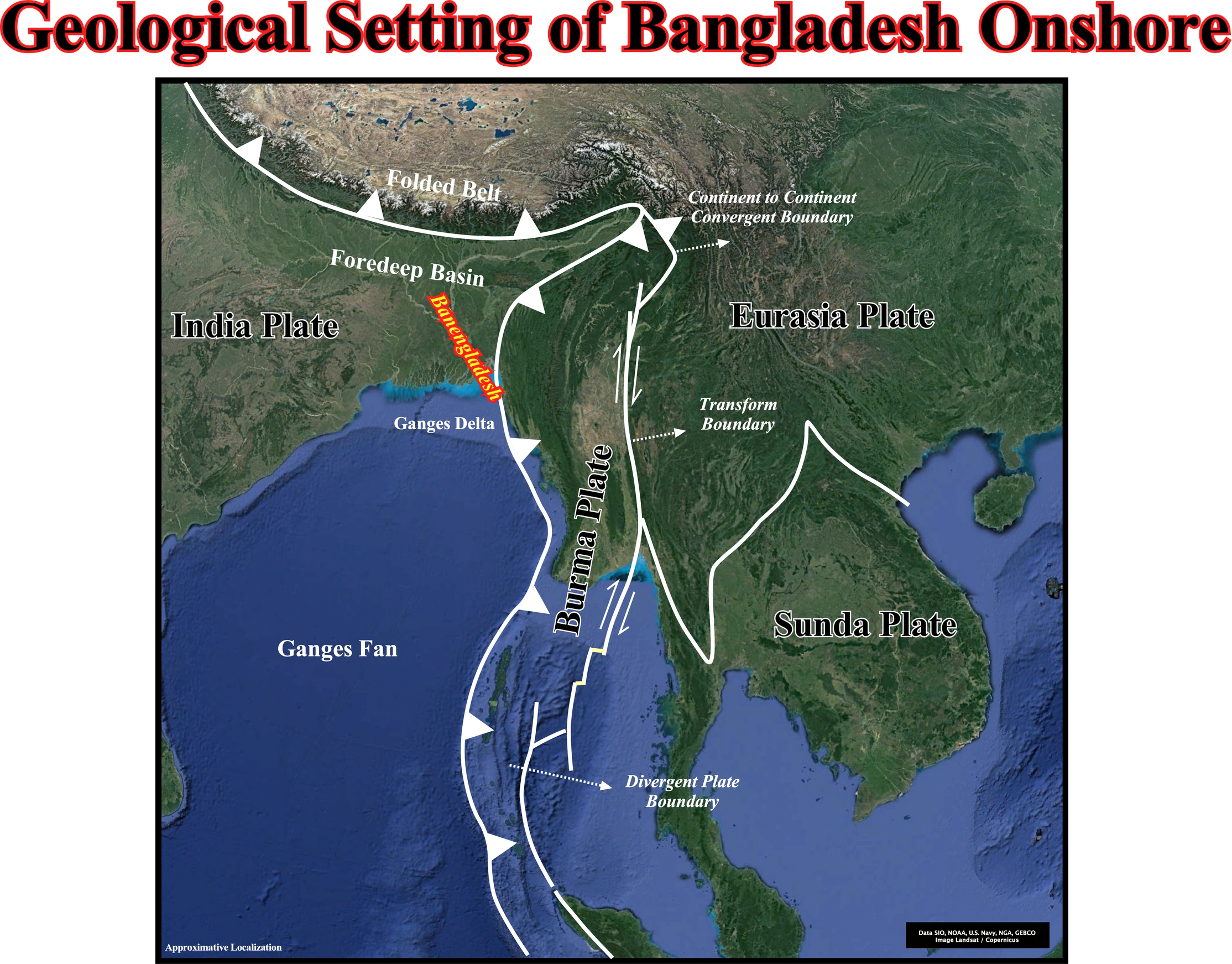
The Bangladesh onshore corresponds to a foredeep basin developed in association with the fold belt of the Himalayas, which is bounded by an A-Type or Ampferer subduction zone,, while the offshore corresponds to the Ganges delta (Bengal geographic basin) and to the Ganges fan. The eastern limit of the offshore is, mainly, marked by a B-Type subduction zone (Benioff subduction zone). The geology of the onshore area formed by collision of the Indian, Burma and Eurasia lithological plates is illustrated by the cross-section depicted on the next plate. Take note the term "collision" used previously is abusive since the kinetic energy does not play any role in plate tectonics. Remind, the kinetic energy is the energy, i.e., the quantitative property that must be transferred to an object in order to perform work on) that it possesses due to its motion and that is defined as the work needed to accelerate a body of a given mass from rest to its stated velocity. and the work measure of energy transfer occurring when an object is moved over a distance by an external force at least part of which is applied in the direction of the displacement.
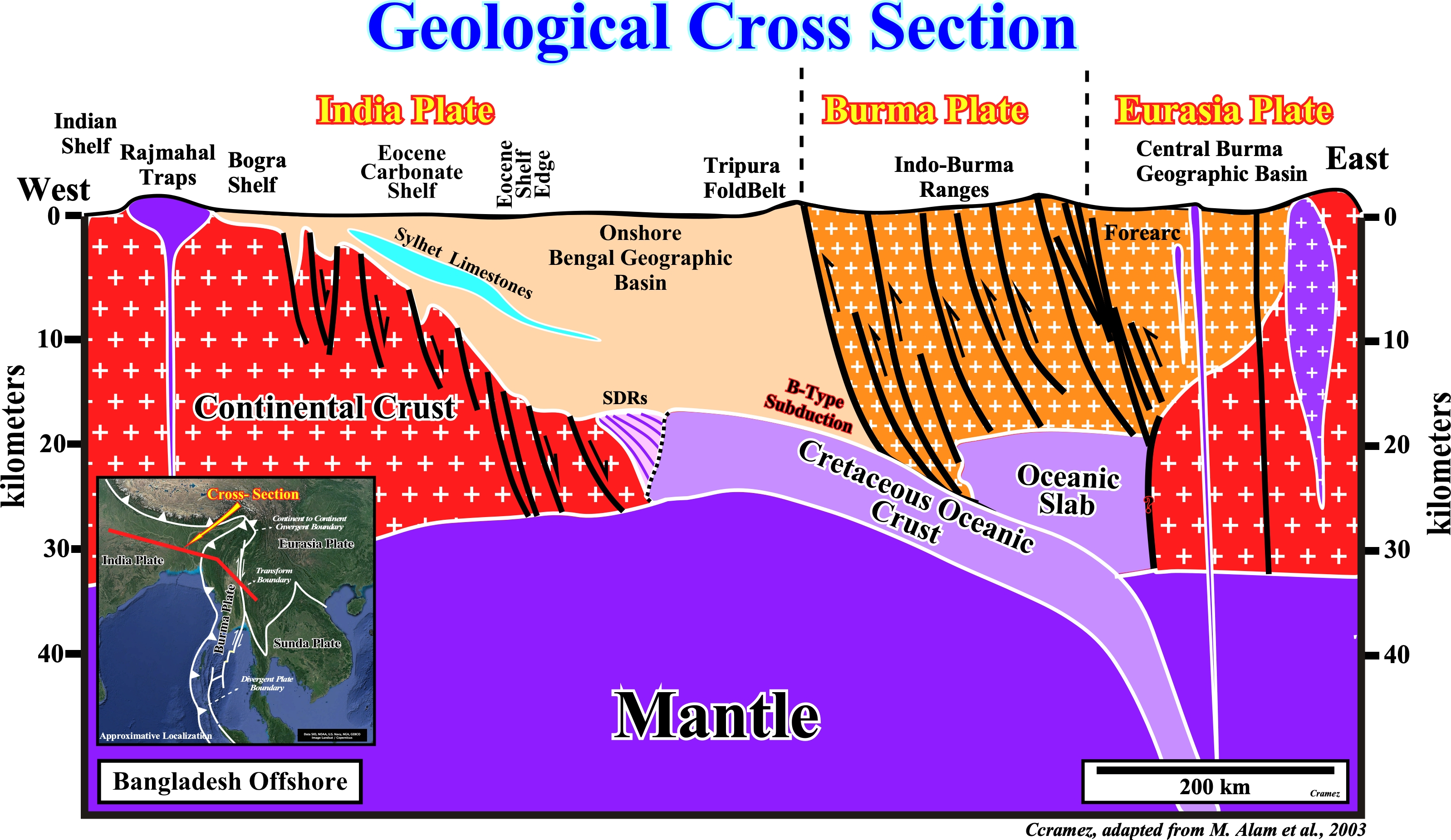
On this geological cross section, the collision between the Eurasia, Indian and the Burma plates is, here, underlain by a B-type subduction (Benioff) in which the Cretaceous volcanic crust (sub-aerial, i.e., SDRs and oceanic) of the Indian plate plunges under the Eurasian Plate (see SDRs in next plate). However, the Bengal geographic basin corresponds, mainly, to a foredeep basin (perisutural basin built up at the periphery of the megasuture, in association with the A-type subduction of the Indian and Eurasian plate) and, partially to a fold belt (Tripura fold belt) induced by collision of the Indian plate with the Burma plate (Burma ranges).. The Central Burma geographic basin, located in the Eurasia plate, and individualized from the Burma plate by a transform boundary, corresponds to the forearc basin originated, probably, by the B-type subduction of the Indian Cretaceous oceanic crust.
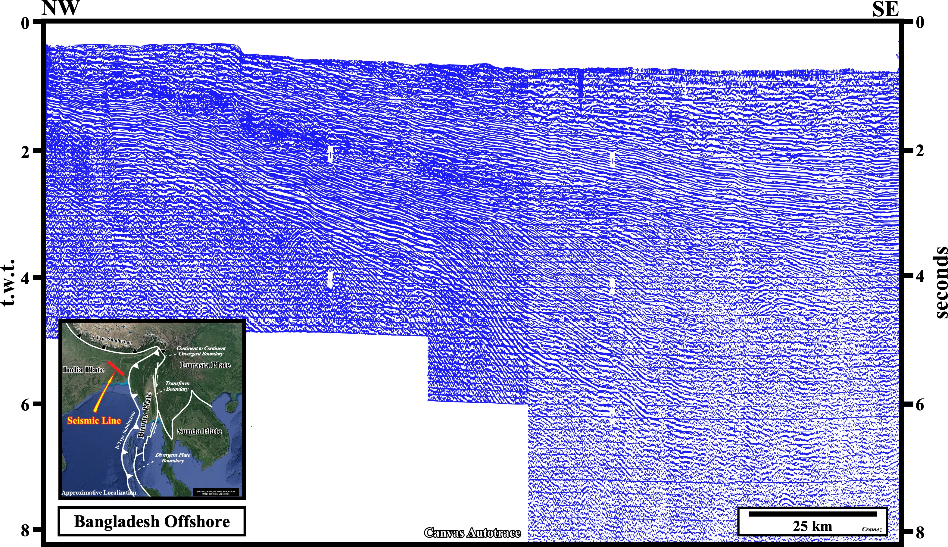

On the location map, we can see the A-type subduction zone between the Indian and the Eurasian plate, as well as, the B-type subduction zone between the western Indian plate and the Burma plate. The old seismic line of this Canvas autotrace is located on the onshore between these two subduction zones. The "Buu" unconformity, i.e., the breakup unconformity of the Gondwana continental crust, which separates the rift-type basins from the overlying Atlantic-type divergent margin, is recognized, easily, since it is fossilized by lava flows (SDRs) forming the sub aerial volcanic crust of the eastern India margin (before the immersion of the expansion centers, which marks the onset of the oceanic crust). The "Su" unconformity highlights the top of SDRs. Above the volcanic crust, the post Pangea continental encroachment stratigraphic cycle, induced by the second 1storder Phanerozoic eustatic cycle, was deposited. However, at Upper Miocene, the Atlantic-type divergent margin is covered by a foredeep basin induced by the A-type subduction zone associated with the Paleogene collision between the Eurasian plate with the Indian plate, which disengaged from the Gondwana small supercontinent in the Early Cretaceous.

![]()
![]()
Send E-mails to carlos.cramez@bluewin.ch with comments and suggestions to improve this atlas.
Copyright © 2001 CCramez
Last update:
2022![]()