
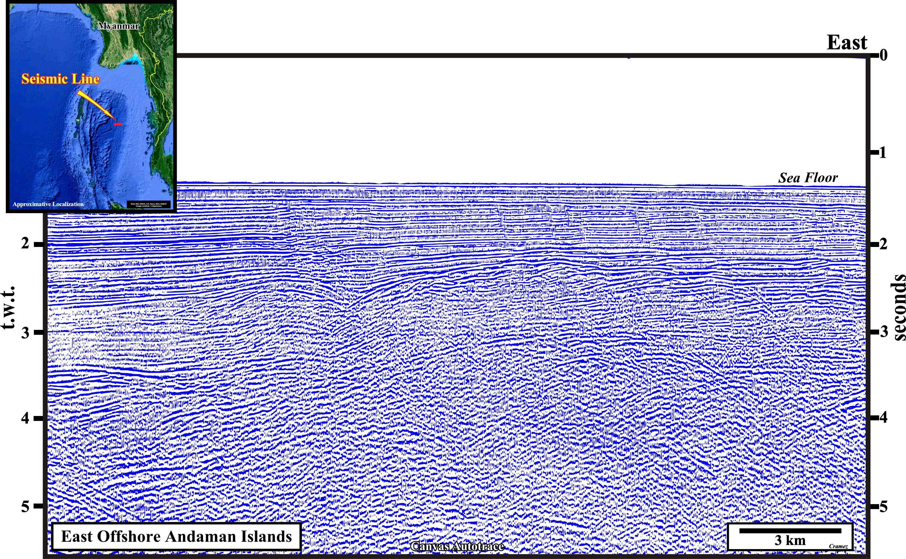
East Andaman Islands Offshore
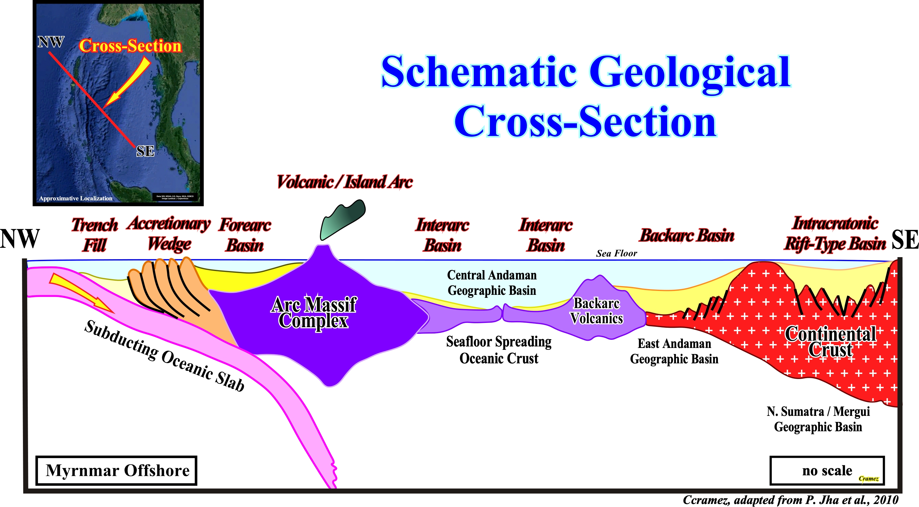
This NW-SE schematic geological cross-section suggests the more likely geological context of the Andaman geographic basin, i.e., the plunging of Pacific lithospheric plate forming B-Type subduction zone with formation, in the overriding plate of a trench fill, an accretionary wedge, a forearc basin, a volcanic arc, interarc basins with oceanization covered by non Atlantic-type divergent margins, a backarc basin, in which a rifting and sag phases can be individualized, and intracratonic rift-type basins. The knowledge of such a geological context strongly help the tentative interpretation of the Canvas autotraces of the seismic lines of the area. In fact, at least in the oil companies, it is well known that an interpreter (geoscientist in charge of the tentative interpretations of the seismic lines) just recognize, on a seismic line, what he knows. For instance, if he does not know, a priori, what is forearc or an accretionary wedge he can send hours or weeks observing a seismic line, but he never recognizes it. The large majority of the geoscientists follow Karl Popper, i.e., they believe that Theory precedes Observation (Karl Popper, 1934) and not the opposite.
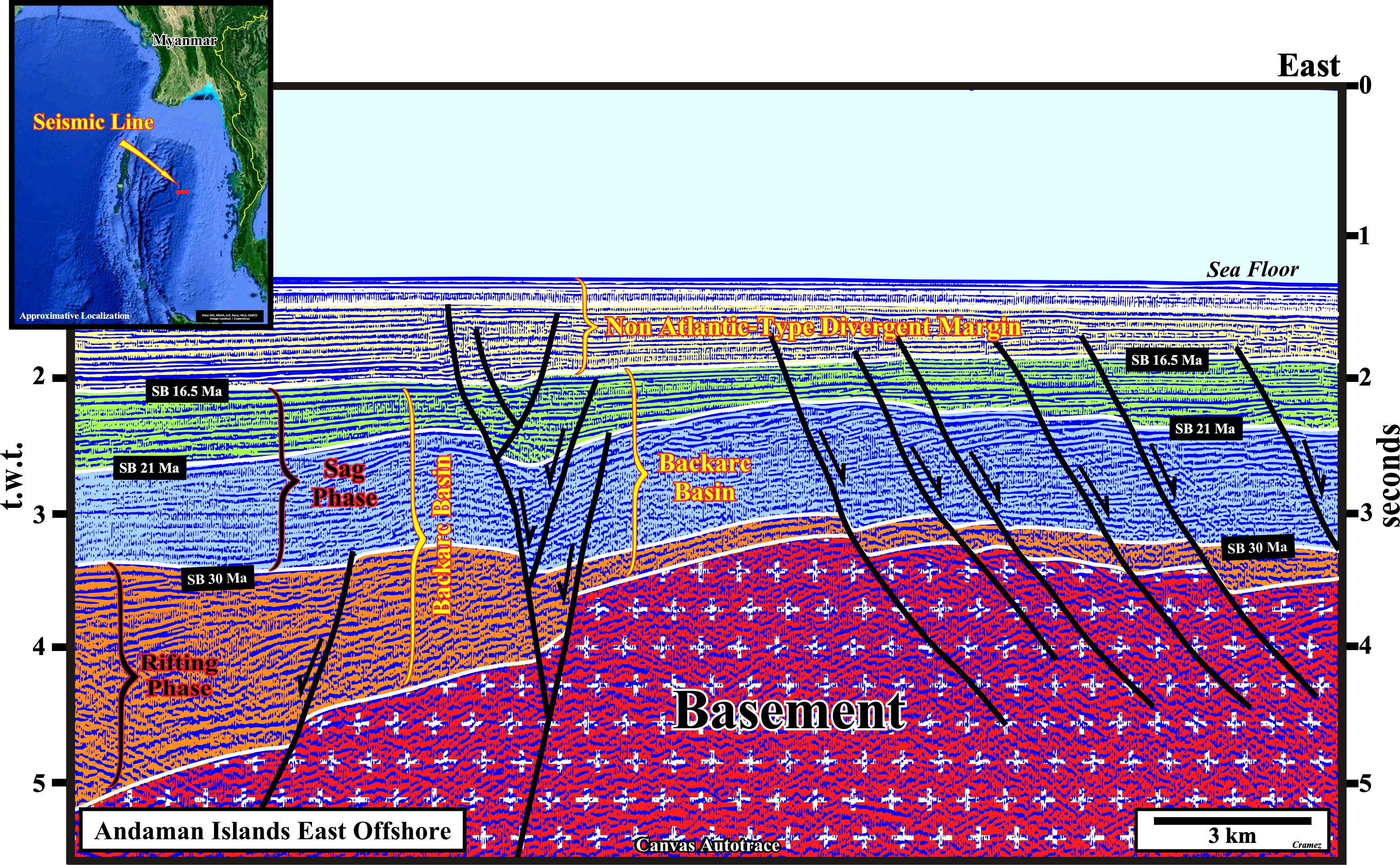
This tentative geological interpretation illustrates a basement buried hill in a backarc basin with two depocenters of the rift phase strata characterized by normal faults with opposite vergence. The eastern depocenter of the rifting phase is out of the autotrace. Above the backarc basin, a non Atlantic-type margin was deposited since the lengthening of the backarc basin has been big enough to produce an oceanization with formation of a marginal sea. The term vergence utilized, here, is, often, used in geology to indicate the dip of a geological object as for instance the dip of fault. Actually, some geoscientists say that when the vergence of a fault plane is towards a depressed hanging-wall (lowered relatively to the foot-wall), the fault is normal, which means the sediments were shortened by an extensional tectonic regime characterized by an oblong ellipsoid of the effective stresses (geostatic pressure σg + hydrostatic pressure or pores σp + tectonic vector σt). In such a case, the σ1, i.e., the largest axis of the ellipsoid is vertical and σ2 (middle axis) is horizontal and parallel to the fault plane. If, on the contrary, the vergence of a fault plane is towards a raised hanging-wall (relatively to the foot-wall), the fault is normal, which means that the sediments were lengthened by a tectonic extensional regime (σ1 is vertical and σ2 horizontal and parallel to the fault plane).
![]()
![]()
Send E-mails to carlos.cramez@bluewin.ch with comments and suggestions to improve this atlas.
Copyright © 2001 CCramez
Last update:
2022![]()
