
East Japan Offshore
Kuril Oceanic Trench (SE Hokkaido Offshore)
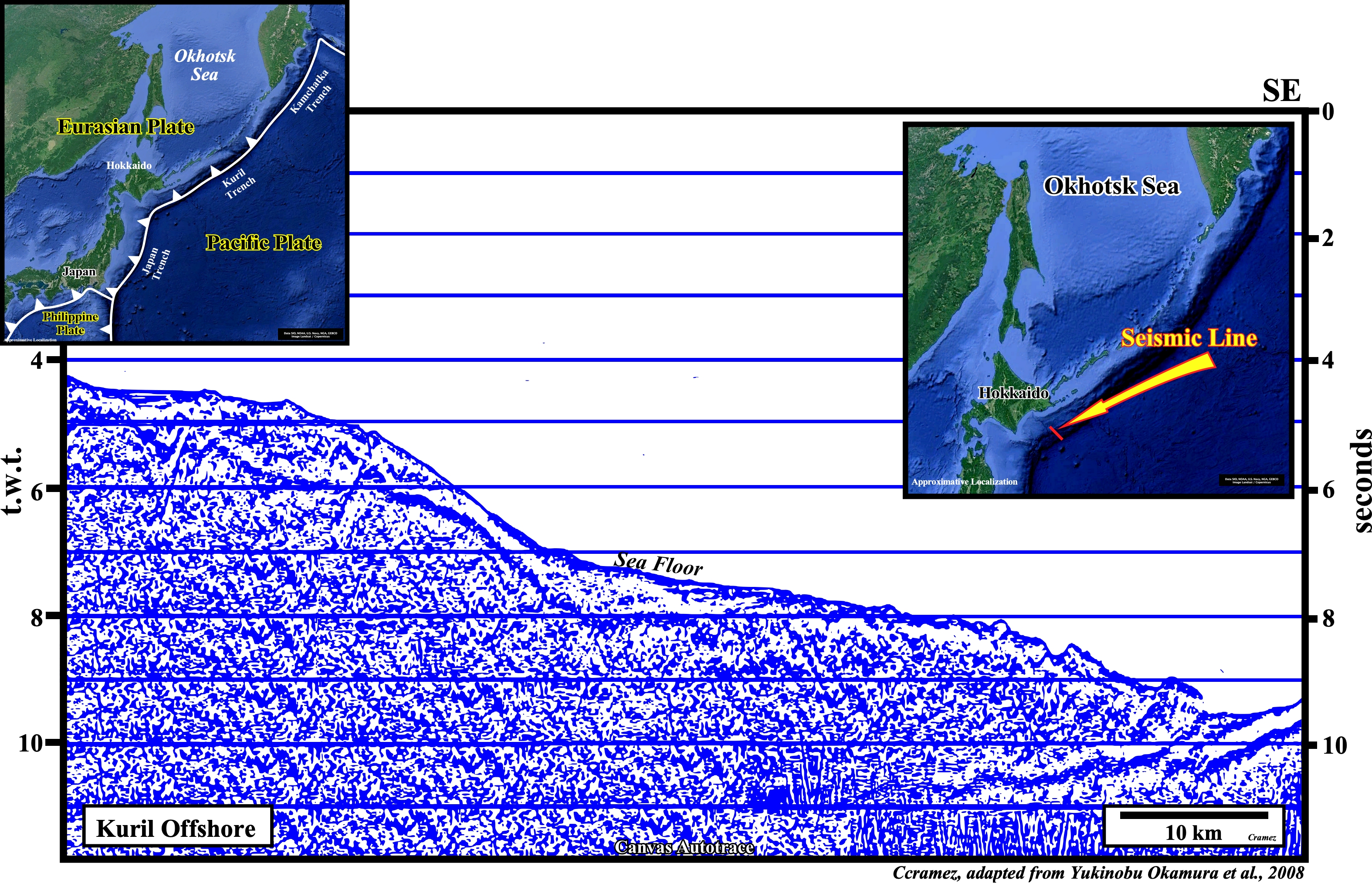
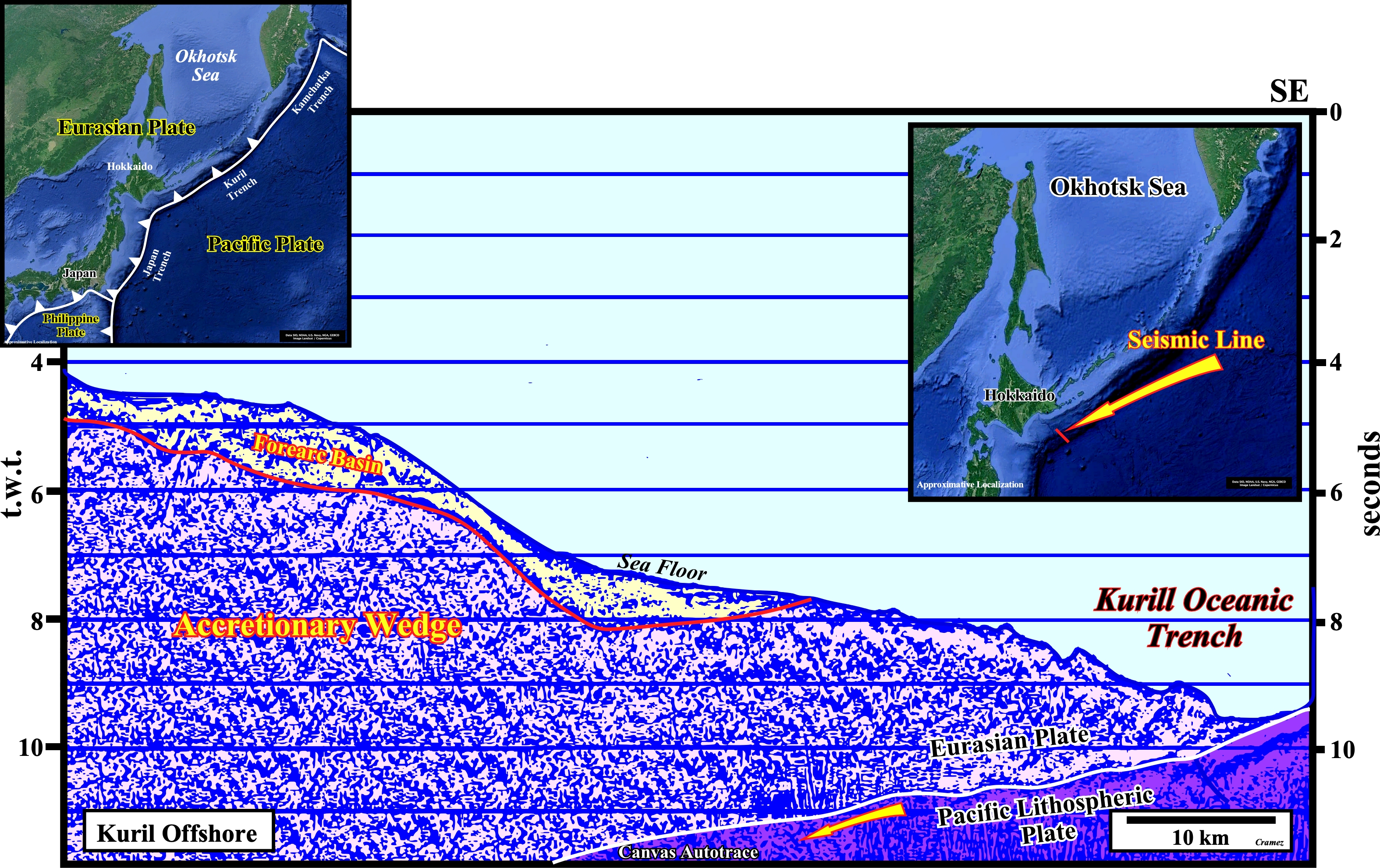
As illustrated above, the Kuril oceanic trench is a deep submarine depression located in the western Pacific Ocean, between the Japan and Kamchatka trenches, seaward of the Kuril Islands and Hokkaido island (Japan), which marks the convergence an the collision of the Pacific lithospheric plate with Eurasian plate. The B-type subduction zone is, clearly recognized, as well as the shortened accretionary prism of the overriding plate (Eurasian plate), which is covered by a recent forearc basin, that is to say, by sedimentary basin located between the oceanic trench and the associated volcanic arc (placed westward of this Canvas autotrace), which is, also, recognized on next plates.
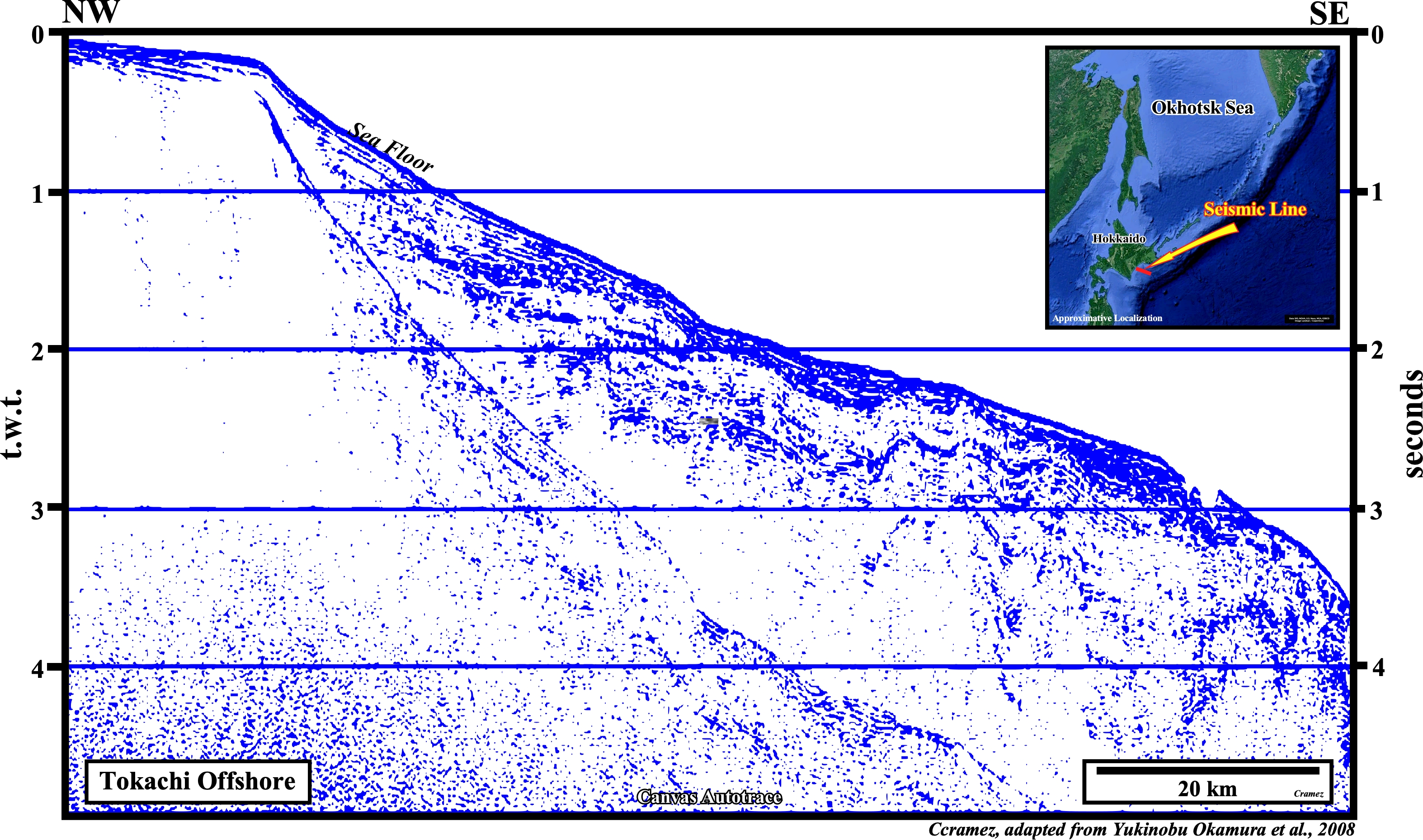
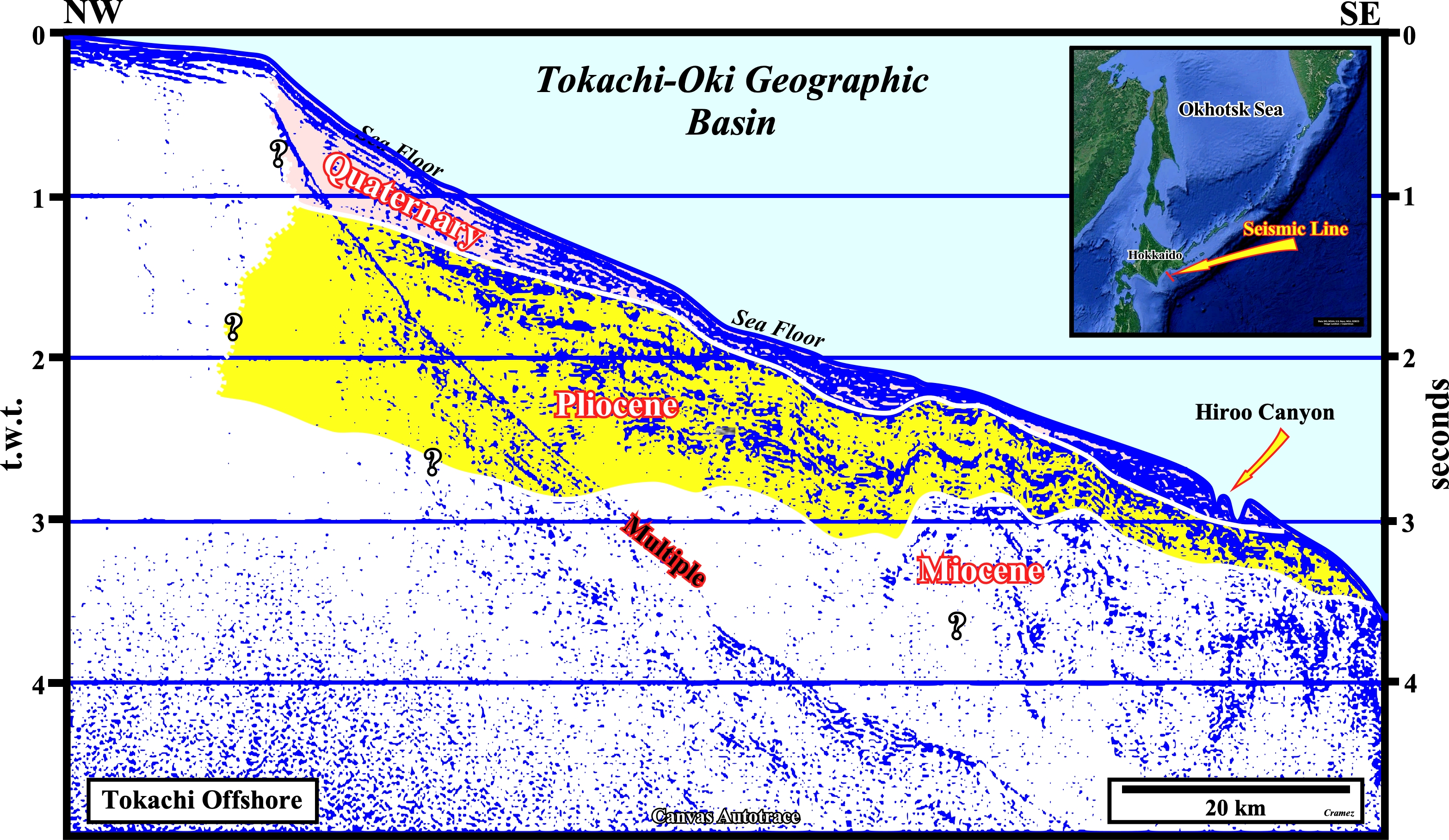
This tentative interpretation of a Canvas autotrace of a seismic line shot in Tokachi offshore, suggests Quaternary sediments along the continental slope (as was the case on the previous plate) till the Hiroo Canyon. The Tokachi-Oki forearc basin sedimentary basin occupies the upper continental slope in the Tokachi-oki area. The Miocene and Pliocene sediments seem to be gently folded with fold axes trending NW-SE in the western and northern parts of the basin, while the Quaternary sediments are almost undeformed. The lower limit of forearc sediments, i.e., the top of the accretionary wedge strata are difficult to recognize (see Page 34).
![]()
![]()
Send E-mails to carlos.cramez@bluewin.ch with comments and suggestions to improve this atlas.
Copyright © 2001 CCramez
Last update:
2022![]()
