
North Australia Offshore
Arafura Geographic Basin (Tanimbar Trough)
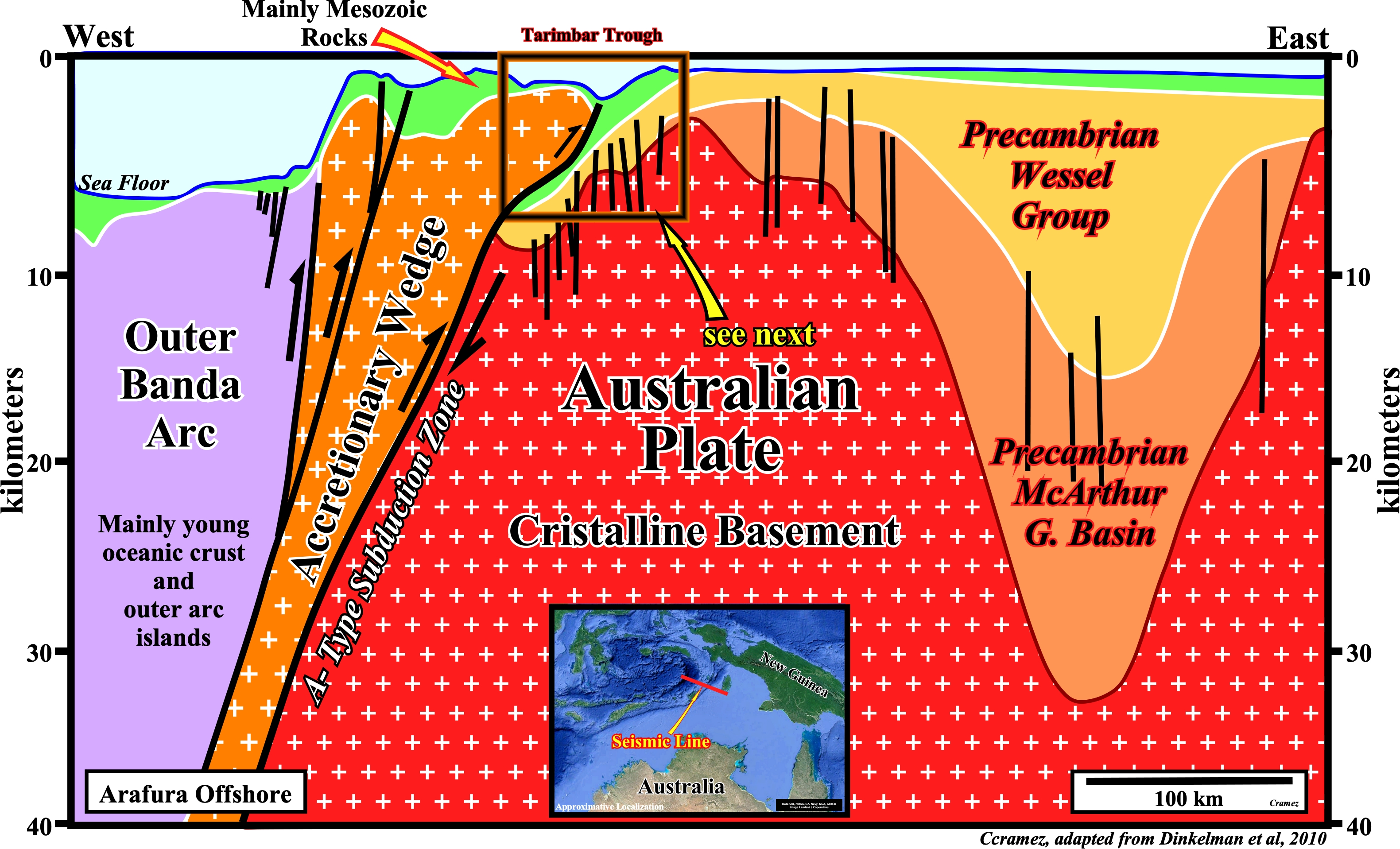
On this tentative geological interpretation of a Canvas autotrace of a regional seismic section across the north of the Tanimbar Trough, the relationship between the Arafura geographic basin, the Tanimbar trough and the accretionary wedge complex are, easily, recognized. The Australian plate, i.e., the crystalline basement, in which, Precambrian sedimentary rocks (Wessel group and Mc Arthur geographic basin) plunge under the Tanimbar accretionary wedge creating a major Benioff subduction zone (B-Type subduction zone). Westward of the accretionary wedge, the outer Banda Arc is formed, mainly, by young oceanic crust enclosed by a volcanic arc, outer arc islands and a trough, more or less, parallel to the Australian continental margin. According several geoscientists this complex subduction zone extends to a depth of about 650 km.
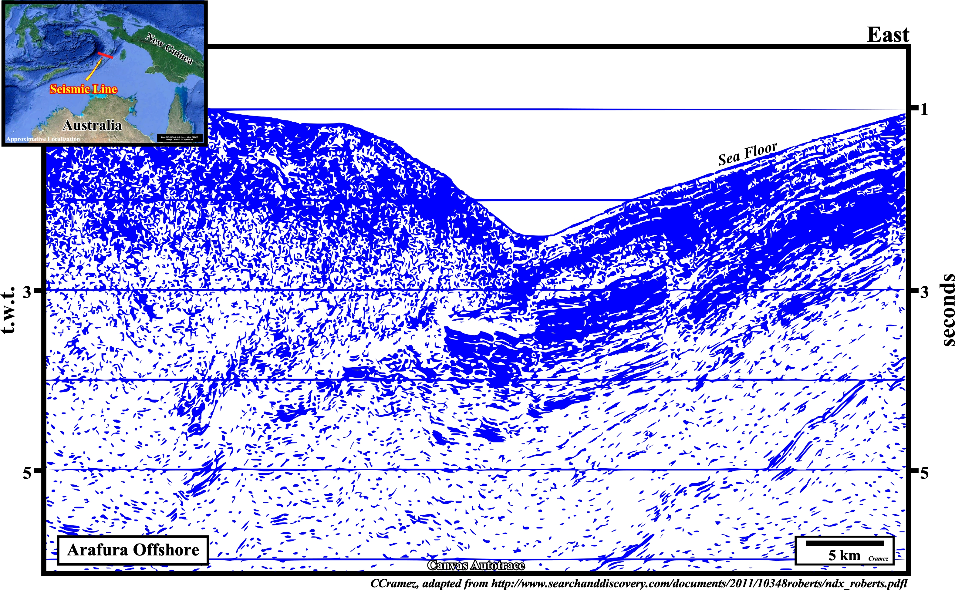
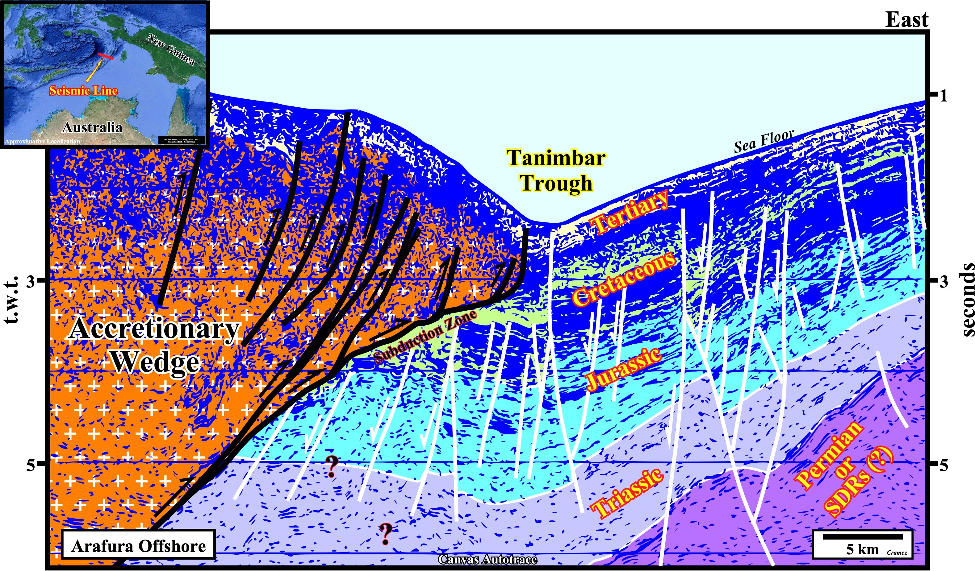
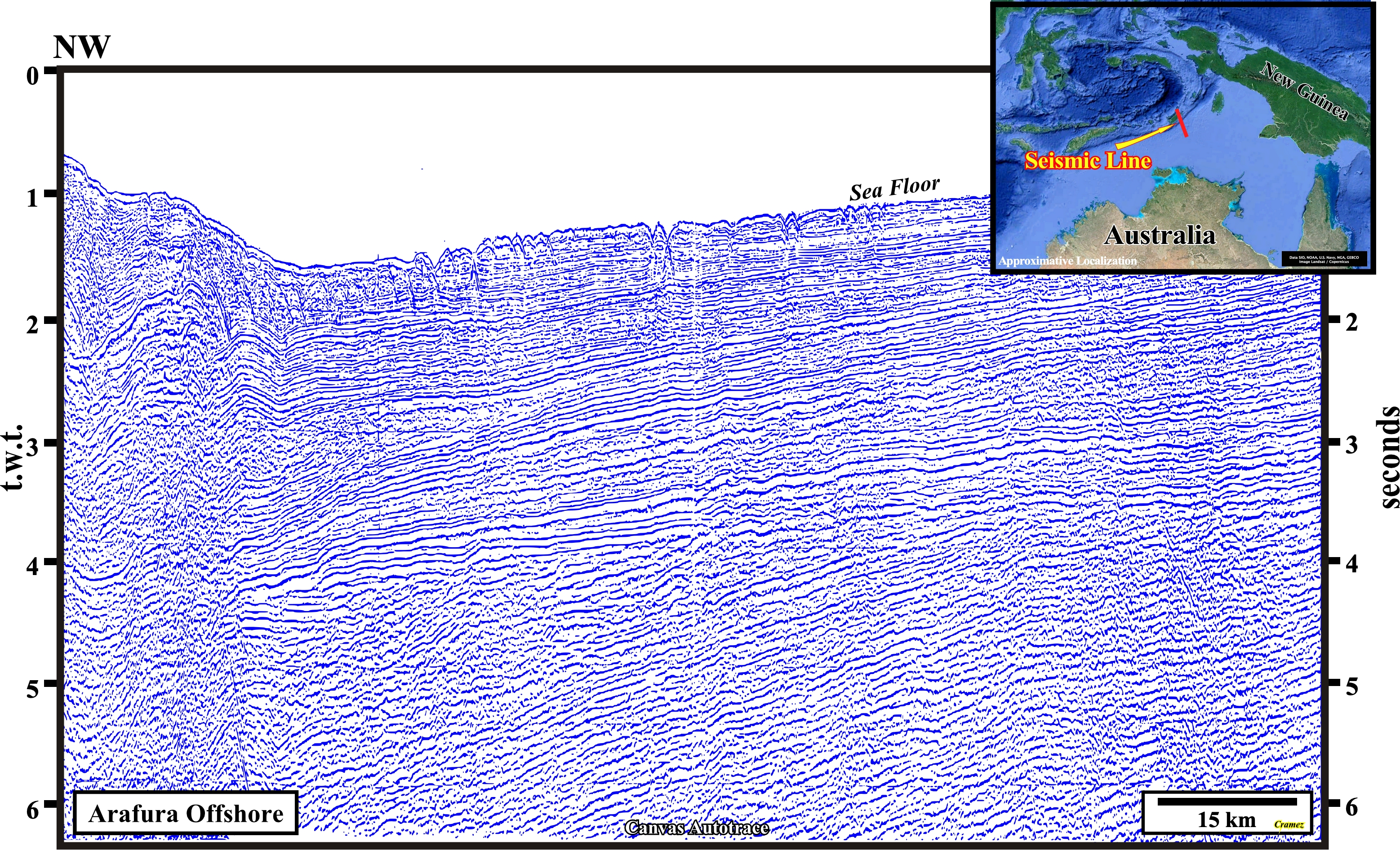
On this tentative geological interpretation of Canvas autotrace of an Arafura offshore seismic line, the A-type subduction zone (collision between two margins or between a margin and an oceanic plate, in which the sinking or plunging plate is continental) of the Australian lithospheric plate is, easily, recognized. Paleozoic sediments (Permian) or Mesozoic lava flows (postdating the lithosphere's breakup) seems to form the substratum of the Australian margin. Certain seismic lines (next plate) suggest the reflectors, below the Triassic strata, can be, provisionally, considered as SDRs (seaward dipping reflectors), since heir stratigraphic position, dipping and thickening are those of the sub-aerial lava-flows postdating the breakup of the Gondwana continent.
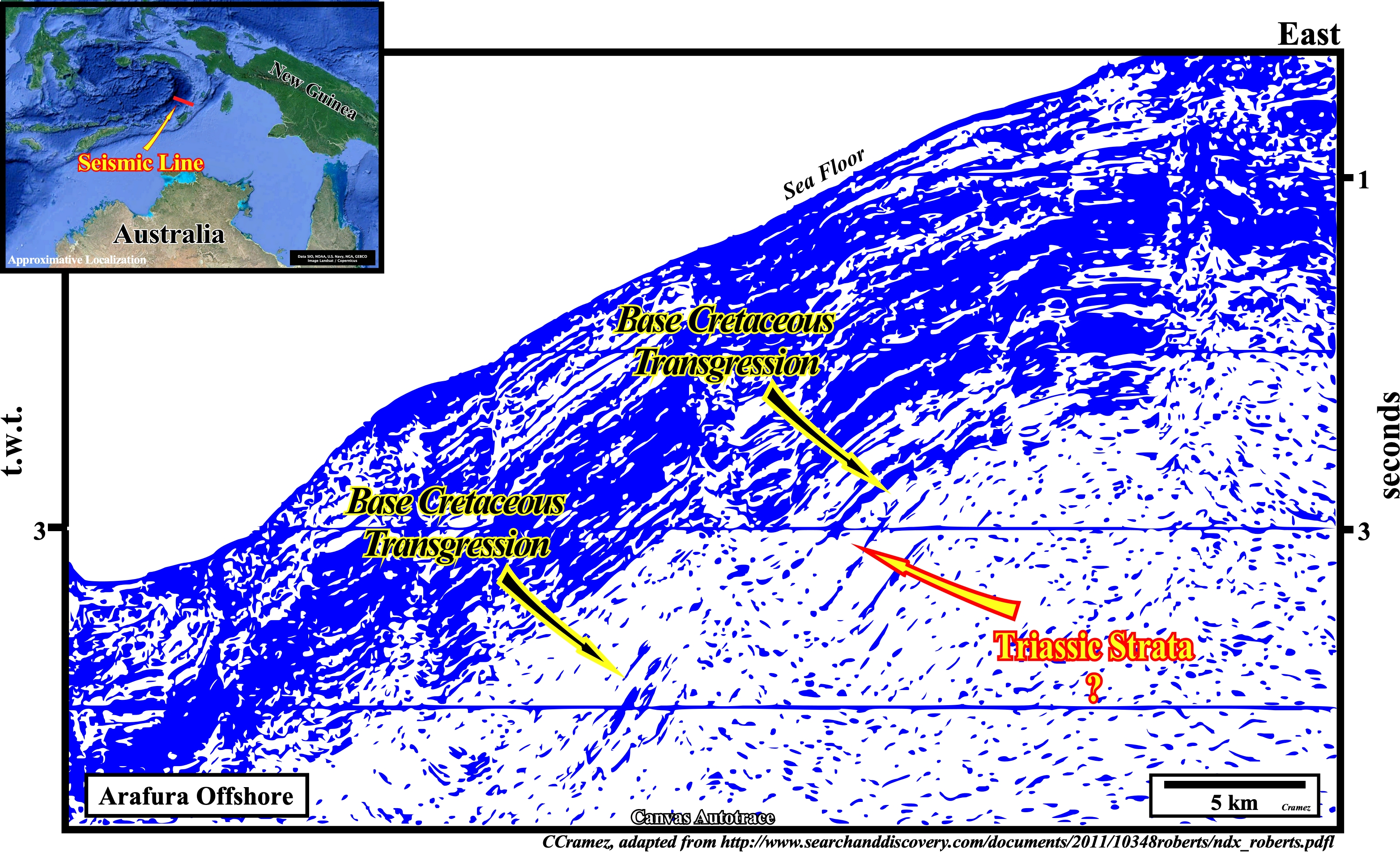
On this Canvas autotrace of a detail of an Arafura seismic line parallel, more or less, to the autotrace illustrated on previous plates, below the transgressive Cretaceous sediments, the dipping seaward reflectors can be, tentatively, interpreted either as Triassic sediments or as sub-aerial lava-flows. If the presence of sub-aerial lava-flows is corroborated the north Australian Atlantic-type divergent margin can be considered as a volcanic margin (having a lower volcanic sector), what is the case for the large majority of the Pangea Atlantic-type divergent margins. On this subject the next Canvas autotrace can be very instructive, because it suggests a different geological history.
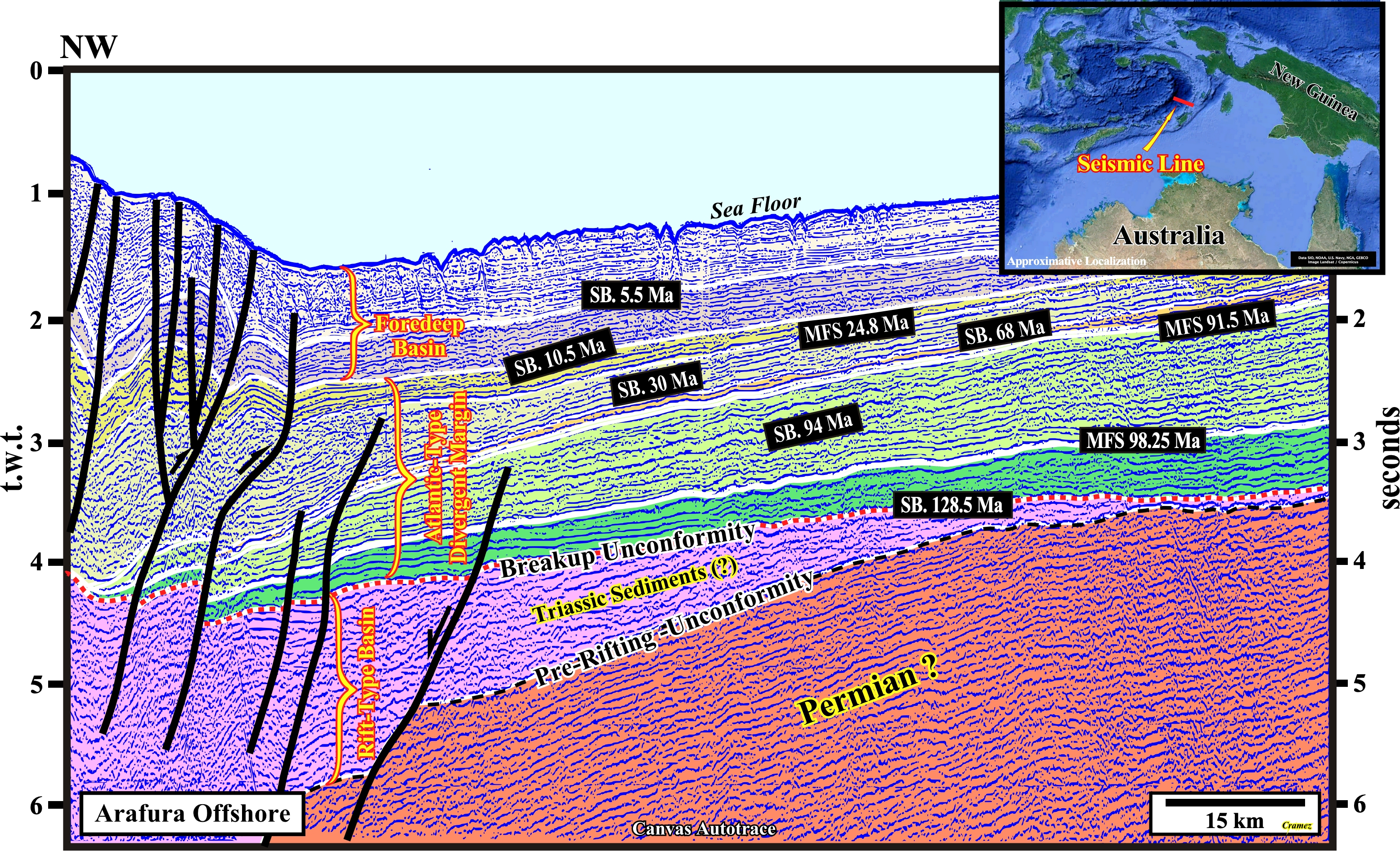
Using the P. Vail stratigraphic signature of the area, the tentative geological interpretation of this Canvas autotrace suggests, from bottom to top, the following geological events and sedimentary packages: (i) A pre-rifting Paleozoic substratum rather than a basement ; (ii) The pre-rifting unconformity marking the onset of the lengthening (extension) of the Pangea continental crust ; (iii) The development of Triassic rift-type basins ; (iv) The breakup unconformity, which highlights the breakdown of the lengthened Pangea continental crust, i.e., the end of the lengthening (differential subsidence) and the onset of the thermal subsidence ; (v) The Atlantic-type divergent margin, in which the transgressive (SB. 128.5 Ma / MFS 91.8 Ma) and regressive (MFS 91.5 Ma / SB 10.1 Ma) stratigraphic phases are, easily, recognized, by their geometry and internal configuration (upbuilding retrogradational and outbuilding progradational respectively) ; (vi) A foredeep basin induced by the weight of the thrust faults (flexural subsidence) associated with the compressional tectonic regime created by the collision between Indo-Australian and Eurasia plates (formation of the Banda island arcs following the collision of Australia continent with an intra-oceanic island arc).

![]()
![]()
Send E-mails to carlos.cramez@bluewin.ch with comments and suggestions to improve this atlas.
Copyright © 2001 CCramez
Last update:
2022![]()