
South Australia Offshore
Bight Geographic Basin (Bremen Geographic Sub-Basin)
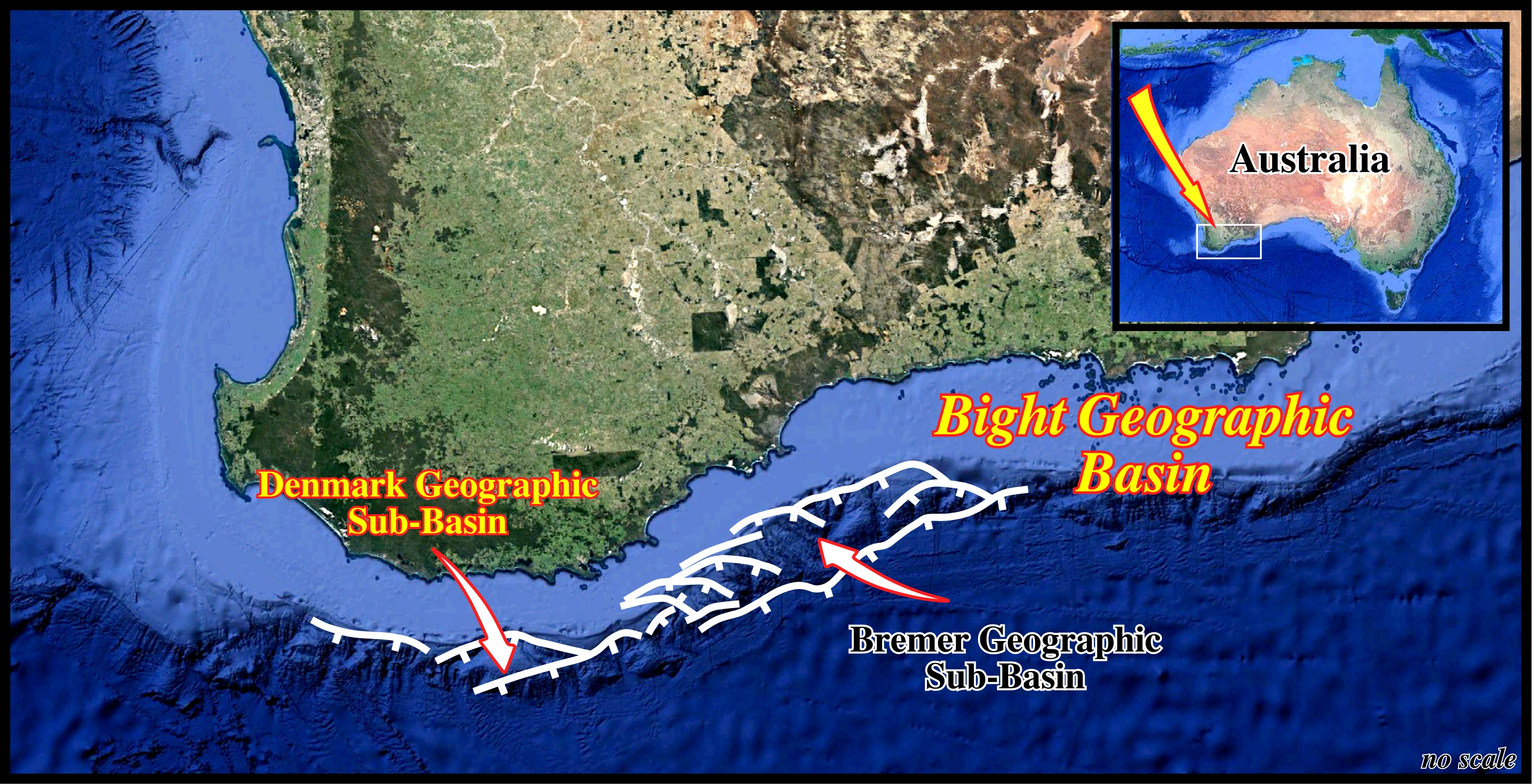
The Bremer Geographic Sub-Basin is the new name of the old Albany Geographic Sub-basin. It extends in water depths of 100 to 4500 meters with a lot of submarine canyons. Geological speaking, it correspond to complex half-graben depocenters with thick Jurassic and Lower Cretaceous sediments deposited above above Proterozoic rocks and originated during rifting in the Middle–Late Jurassic. Southward, this Bight geographic sub-basin passes progressively, by down-stepping of fault blocks, to the Recherche Sub-basin. The western and eastern limits are north to northeast striking, near-vertical faults that are hard-linked to basement and strike perpendicular to the basin axis. Most of the sediments consists of Middle Jurassic / Early Cretaceous fluvial and lacustrine sedimentary rock. Mid–Late Cretaceous / Cenozoic marine sedimentary rocks are also present, but form only a thin overburden.
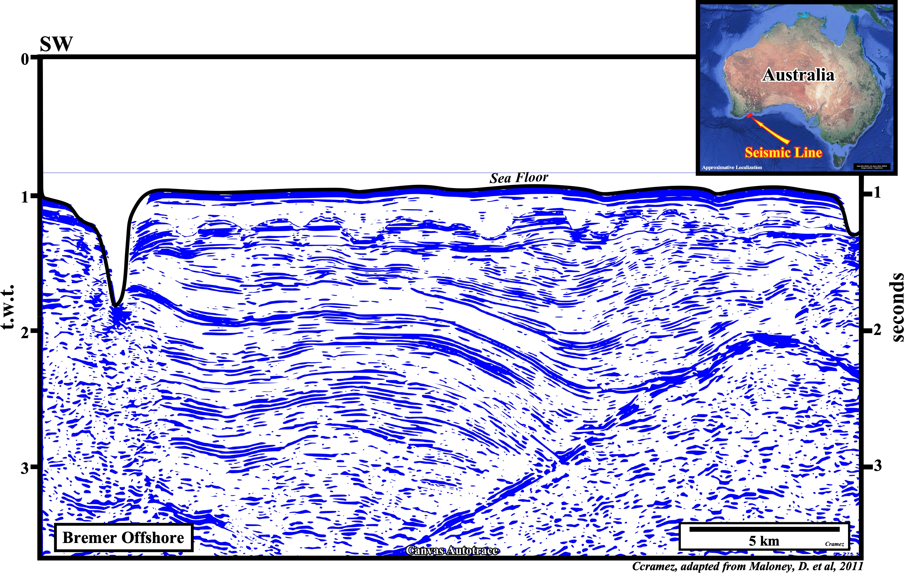
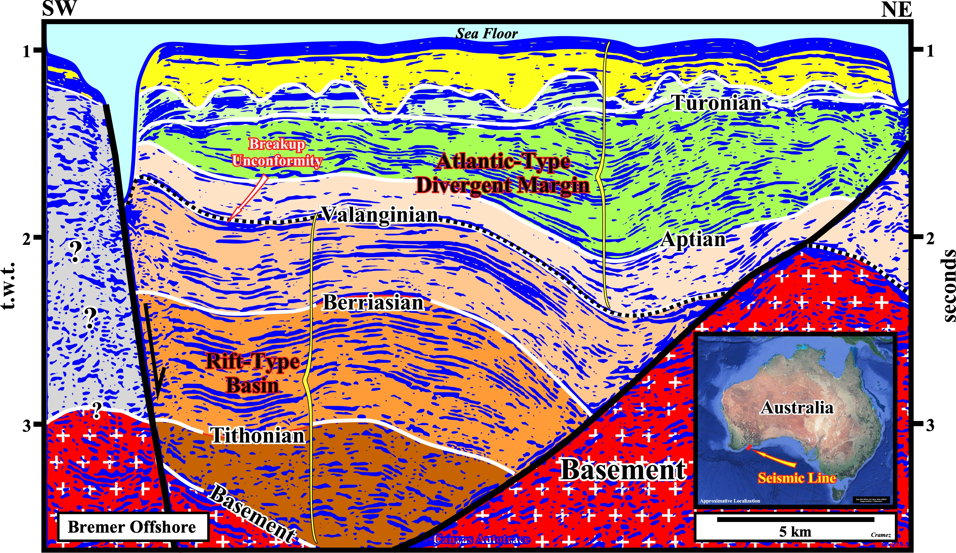
On this tentative interpretation, the breakup unconformity, which separates the rift-type basins from the Atlantic-type divergent margin, corresponds rather to the top Valanginian rather than Aptian as it was the case on other tentatives interpretations (see Page 17). The bottom Cenozoic unconformity is enhanced by submarine canyon incisions. On the other hand, it is evident that the geometry of the right fault plane is apparent, i.e., the seismic line is to oblique to the strike of the fault plane.

![]()
![]()
Send E-mails to carloscramez@gmail.com or to carlos.cramez@bluewin.ch with comments and suggestions to improve this atlas.
Copyright © 2001 CCramez
Last update:
2020
![]()