

New Zealand Offshore
East Coast Geographic Basin
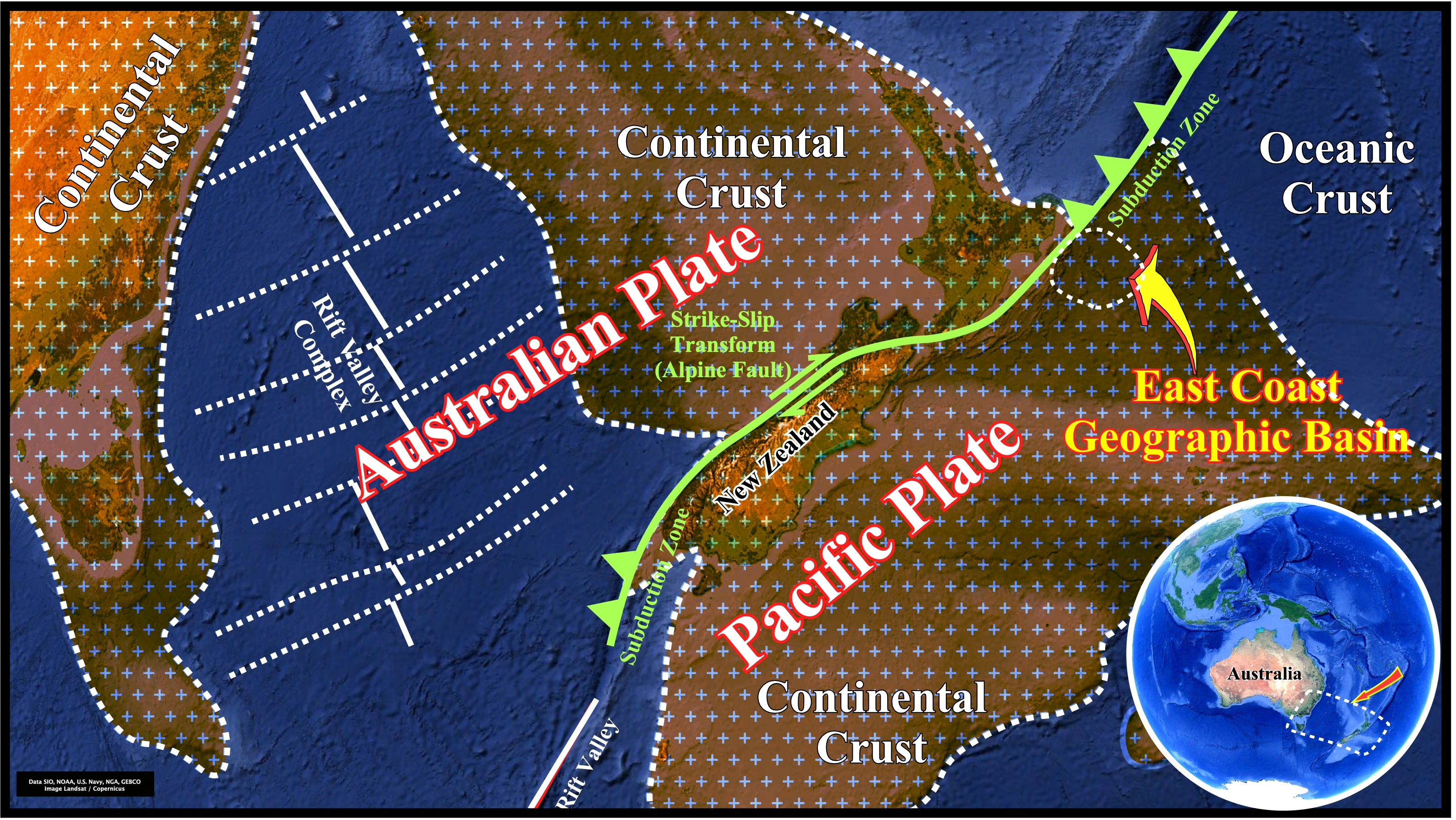
Taking into account the extension of the Pangea continental crust, the long, narrow, mountainous landmass of New Zealand is just the highlands of a submerged continent (geoscientists called it Zelandia) astriding the collision between the Pacific and Australian lithospheric plates, which pushes up the overlying rocks and sediments, creating the hilly terrain of New Zealand. As illustrated, in the North Island, the boundary between the two lithospheric plates lies off the East Coast along the oceanic trench of the Kermadec-Tonga subduction zone (see next plate). Then, southward, it cuts, diagonally, across the South Island to the West Coast to continues south-westward along the great Alpine Transform Fault and runs back out to sea. The motion of the Alpine fault, which is, mainly, a strike-slip fault in which the Australian plate moving northward and the Pacific plate southward at a rate not far from 3-4 centimeters per year, uplifted the South Island over the last 12 million years. Notice the rift-valley complex formed in the southern part of the Australian plate following a breakup and oceanization of the Pangea continental crust.
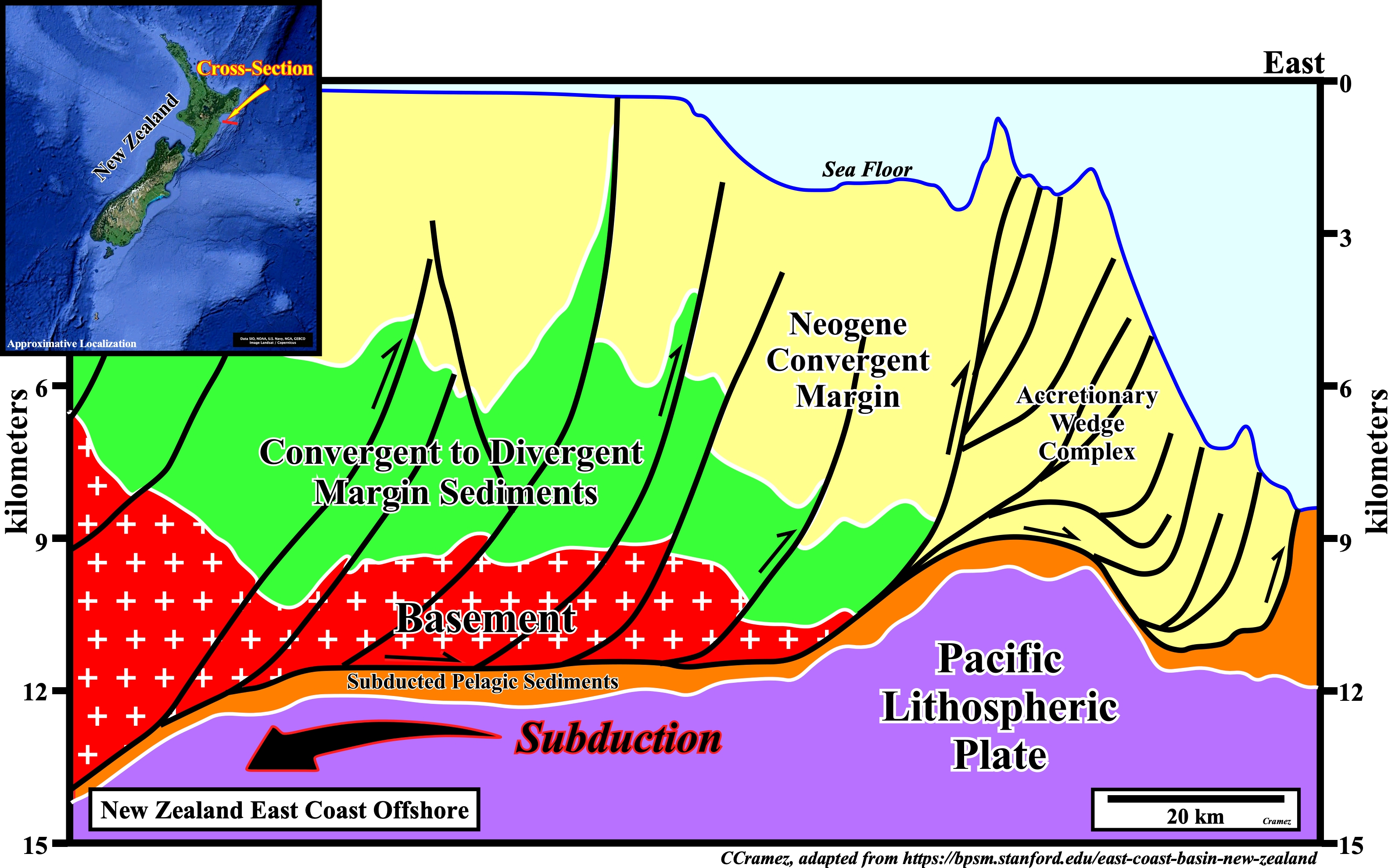
Presently and geologically speaking, the East Coast geographic basin correspond to a forearc basin (perisutural basins association with a B-type (Benioff) subduction zone and external to the volcanic arch). It is associated with the subduction of the Pacific lithospheric plate under the Australian plate. As illustrated, in the overriding plate, different geological unities can be recognized: (i) The accretionary wedge complex, which comprise Quaternary and Neogene sediments ; (ii) The Neogene fill apron, which contains localized and fragment sub-basins associated with the present day tectonic configuration ; (iii) A convergent to passive margin, composed by sediments related to the final stages of the Cretaceous convergence, then subsiding as the western margin of Zelandia rifted from the Gondwana (southern Pangea small supercontinent), and (iv) The basement, which can represent a former accretionary subduction complex of Gondwana priori to the rifting.
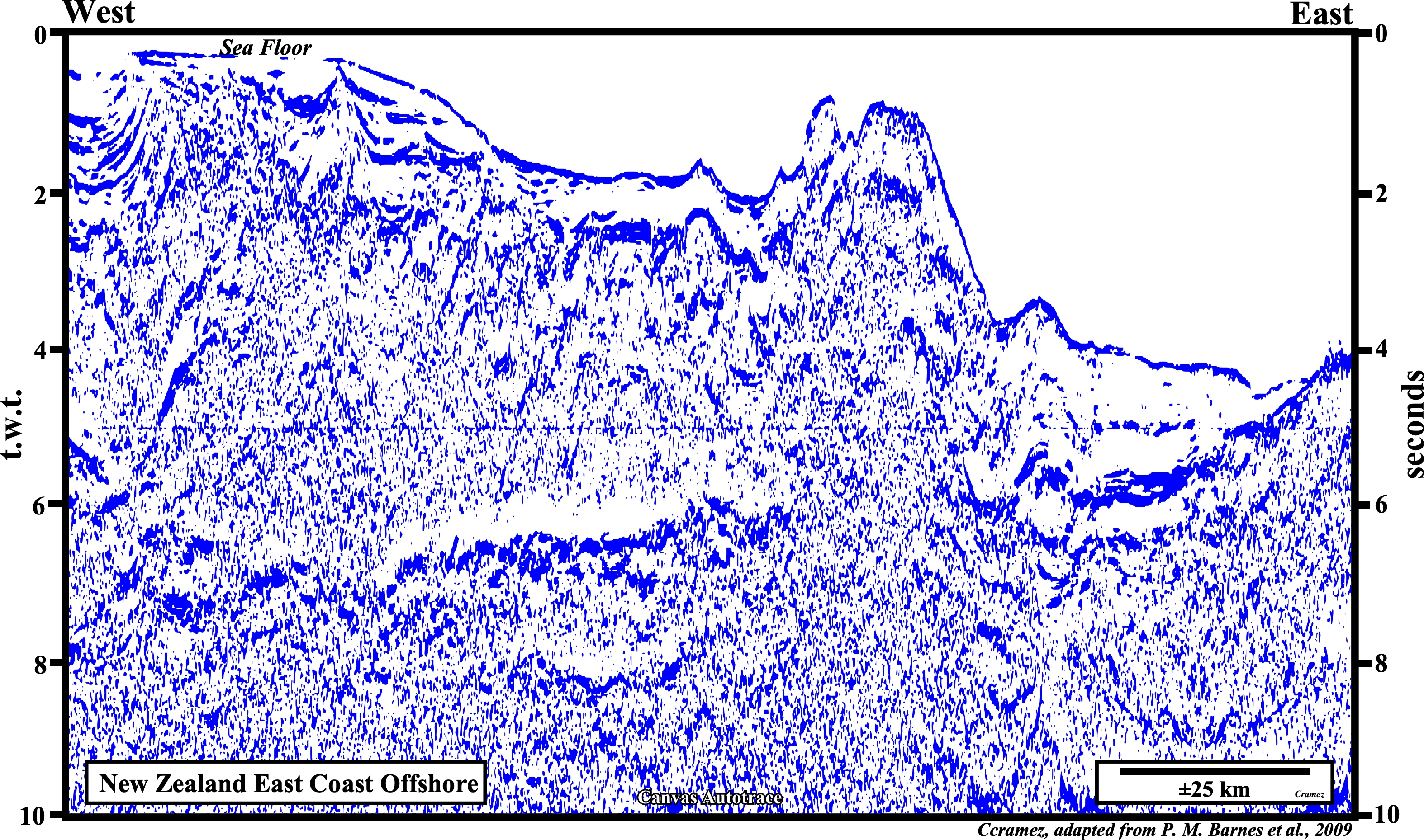
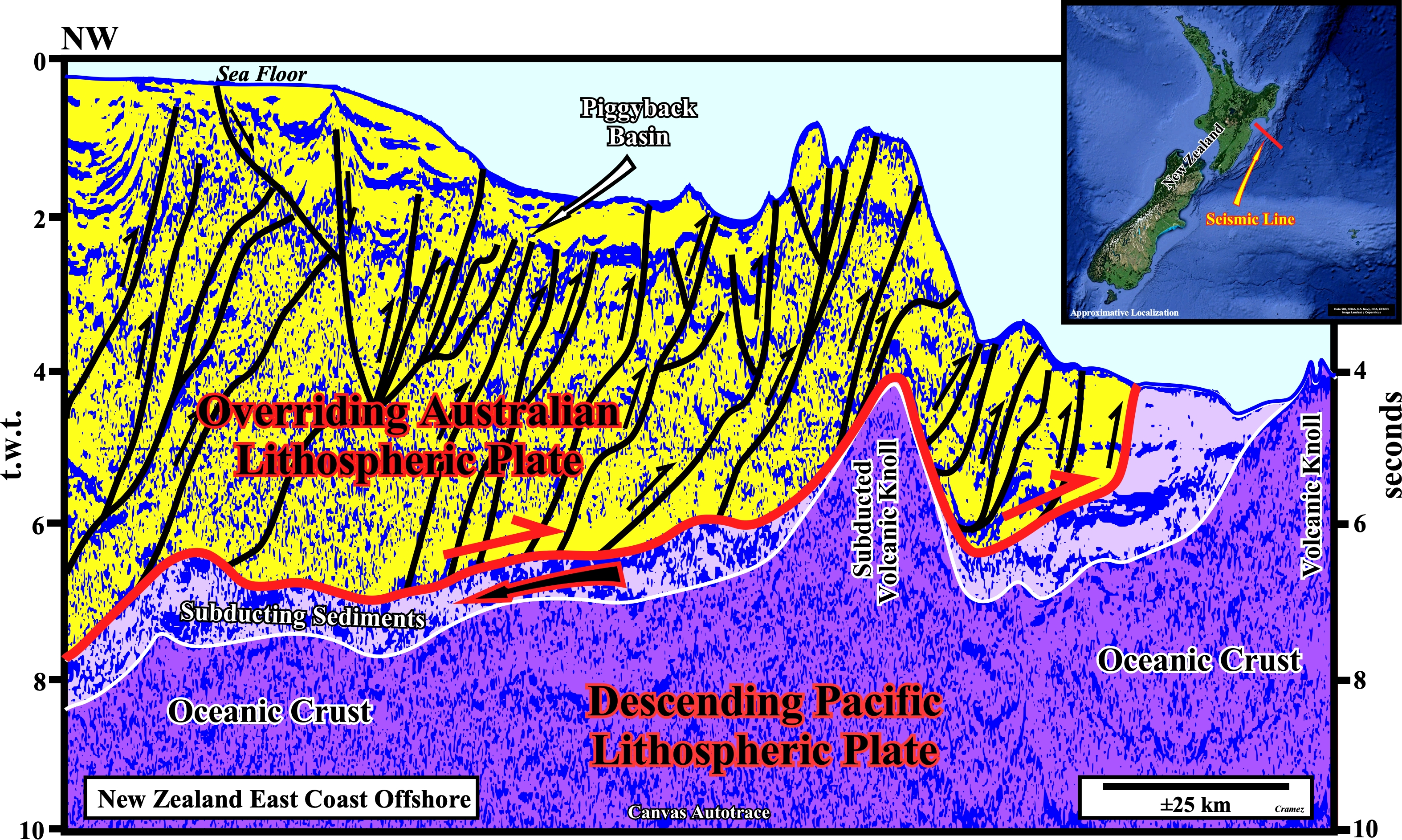
On this Canvas autotrace of a regional seismic line, the decollement surface, over which the sediments of the Australian lithospheric plate are shortened. is obvious. Below the decollement surface, a thin interval of pelagic and volcano-clastic sediments, deposited on the oceanic crust, are, as well as, the Pacific lithospheric plate, under subduction. In fact, in this area, the Australian and Pacific plates are bounded by a B-Type subduction zone, in which the overriding plate is the continental Australian Plate and the descending plate is the oceanic Pacific plate with its thin pelagic sedimentary cover. Notice, in the descending lithospheric plate the presence of a two volcanic Knolls, one of which is under subduction. Similarly, on the overriding plate, the presence of a piggyback basin, at the sea floor, is quite possible (see next plate).
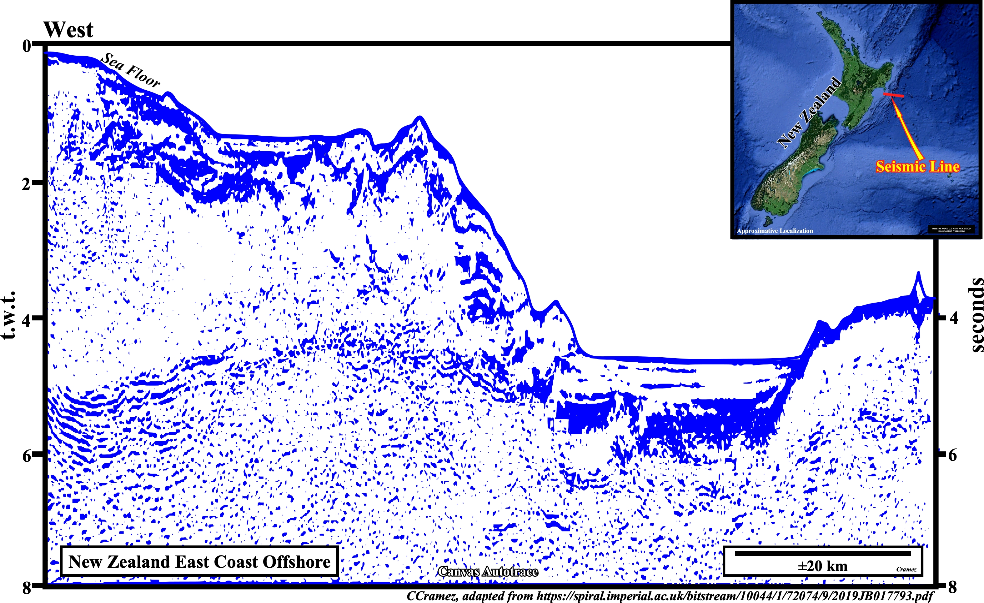
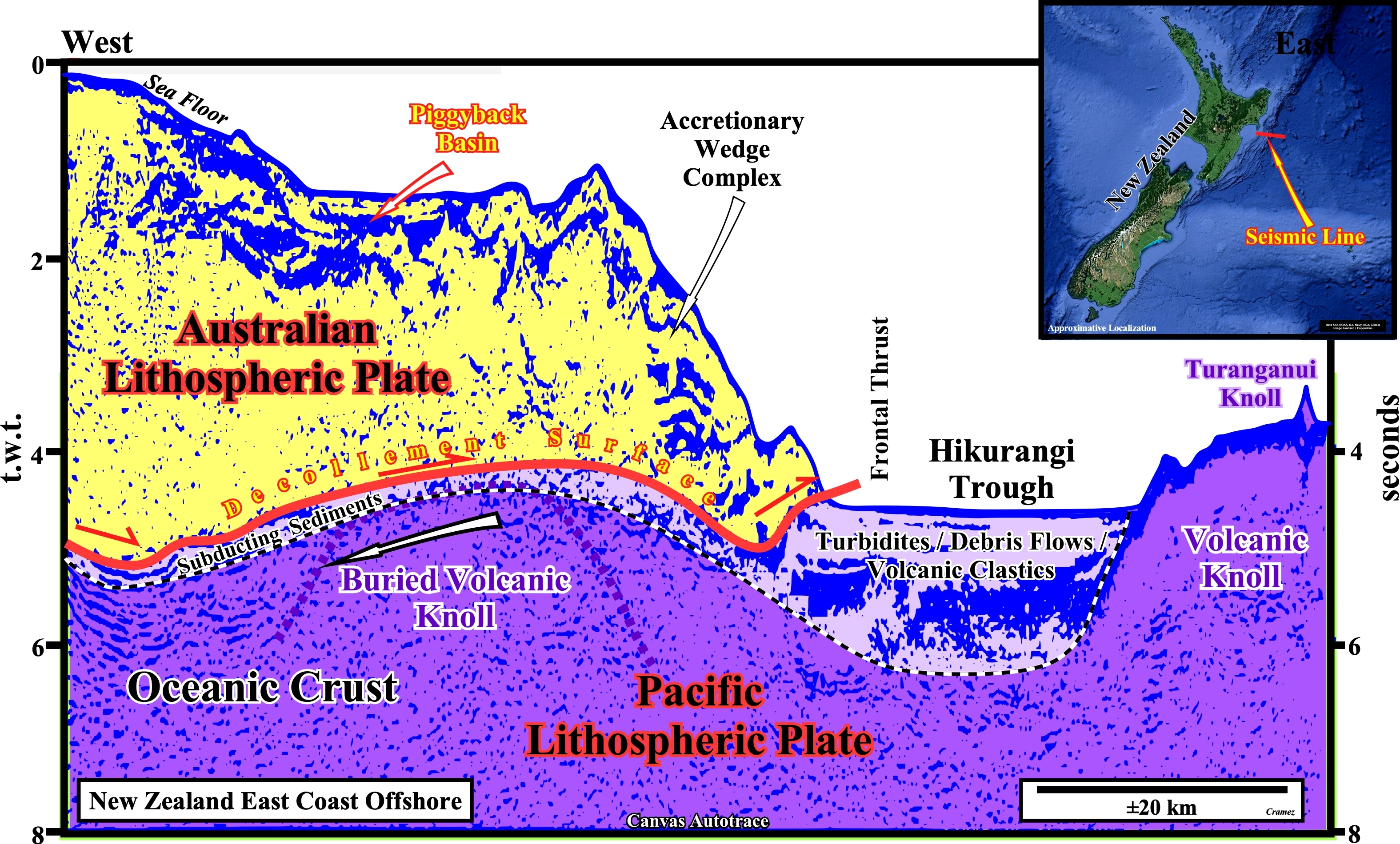
This autotrace corroborates not only the subducting sediments overlying the Pacific lithospheric plate (probably, turbidite, debris-flows and volcano-clastics), the occurrence of two volcanic knolls in the oceanic crust, but the presence of a piggyback basin in the overriding Australian lithospheric plate as well. The actual existence of a piggyback basin, i.e., a depression, more or less, stable behind the frontal thrusts of the accretionary wedge complex, means that the basal lamina (decollement surface) of the thrusts advances outward, that is to say, towards the Pacific plate. This type of shortening, of the overriding plate, in which the most distal thrust (relative to the orogen) is the younger, is known as "shortening in sequence." The geometry and internal configuration is better seen on the next plate.
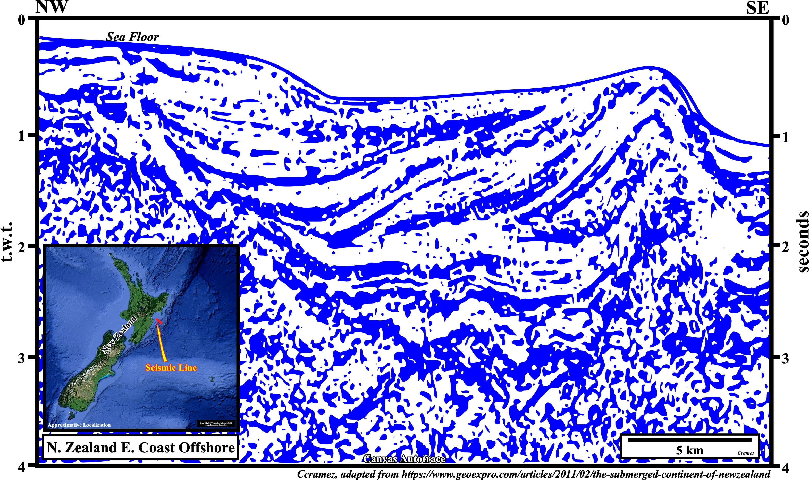
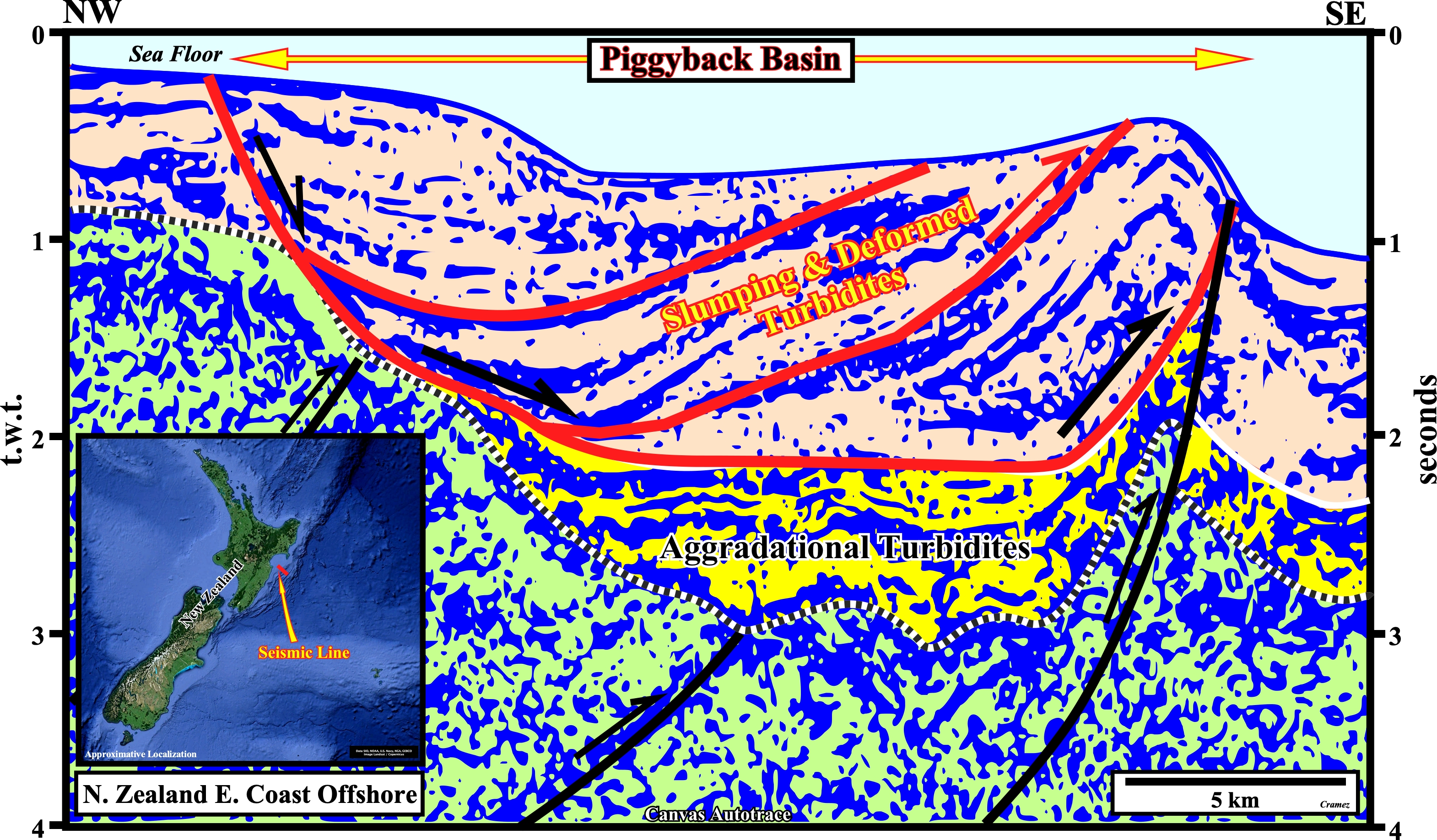
Above the lower unconformity (dotted line) of the piggyback basin ("bassin transporté" of French geoscientists) two sedimentary unities bounded by a basal listric fault (fault, which at the top, is normal and reverse at the bottom that, naturally, has, in a dip seismic line, a curved fault plane, i.e., all listric faults have a curved plane, but not all faults with a curved fault plane are listric) can be recognized. The lower unity (colored in yellow) has a parallel internal configuration, which suggests a aggradational infilling of turbidite. The upper unity (colored in beige) is more complex. In fact, it is formed by sedimentary packages limited by listric fault. The internal configuration of the lower package being parallel suggests a post depositional slumping. The intermediate packages having a divergent internal configuration suggests a syn-tectonic deposition. The upper sedimentary package is just slighted affect by gravitational deformation (gliding).
Send E-mails to carlos.cramez@bluewin.ch with comments and suggestions to improve this atlas.
Copyright © 2001 CCramez
Last update:
2022