
NW Australia Offshore
Carnarvon Geographic Basin
The Carnarvon offshore encompasses the Exmouth and Wombat Plateau, as well as, the North and South Carnarvon basins, in which several geographic sub-basins as Investigator, Rankin, Exmouth, Barrow, Dampier, Beagle, etc., can be recognized. It is part of a large elongated cratonic, faulted and folded Phanerozoic basin (Carnarvon basin) between the Perth (south) and Cannin (north) geographic basins.
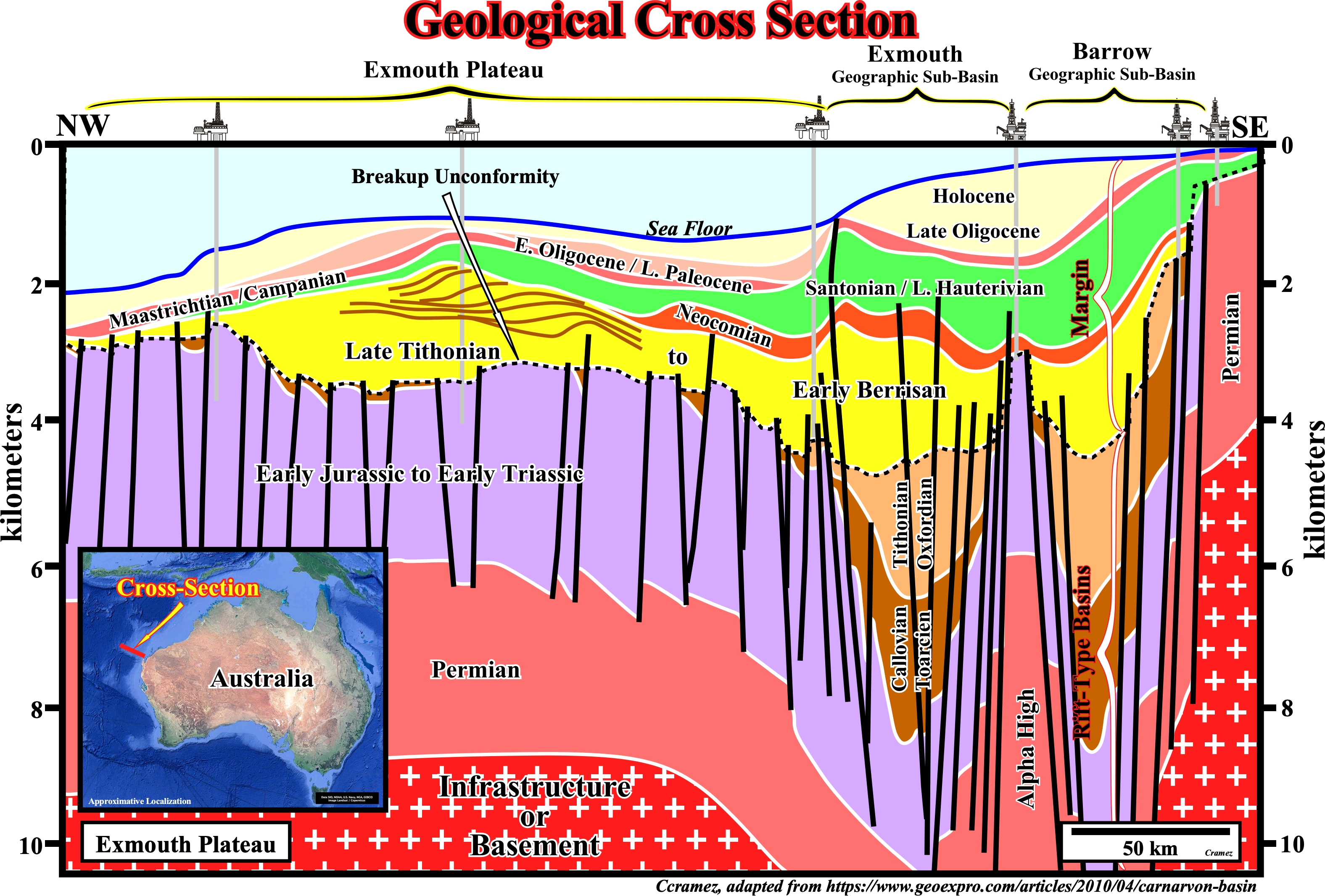
The Carnarvon offshore encompasses the Exmouth and Wombat Plateau, as well as, the North and South Carnarvon basins, in which several geographic sub-basins as Investigator, Rankin, Exmouth, Barrow, Dampier, Beagle, etc., can be recognized. It is part of a large elongated cratonic, faulted and folded Phanerozoic basin (Carnarvon basin) between the Perth (south) and Cannin (north) geographic offshore basins. The Exmouth plateau is an elongated continental margin of the westernmost part of the North Carnarvon geographic basin. It strikes NE and several depocenters (geographic sub-basins) can be recognized : Exmouth, Barrow, Dampier, etc. The Exmouth Plateau is surrounded by the oceanic crust of the Argo (see Page 2), Cuvier and Gascoyne abyssal plains, although by the end of Paleozoic, it was part of the eastern Gondwana small supercontinent, before the seafloor spreading that followed the breakup of the Gondwana lithosphere, during the Late Jurassic (Thithonian/Berrisian) as illustrated on this geological cross-section.
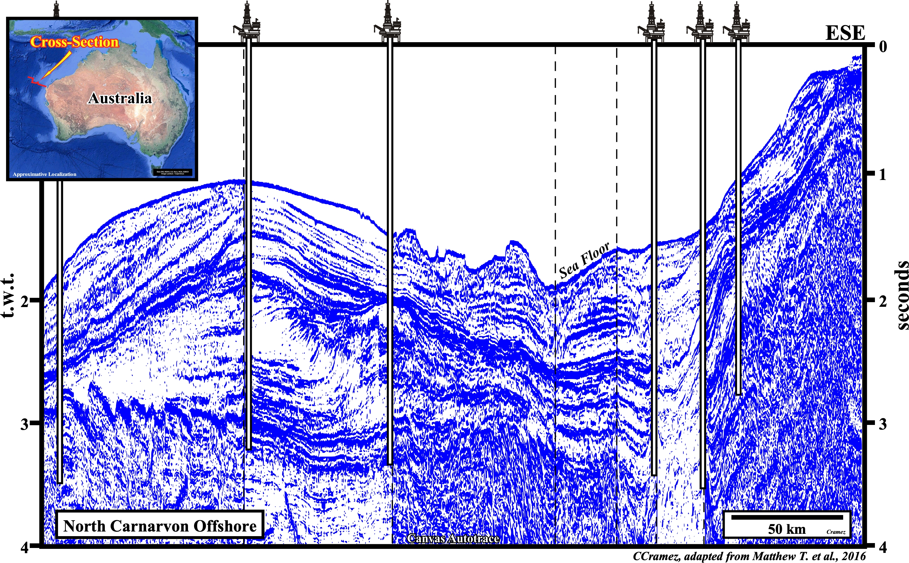
On this Canvas autotrace, the breakup unconformity, which separates the rift-type basins from the Atlantic-type divergent margin can be placed, at least seismically, at top Jurassic (top blue interval), capping a quite thick Jurassic rift-type basin (right end of the autotrace). In th Atlantic-type divergent margin, during the Berriasian / Valanginian, there is deposition of an important progradational interval that is better visualized on the next plate.
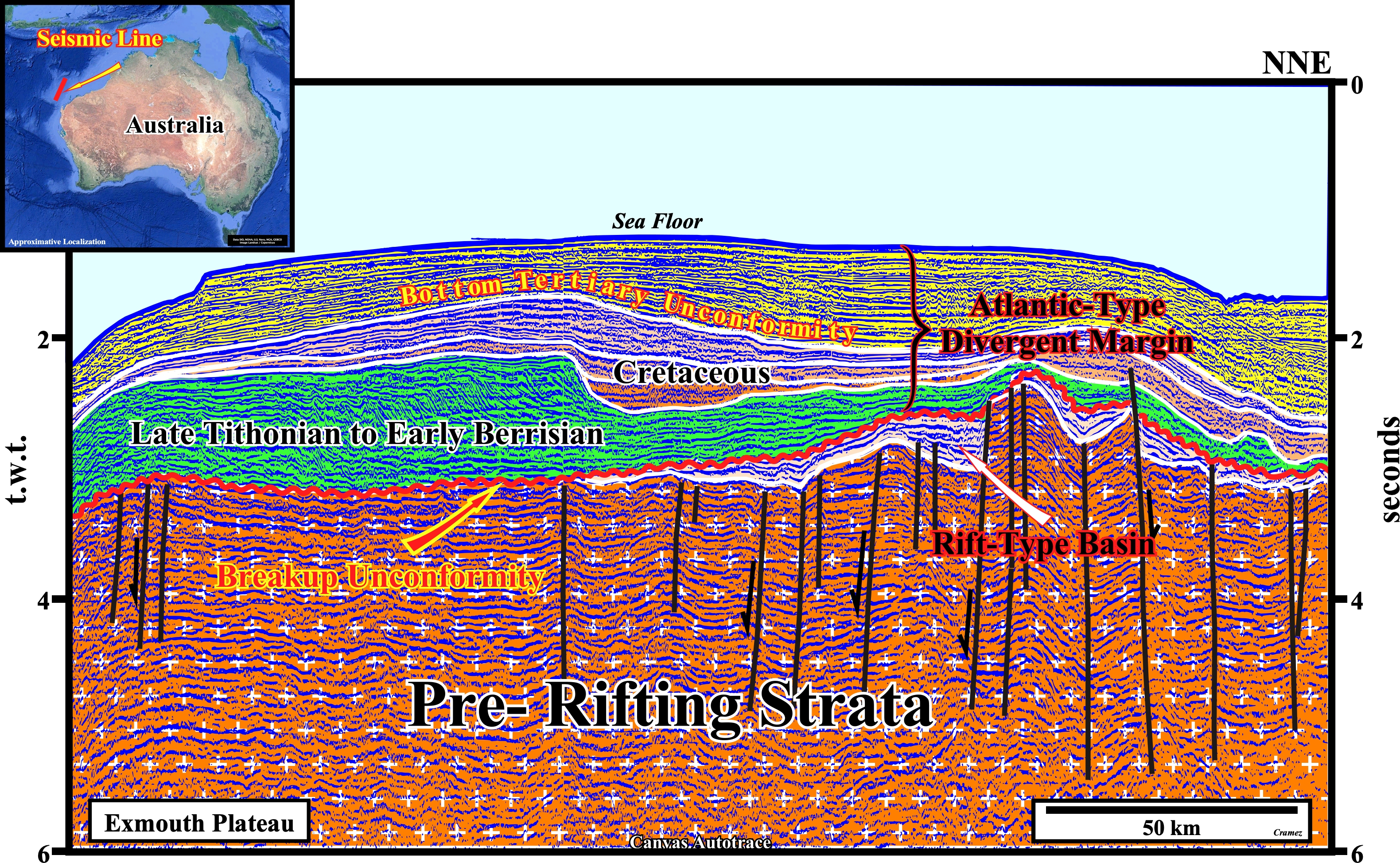
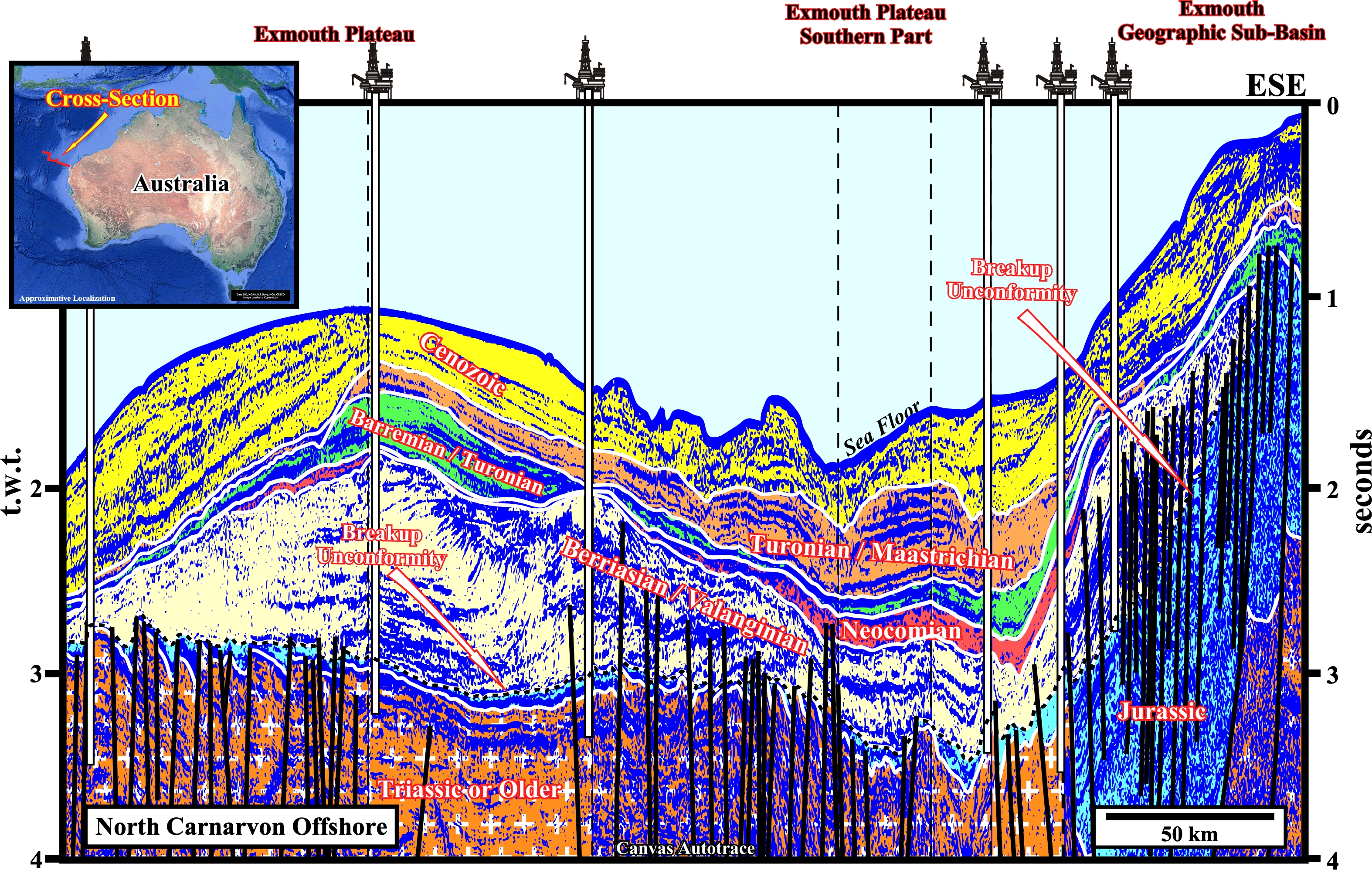
The progradations in the green interval (Late Tithonian to Early Berriasian) are obvious. Taking into account the scales of the autotrace (horizontal in kilometers and vertical in seconds t.w.t.), it can be said : (a) The outbuilding out the progradations is, largely, predominant over the upbuiding and (b) The height of intermediate sector of the progradations, i.e., the slope exceeds 200 meters. Such features favors the hypothesis of a progradational carbonate body rather than a deltaic body for the following reasons: (i) The extension of a delta plain can vary greatly ; (ii) It has about 450 km at the end of the Niger delta building, 100 km at the end of the Mississippi delta building, 32 km at the end of the Rhone delta building and 16 km at the end of the Rhine delta building, etc. ; (iii) The average height of the delta slope forming the above-mentioned delta buildings is respectively 115, 106, 61 and 36 meters , (iii) Do not confuse a delta with a delta building : a delta, generally, corresponds to a sedimentary systems tract (lateral association of synchronous and genetically related depositional systems), and its thickness, rarely, exceeds 30-60 meters (iv) A delta building is a, more or less, progradational stacking of deltas of different ages, which may or may not belong to the same sequence-cycle, i.e., that may be associated with one or more eustatic cycles ; (v) Although the height of a delta slope with a large delta plain is larger than that of a delta with a small plain, it can not be said that the height of a delta slope is a function of the delta plain dimensions ; (vi) The seismic resolution may be close to or even lower than the thickness of a delta ; (vii) Many geoscientists confuse, sometimes, a delta with a delta building,that is to say, they confuse the delta slope with the continental slope, which may be the result of the vertical stacking of several delta slopes as is, sometimes, the case in a delta building ; (vii) In the same way that a skyscraper is a stacking of flats with 2.4 m in height (in average), a deltaic building (skyscraper) is a progradational stacking of a large number of deltas (flats) with average thickness between 30-60 m ; (viii) Confusing a delta building with a delta corresponds to confusing a continental slope with a prodelta, although, sometimes, a delta slope may exist on top of a continental slope formed by the staking of delta with negligible outbuilding (still-stand geological conditions).

![]()
![]()
Send E-mails to carlos.cramez@bluewin.ch with comments and suggestions to improve this atlas.
Copyright © 2001 CCramez
Last update:
2022![]()