
North Iceland Offshore
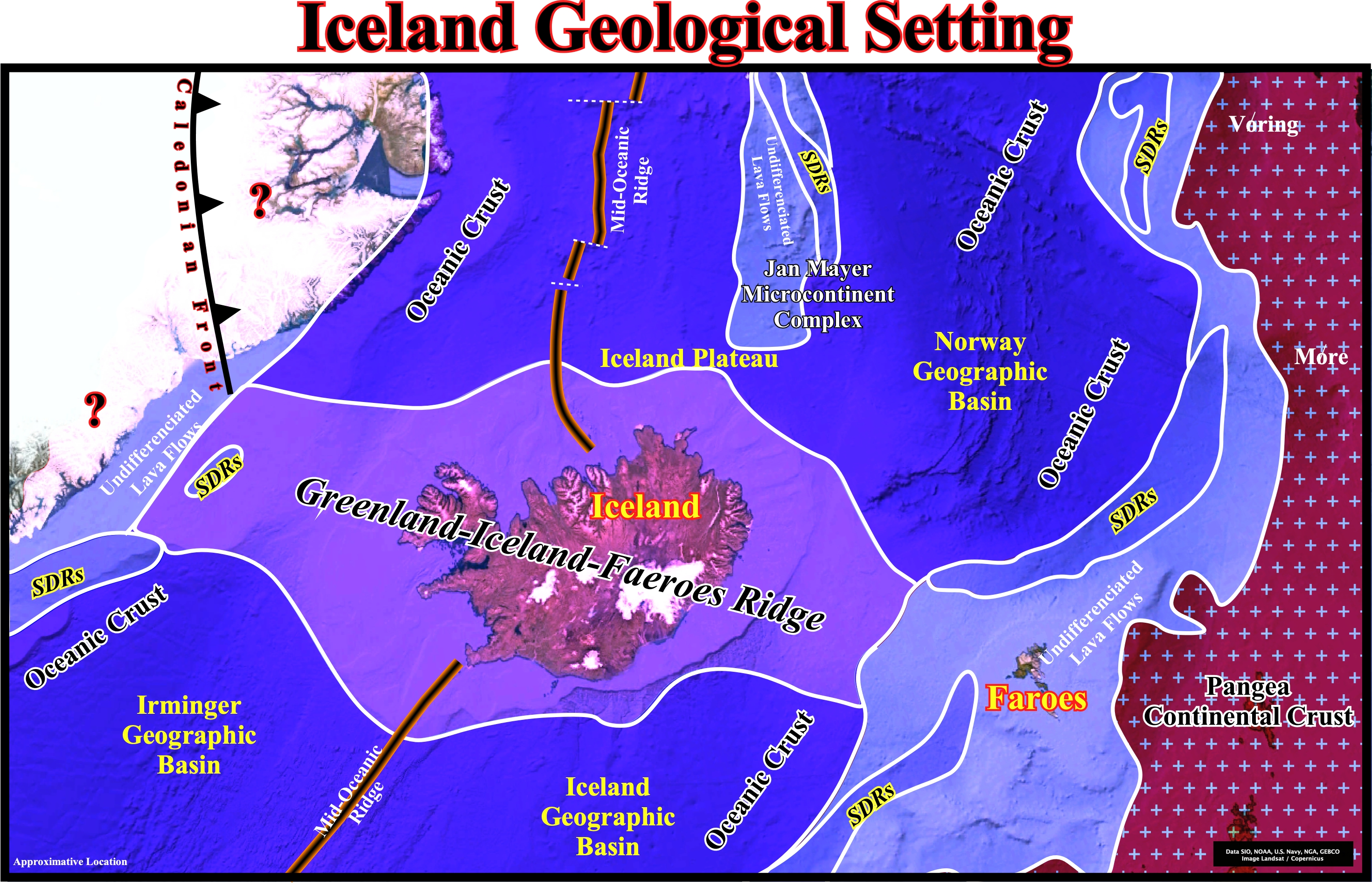
On the Iceland geological setting, it is important to recognize the Greenland–Iceland–Faroe Ridge Complex (known, often by the acronym GIFRC), which seems to be present since the opening of the NE Atlantic Sea, at the Paleocene time, i.e., since the westward shift of the breakup zone of North Atlantic (see Page 12H). Along the GIFRC, several rift-type valleys were abandoned due to lateral jumps of the valley-axis (A. Hjartarson et al., 2017) and seamounts have been mapped. The different rift-valleys corroborate crustal accretion through time. The seamounts, particularly, southward of ridge complex, seem to be younger than the surrounding ocean floor, suggesting a still active intra-plate volcanic zone. Notice the presence of the Jan Mayer micro-continent complex in the North Iceland offshore eastward of the Mid-Oceanic Ridge.
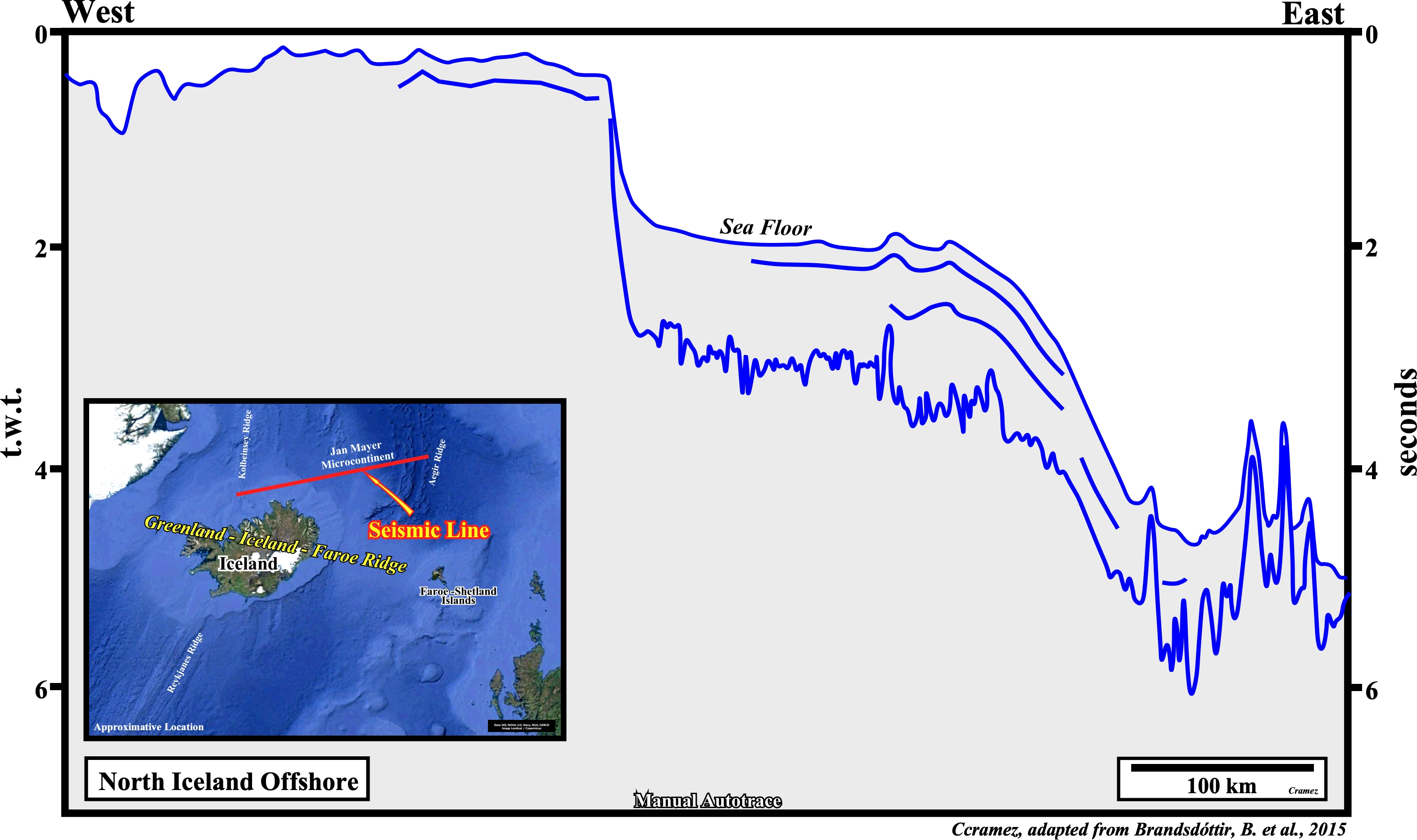
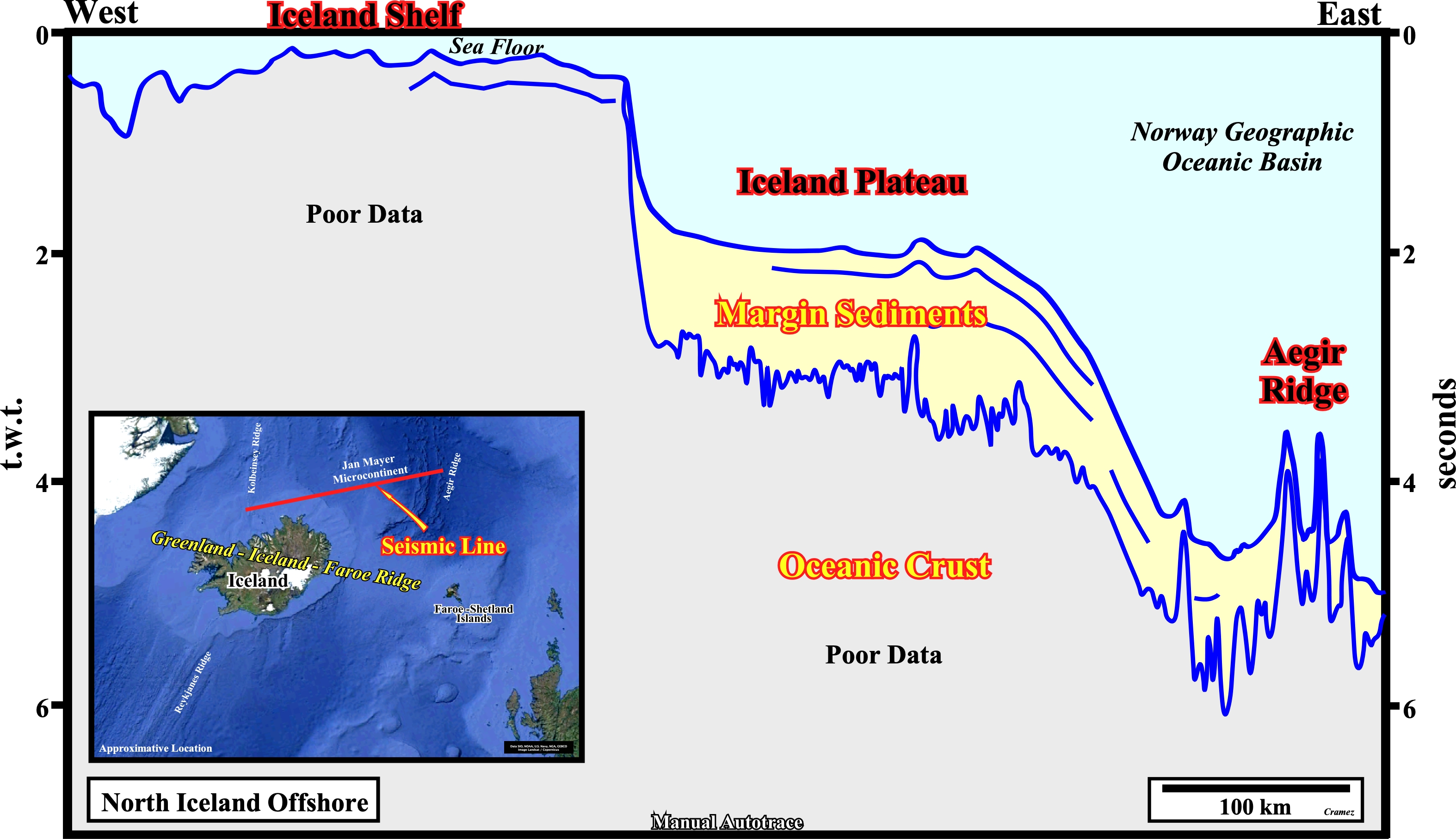
On this manual autotrace of a seismic lime of the North Iceland offshore shot between the Kolbeinsey Ridge (segment of the Mid-Atlantic Ridge located in the Attic Ocean, northward of Iceland) the Aegir Ridge (extinct valley rift located, that was an active spreading center before the ridge-jump to the west of the Jan Mayen micro-continent), the Iceland shelf and the Iceland plateau are, easily, recognized. The Iceland onshore and the Iceland shelf, which can be considered as parts of the Iceland plateau are located on both t the Iceland hotspot and the Mid-Atlantic ridge, which runs right through it. In fact, the Iceland Plateau can be interpreted as the result of a valley rift / hot spot interaction. It is bounded on the south by the Reykjanes ridge, on the west by the Greenland-Iceland Ridge, on the north by the Kolbeinsey ridge and on the east by the Iceland-Faeroe Ridge, and corresponds to a large igneous province that has been volcanically active since the Miocene (https://en.wikipedia.org/wiki/ Iceland_Plateau).

![]()
![]()
Send E-mails to carlos.cramez@bluewin.ch with comments and suggestions to improve this atlas.
Copyright © 2001 CCramez
Last update:
2022
![]()