
West Hatton Bank Offshore
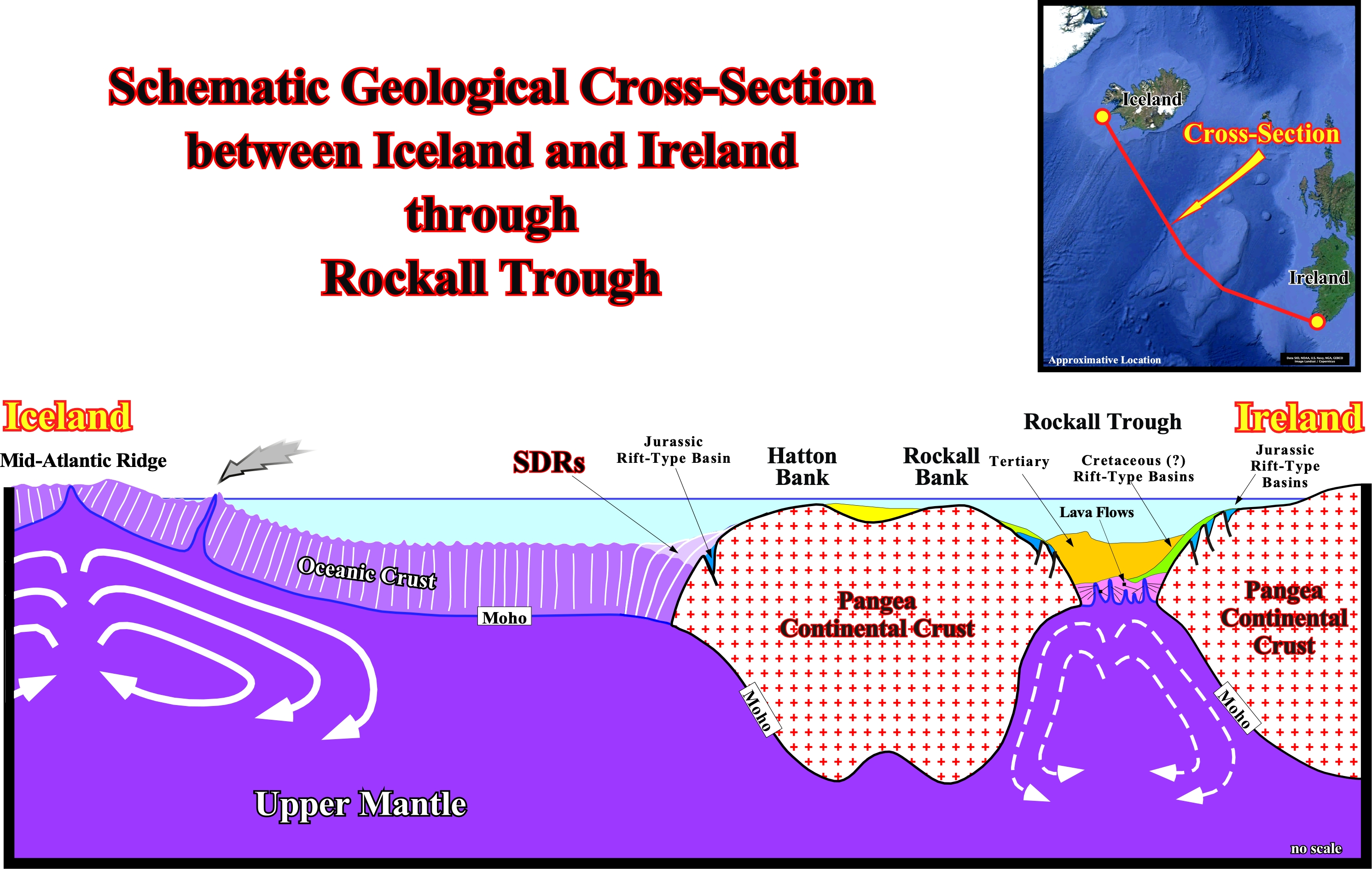
On this schematic geological cross-section between the South Iceland offshore (mid-oceanic ridge and Ireland offshore), passing trough the Rockall Trough, it is easy to understand that the Rockall trough area is an aborted Atlantic-type divergent margin preserving a tectonic evolution similar to that of the breakup of the South Atlantic. In fact, the Pangea lengthened and thinned continental crust (Rockall Through), Jurassic and Cretaceous rift-type basins developed before the the breakup of the lithosphere, which seems, here, to done, exclusively, by sub-aerial expansion centers from which effused mantle material formed lava-flows (SDRs) and built lava deltas with seamounts along leaky fault zones. The breakup zone was, later, fossilized by Tertiary sediments forming an aborted divergent margin, because, in the Early Tertiary, the Rockall geographic basin ceased to widen after the mantle upwelling ceased or shifted westward. Nevertheless the basin continued to subside faster than the onlapping deepwater sediments accumulated, forming the present-day Rockall Trough. Since the mantle upwelling shifted westward, a new spreading centers took place westward of the Hatton bank with lava flows overlying Jurassic rift-type basin. The lava-lows pass, laterally, to the oceanic crust as the expansion centers become immersed as illustrated on the next Canvas autotrace.
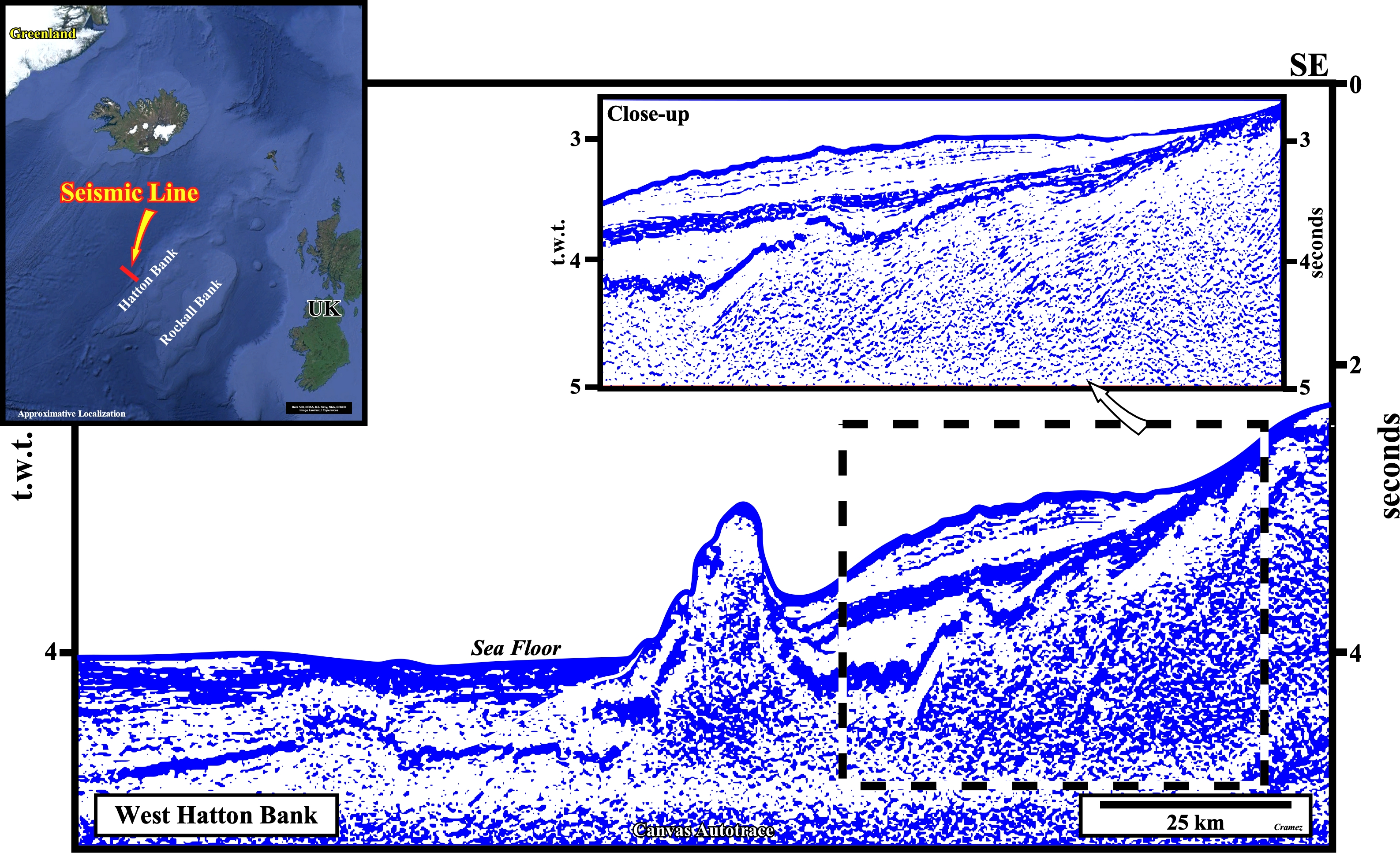
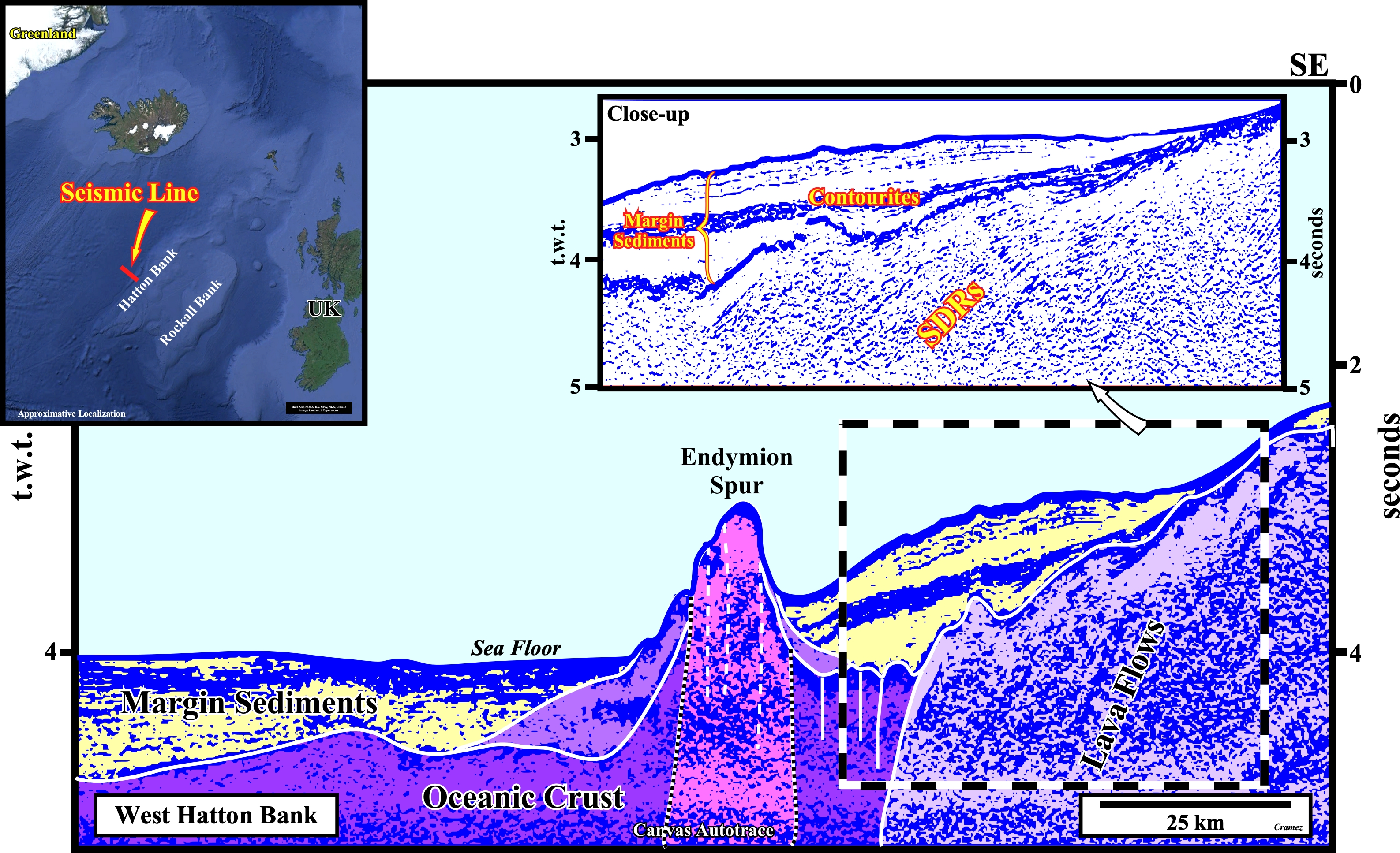
This Canvas autotrace of a seismic line shot along the western flank of the Hatton Bank, does not falsify the presence of lava-flows, i.e., SDRs, between the oceanic crust and the lengthened and thinned Pangea continental crust, which forms the core of the Hatton and Rockall bank and in which Mesozoic rift-type basin were developed before the breakup of the lithosphere. In addition, not only this autotrace illustrates, within the oceanic crust, the Endymion Spur, which seems to be a chain of steep sided, volcanic cones connected by narrow necks, but the probably presence of contourites in the margin sediments eastward of the spur and the more likely limit between the SDRs and the oceanic crust as well. Notice this possible limit SDRs/Oceanic crust marks the immersion of the expansion or spreading centers (linear fractures, with scattered volcanoes, between the diverging plates on the continent (sub-aerial expansion center) or on the sea floor (oceanic expansion center), along which molten mantle material fills, at a rate of few centimeters per year, the gap between the plates (valley rift axis).

![]()
![]()
Send E-mails to carlos.cramez@bluewin.ch with comments and suggestions to improve this atlas.
Copyright © 2001 CCramez
Last update:
2022
![]()