
South Norway Offshore
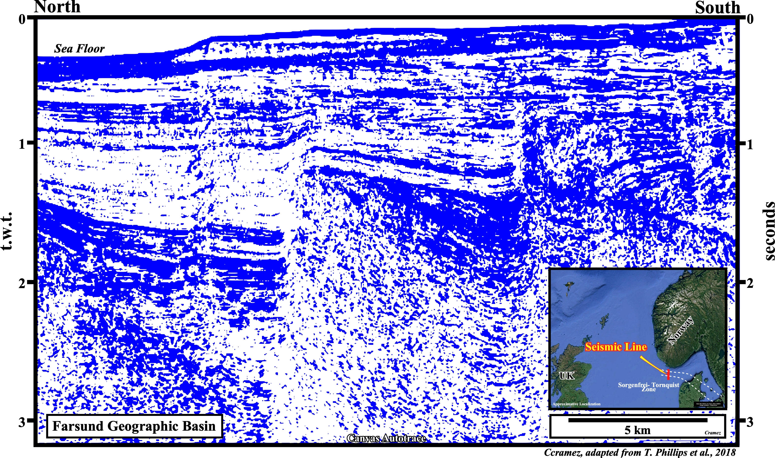
Farsund Geographic Basin
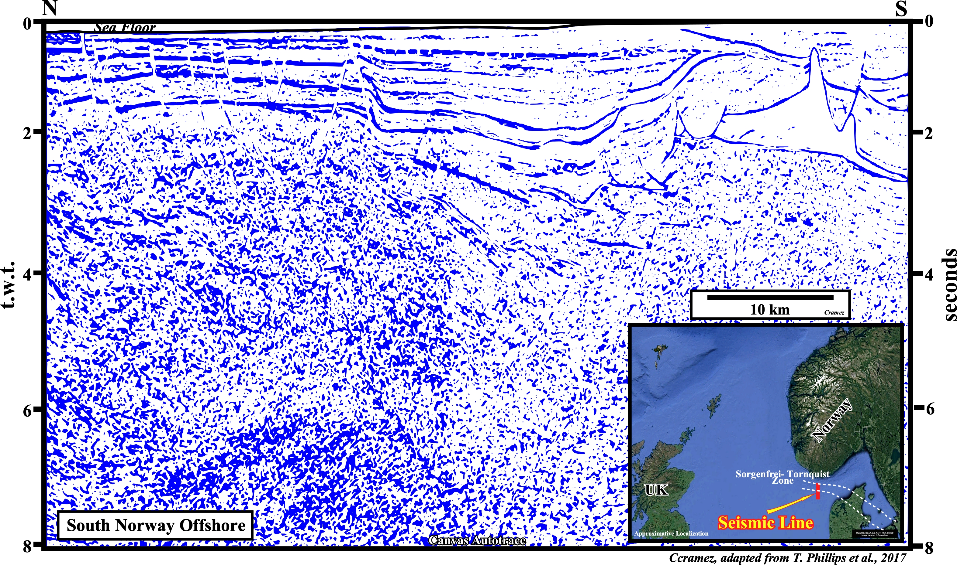
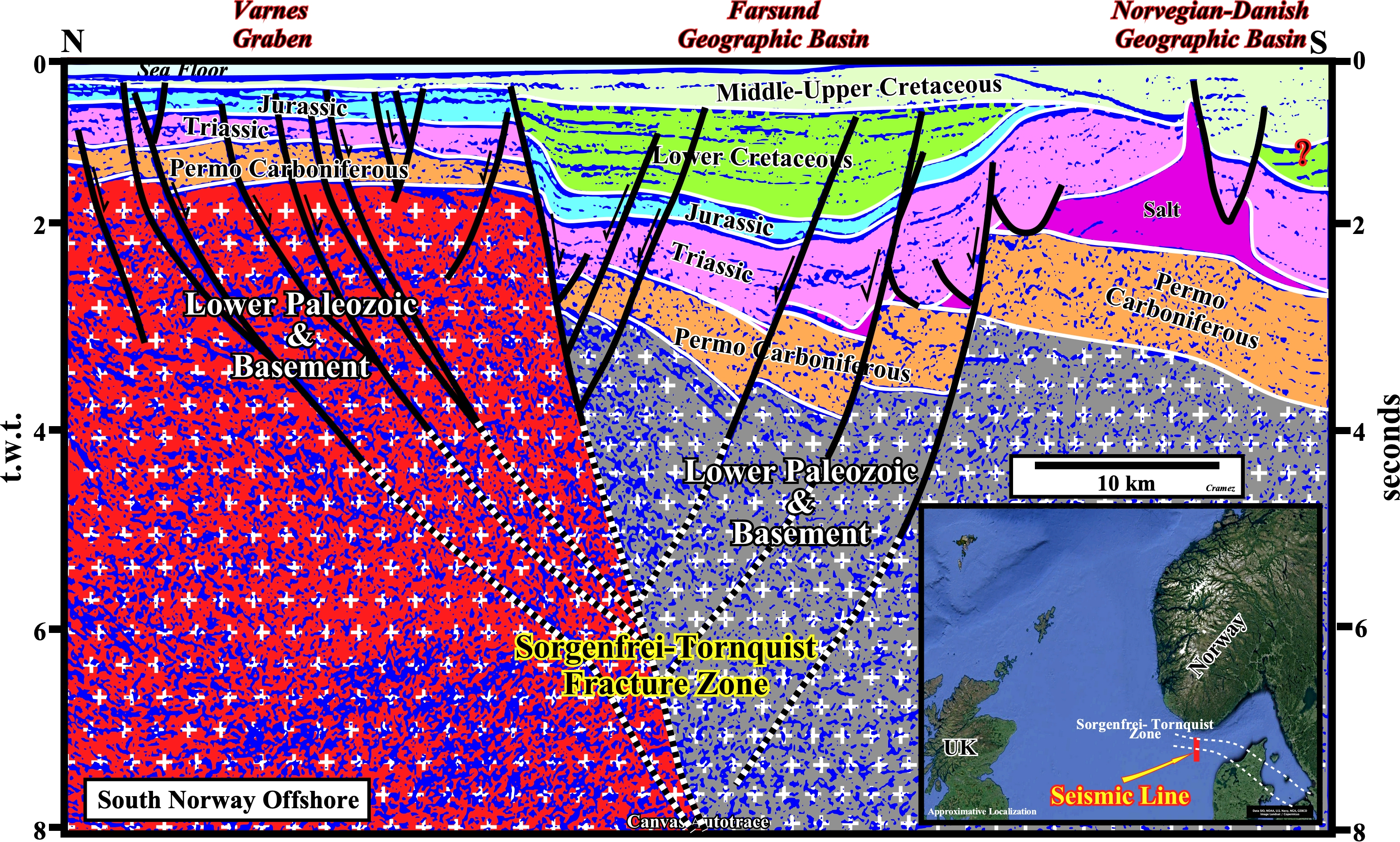
This tentative geological interpretation of a N-S seismic line shot in South Norway offshore illustrates not only the Farsund geographic basin, but the Sorgenfrei-Tornquist faulted zone as well. The Farsund geographic basin, as illustrated above, corresponds, mainly, to a W-E Lower Cretaceous graben that during the Late Cretaceous and Cenozoic was shortened and uplifted creating tectonic inversion, due to the reactivation of the old normal faults with a reverse movement. Notice I said Lower Cretaceous graben and not Lower Cretaceous rift-type basin. Rift-type basin is a genetic expression and it is reserved to the half-grabens or grabens developed during the lengthening of a supercontinent that predates its breakdown, while graben or half-graben is just a descriptive geometric terms. The Sorgenfrei-Tornquist faulted zone (NW segment of the Tornquist zone), which extends from the Baltic Sea to the North Sea, which seems to represent a major lithospheric structure with a significant increase in lithosphere thickness from south to north (reason why two different color were used to highlight "Lower Paleozoic & Basement" interval. This tentative interpretation suggests the effective stresses are localized along the Sorgenfrei-Tornquist Fracture Zone, where it is expressed in the upper crust as hanging-wall folding, reverse reactivation of the basin-bounding normal fault, and bulk regional uplift as illustrated in the next autotrace.
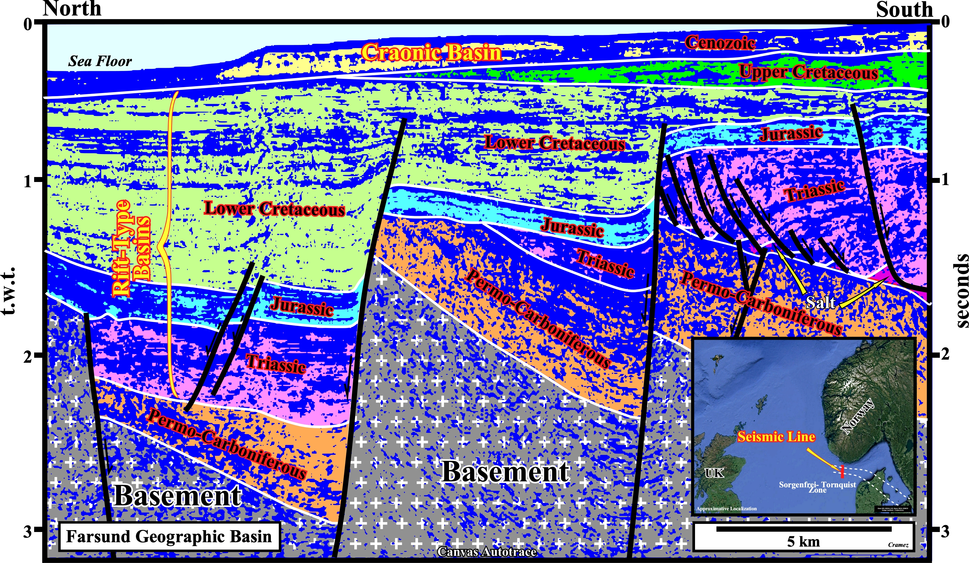
On this tentative interpretation, where the rift-type basins a the Cenozoic cratonic basins are easily individualized, tectonic inversions are obvious. The old normal fault planes were reactivated as reverse faults, with the null point, i.e., i.e. a point with no apparent displacement, in the lower sector of the fault plane (above the “null point”, the fault has a reverse geometry, while below the "null point", the geometry of the fault is normal, in spite of fact that the fault is reverse, what means the last movement was reverse, but not enough to change the geometry). The tectonic inversion, which is induced by a compressional tectonic regime, creates an uplift and, subsequently, a significant relative sea level fall, which explains important erosion not only at the end Triassic but at top lower Cretaceous as well. Such a fact, suggest two significant relative sea level falls separate by a relative sea level rise during the Jurassic. Notice the normal fault reactivation is function of the angle between the σ1 (maximum effective stress of the compressional tectonic regime) and the strike of fault plane, as well as of the angle between the σ1 and the dip of the fault plane.

![]()
![]()
Send E-mails to carlos.cramez@bluewin.ch with comments and suggestions to improve this atlas.
Copyright © 2001 CCramez
Last update:
2022
![]()