

Mediterranean Sea
Tyrrhenian Sea
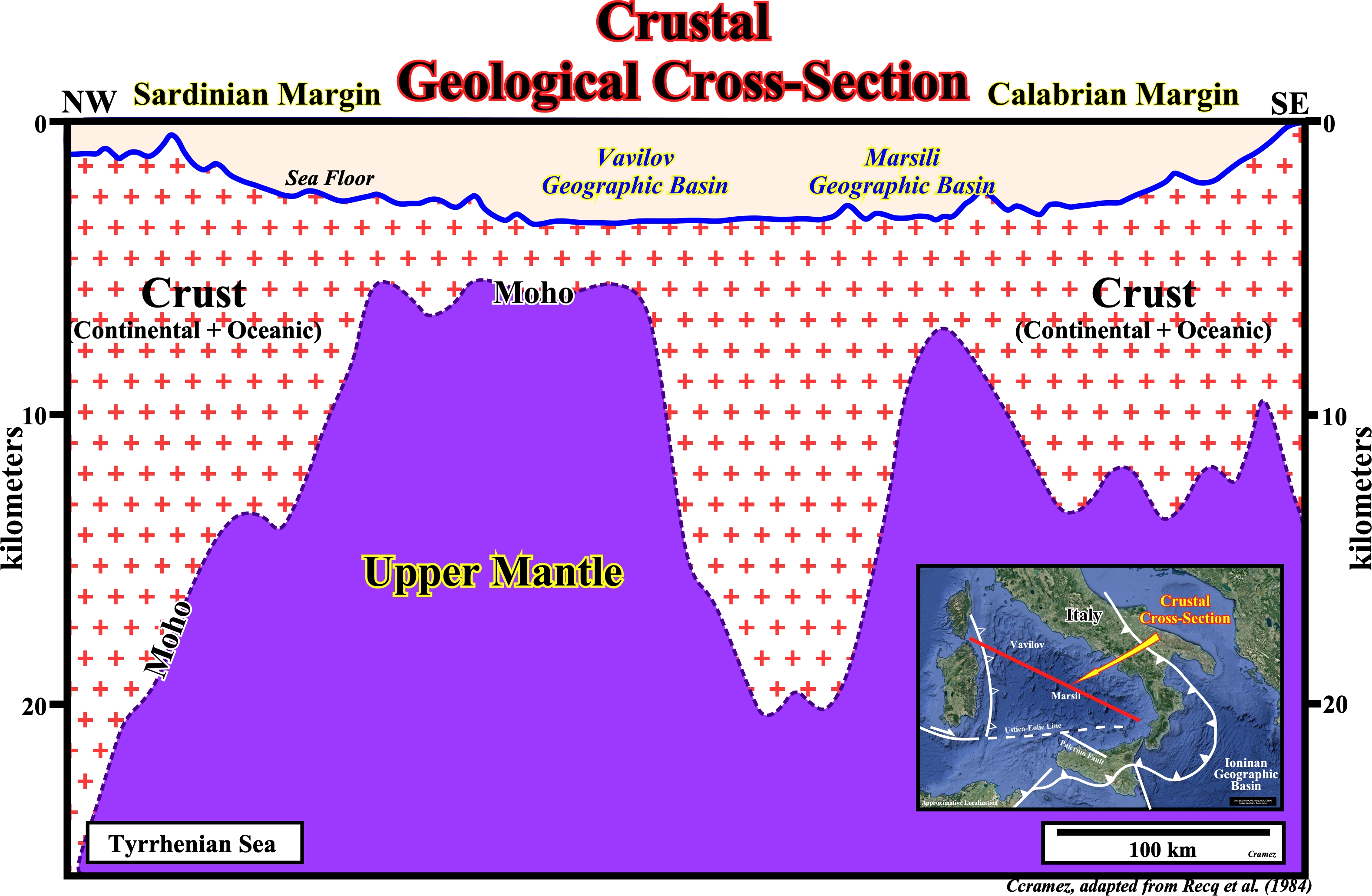
This crustal geological cross section, between Sardinia and Apenninic margin, passing through the Vavilov and Marsili geographic basins, which are not depicted, shows the progressive thinning of the crust, i.e., the shoaling of the Mohorovicic discontinuity or Moho, which is the boundary between crust and Earth's mantle. The Moho morphology (crustal thickness) was modified from Steinmetz et al. (1983), using an average crustal propagation velocity of 5.5 km/s.
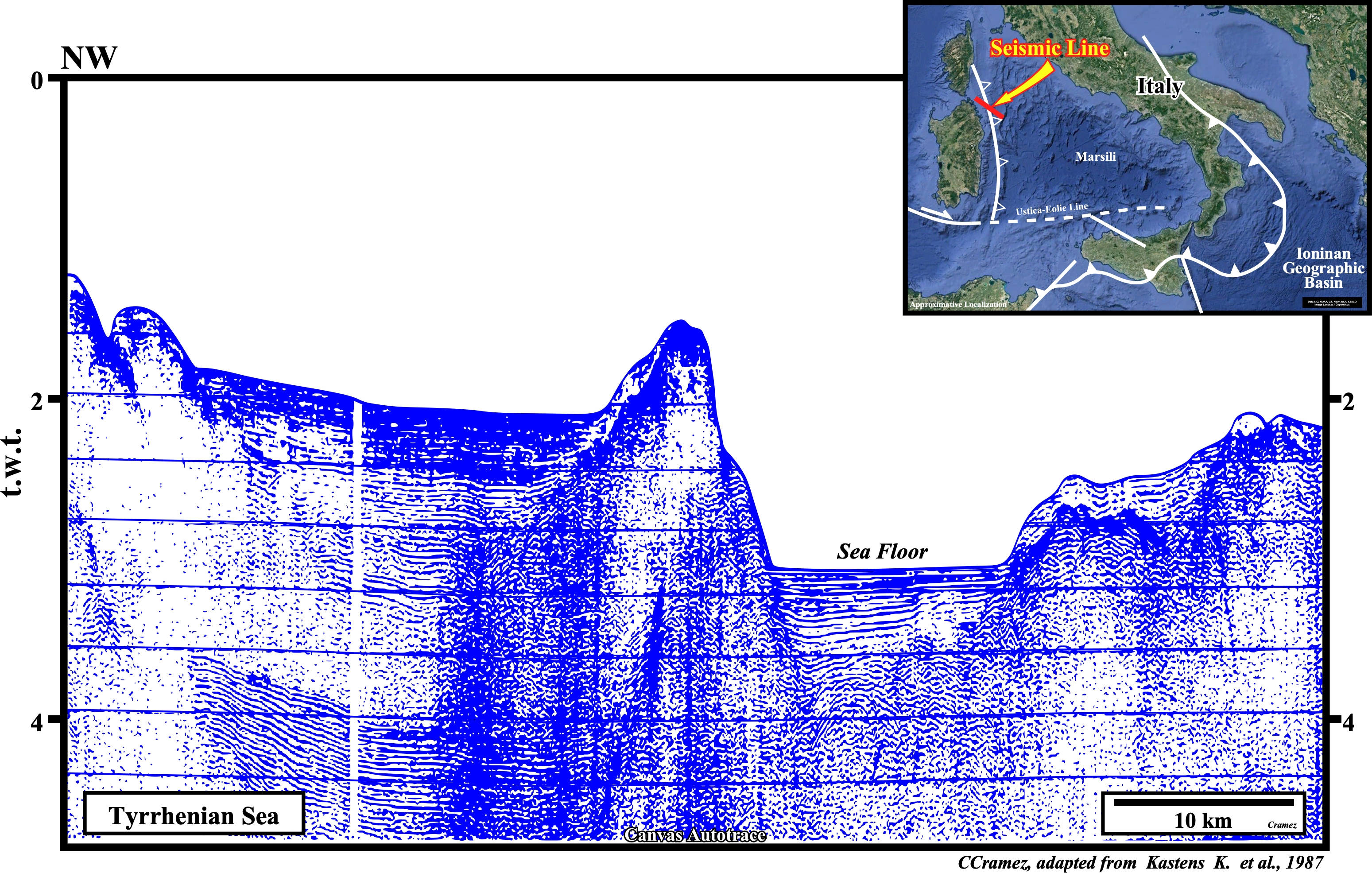
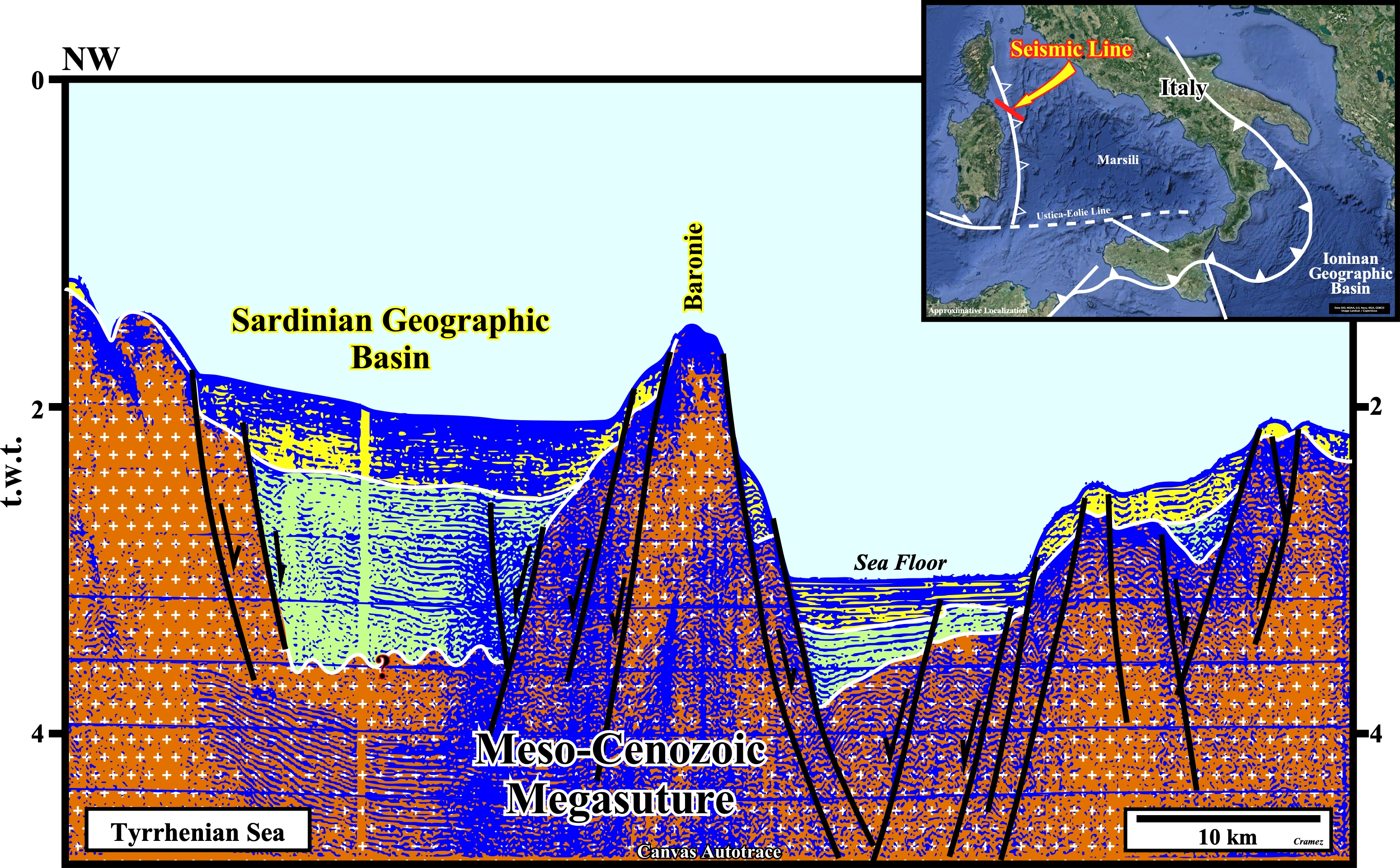
On this Canvas autotrace of seismic line shot in the eastern Sardinia offshore, the lengthening of the Meso-Cenozoic megasuture is highlighted by the normal faulting, around the Baronie structural high, which seems to correspond to an important fault zone. Seuch a bormal faulzting creates two rift-type basins before the oceanization, i.e., before the breakup of the lithosphere and the formation of the Tyrrhenian marginal sea.
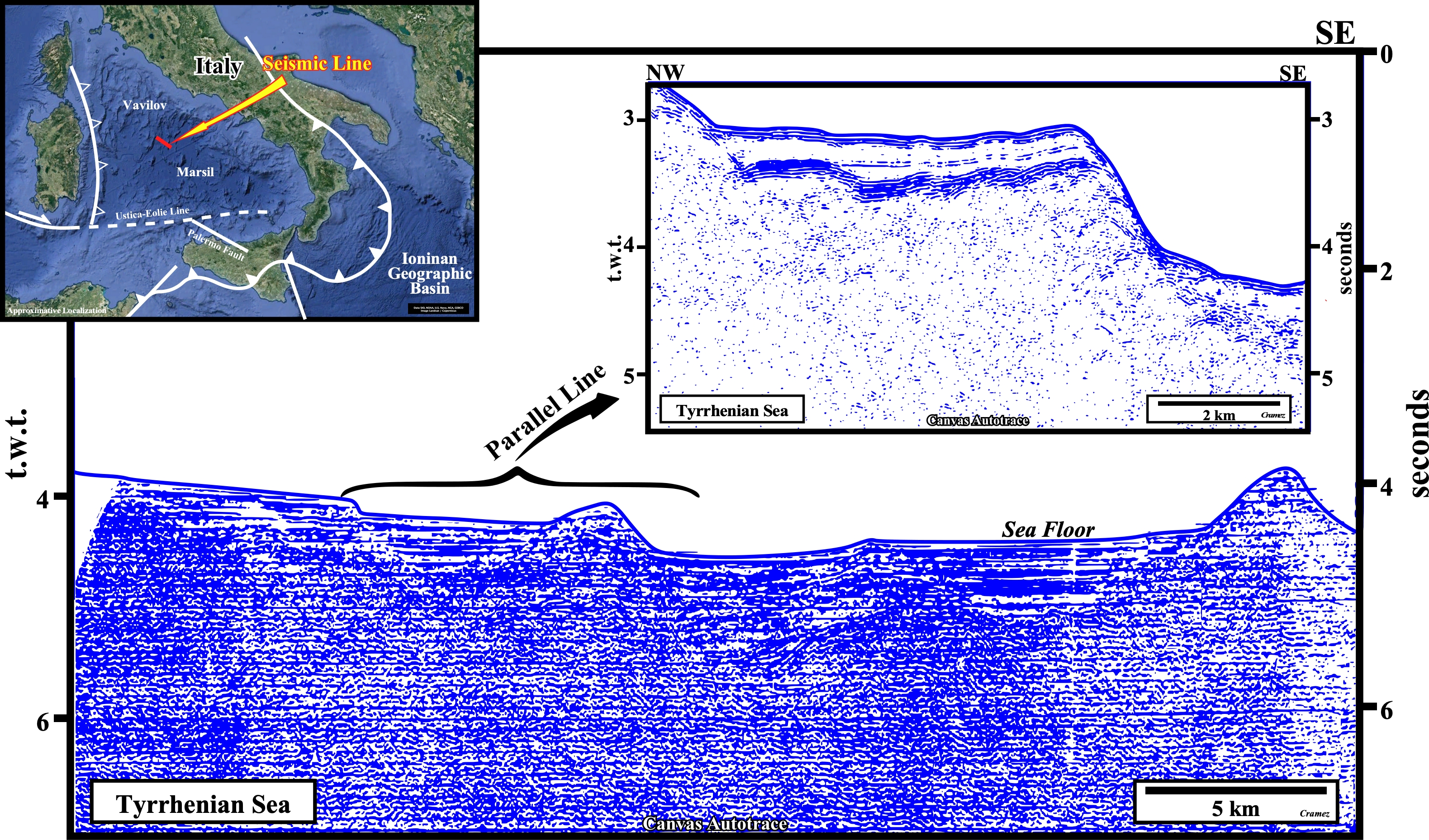
This Canvas autotrace of a seismic line shot between the Vaviloy and geographic basins, shows the tilted faulted blocks (rift-type basins), induced by the extensional tectonic regime that affected Meso-Cenozoic megasuture, covered by a Mediterranean-type basin developed after the breakup of the lithosphere.
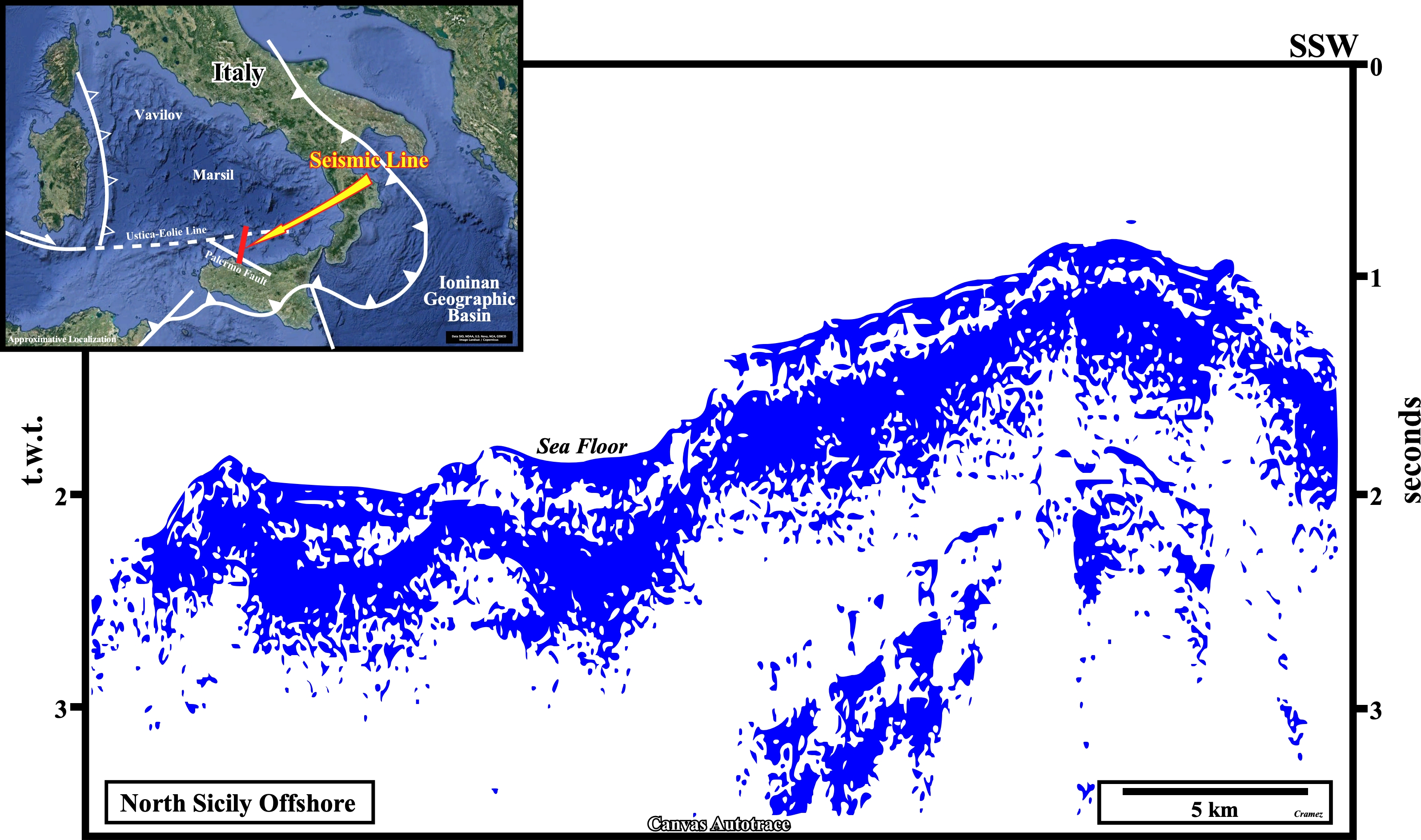
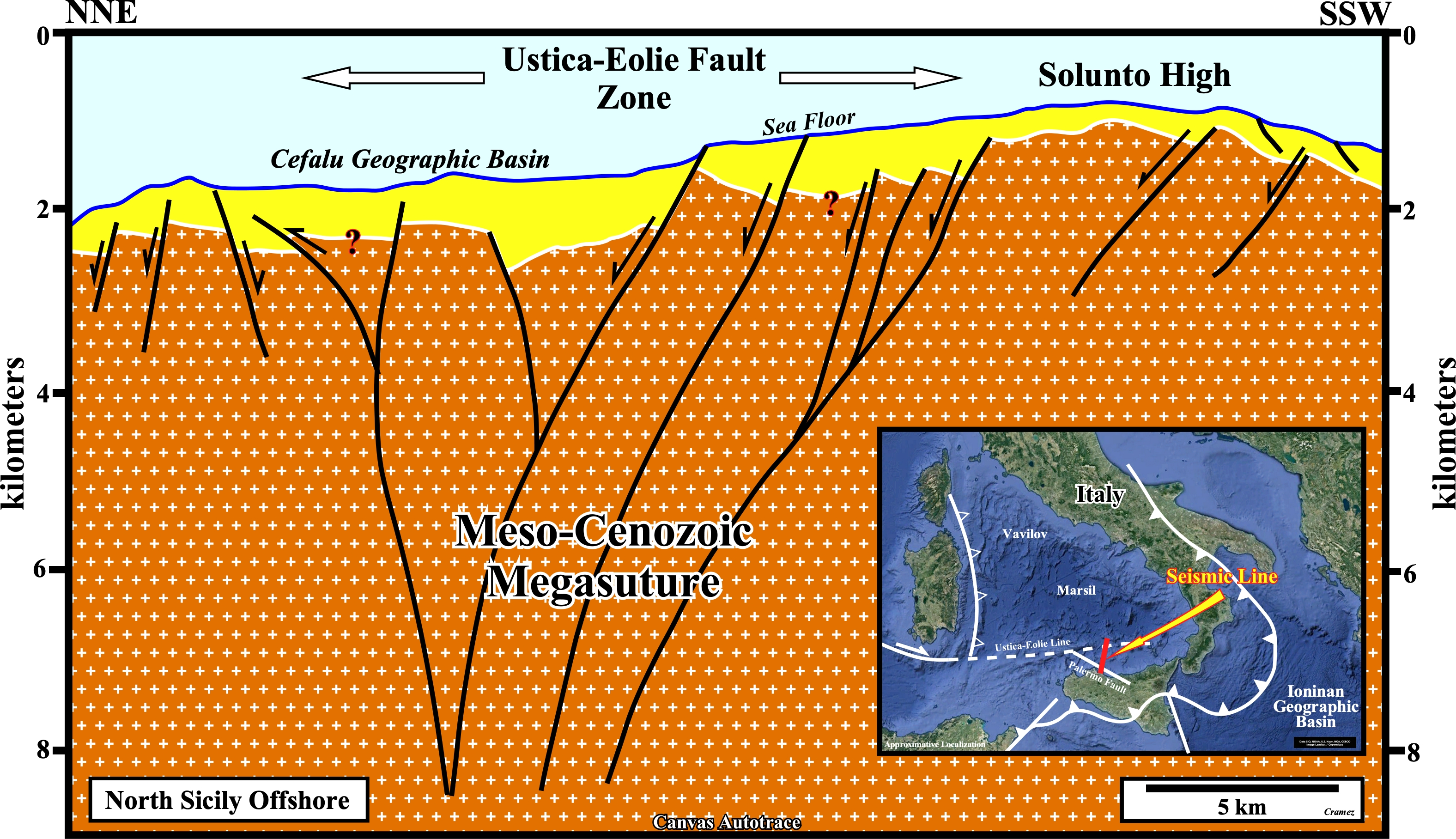
On this tentative geological interpretation of a Canvas autotrace of a seismic line through the Ustica-Eolie fault zone, the Meso-Cenozoic megasuture (folded and faulted mountain ranges with accretion and deformation phases in regions with compressional tectonic regimes) between the Eurasia and Africa lithospheric plates, is taken as an whole geological body affected by an intense lengthening (extension) that, locally, creates a breakdown of the lithosphere with a significant oceanization and development of Mediterranean-type basins.
Send E-mails to carlos.cramez@bluewin.ch with comments and suggestions to improve this atlas.
Copyright © 2001 CCramez
Last update:
2022