North Caspian Sea
North Caspian Sea
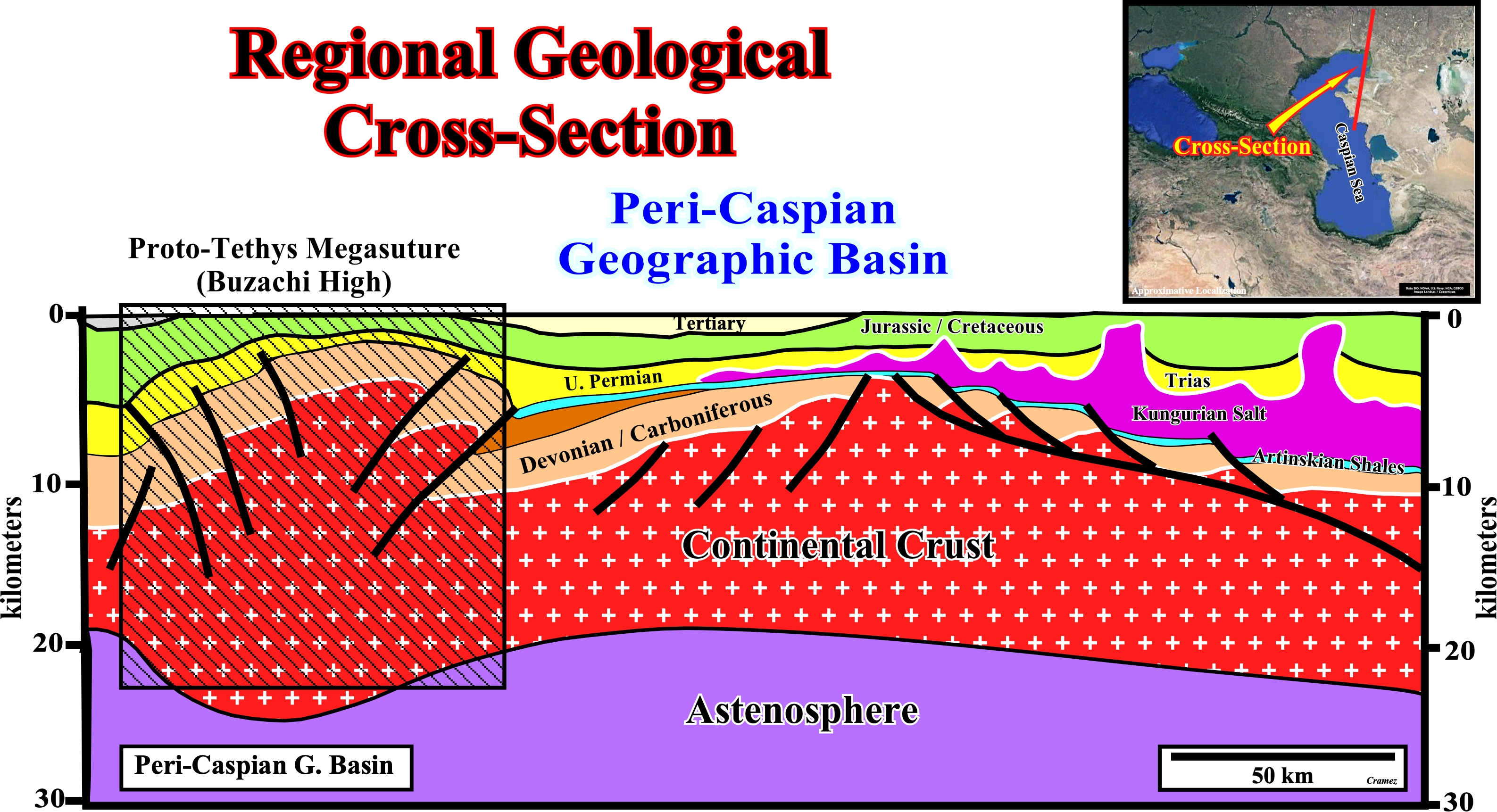
On this regional cross-section, the Proto-Tethys Megasuture (Buzachi high) and the Peri-Caspian geographic basin are well illustrated. The Proto-Tethys Ocean existed from the latest Edicaran to the Carboniferous (550-330 Ma) and was a predecessor of the later Paleo-Tethys Ocean. It formed when Pannotia disintegrated, Proto-Laurasia (Laurentia, Baltica, and Siberia) rifted away from a supercontinent that will become Gondwana. Proto-Tethys, situated between the Siberia to the west, and Gondwana to the east, formed between these two supercontinents expanding during Cambrian reaching its widest during the Late Ordovician to Middle Silurian. The ocean began to shrink during the Late Silurian, when North China, and South China moved away from Gondwana and headed north. In the late Devonian, the micro-continent of Kazakhstania collided with Siberia, shrinking the ocean even more. The ocean closed when the North China craton collided with Siberia-Kazakstania continent in the Carboniferous, while the Paleo-Tethys Ocean expanded (https://fossil.fandom.com /wiki/Proto-Tethys Ocean). Northward of the Buzachi high, a large salt basin was developed during the Devonian (Kungurian). Below the evaporites, an organic shale interval, the Artinskian shales, is the responsible of the majority of the hydrocarbons generated in the Peri-Caspian geographic basin, which is bounded by the Paleozoic carbonate platform of the Volga-Ural province to the north and west and by the Ural, South Emba, and Karpinsky Hercynian fold belts to the east and south. The Peri-Caspian geographic basin that occupies the shallow northern portion of the Caspian Sea and a large plain to the north of the sea between the Volga and Ural Rivers, was originated by pre-Late Devonian rifting and subsequent spreading with a breakup of the lithosphere that created oceanic crust, but the precise time of these tectonic events is not known (G. F. Ulmisheck, 2001). Obviously, the geological history of this area, implies a time and space stacking of different sedimentary basins of the Bally & Snelson's sedimentary basins classification (1980).
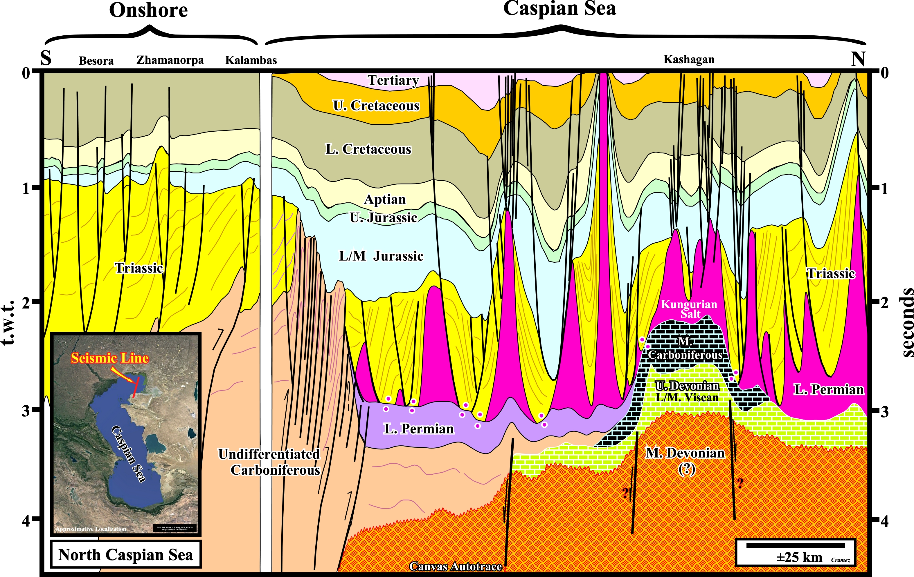
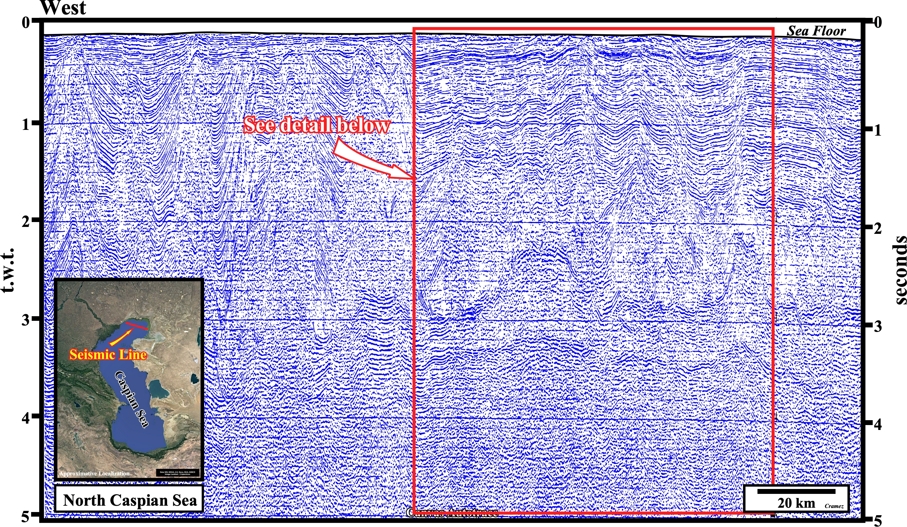
On this tentative geological interpretation of a composite seismic line between the onshore and the NE of Caspian Sea. The onshore area illustrates the tectonic inversion associated with the Buzachi high, while the offshore area illustrates North Caspian Depression (see Page 49). On the offshore seismic line, passing through the Kashagan Giant Field, the Kungurian evaporites and the underlying Middle Carboniferous are, easily, recognized as well as the Triassic sediments deformed by halokinesis. In 1993 a a group of oil companies (Eni, BG, BP/Statoil, Mobil, Royal Dutch Shell and Total SA), along with the Kazakh government, undertake the Caspian Sea seismic exploration that led to Kasaghan discovery, in 2000, which its estimated recoverable reserves of ± 13 x 109 barrels (high level of hydrogen sulfide), which is one of the largest oil fields in the world. The next plate illustrates the Canvas autotrace of the onshore seismic line.
On this tentative geological interpretation of the Canvas autotrace of the offshore seismic line of the previous plate, the Middle Carboniferous and the Upper Devonian carbonate anomalies are, easily, recognized below the Lower Permian evaporites (Kungurian salt)- The salt induced tectonic disharmony is quite evident, in spite of the seismic pitfalls induced by the lateral velocity changes of the of the cover (salt + overburden). In fact, the halokinesis was quite important not only during the during the Triassic time, but during the Cretaceous time as well, although on a rather different posture (mainly diapirism). Such a geological features are, also, clearly recognized on perpendicular lines as depicted on the next plate.
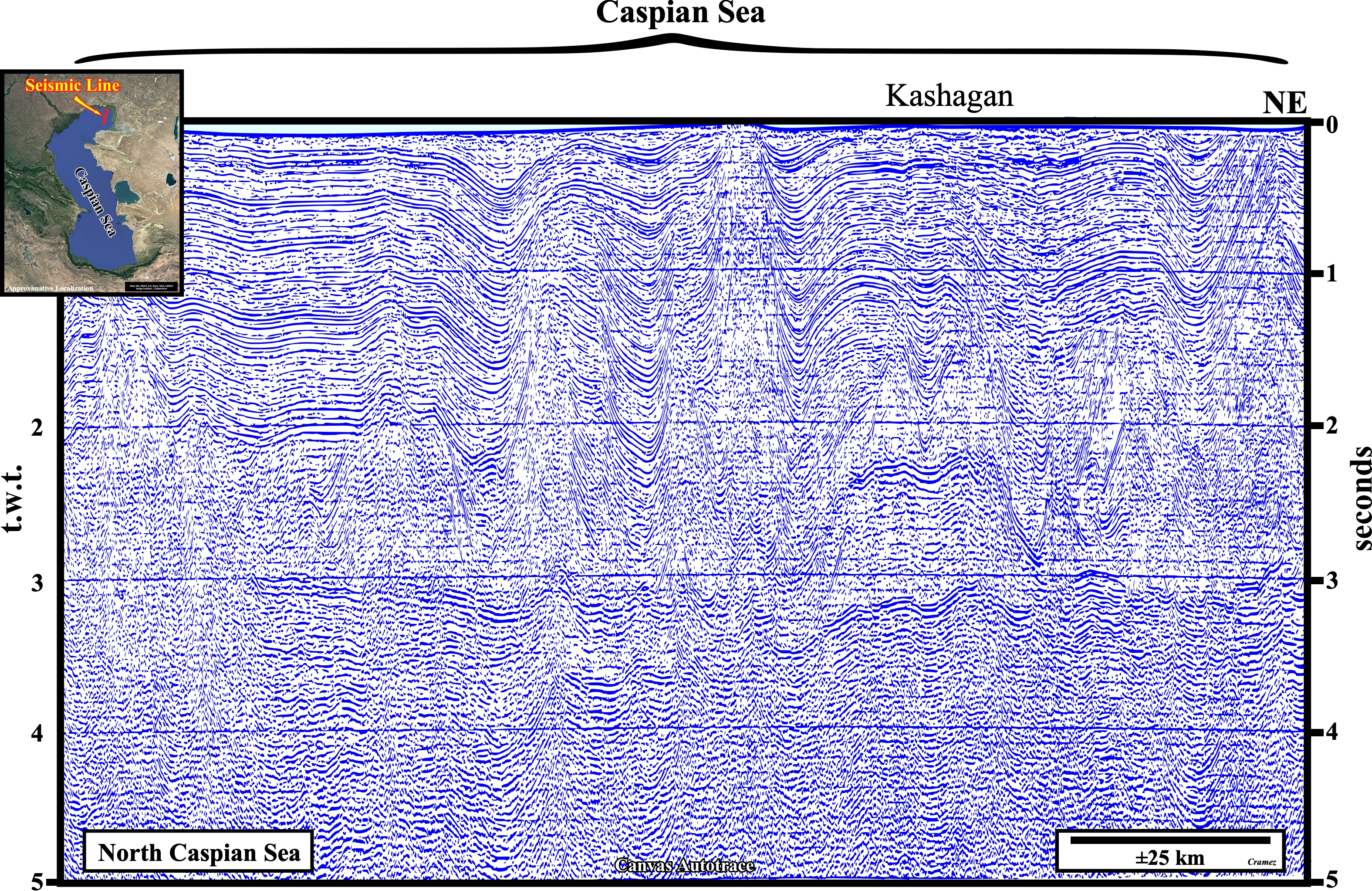
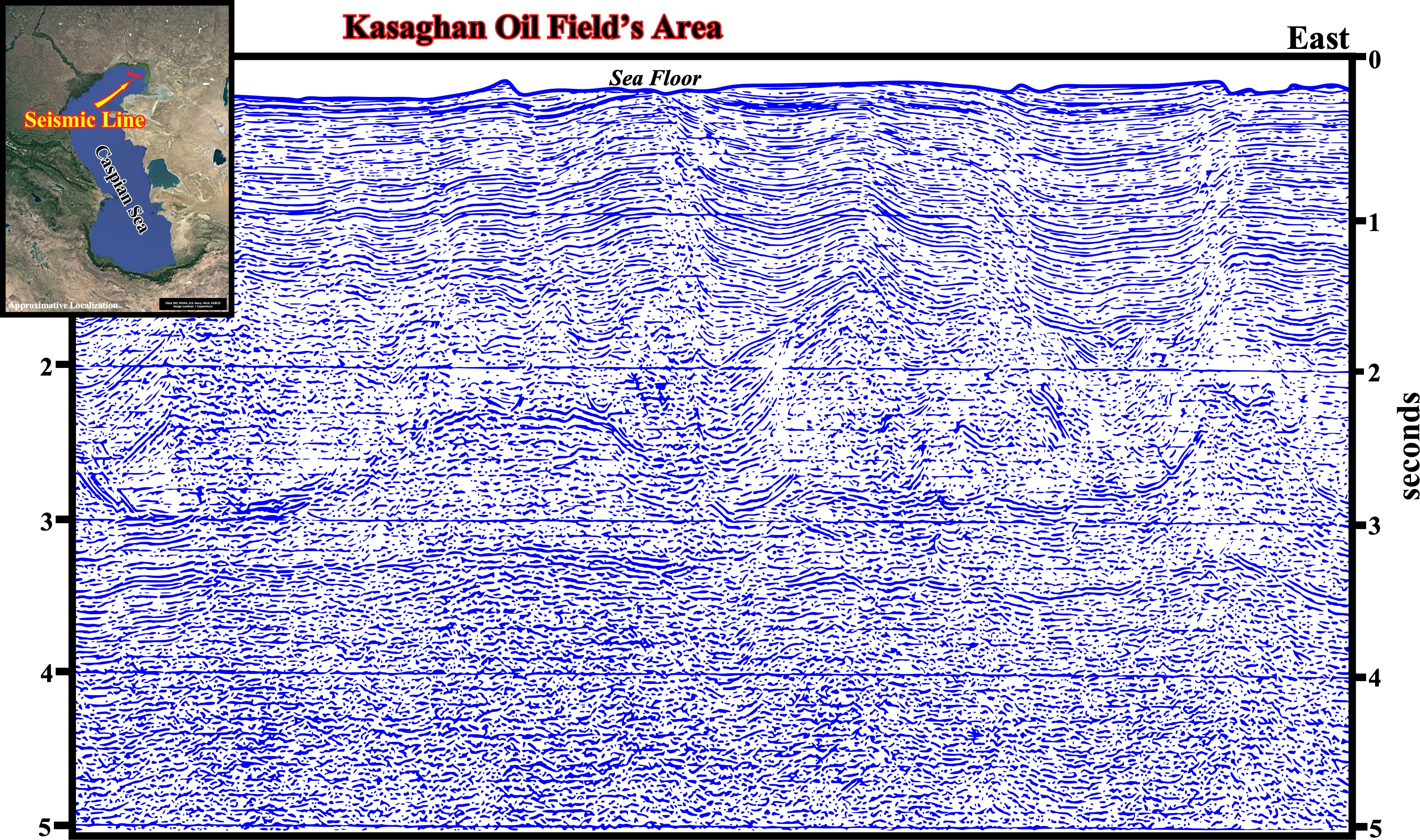
On this Canvas autotrace of a seismic line perpendicular to the one used to built the previous autotrace, the same geological features can be highlighted, particularly, on the area of Kasaghan oil filed, which is, tentatively, interpreted in geological terms on the next plate.
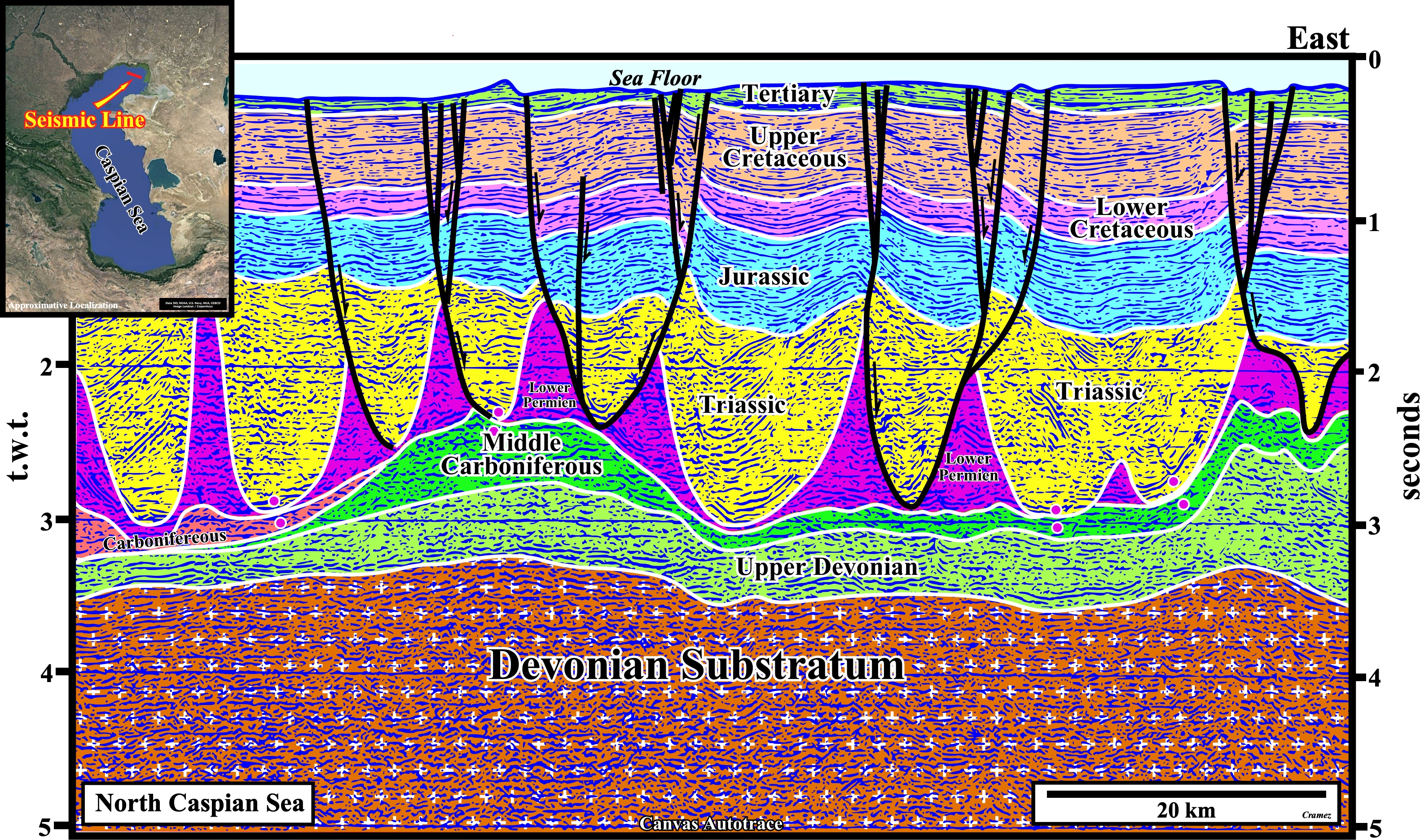
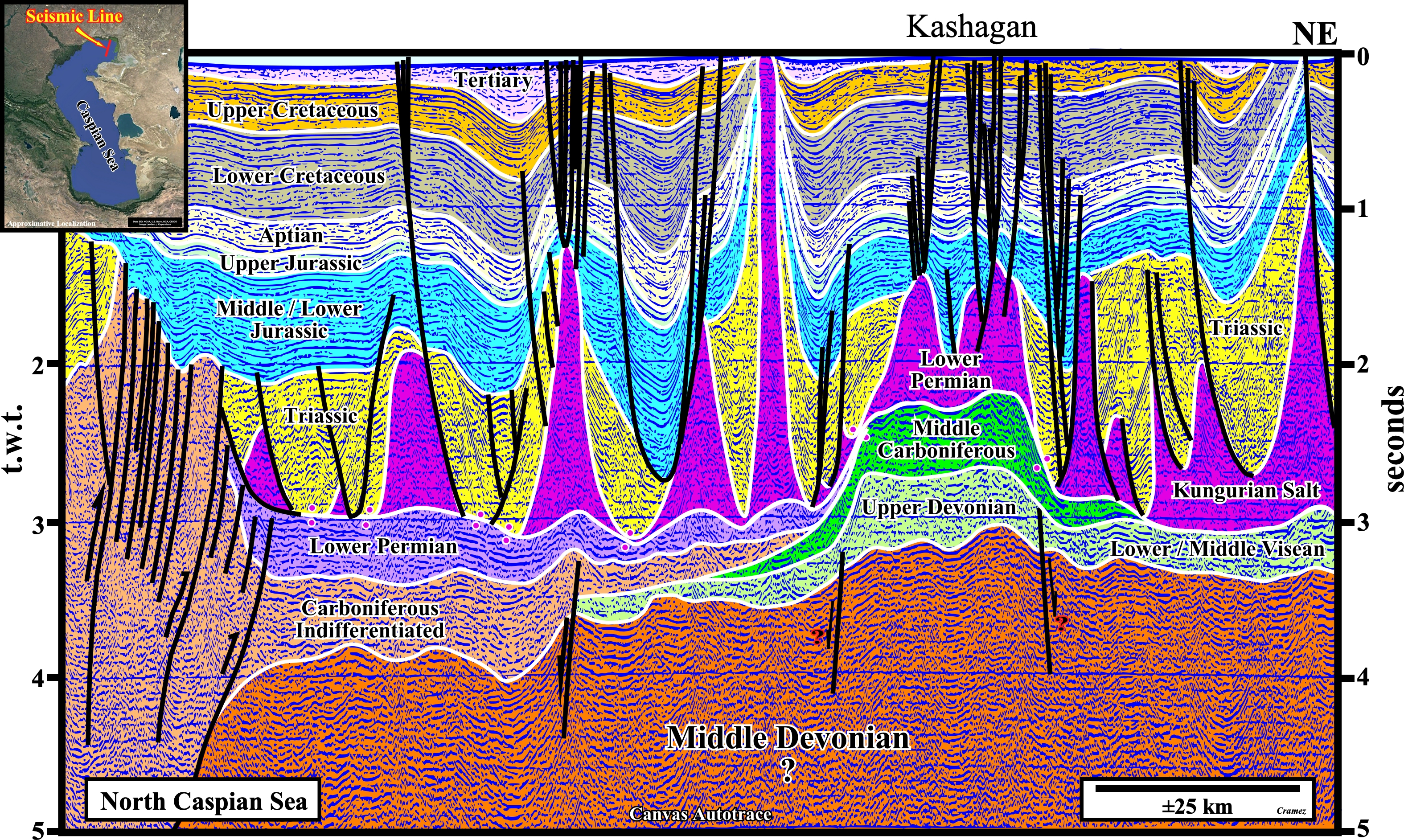
The salt induced tectonic disharmony (geological surface individualizing two realms of deformation, generally, associated with a mobile substratum) is easily recognized. Above it, the cover (salt + overburden) is deformed, mainly, by halokinesis, that is to say, by a form of salt tectonics in which the salt flow is powered by buoyancy, i.e., that is, by release of gravity potential energy alone, in absence of significant lateral tectonic stress (σt=0). The most active halokinesis occurred during the Late Permian / Triassic, however some of the salt domes continued to growth later and can, even, reach the present-day surface as illustrated on the before last Canvas autotrace. Below the salt induced tectonic disharmony, i.e., underlying the Kungurian salt (Lower Permian), which seems to onlap on a Carboniferous unconformity, the substratum is formed, mainly, by Middle Carboniferous and Upper Devonian carbonate anomalies, in which reservoir rocks are frequent. As illustrated on this tentative geological interpretation, the salt induced tectonic disharmony is, locally, highlighted by salt welds (negative salt structures resulting from the complete or nearly complete salt removal), which are zones joining strata originally separated by salt materialized by insoluble residue containing halite pseudomorphs or by salt too thin to be resolved in reflection seismic data. Southward of the of Kasaghan oil field area, particularly, south of the Pricaspian geographic basin, the salt tectonic disharmony is inverted by a compressional tectonic regime (σ1 horizontal) and not by halokinesis as illustrated on the next Canvas autotrace.
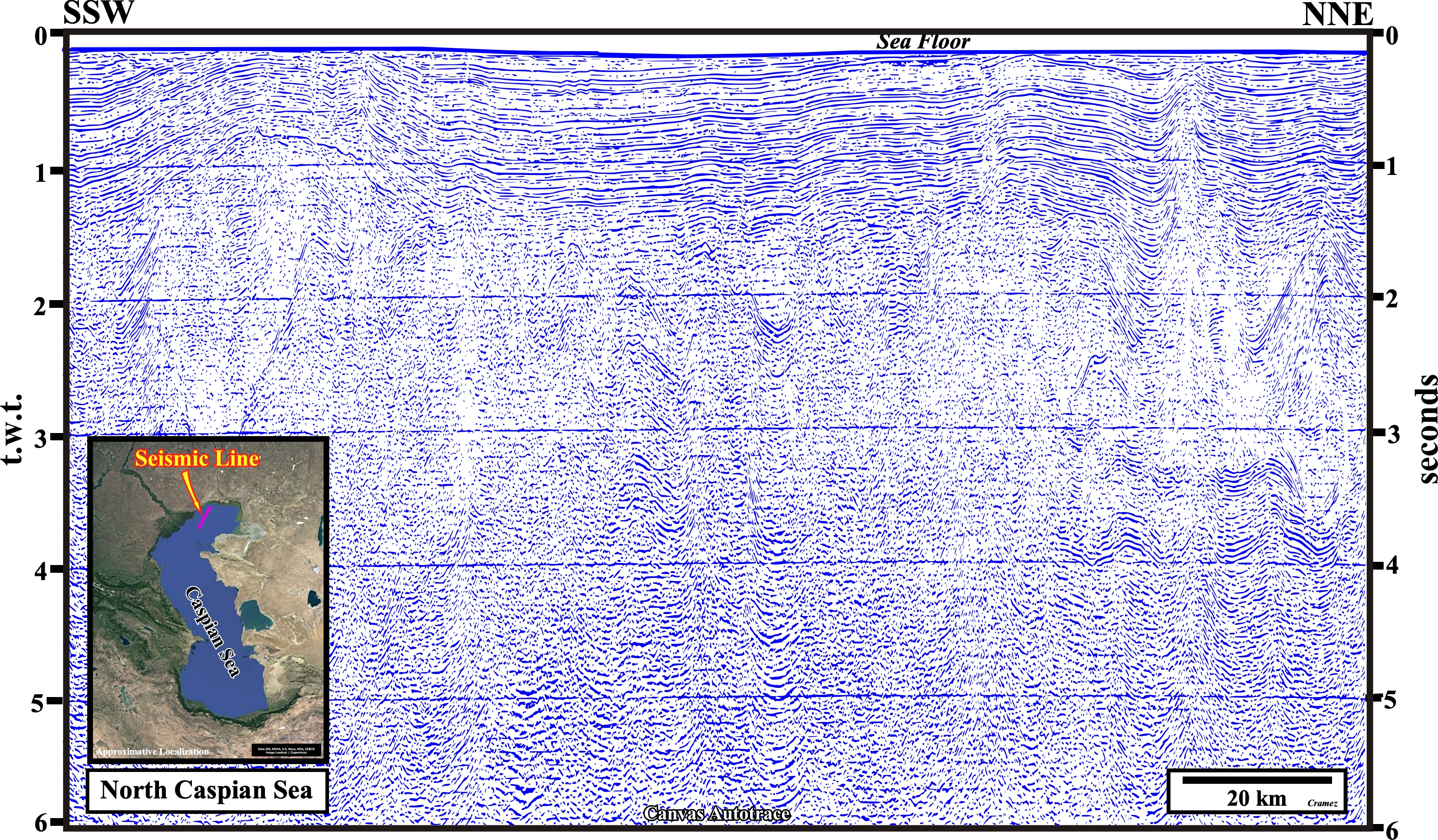
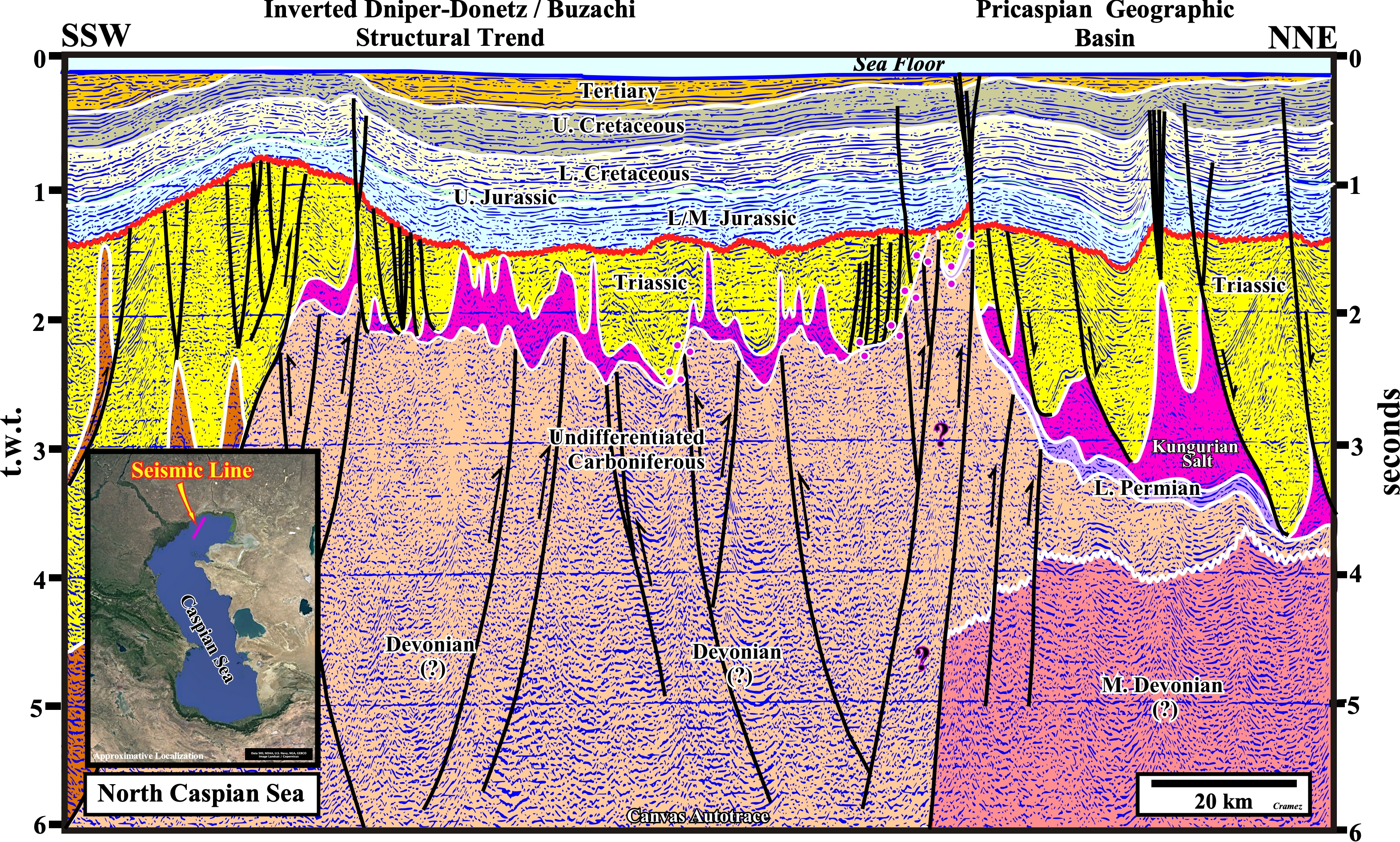
On this tentative geological interpretation, the tectonic inversion of the Dniper-Donetz / Buzachi structural trend is clearly visible southward of the Pricaspian geographic basin. In fact, along the southern margin of the East-European platform, the Late Devonian rift-type basin, the Dniper-Donetz geographic basin and the Pricaspian geographic are well recognized. The salt induced tectonic disharmony (bottom of the Kungurian salt) was uplifted (shortened) by the compressional tectonic regime responsible of the tectonic inversion of the Dniper-Donetz / Buzachi trend. Such a tectonic inversion was done in several phases. An important phase ended with the top Triassic unconformity, which seems to have flattened the topography of the area, over which a, more or less, isopach Mesozoic interval was deposited. A last tectonic compressional phase occurred during the Late Tertiary, which is the responsible of the late sedimentary shortening, easily, recognized at the sea floor.
![]()
![]()
Send E-mails to carlos.cramez@bluewin.ch with comments and suggestions to improve this atlas.
Copyright © 2001 CCramez
Last update:
2022
![]()