Indonesia Offshore
Kai Besar Offshores (West & East)
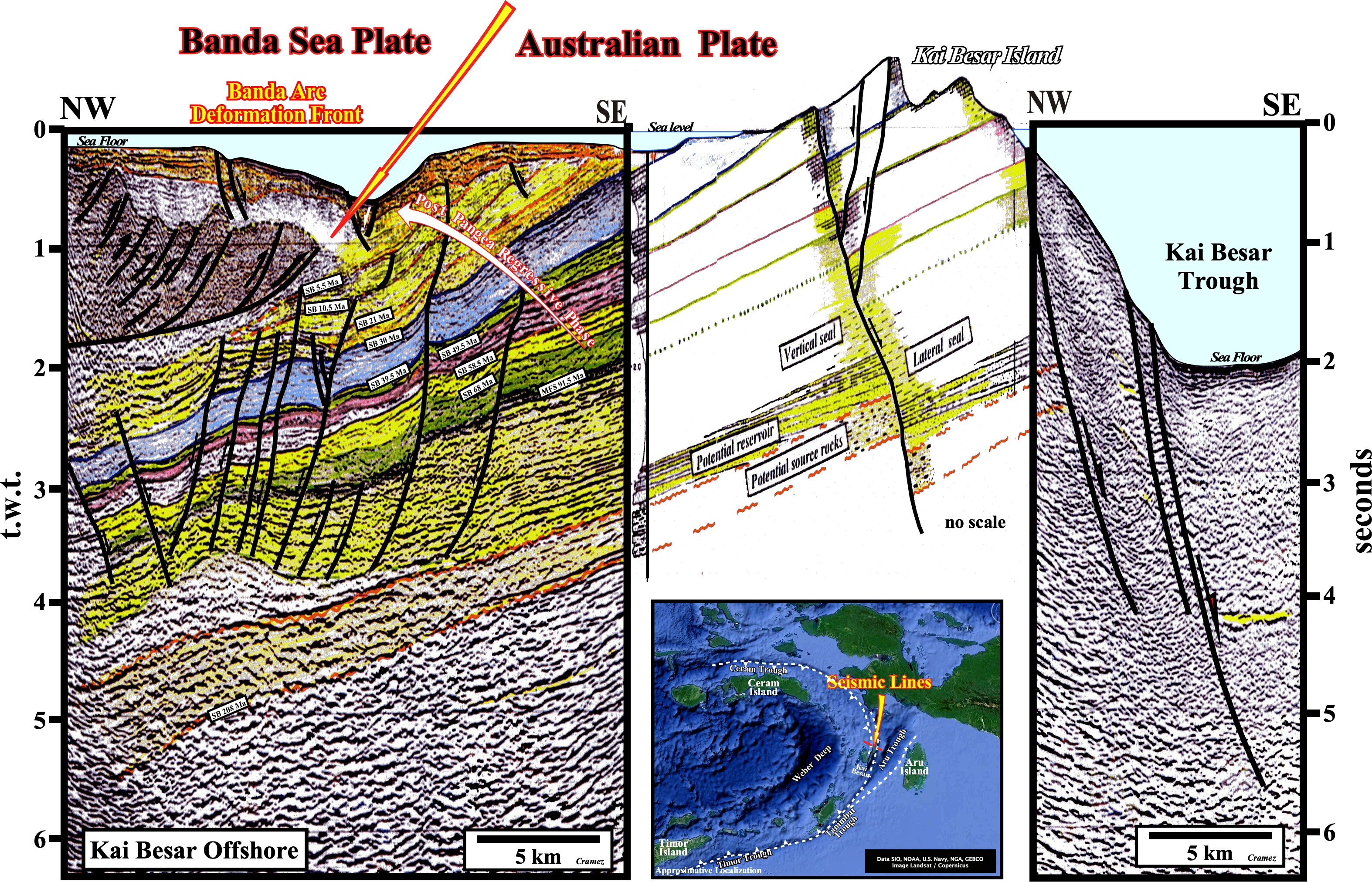
In geological terms, the area of Kai Besar Island is quite interesting, because, as illustrated on the location map, it seems that there is a westward shift of the subduction zone. In fact, the Aru trough does not correspond to an oceanic trench associated with a compressional tectonic regime as the Tanimbar and Timor trough, but to an extensional depression. On the seismic line located westward of the Island, we can see the more likely limit between the plunging Australian lithospheric plate, with its Atlantic-type divergent margin, in which normal faulting is paramount, and the Banda Sea lithospheric plate. Remind, the Banda Sea Plate is a minor lithospheric plate underlying the Banda Sea carrying a portion of Sulawesi Island, the entire Ceram Island (see Page 28 & Page 28B), and the Banda Islands (Banda Besar, Neira, Banda Api, Pulau Hatta, Pulay Ay, Pulau Rhun Banda Islands, etc) and bounded, clockwise from the east, by the Bird's Head plate of western New Guinea, Australian plate, Timor plate, Sunda plate and Molucca sea collision zone. (https://en.wikipedia. org/wiki/Banda_Sea_Plate)
![]()
![]()
Send E-mails to carlos.cramez@bluewin.ch with comments and suggestions to improve this atlas.
Copyright © 2001 CCramez
Last update:
2022![]()