
Universidade Fernando Pessoa
Porto, Portugal
Geological Setting & Seismic Interpretation
The majority of the plates used on these notes was provided by Prof. Dr. Albert Bally. These plates are largely self-explanatory and so they required limited comments. Originally, they formed a booklet entitled “The Well-Tempered Mountain Range” (as illustrated by western Cordillera and Alps) that Dr. Bally prepared when he was Chief Geologist of Shell Canada Limited.
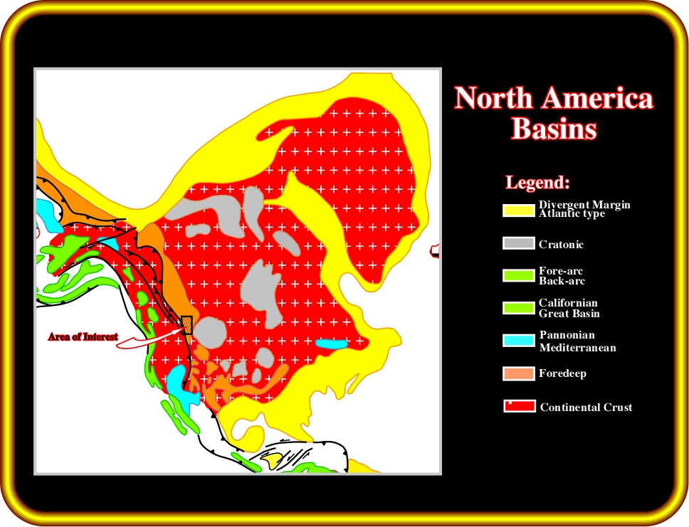
Plate 1- In the Bally & Snelson sedimentary basin classification, the area of interest corresponds to a foredeep basin. The subsidence responsible for the creation of the space available for the sediments was mainly flexural. It was induced by thrust loading proceeding from west to east. In a such tectonic setting, a typical wedge with multiple unconformities is easily recognized between the bulge area (minor subsidence) and the deep foredeep basin (subsidence). The bulge area is characterized by a complete hiatus, while the deep basin is characterized by complete stratigraphic intervals.
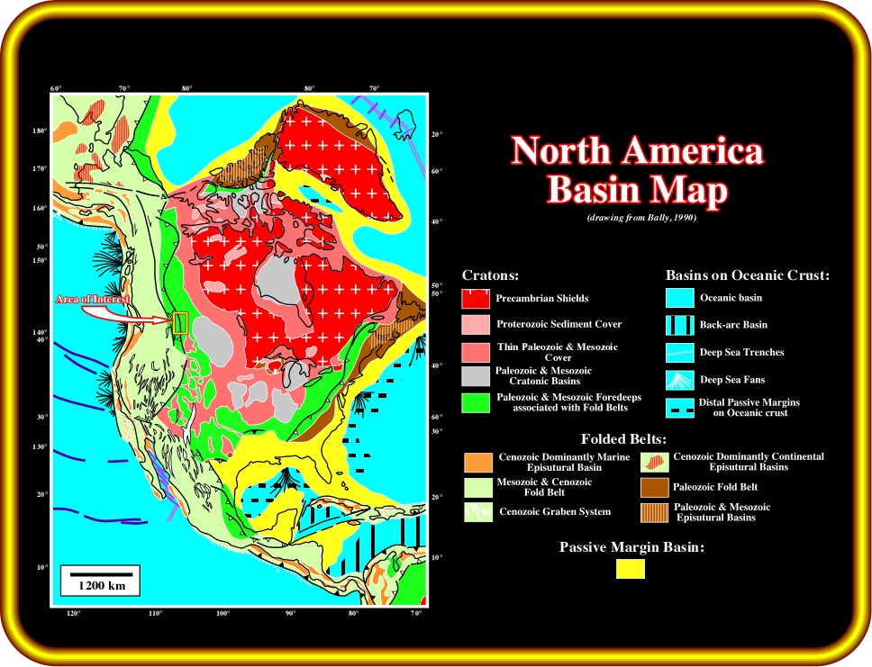
Plate 2 - The schematic distribution of the various basin types (Bally & Snelson, 1980) for North America indicates that the foredeeps of the Laramide U.S. Rocky Mountains and the Paleozoic Ouachita-Marathon folded belts of the southern United States are disrupted by basement involved uplifts of the cratons. As depicted, the area of interest area, corresponds to a Paleozoic divergent margin overlain by Paleozoic/Mesozoic foredeeps and associated fold belts. A flexural subsidence is predominant, after Later Paleozoic.
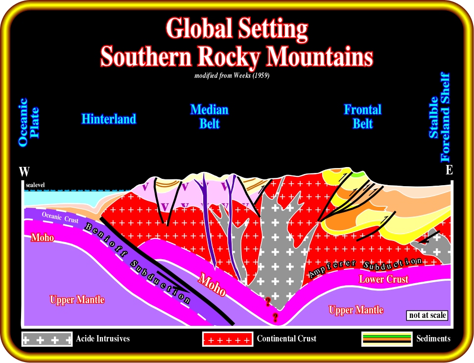
Plate 3 - The southern Canadian Rocky Mountains are associated with a B-type (Benioff) subduction zone, i.e. a destructive margin. The Juan de Fuca plate (oceanic) plunges under the North America plate (continental). Eastward of the oceanic trench, in the field, the Hinterland, the Median Belt, the Frontal Belt and the stable Foreland shelf are easily recognized. The area of interest is located on the eastern part of the Frontal Belt, where Mesozoic and Tertiary foredeep sediments were deposited overlying a Paleozoic margin or a Paleozoic foredeep. The sedimentary shortening proceeded from west to east concomitantly with the formation and migration of the foredeeps. Such a deformation is associated with development of an Ampferer subduction zone (A-type subduction), in which the plunging sediments (foredeep, substratum and basement) can reach depths up to 80-100 km. The igneous intrusions seem to have been induced by the uplift of the deepest slabs of the A type subduction zone, i.e. they are mainly post deformation.
![]()