
Universidade Fernando Pessoa
Porto, Portugal
Geological Setting & Seismic Interpretation
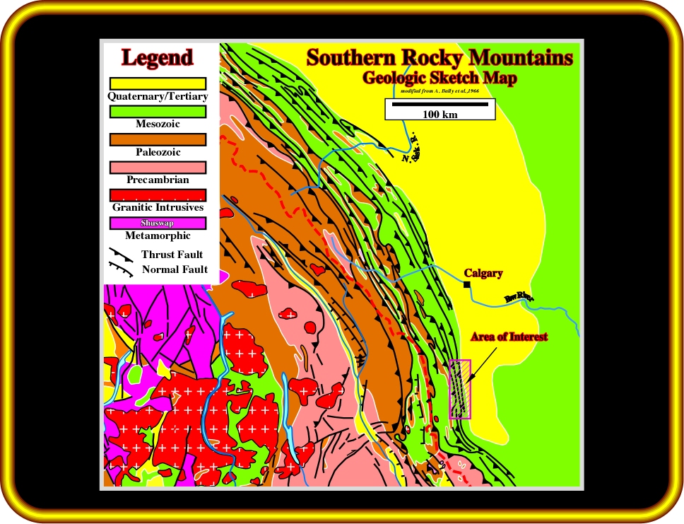
Plate 13 - This map corroborates the global geological setting of the Southern Canadian Rocky Mountains. Compressional tectonic regimes are predominant. Paleozoic and Mesozoic sediments are strongly shortened by faulting and folding. Much of the displacement was done along thrust-fault planes parallel to the bedding without producing duplication. Stratigraphic succession and thickness are unaltered. In the marginal part of the deformed belt it is only at the forward edge of the thrust sheet that the beds are shoved above “regional dip”. Westward, they return to regional dip, which can be used as the basis for extrapolation in maps or cross sections.
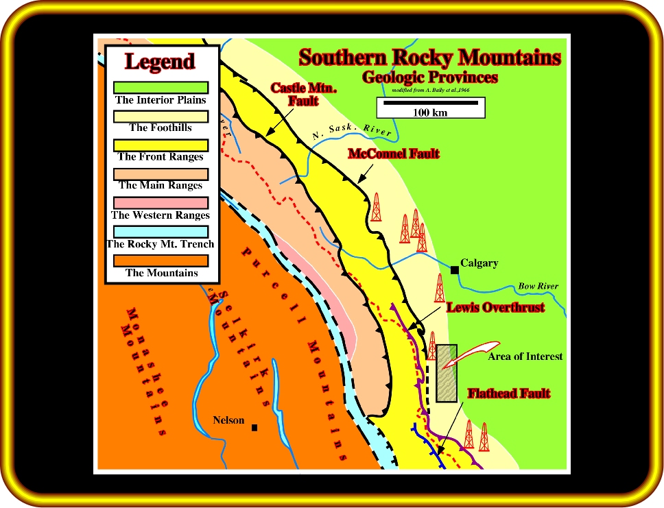
Plate 14 - Seven physiographic provinces can be individualized in the Southern Canadian Rocky Mountains. (1) The Interior Plains, (2) The Foothills, (3) The Front Ranges, (4) The Eastern Main Ranges, (5) The Western Ranges, (6) The Rocky Mountain Trench and (7) The Mountains. Each of these provinces has typical structural characteristics (next plate).
Geologic Provinces of Eastern Cordillera (A. Bally et al., 1966):
1) The Interior Plains, underlain by a relatively undisturbed sequence of Paleozoic, Mesozoic and Cenozoic sediments directly overlying a gently westward dipping Canadian shield.
2) The Foothills, whose structural skeleton is formed by relatively large and flat thrust sheets involving Paleozoic carbonates, with some frontal imbrications. Intensive imbrications of Mesozoic clastic rocks drape this Paleozoic skeleton. The whole is underlain by a relatively undisturbed westward continuation of the Canadian Shield.
3) The Front Ranges, formed by thrust sheets, stacked in imbricated fashion, mainly involving Paleozoic carbonates and Precambrian (Beltian) carbonates and clastic rocks. This province is also underlain by undisturbed westward extension of the Canadian shield.
4) The eastern Main Ranges, with elements composed largely of Precambrian (Beltian) and lower Paleozoic sediments, seemingly much less deformed than in the Front ranges. The western Main ranges are characterized by intensive cleavage in lower Paleozoic strata. Normal faulting occurs in both the eastern and western Main Ranges.
5) The Western Ranges, characterized by intensive cleavage and thrusting toward both east and west. Normal faulting is common and some recumbent faults occur.
6) The Rocky Mountain Trench, a linear topographic depression showing some evidence of normal faulting on its flanks.
7) The Mountains
7.1- The Purcell Mountain, essentially a large anticlinorium complicated by thrust faulting, involving thick sequences of Proterozoic and lower Paleozoic sediments, intruded by large, more or less discordant granitic batholiths.
7.2- The Selkirk-Monashee Mountains, characterized by extensive gneiss complexes, by more or less discordant granitic intrusions and Paleozoic and Mesozoic volcanics.
![]()