.jpg)
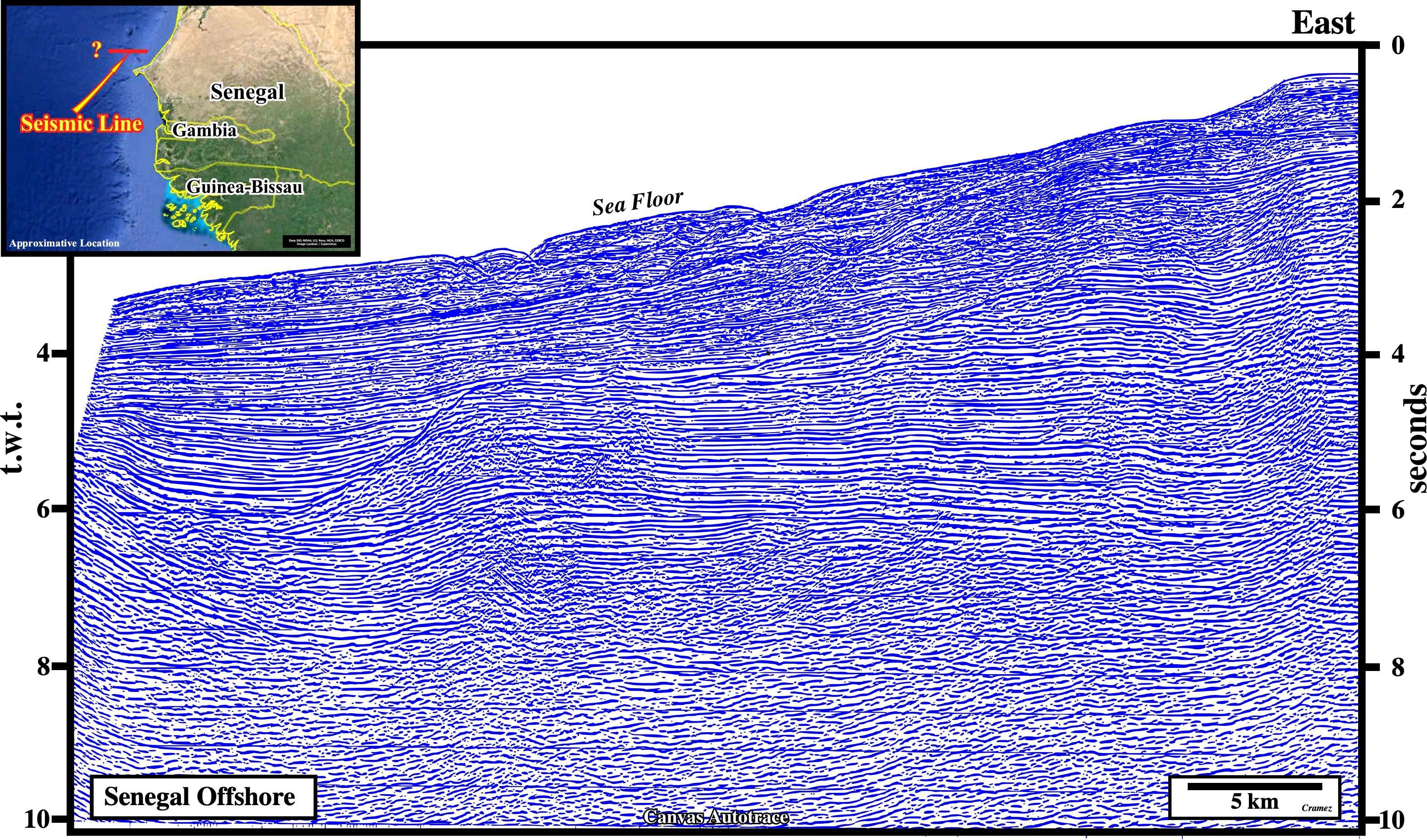
Senegal Offshore
North Dakar Offshore
The Senegal geographic basin, associated with the Atlantic-type divergent margin, formed after the culmination of the Permian- Triassic rifting developed over an extensive Paleozoic basins during the breakup of North America, Africa, and South America. Two major unconformities, i.e., (i) Pre-rifting unconformity and (ii) Breakup conformities underline its geological history, which can be summarized as follow: (a) Pre-rifting, from the Upper Proterozoic to Paleozoic ; (b) Rifting with development Permian to Triassic rift-type basins and (iii) a Middle Jurassic to Holocene Atlantic-type divergent margin. The initial phase of the post-Hercynian opening of the North Atlantic and the splitting of North America from Eurasia and Africa began during Late Permian-Early Triassic time is represented by rift-type basins. The breakup of the Gondwana with individualization of Africa and South America continents began in the Late Jurassic in the southern most part of the South Atlantic and prograded northward during Neocomian time. However, the opening of the Atlantic was not completed until Albian time. The basal Jurassic and lowermost Cretaceous limestones of the Mesozoic-Tertiary platform, considered by some geoscientists as more related to the Tethys Sea rather than the South Atlantic because the final opening of the Atlantic did not take place before Albian time, seems to be refuted by the eastward progradations of the seismic intervals(See Morocco offshore and onshore lines, Page 26 & Page 27).
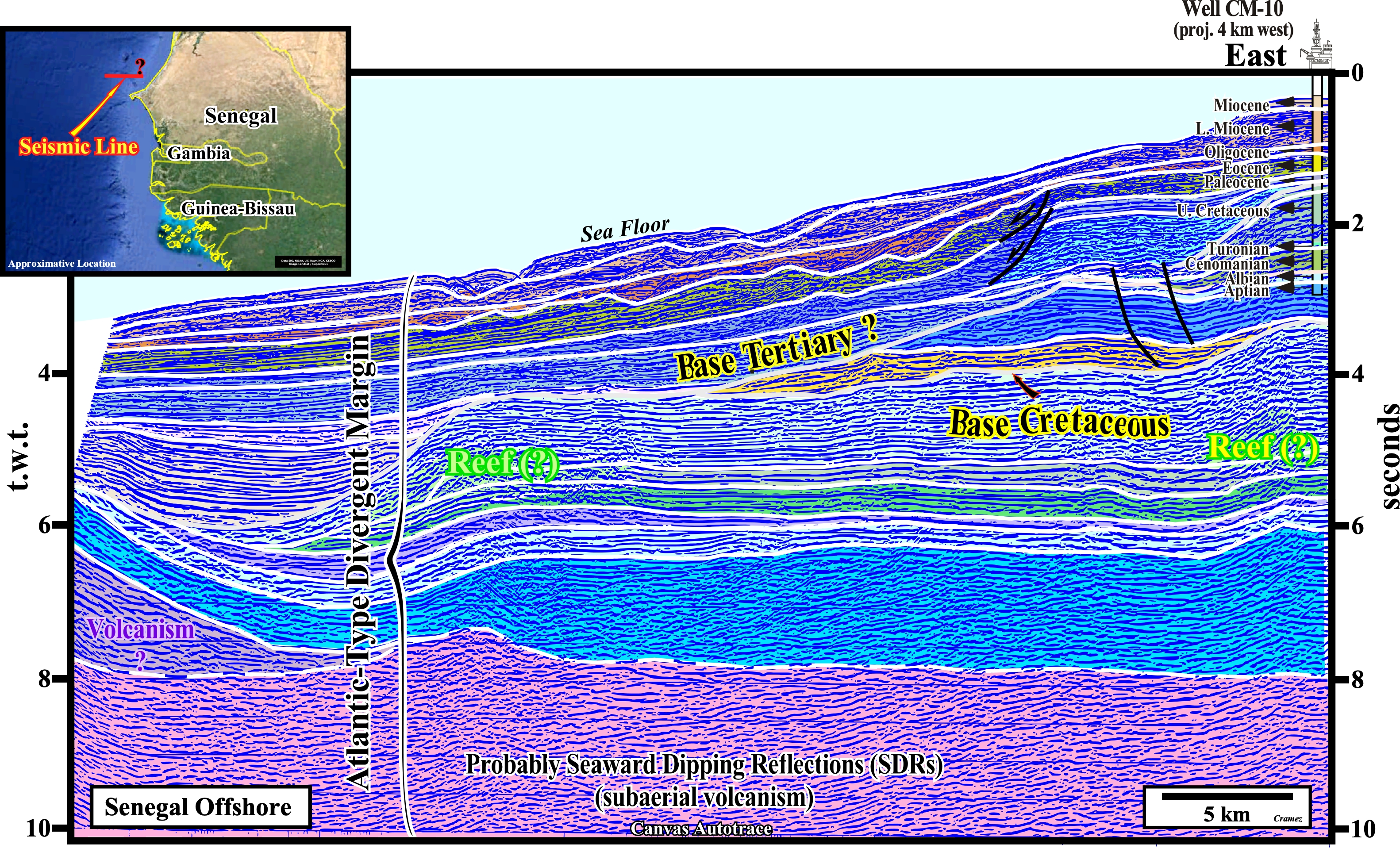
The geological results of the CM-10 well, drilled near the present time shelf break, allow the calibration of the upper part of the tentative geological interpretation of a Canvas autotrace of a Senegal offshore seismic line. The original seismic line recognizes, mainly, the upper slope, but the seismic line location on the location map is doubtful. As illustrated, the geological calibration concern just the upper seismic intervals (Aptian to Recent). The base Tertiary seems to match with the Senonian relative sea level fall (uplift, erosion and karst), which caused the slumping of the platform edge. Such a relative sea level fall developed an important unconformity with characteristic incised valley, which act as conduits along which reworked carbonate platform debris and onshore paralic sedimentary particles are transported down and deposited on the slope and at the base of slope. Below the base Cretaceous a thick Jurassic platform seems quite evident above a volcanic substratum, which can be, tentatively, interpreted as post-breakup lava-flows, i.e., SDRs. If that is so, no pre-rifting rock and rift-type sediments can be recognized in this Canvas autotrace. Note that in a depth section, due to important lateral velocity changes of the seismic waves (perturbation traveling without displacing the matter but transporting energy), the pre-Cretaceous sediments have a significant landward dip. Such a structural behavior reinforce the possibility of development of potential traps, as well as an westward migration of the hydrocarbons generated by "speculative" carbonate Jurassic source-rocks.

![]()
![]()
Send E-mails to carlos.cramez@bluewin.ch with comments and suggestions to improve this atlas.
Copyright © 2001 CCramez
Last update:
2022
![]()