.jpg)
Mozambique Offshore
Rovuma Geographic Basin
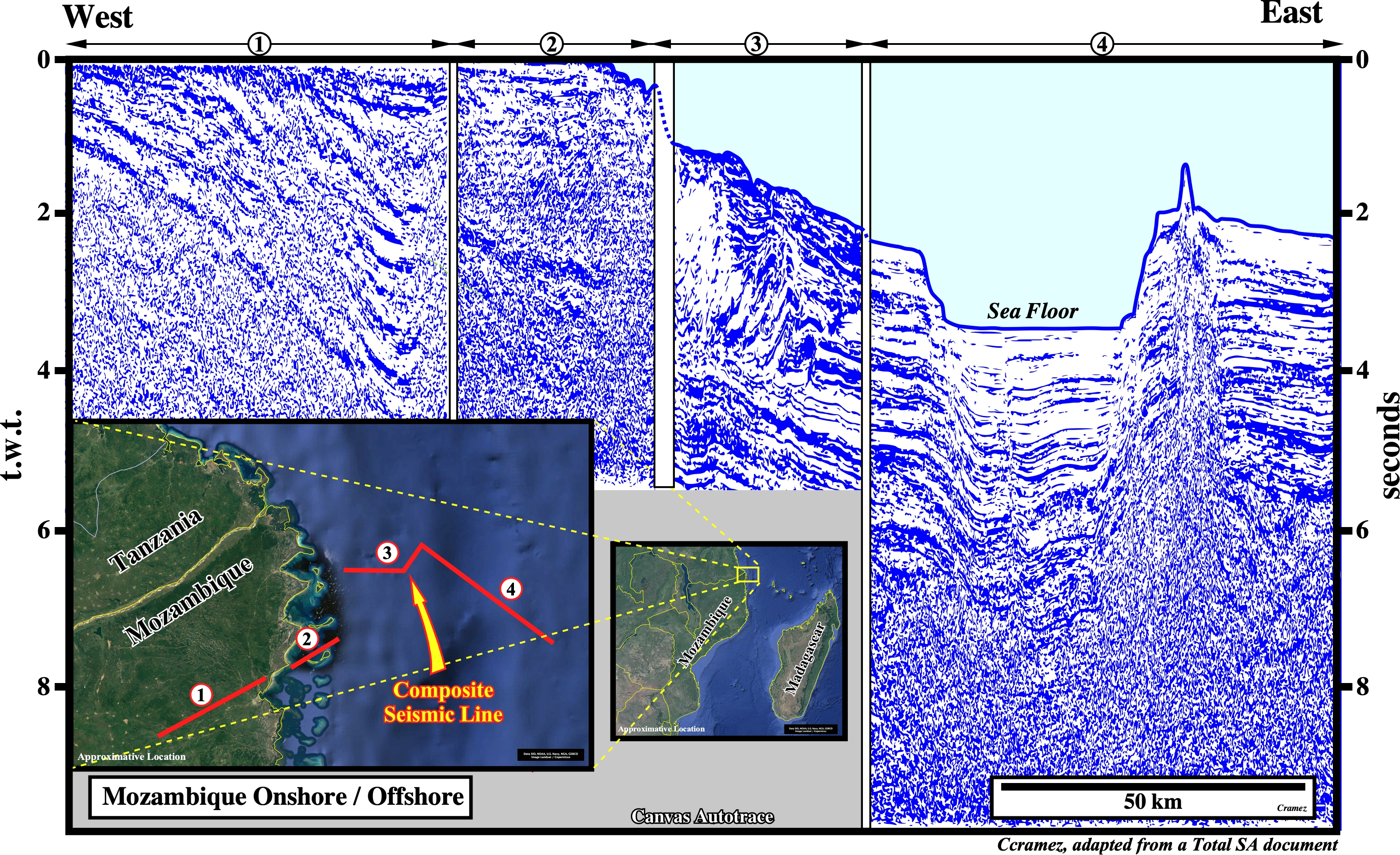
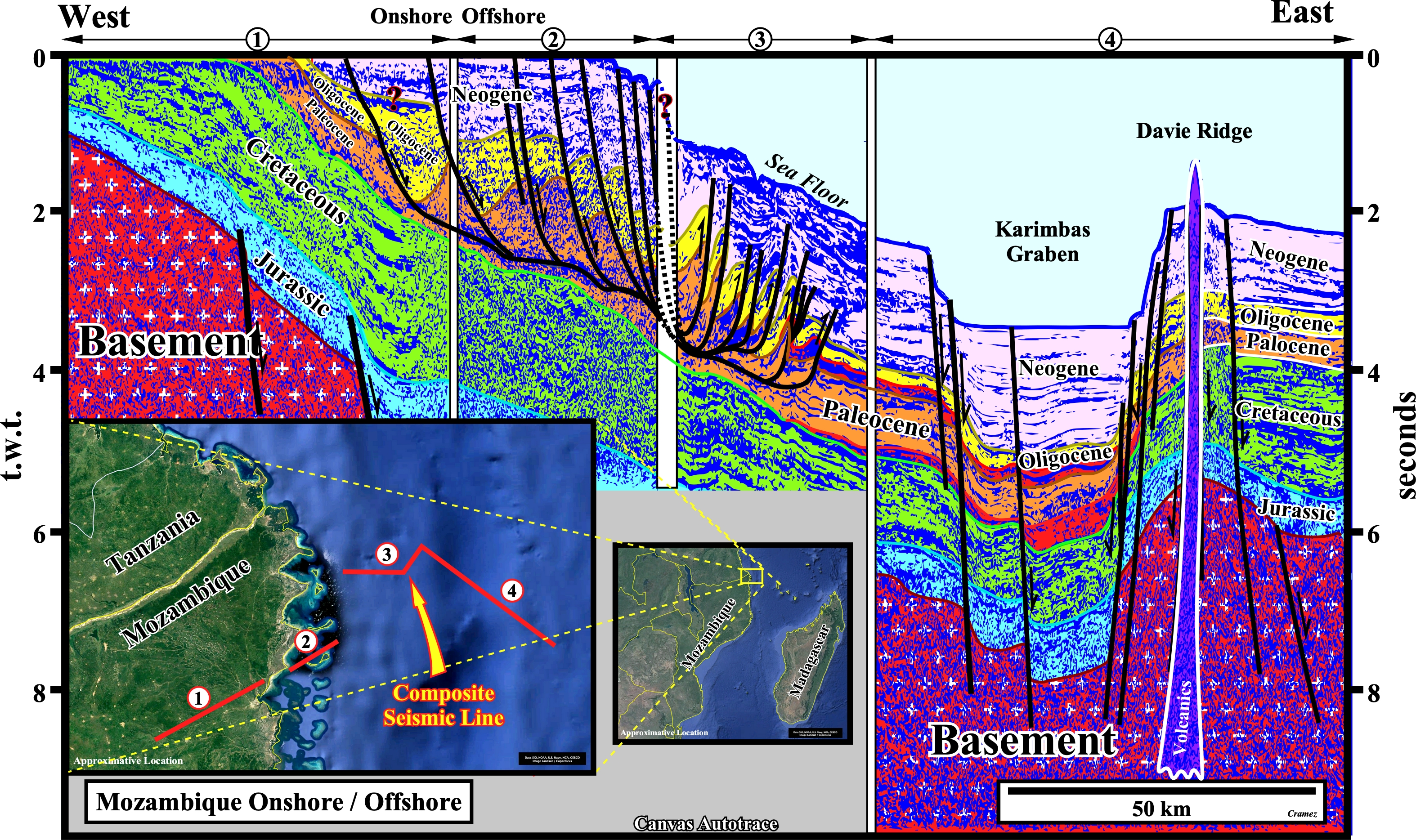
This tentative geological interpretation of a Canvas autotrace of a composite onshore/offshore seismic line of the Rovuma geographic basin, which spanning Mozambique’s northern border with Tanzania in the offshore of the northern province of Cabo Delgado (Mozambique), shows an important offshore depression with a water depth higher than 2,000 meters, which can be followed southward and northward. In fact, such a bathymetric depression seems to be associated with the Davie B-subduction zone (see Page 36B), since the eastern border can be correlated with the Davie Ridge (see Page 35), which separates, southward, the Mozambique from the Morondava geographic basins. In the Tertiary package of the Atlantic-type divergent margin, a listric faulting complex, located between the Present onshore/conventional offshore and the continental slope, develops, in the distal part, a significant local folded belt (sedimentary shortening, see plates below) to properly balanced the up-dip extension (sedimentary lengthening). The associated traps, i.e., morphological traps by juxtaposition (erroneous named *traps against fault" of certain geoscientists) in up-dip lengthened sector and structural traps (four way dip closures) in the down-dip shortened sector, seem to postdate the hydrocarbon migration. However, the morphological traps associated with the Paleocene and Eocene submarine turbidite fans seem to be excellent hydrocarbon targets.

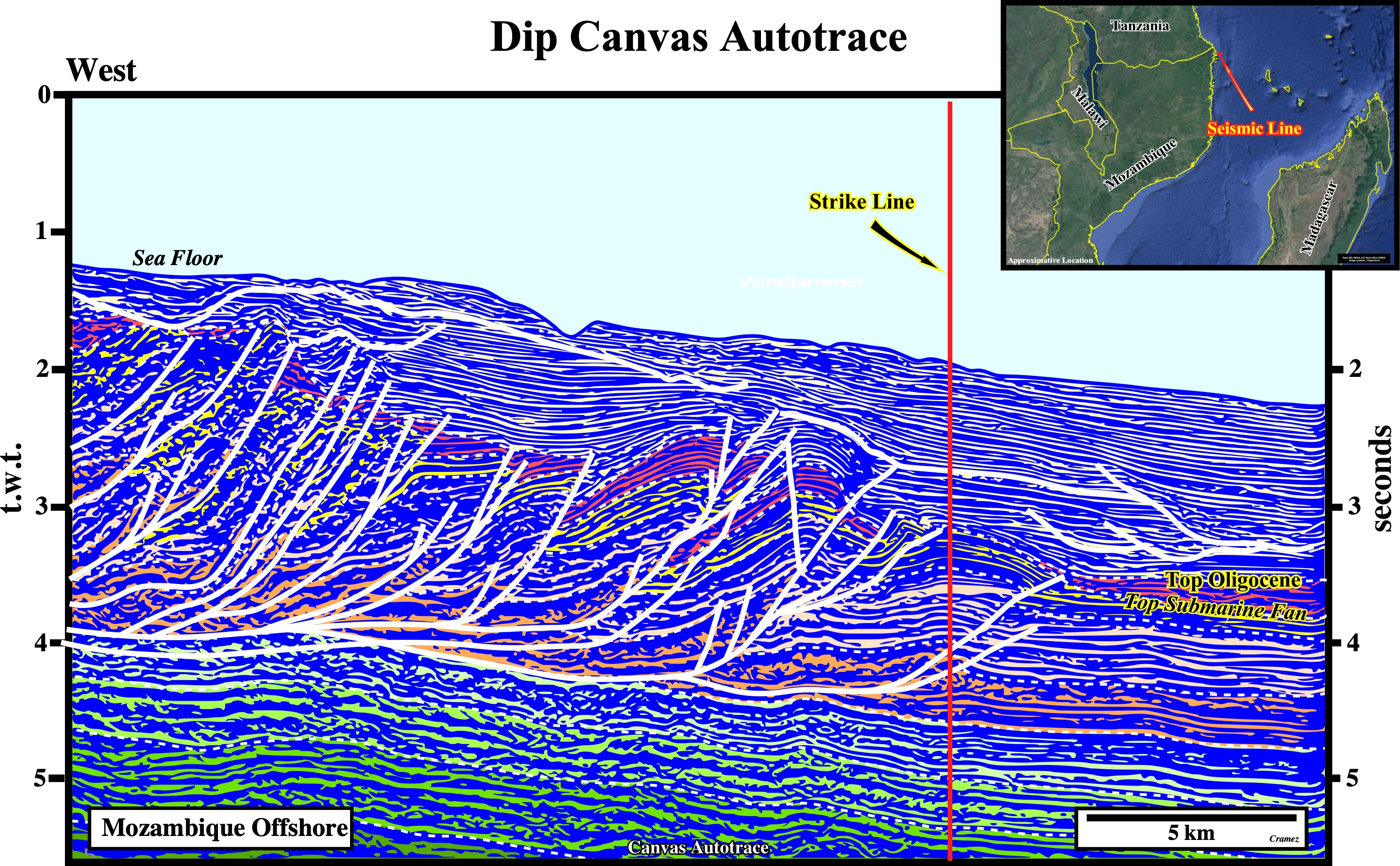
On this tentative geological interpretation of a dip Canvas autotrace of a seismic line shot, perpendicularly, to the axial direction of the folded belt, the geometry of the thrusts is well recognized, as well as, their out of sequence movement. The top of the Oligocene submarine fan complex is, easily, recognized following the seismic calibration made by the hydrocarbon exploration wells. The structural traps (four way dip closures) associated with the local folded belt, particularly, the more recent (the more proximal) look to postdate the hydrocarbon migration.
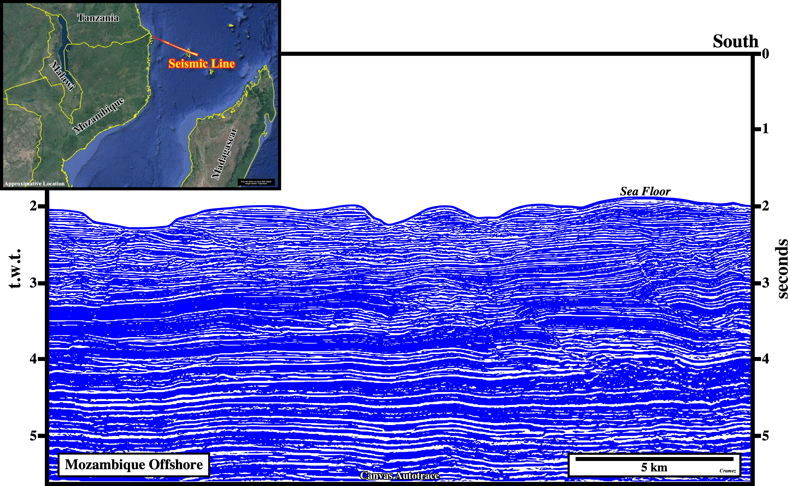
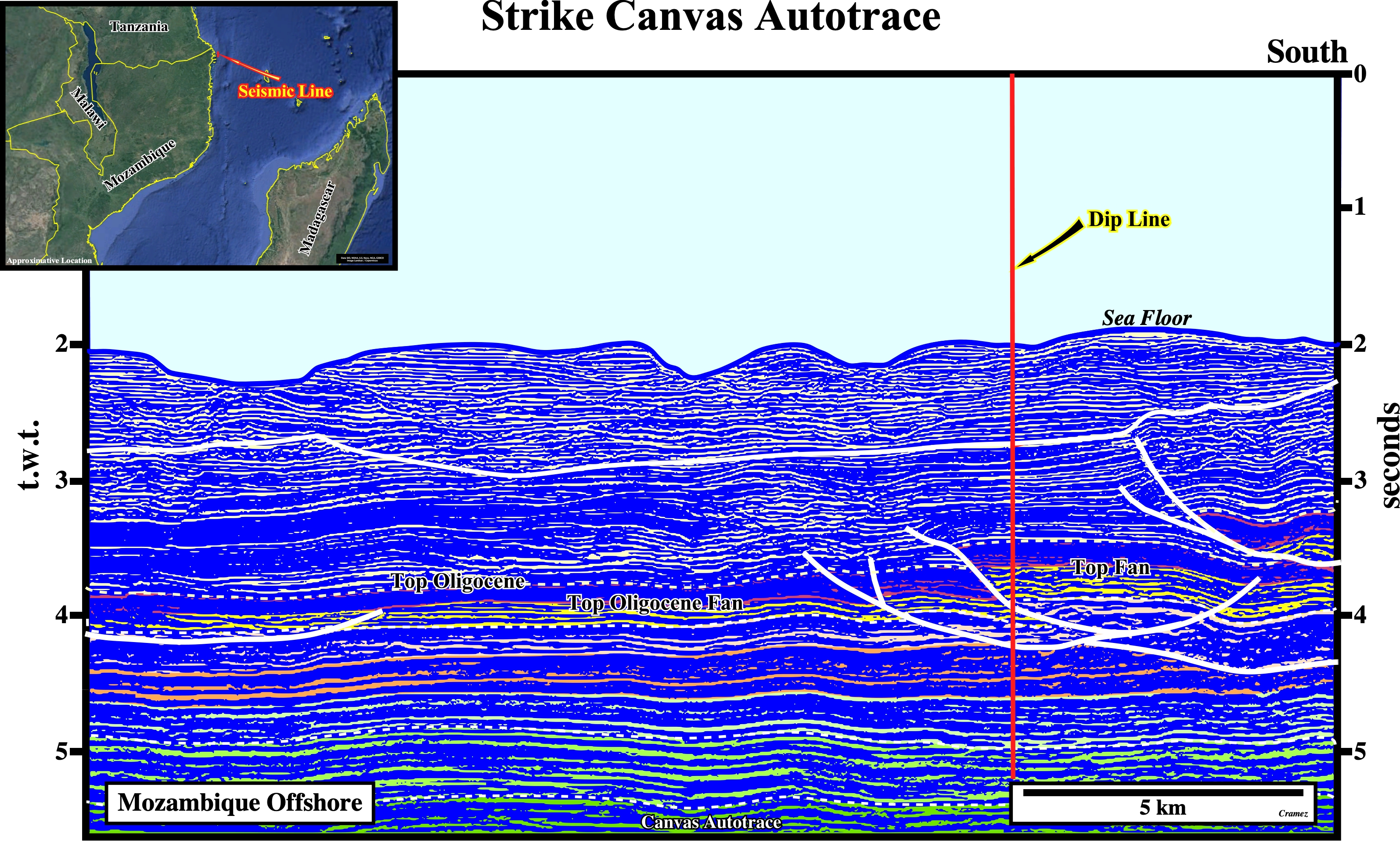
Notice on this tentative interpretation of a strike Canvas autotrace of a seismic line, more or less, perpendicular to the previous one the concave geometry of the fault planes with the hanging wall in the central compartment. Indeed, as all faults (normal or reverse) have two ends, where the relative movement of the fault blocks, after reach a maximum, becomes null, faults, generally, are curvilinear. In addition to get an homogeneous sedimentary lengthening or shortening the fault displacement must be transfer for another fault, generally, by a relay zone. Consequently, in a seismic line the fault geometry depends how the seismic line cuts the fault geometry. Take note the first critical test of geological seismic interpretation in a faulted area is to see if the fault geometry in a, more or less, perpendicular seismic lines: if the fault geometry is the same, the most likely is that the proposed interpretation is not correct.
![]()
![]()
Send E-mails to carlos.cramez@bluewin.ch with comments and suggestions to improve this atlas.
Copyright © 2001 CCramez
Last update:
2022
![]()