
SW Mexico Offshore
Vera Cruz Offshore (Mexico)
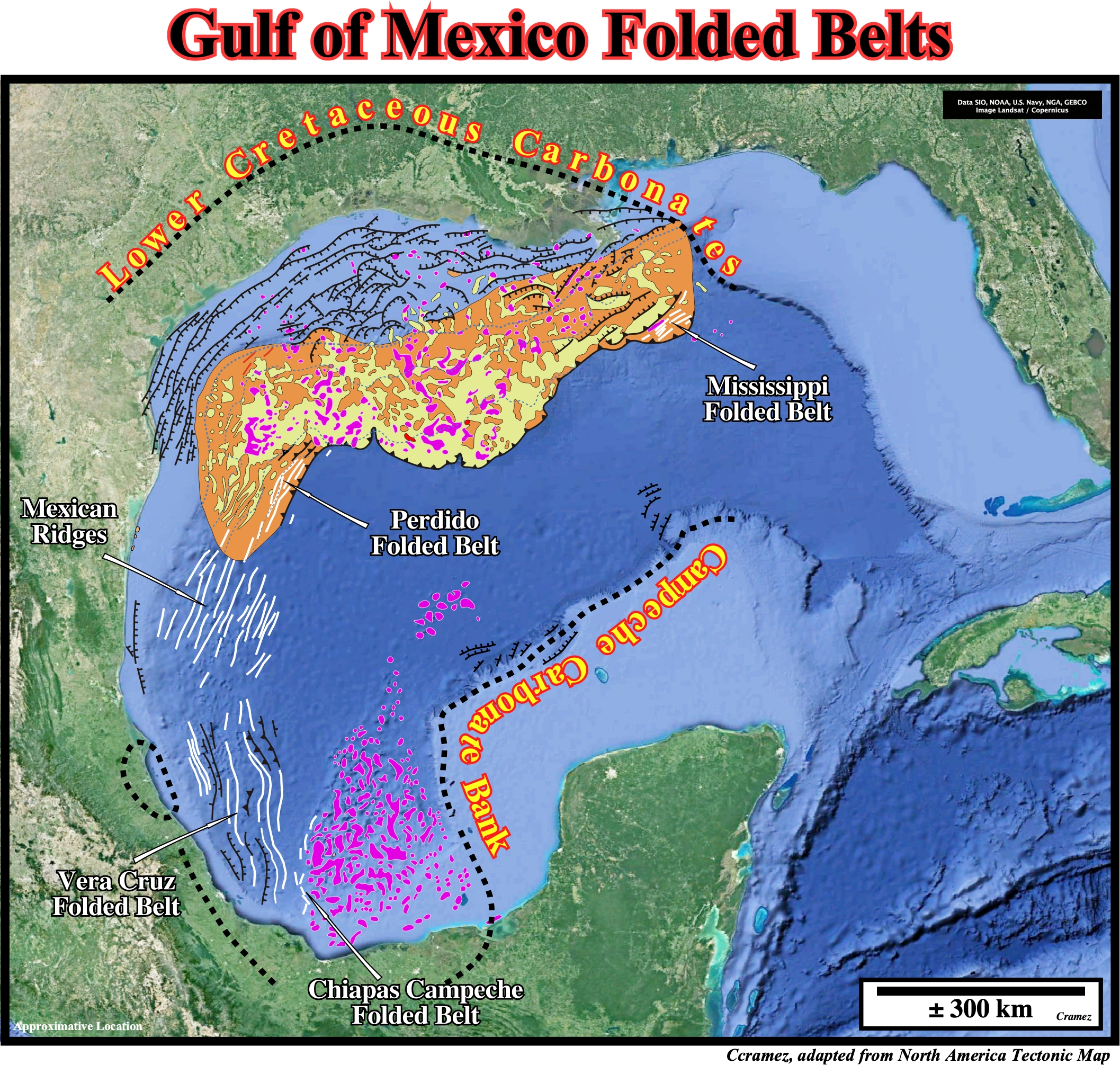
As illustrated on this schematic geological map, in the Gulf of Mexico, which was originated in Late Triassic time as the result of the breakup of the Pangea supercontinent along weakness and old sutures zones (collision of the Laurentia (North American Craton), South America and African lithospheric plates), there are several folded belt induced by gravity and salt tectonics : (i) Mississippi Folded Belt ; (ii) Perdido Folded Belt ; (iii) Mexican Ridges ; (iv) Vera Cruz Folded Belt and (v) Chiapas Campeche Folded belt. Let's see a tentative geological interpretation of Canvas autotrace of seismic line shot in Vera Cruz Folded Belt.
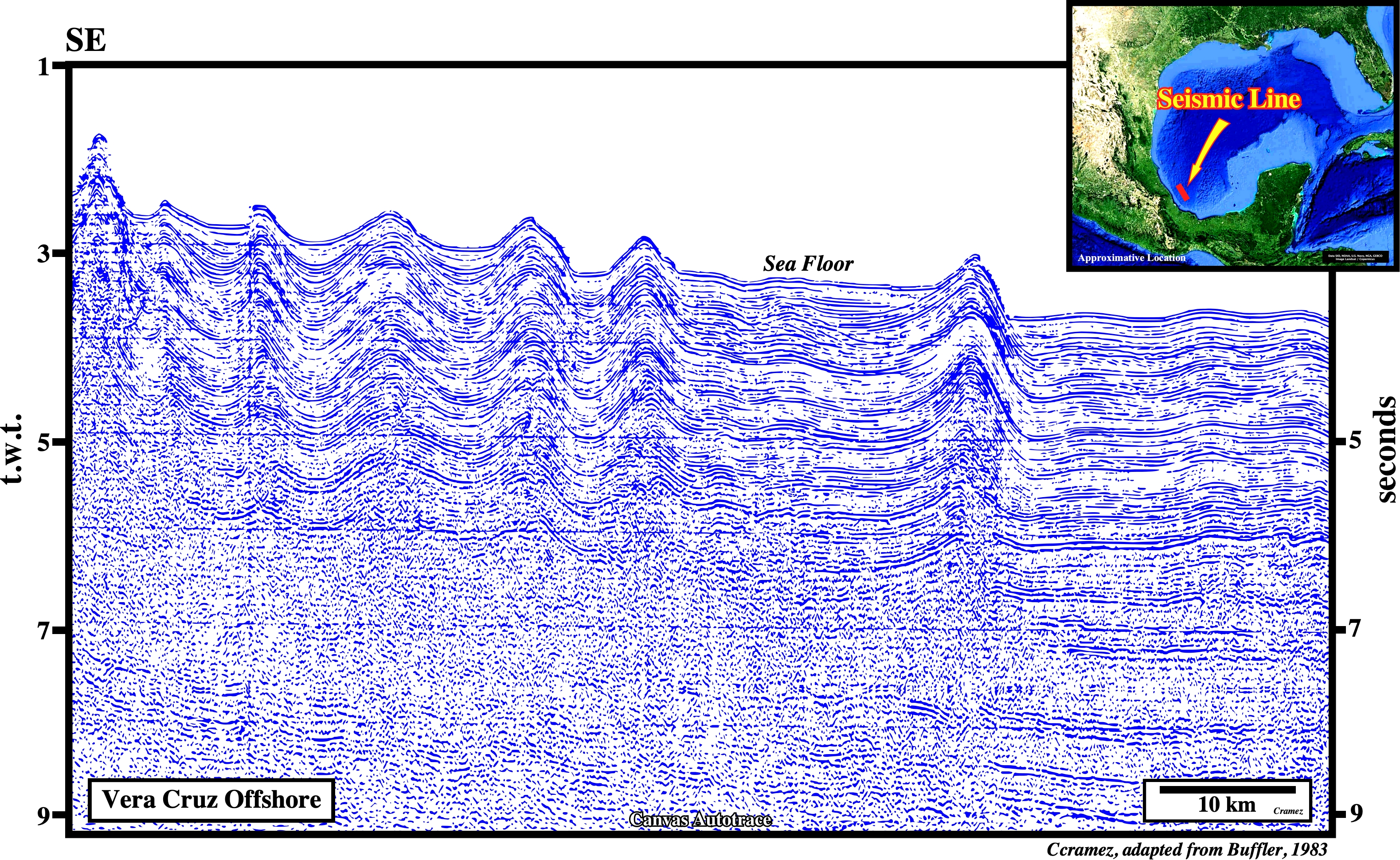
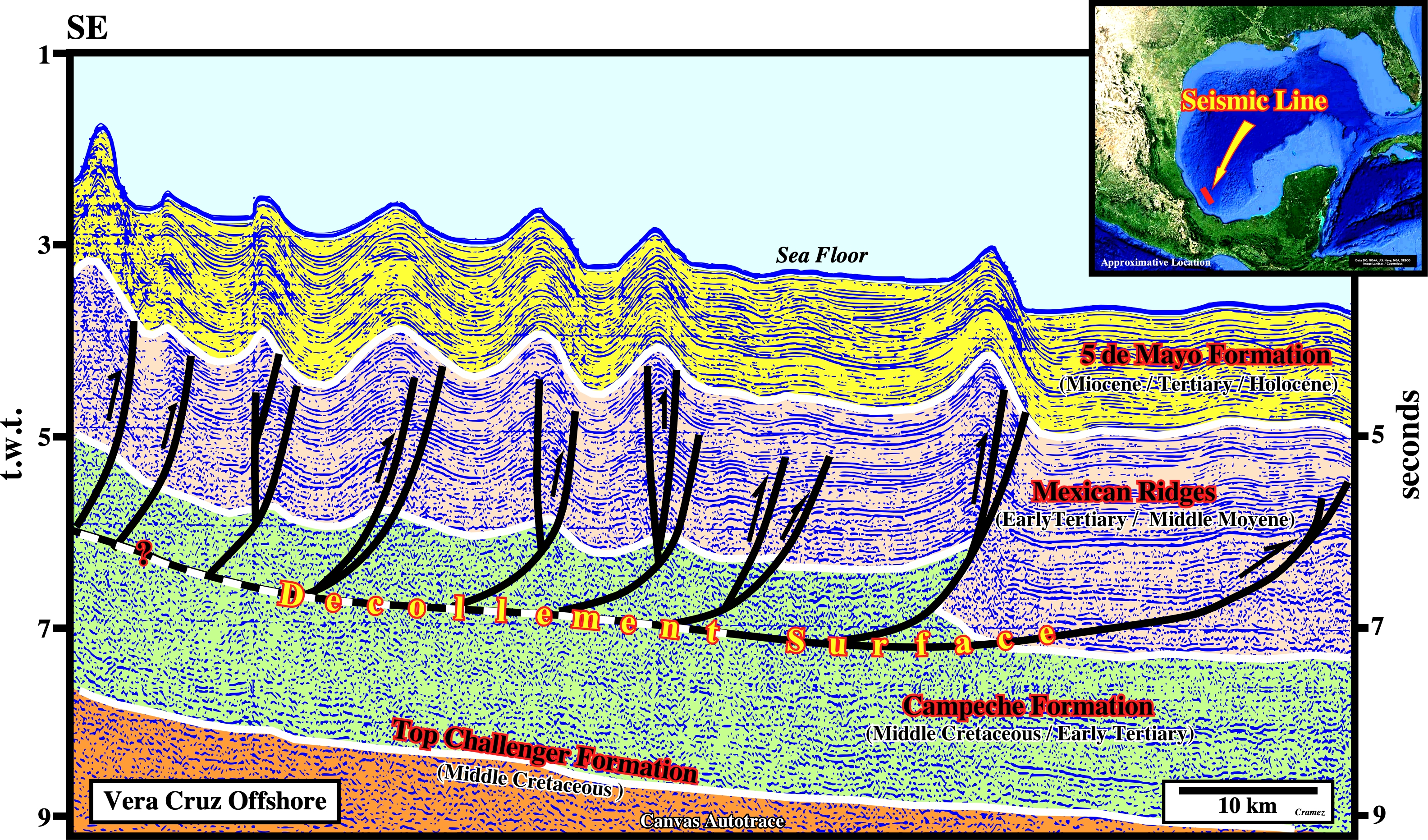
In this area, the fold belt's formation can be explained, as in the USA offshore (Page 31A), by two geological hypotheses: (i) Gravitation and/or (ii) Tectonic. In the first hypothesis the fold belt is local and it represents the sedimentary response to an up-dip extension, i.e., the faulting system corresponds to an huge listric complex, in which the up-dip normal faults become, seaward and down-dip, reverse faults, just due to a volume problem. In the second hypothesis, the shortening is regional and induce by a compressional tectonic regime characterized by a σ1 horizontal, a σ2 roughly parallel to the shoreline and a σ3 vertical.

![]()
![]()
Send E-mails to carlos.cramez@bluewin.ch with comments and suggestions to improve this atlas.
Copyright © 2001 CCramez
Last update:
2022
![]()