
Trinidad / Tobago Offshore
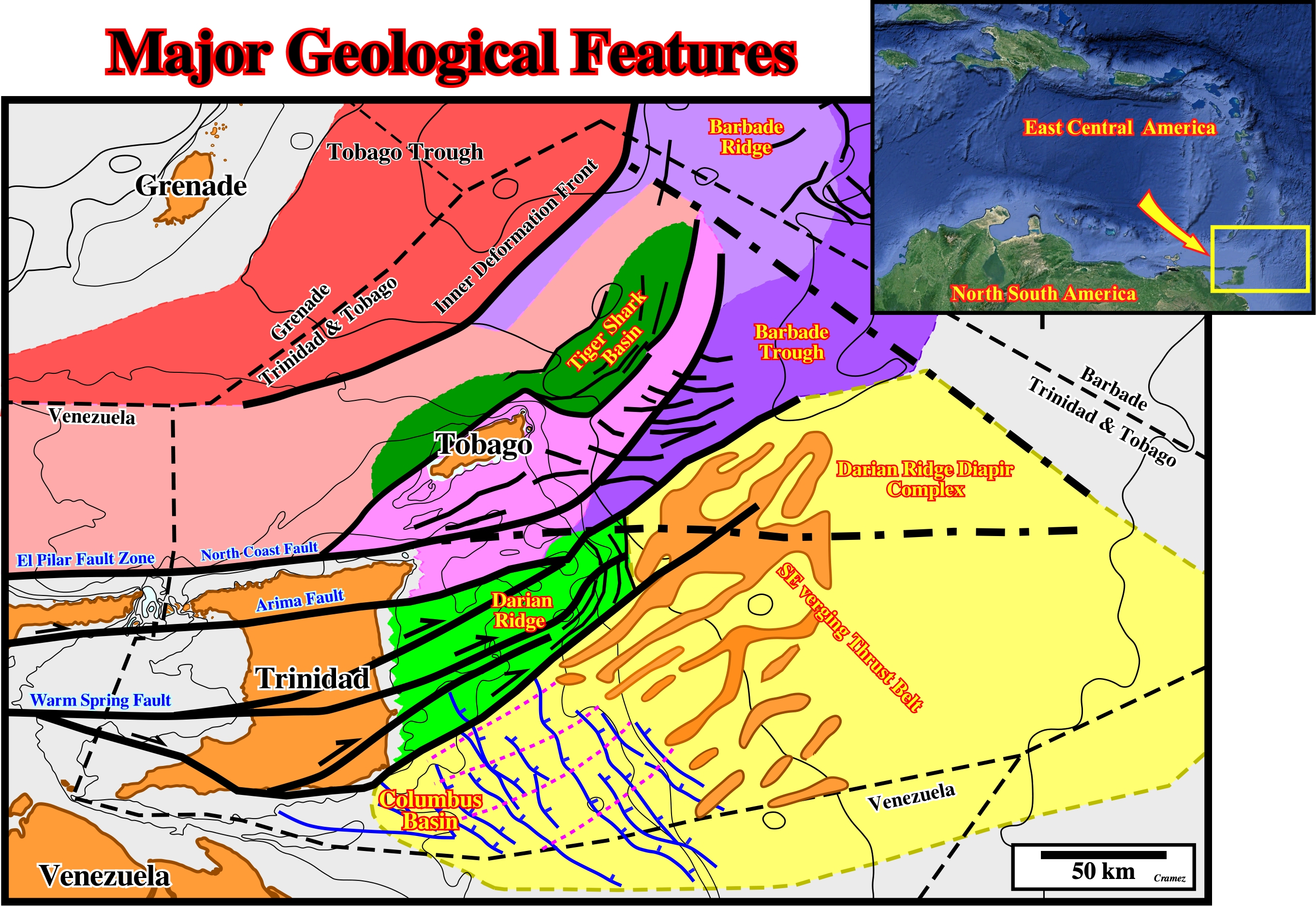
The main geological fractures of the Trinidad / Tobago offshore are depicted in this schematized map, where notice : (i) The Tobago Trough and its Inner Deformation front ; (ii) The Barbade Ridge and the Plio-Pleistocene Barbade Trough ; (iii) The Tiger Shark Geographic basin ; (iv) The Darian Ridge an the Darian Ridge Diapir Complex ; (v) The Columbus Geographic Basin. All these features are better defined on the tentative geological interpretations of seismic line illustrated below.
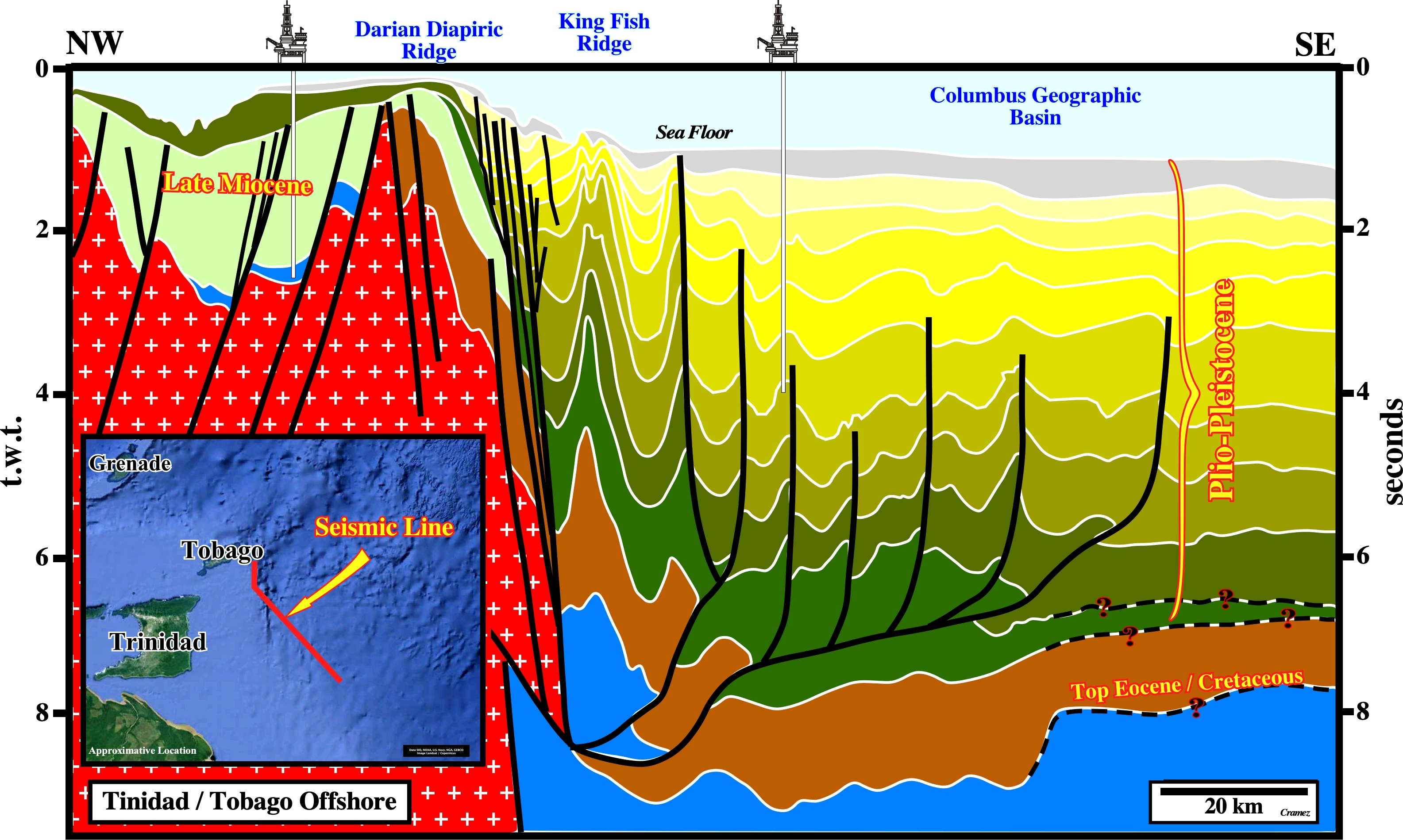
The Plio-Pleistocene Columbus geographic basin overlying a Eocene / Cretaceous substratum is, easily, recognized on this tentative interpretation southeastward of the Darian Ridge, which limits the Tiger Shark geographic basin from Barbade Trough that is better defined in a perpendicular seismic line as illustrated below.
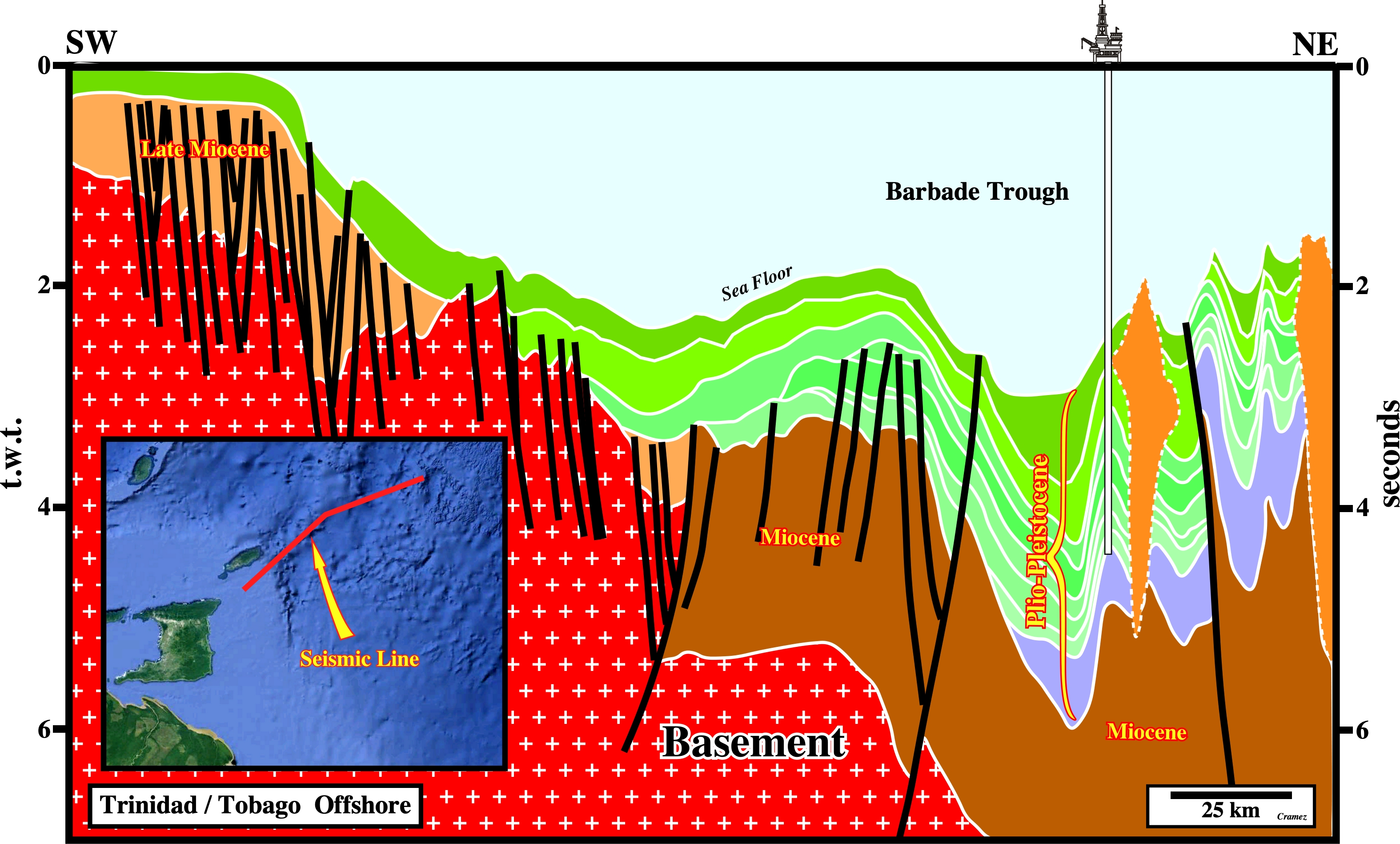
On this tentative interpretation, the Plio-Pleistocene Barbade Trough is very well documented over a Miocene depocenter, as well as, part of the Darian Ridge Diapiric complex The Trinidad northern conventional offshore is corresponds to a thin Pleistocene sedimentary package deposited over a Late Miocene interval covering the basement.
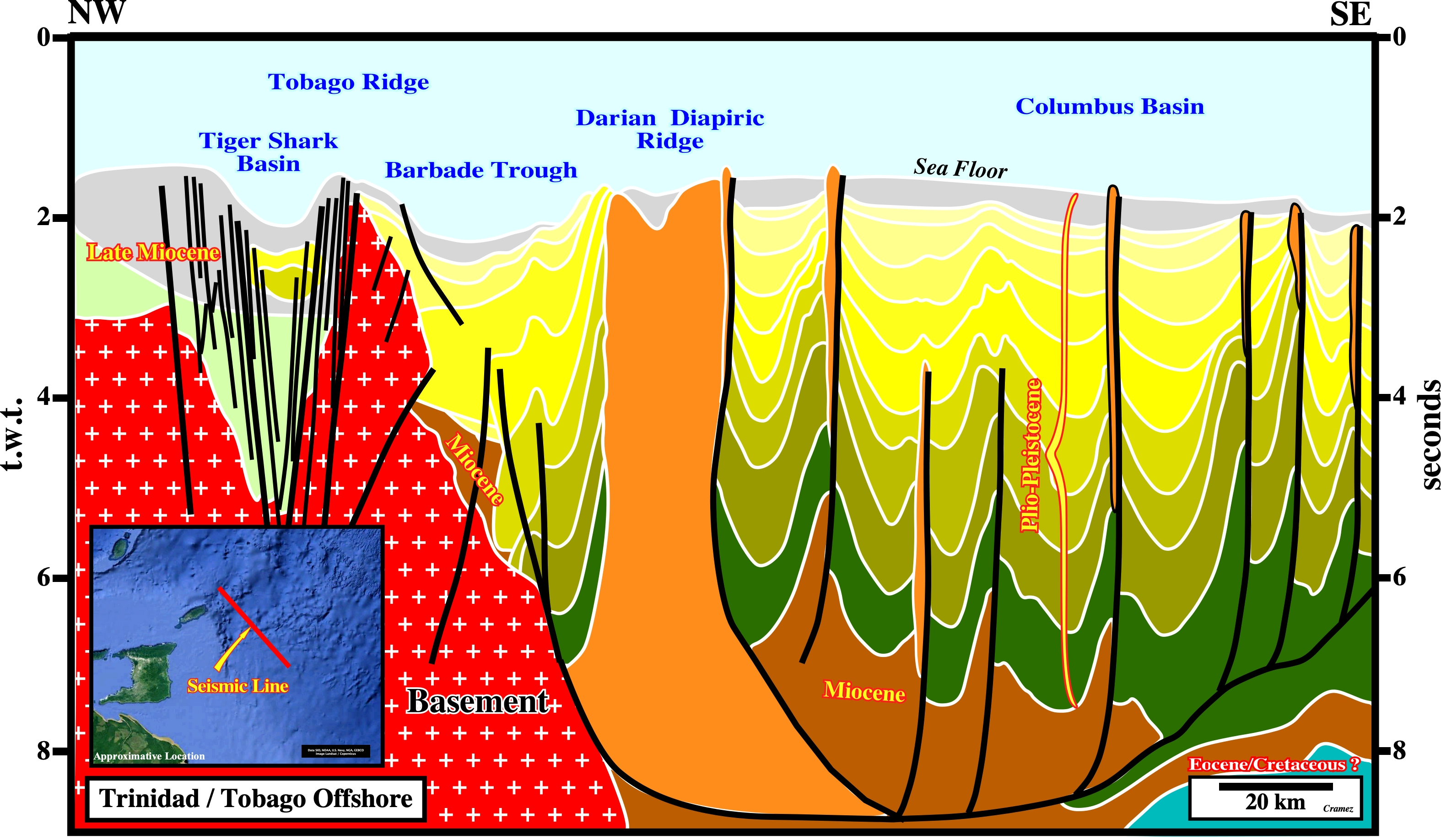
The relative positions of the Plio-Pleistocene Columbus geographic basin, the Darian diapiric ridge, The Barbabe trough and the Tiger Shark geographic basin are illustrated on this tentative interpretation, in which the Tobago ridge, between the Tiger shark geographic basin and the Barbade Trough, is quite well defined.

![]()
![]()
Send E-mails to carlos.cramez@bluewin.ch with comments and suggestions to improve this atlas.
Copyright © 2001 CCramez
Last update:
2022
![]()