
Grenade Offshore
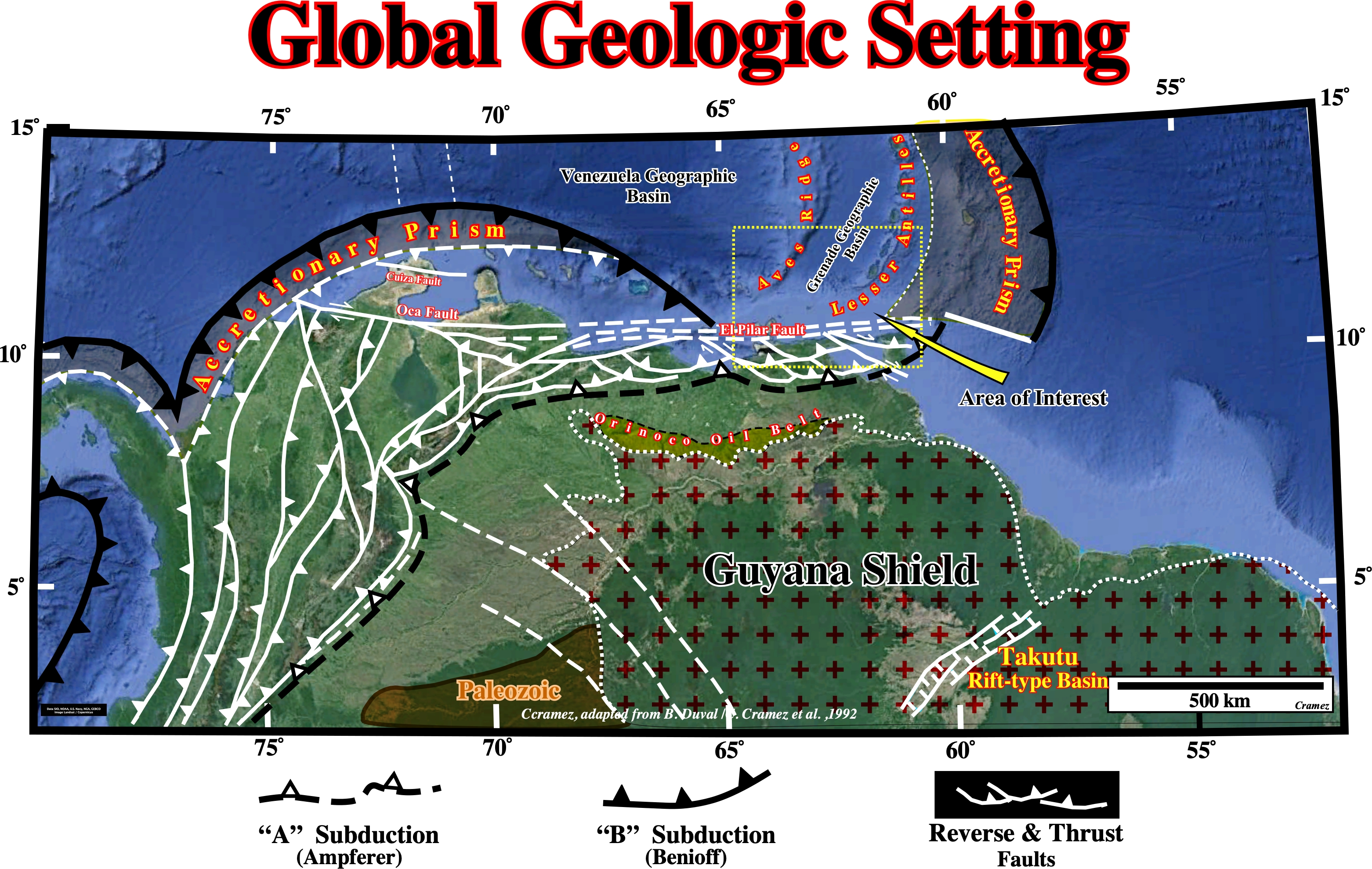
The Grenada Geographic Basin (see location map) is a thick backarc sedimentary basin, located behind the extinct Aves volcanic arc, presently, without active spreading center. The Aves ridge seems to represent a subducted Cretaceous / Paleogene remnant arc that rifted in the early Paleogene as the extensional Grenada Basin opened and the locus of arc magmatism shifted eastward to the Lesser Antilles. In fact, the SE Caribbean Sea is marked by subduction zones, with the North and South American plates subducting beneath the Caribbean plate, which corresponds to a large igneous province (LIP) composed of flood basalt supposed to have come from the eastern Pacific oceanic plateau. The Caribbean LIP seems to have been separated from the Pacific plate and wandered eastward to its current position between 100 and 70 Ma. Probably, the associated basins of the area (Grenade geographic basin included) may have been one continuous basin. However, the formation of the Aves Ridge (presently an extinct volcanic arc) divided the region, individualizing the Venezuela and the Grenada geographic basin. Later, another volcanic arc, the Lesser Antilles, separated the Grenade geographic from the Tobago geographic basin.
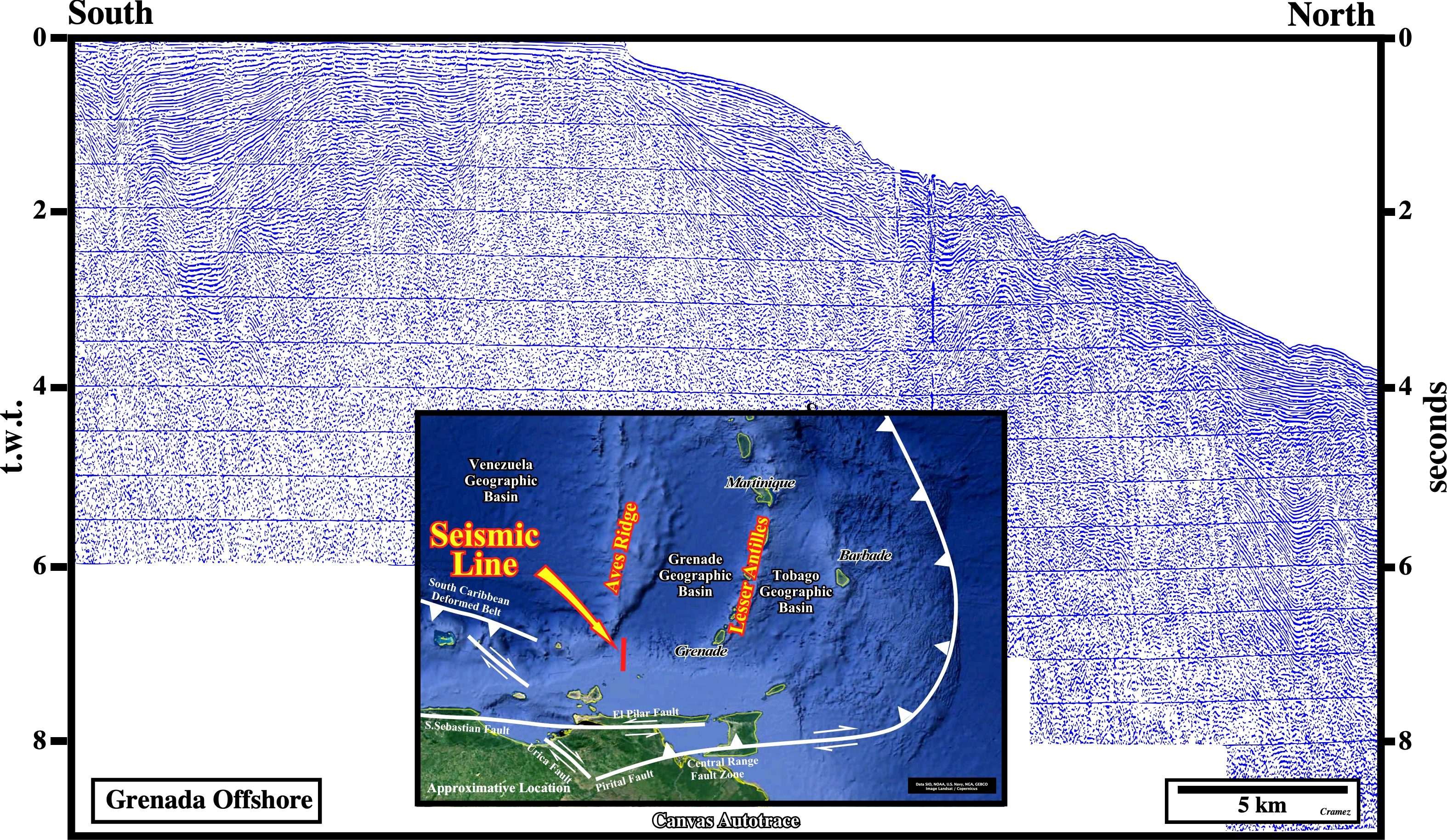
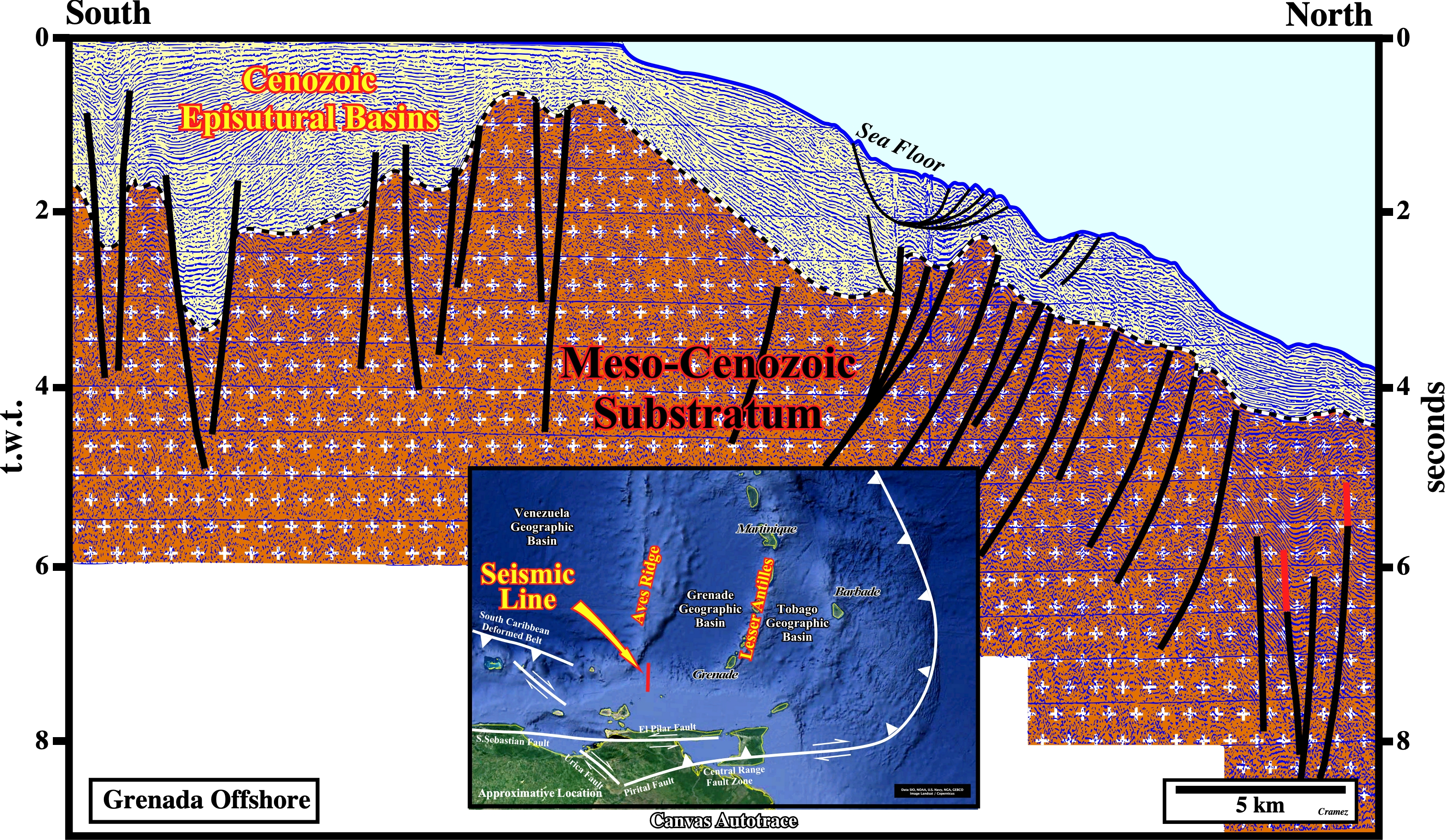
This Canvas autotrace of an old composite seismic line located on the northern margin of the South America lithospheric plates, not far from the southern end of the Aves ridge illustrates the development of Cenozoic episutural basins on a Meso-Cenozoic substratum (probably an old folded belt), which seems to subsiding under the Caribbean plate (see the above Global Geological Setting).

![]()
![]()
Send E-mails to carlos.cramez@bluewin.ch with comments and suggestions to improve this atlas.
Copyright © 2001 CCramez
Last update:
2022
![]()