
Colombia Offshore
Guajira Geographic Basin
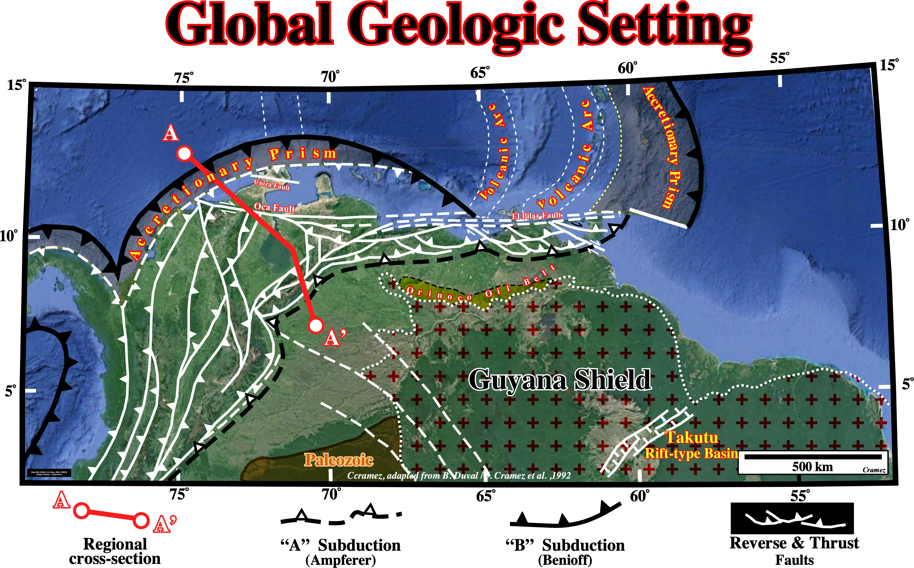
This tectonic sketch is a tentative representation of the global geological setting of the South America lithospheric plate, in which two subduction zones are paramount. The northern subduction zone is a B-Type subduction (Benioff type), since the descending plate is oceanic (B-type subductions are underlined by : (i) Oceanic trench ; (ii) Alignment of volcanoes and (iii) Deformation of the crust, which often causes the formation of mountains). The southern subduction zone is A-type subduction zone (Ampferer type). The descending plate is continental (A-type subduction are underlined by a foreland basin). Thus, we can say, the Guajira geographic basin, located on the northern part of the A-A' geological cross-section (see next plate), is associated with a B-Type subduction zone, which is responsible, in the overriding lithospheric plate (South America plate) for the development of a volcanic arc and an accretionary forearc basin.
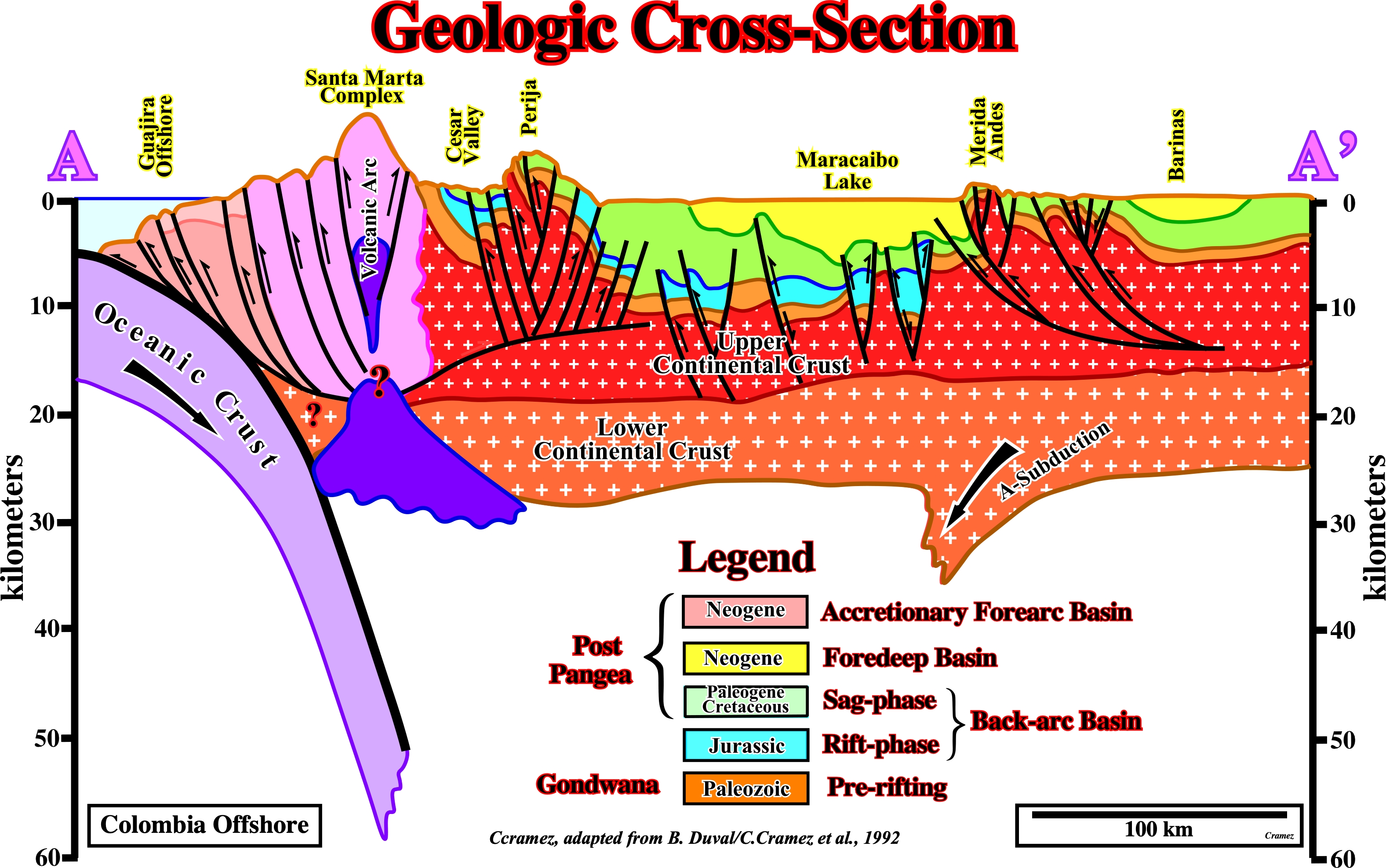
This geological cross-section between the Guajira offshore and the Barinas state (see location on the previous plate), not only depicts the geological setting of the Guajira geographic basin (Guajira offshore), but the Merida Andes as well. The Guajira offshore is associated with a B-subduction and corresponds to an accretionary wedge and its associated forearc basin. The Merida Andes and the Barinas foreland basin area associated with a A-subduction. In the A-type subduction zone, since both plates are of the same nature and density, there is, practically, no consummation of lithospheric material, but rather accretion (if it is not compensated by erosion). This means the descending plate does not penetrate the asthenosphere. On the contrary, in Benioff or B-type subduction zones, as the descending lithospheric plate is oceanic in nature and the overriding plate is continental, the descending plate, denser, enters the asthenosphere where it is consumed. For these reasons, many geoscientists consider that the true subduction zones are just the B-type, since they counterbalance the creation of oceanic crust in the mid-ocean ridges. Assuming this geological cross-section depicts the geological context of the Colombia northern coastal area, on the seismic lines geoscientist must look for a B-Type subduction zone in the descending lithospheric plate and for an accretionary wedge and a forearc basin in the overriding plate.
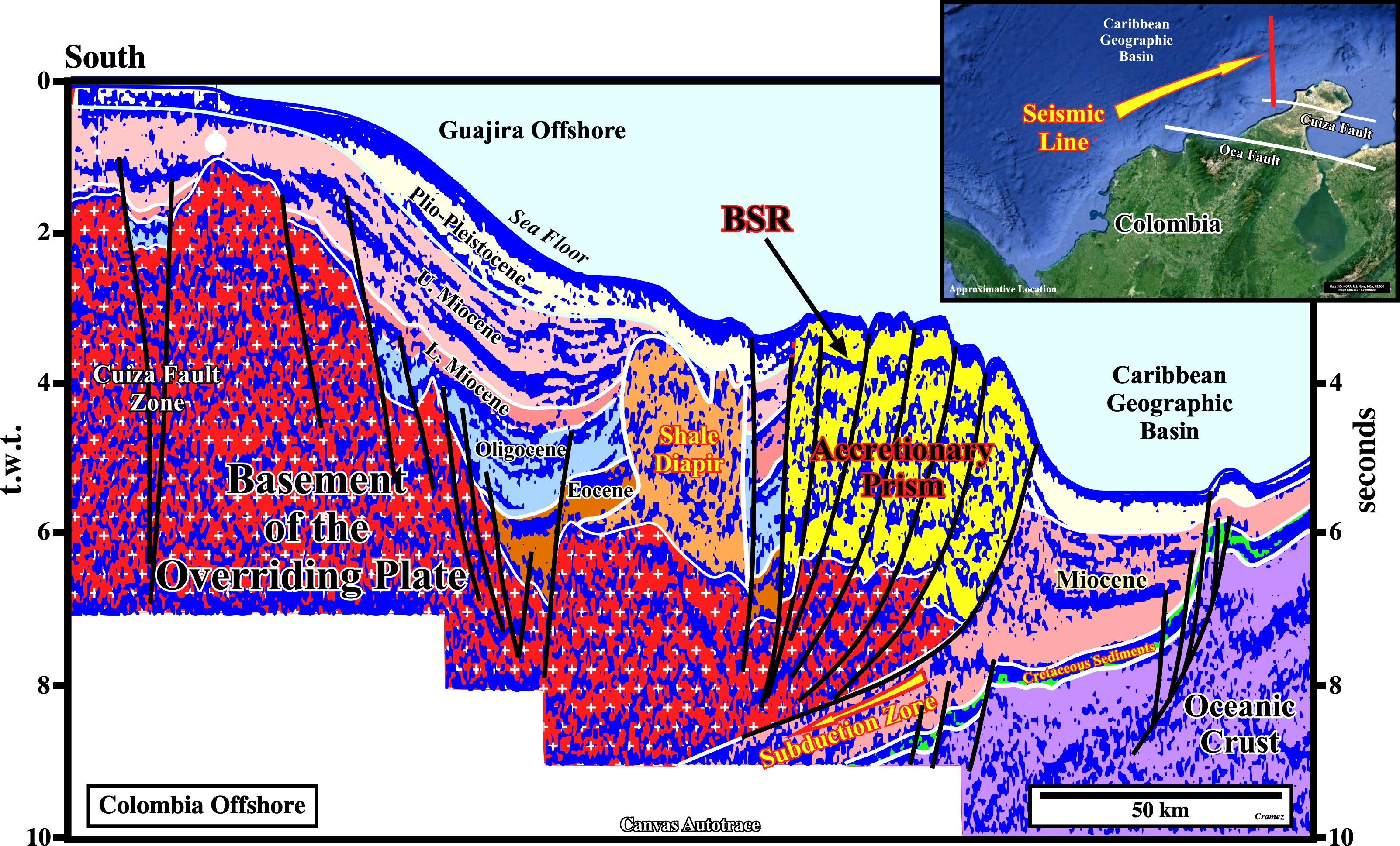
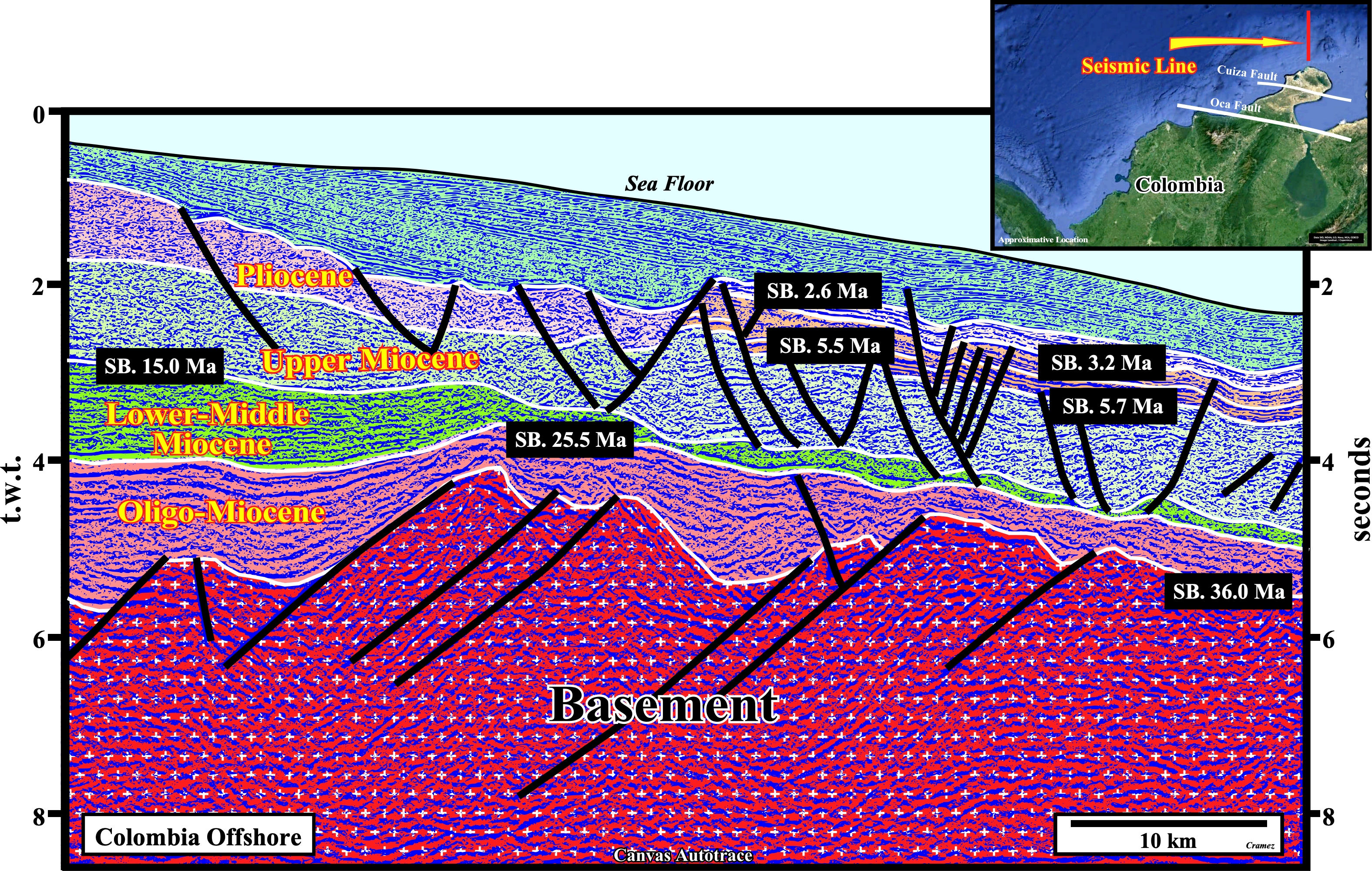
On this tentative geological interpretation of a Canvas autotrace of the Colombia offshore (Guajira offshore), it is easy to recognize on the northern South America overriding lithospheric plate an accretionary prism formed in response to the subduction of the Caribbean plate. Southward of the accretionary prism a forearc sedimentary basin is also, easily, recognized, which is, strongly, affected by affected by strike slip faults (e.g., Cuiza Fault Zone). BSRs (acronym of Bottom-Simulating Reflectors), which are primary seismic indicators of the base of hydrate stability in continental margins are quite frequent in this area. In fact, naturally occurring gas hydrates are stable for certain temperatures and pressures. The hydrate stability zone (HSZ) tends to occur in deep water just beneath the sea floor. This zone exists from the seafloor down to the base of gas hydrate stability, where temperatures and pressures are not ideal for hydrates (https://search.yahoo.com/search?ei=utf-8&fr=aaplw&p=hydrate+stability).
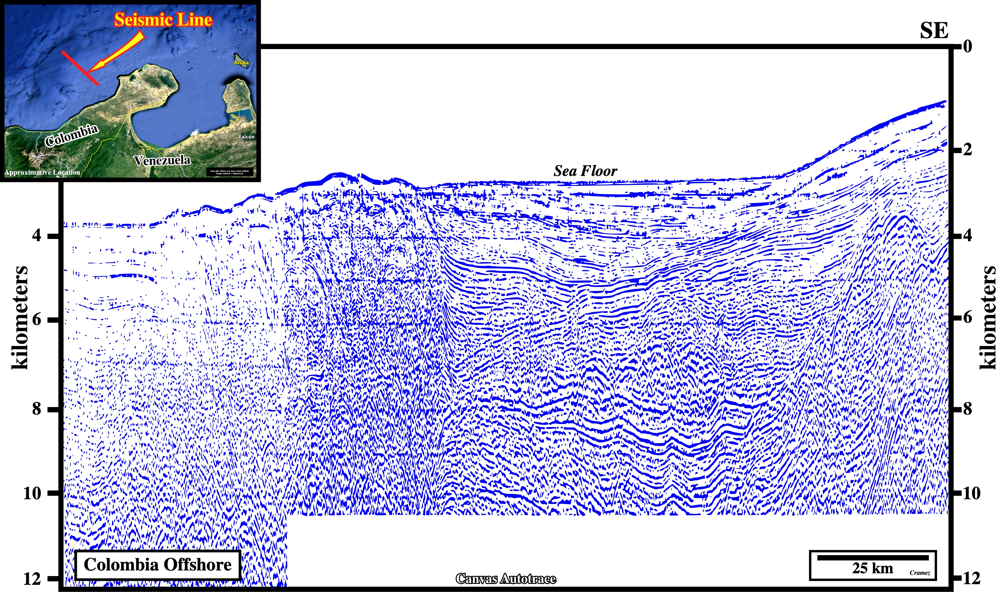
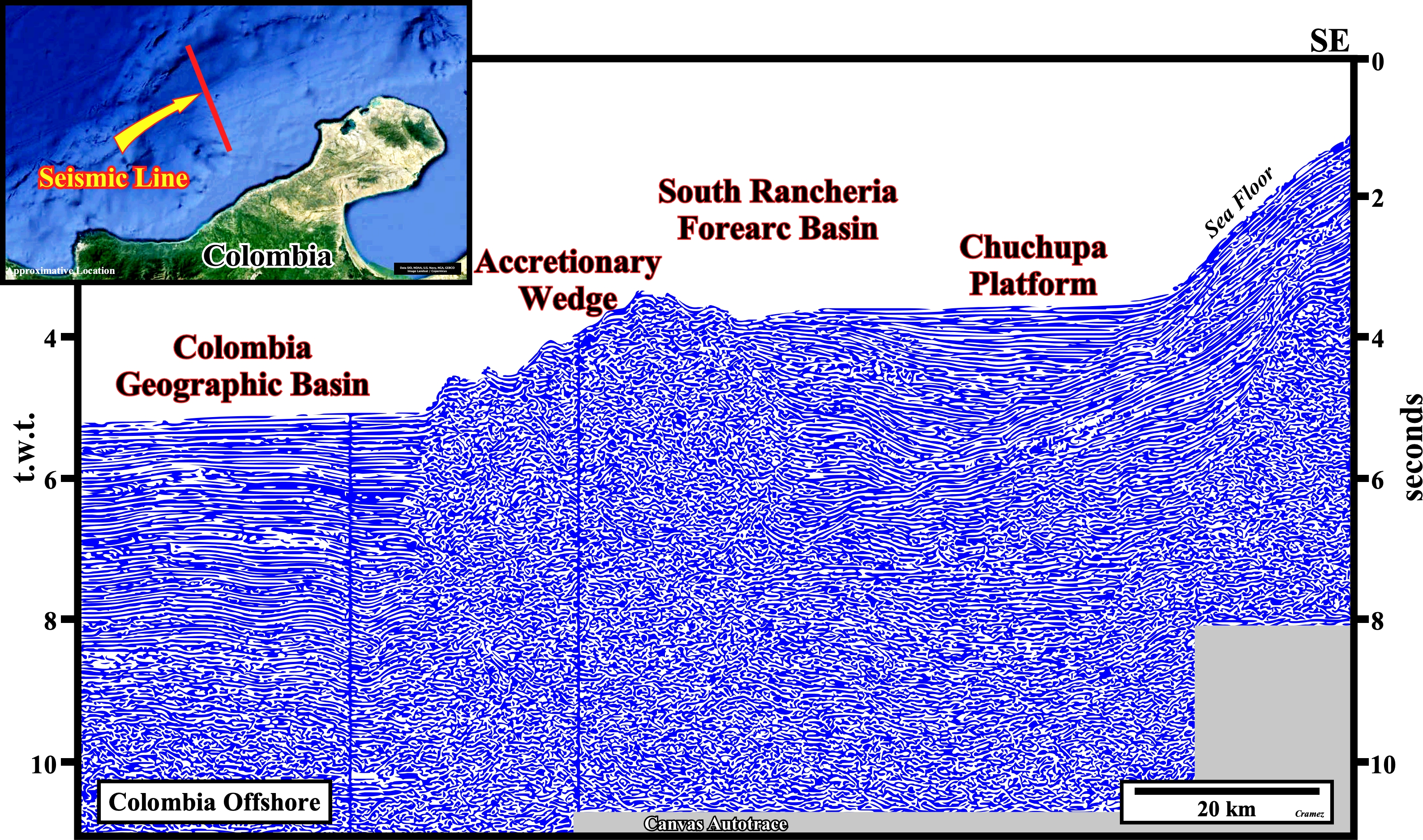
This tentative interpretation of a Canvas autotrace of a seismic line located northward of the Airrainmaru Punta Gallina (Guajira Peninsule), illustrates the forearc basin located southward of the accretionary prism induced by the subduction of the Caribbean plate under the South America lithospheric plate.
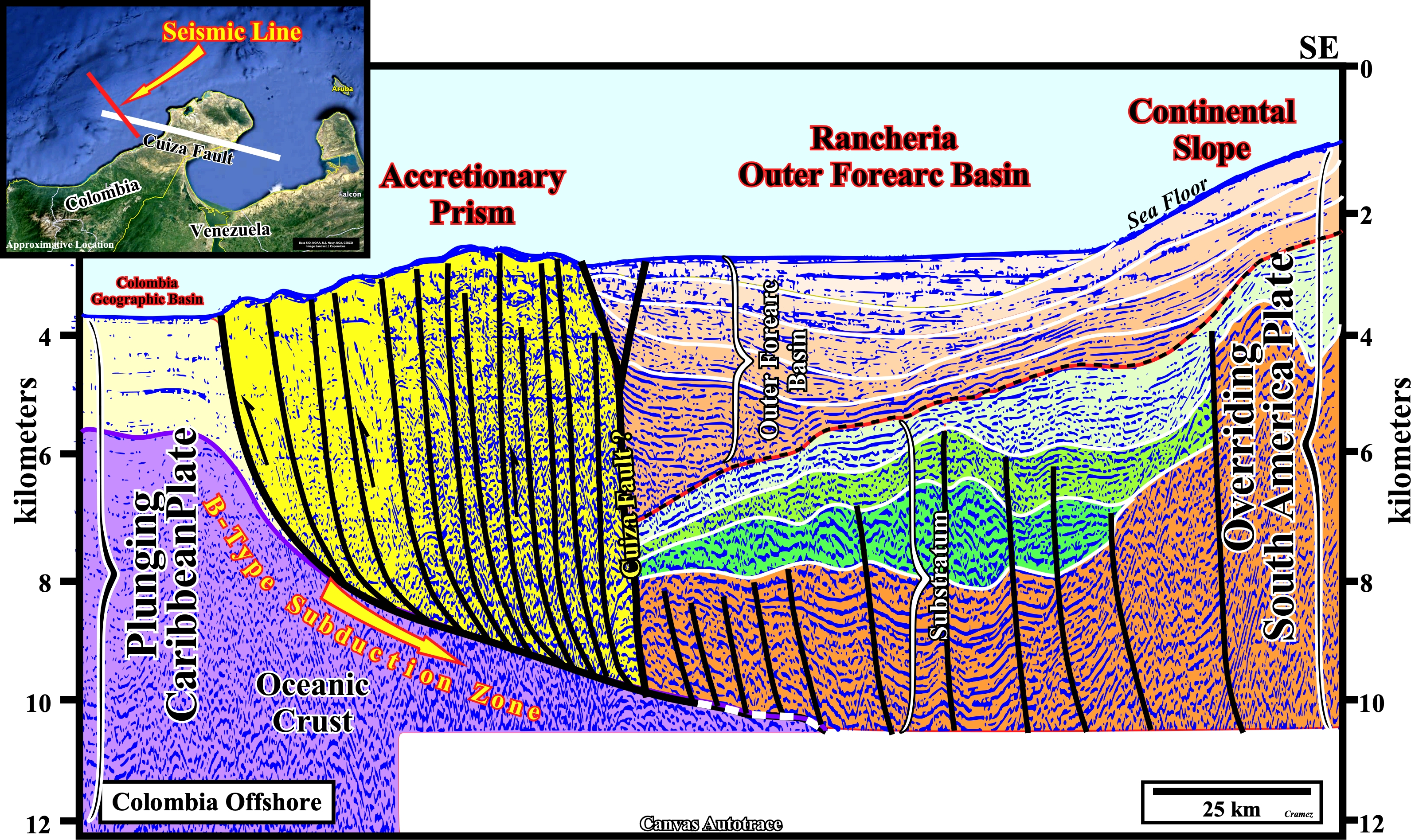
On this tentative geological interpretation, in the overriding lithospheric plate we recognize the accretionary prism and the Rancheria outer forearc basin, as well as the lower continental slope. The limit between the accretionary prism and the outer forearc basin seems to correspond to the Cuiza fault zone. The limit between the accretionary prism and the pelagic sediments of the Colombia geographic basin is highlighted by the frontal thrust of the accretionary prism. The B-subduction zone along which the Caribbean plate plunges under the South America Plate is, easily, recognized.
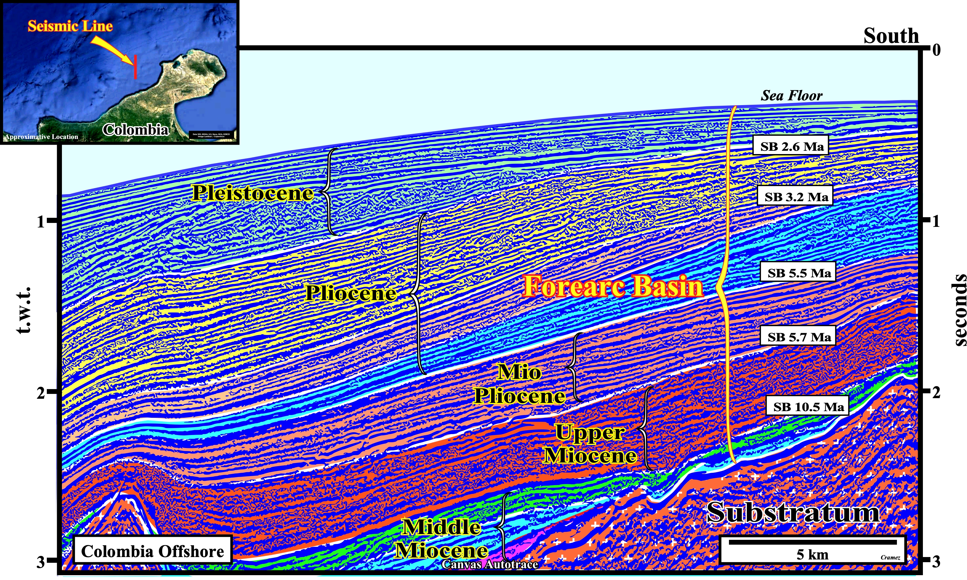
The seismo-stratigraphy of the Rancheria forearc basin, above a Gondwana substratum, can be proposed as illustrated. The different seismic packages correspond to sequence stratigraphic cycles induced by third order eustatic cycles, which time duration ranges between 3.5 and 5.0 My. They are bounded by unconformity, i.e., erosional surfaces created by relative sea level changes, induced by the combined action of the absolute sea level changes and tectonics. The relative sea level changes not only have always controlled the stratigraphy, but control the coastal morphology. In fact, local relative sea level changes are what matters for the coastal planning. They are, highly, variable around of the world since they depend upon the different rates at which particular coasts are undergoing tectonic uplift (isostatic re-equilibrium, e.g., Norway) or subsidence (epeiro-eustasy, induced by the due to the weight of sediments and buildings or due to water pumping water, as is happening in the majority of the coastal cities).
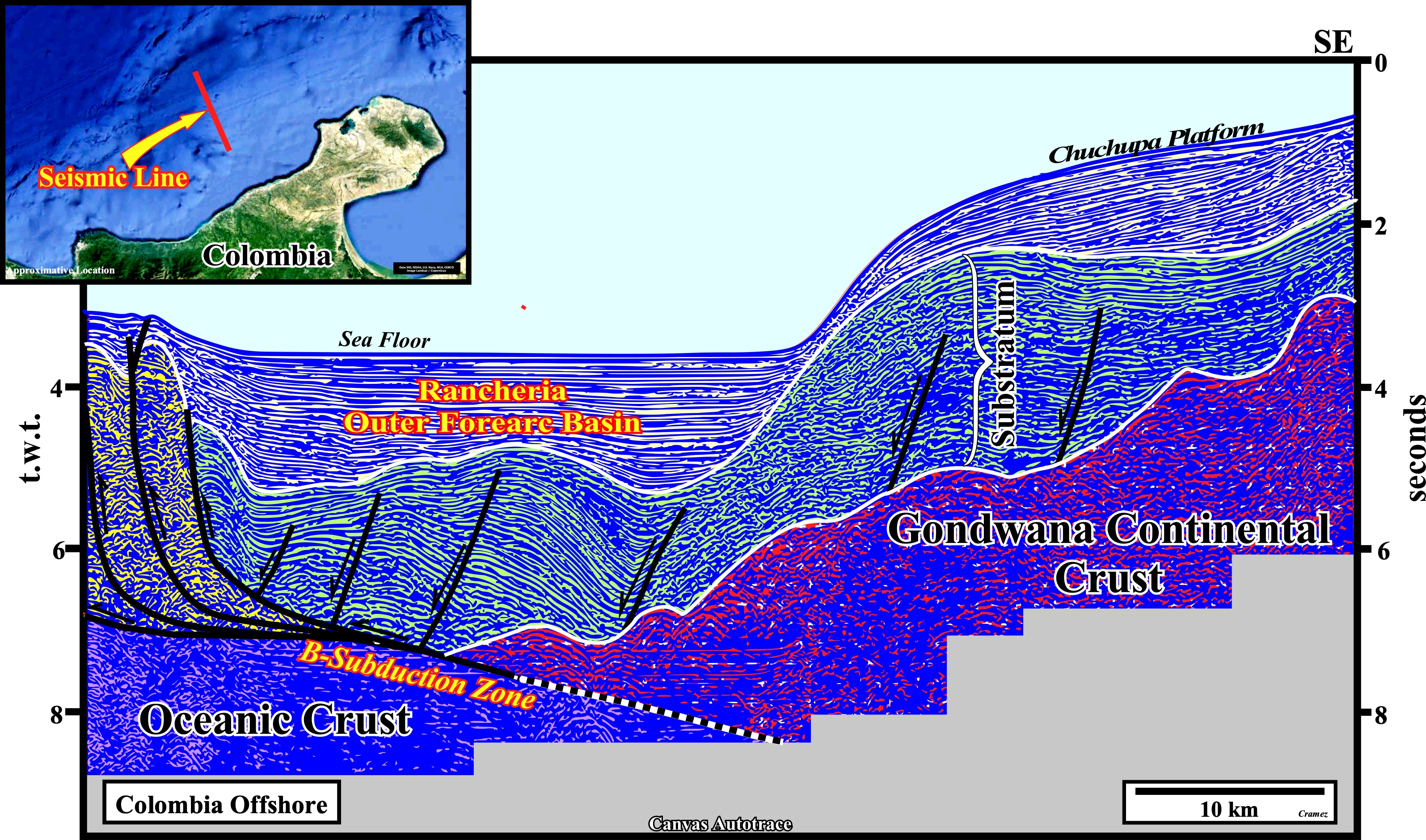
On this tentative interpretation the relations between the B-subduction zone, in which the oceanic crust plunges under the South America Gondwana continental crust, the accretionary prism, the lengthening of the sediments of the substratum and the Rancheria outer forearc basin are, clearly, recognized. The deformation of the accretionary forearc matches with the forearc basins single-wedge model (A. Noda and A. Myakaway, 2017), i.e, the sediments are less shortened but they are tilted landward because the outer arc highs move seaward with displacements of the thrusts faults in the accretionary wedges. In fact, the basin width is extended by this seaward movement of the outer-arc high, as well as, due to the landward migration of the depocenter.
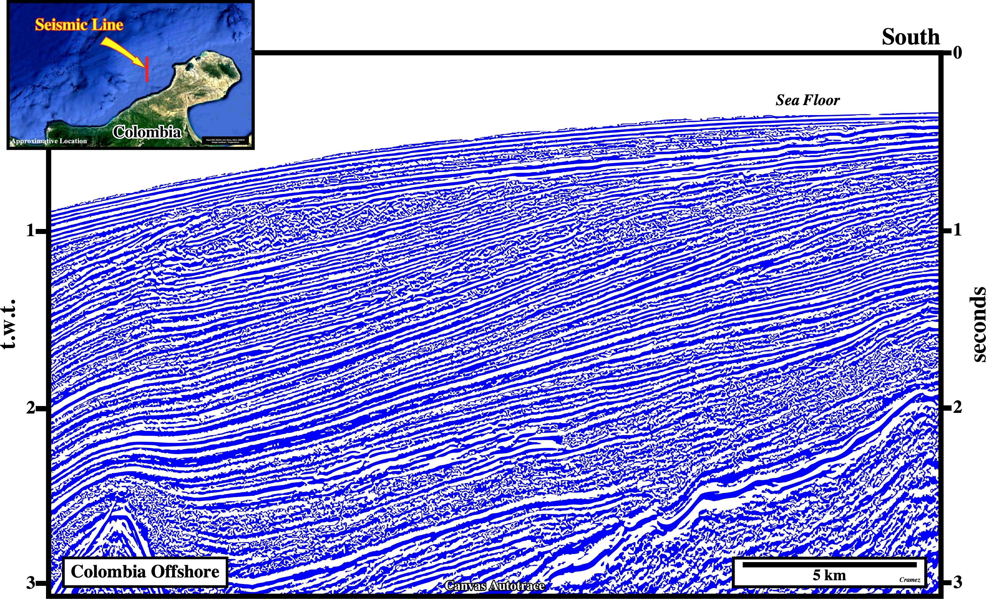
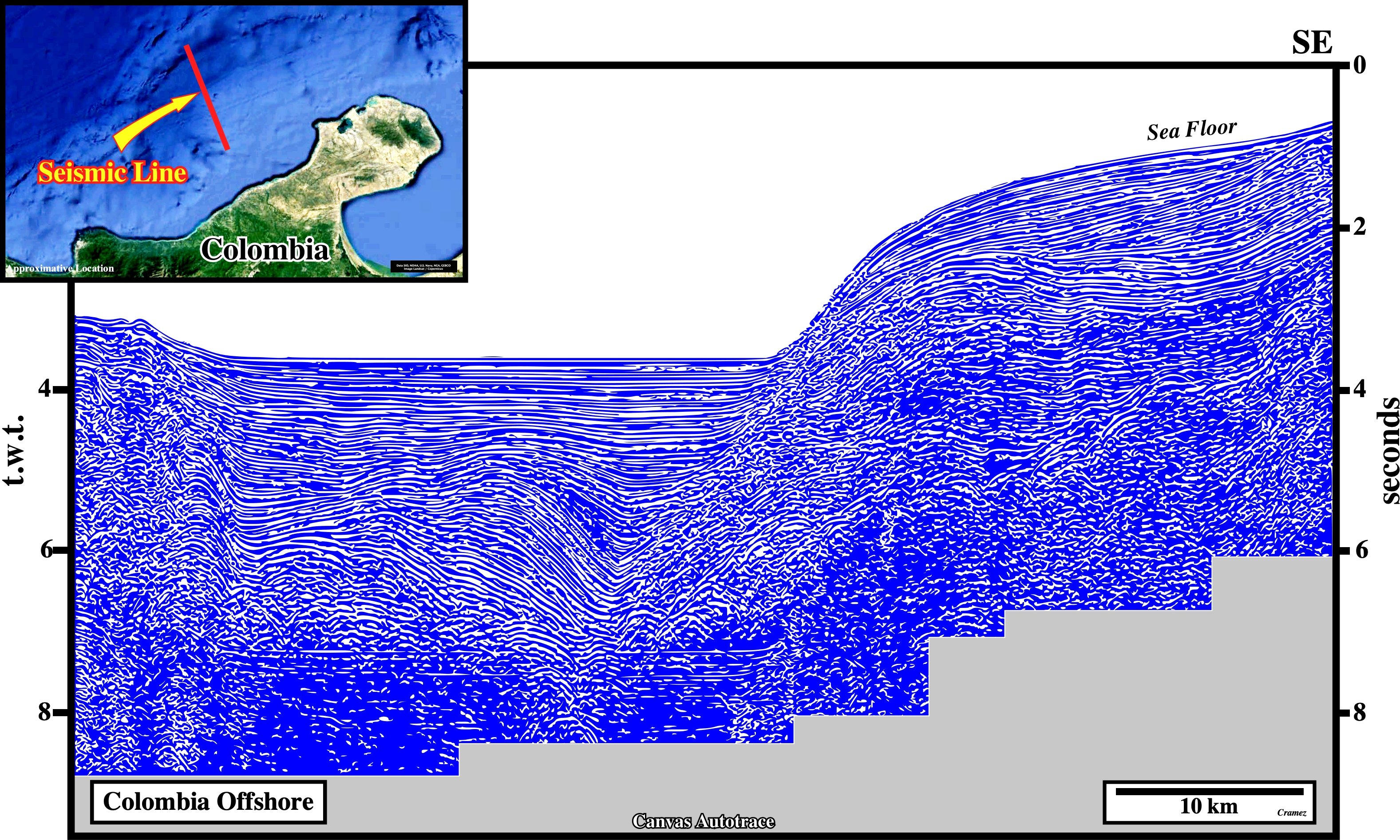
This Canvas autotrace is, more or less, parallel to the previous one, but a little bit longer. The frontal thrusts of the accretionary are, readilym recognized, as well as, the deepwater pelagic sediments deposited on the descending plate (Colombia geographic basin). Contrariwise, the decollement surface on which the thrust faults of the accretionary prism die, and the B-subduction zone are completely masked by the multiples of the sea floor, reason why any tentative geological interpretation is proposed.

![]()
![]()
Send E-mails to carlos.cramez@bluewin.ch with comments and suggestions to improve this atlas.
Copyright © 2001 CCramez
Last update:
2022
![]()