
Argentina Offshore
SE Malouines Offshore

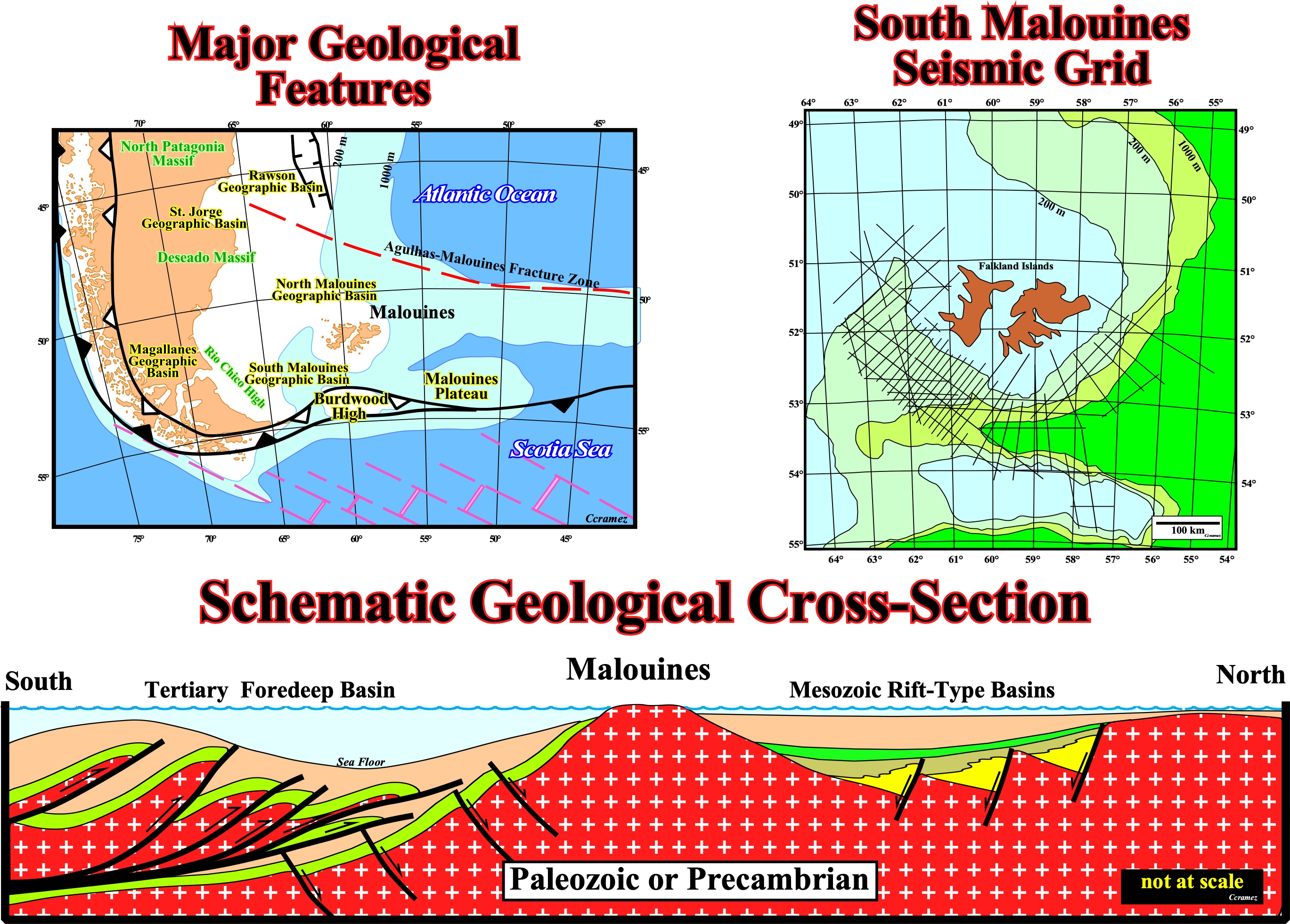
The major sedimentary basins of the Malouines (Falkland Islands) offshores, which are limited between the Agulhas-Malouines fracture zone and the A-subduction zone (Ampferer subduction) bounding the Burdwood High are illustrated on this South-North schematic geological cross-section. Roughly speaking, it can be said, Mesozoic rift-type basins, developed during the lengthening of the Gondwana continental crust, i.e., before the breakup of the lithosphere, are preponderant in North Malouines offshore, while a Tertiary foredeep basin, associated with the A-subduction zone bordering the northern northern flank of the Burdwood High, is the preponderating depocenter in south Malouines offshore as illustrated below.

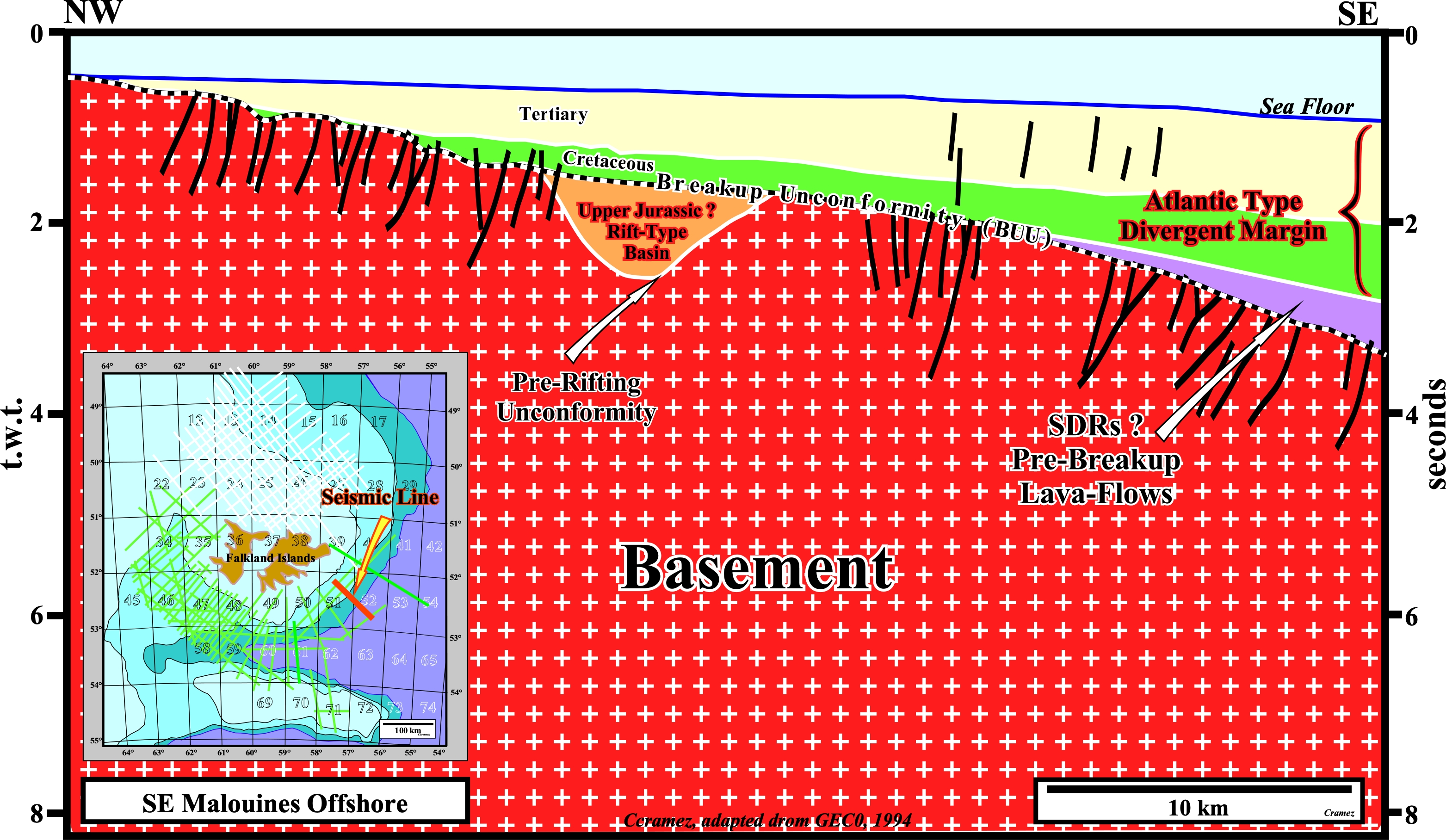
This tentative interpretation of a seismic line of the SE Malouines offshore shows : (i) A rift-type basin developing during the lengthening of the continental crust of Gondwana small supercontinent ; (ii) The pre-rifting unconformity at the base of the rift-type basin ; (iii) The breakup unconformity, which cap the rift-type basin ; (iv) The SDRs, that is to say, the post breakup lava-flows, which, partially, fossilize the breakup unconformity, thickening seaward, i.e., toward the expansion centers and the (v) The Atlantic-type divergent margin, in which a retrogradational interval colored in green (transgressive phase), and a progradational interval colored in yellow, (regressive phase), separated by a major downlap surface, can be recognized. It is interesting to notice the development in the basement of a normal faulting system as the thermal subsidence increases basinward.
Send E-mails to carlos.cramez@bluewin.ch with comments and suggestions to improve this atlas.
Copyright © 2001 CCramez
Last update:
2022