
Argentina Offshore
Offshore of Colorado Geographic Basin
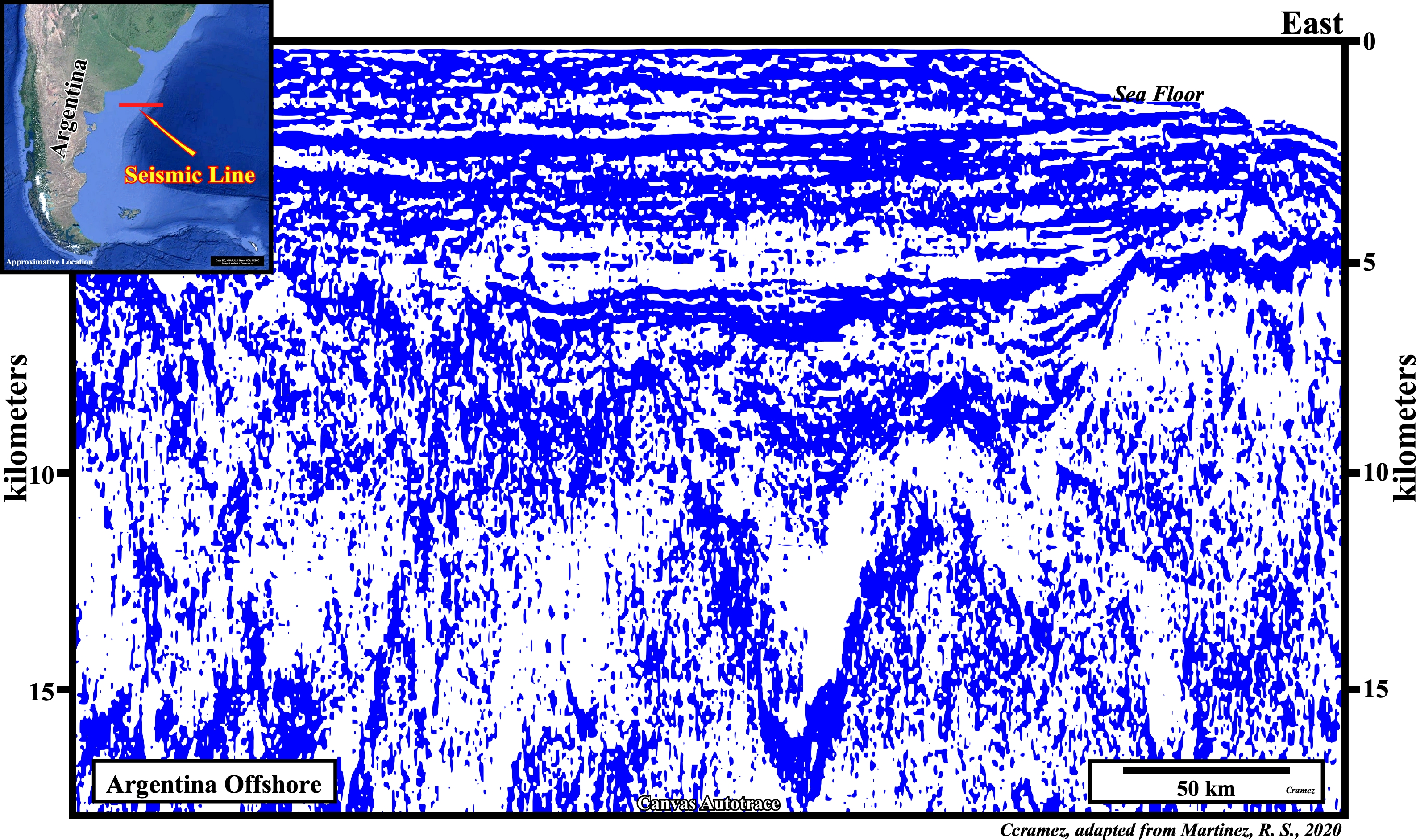
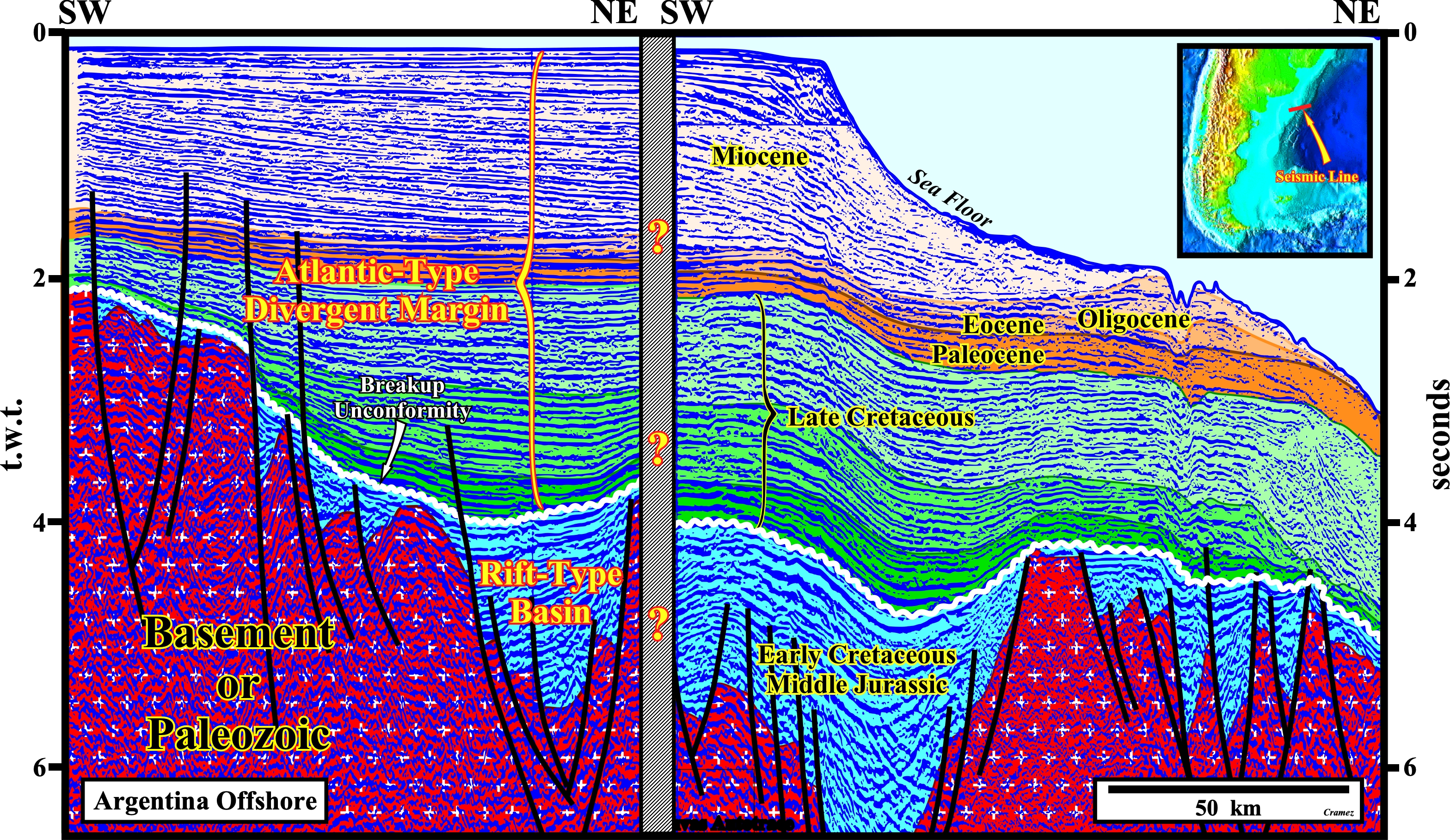
This Canvas autotrace of a regional seismic line of the Argentina offshore illustrates the Colorado geographic basin developed above a Paleozoic substratum. Jurassic rift-type basins and the Meso-Cenozoic Atlantic-type divergent margin are, easily, recognized. They are individualized by the breakup unconformity that caps the rift-type basins. The Cretaceous transgressive phase (colored in green) and the Tertiary regressive (colored in yellow) are separated by a major downlap surface, whose subhorizontal geometry (no evidence of significant subsidence) emphasizes the predominance of eustasy in the creation of the space available for sediments (accommodation).
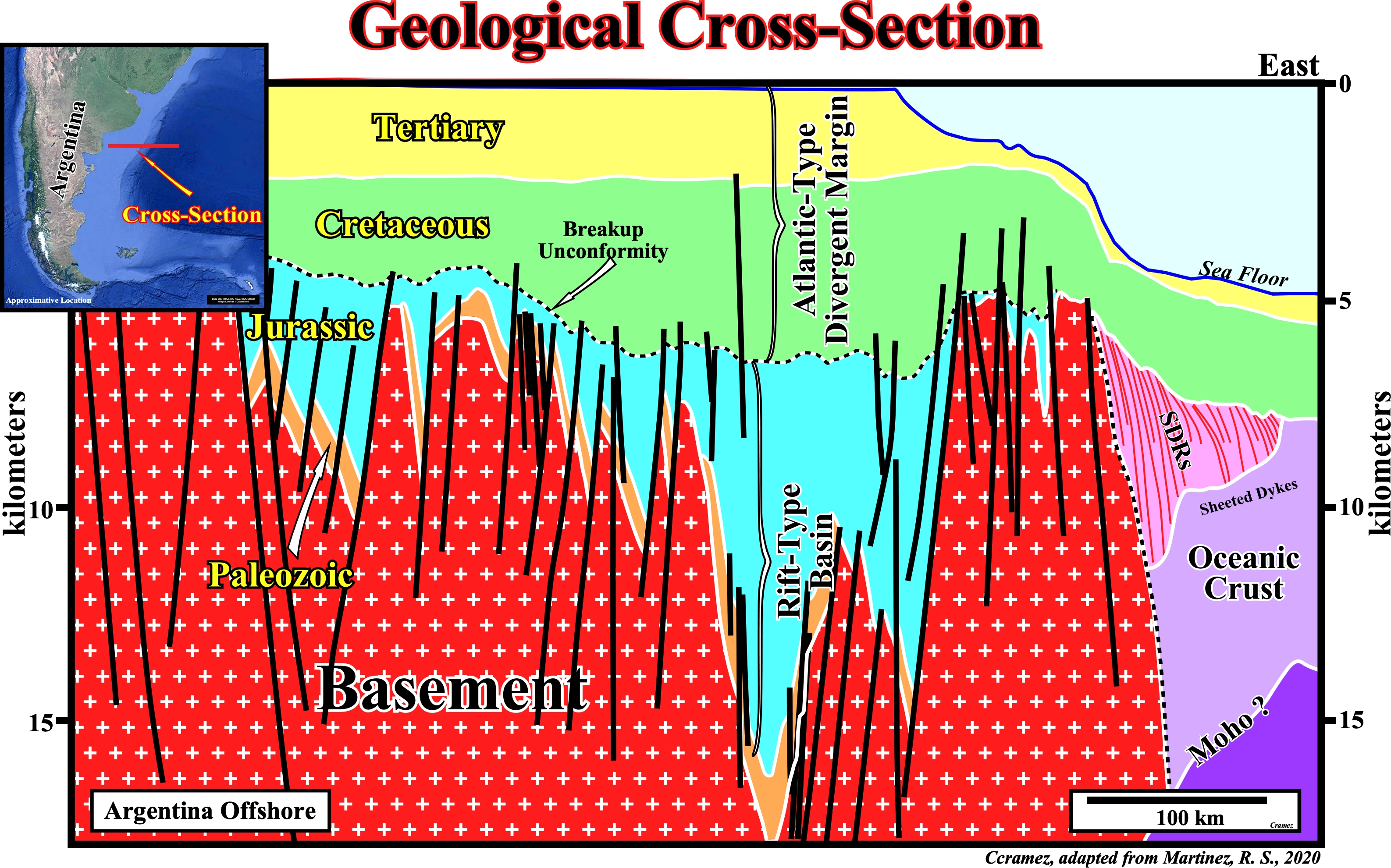
This geological cross-section of the Colorado geographic basin (Argentina offshore) shows the distal part of the Atlantic-type divergent margin (the central part corresponds to the tentative interpretation of the previous autotrace). On this cross-section, it was assumed the breakup of the Gondwana continental margin was done, mainly, by injection of mantle material till the individualization of the lithospheric plates (South America and Africa), with development of the SDRs (lava-flows) effusing from the expansion centers toward the continents, while the expansion centers (mainly sheeted dykes) were sub-aerial and oceanic crust since the expansion centers were put under the water.
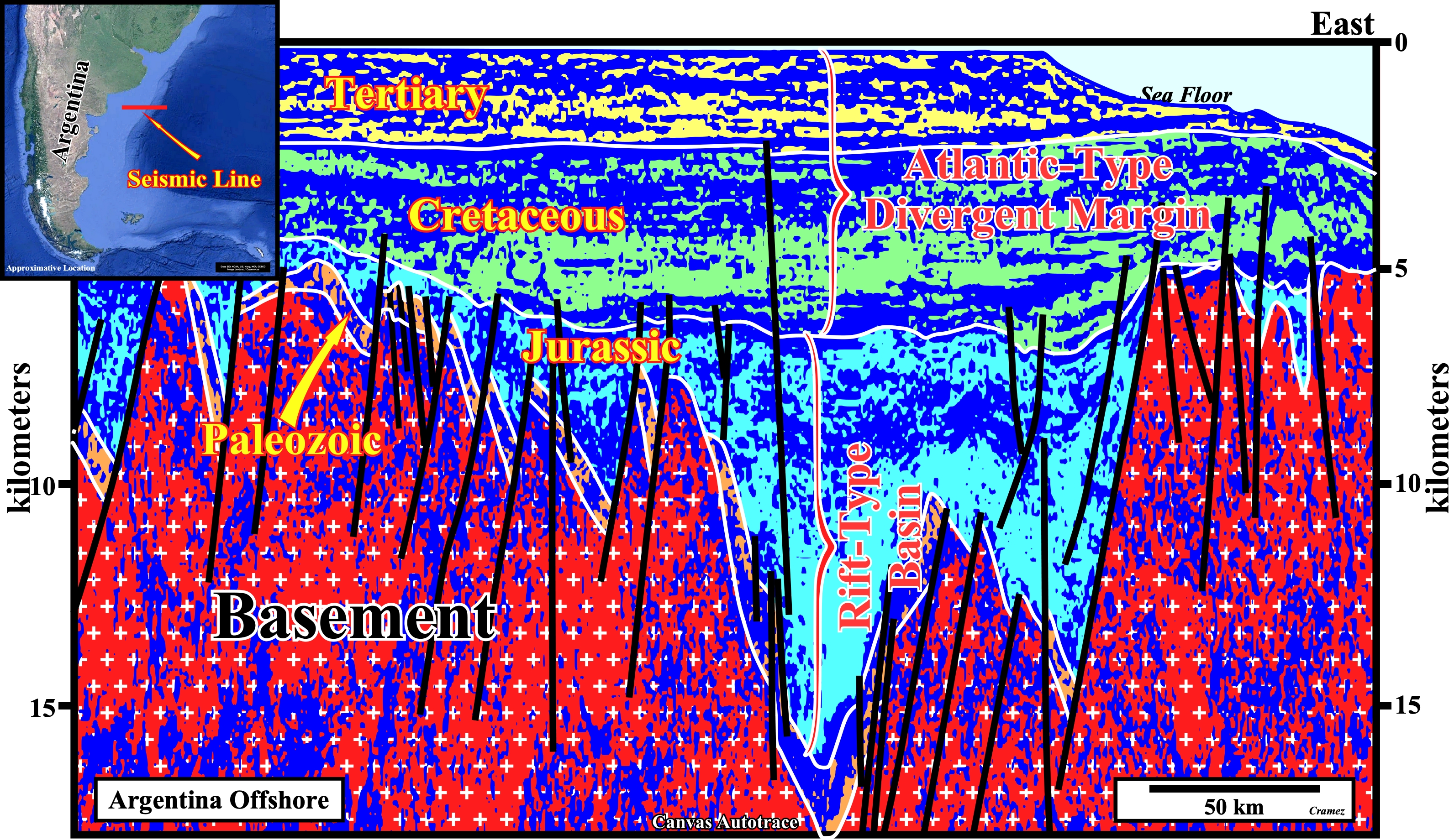
On this tentative geological interpretation of a Canvas autotrace of a modern composite seismic line of the Argentina offshore (Colorado geographic basin), the most important geological features are easily recognized: (i) The pre-rifting unconformity (bottom of the blue interval) ; (ii) The Early Cretaceous / Middle Jurassic rift-type basin and the (iii) Meso-Cenozoic Atlantic-type divergent margin. The limit between the transgressive phase of the margin, which, normally, is characterized by an upbuilding retrogradational geometry, and the progradational regressive phase is not quite sharp. However, admittedly, the Miocene interval has a progradational geometry, while the Late Cretaceous interval has an upbuilding retrogradational geometry. Do not forget to take into account the pitfall induced by the abrupt change in the water-depth.

![]()
![]()
Send E-mails to carlos.cramez@bluewin.ch with comments and suggestions to improve this atlas.
Copyright © 2001 CCramez
Last update:
2022
![]()