
Brazil Offshore
Sergipe-Alagoas Geographic Basin
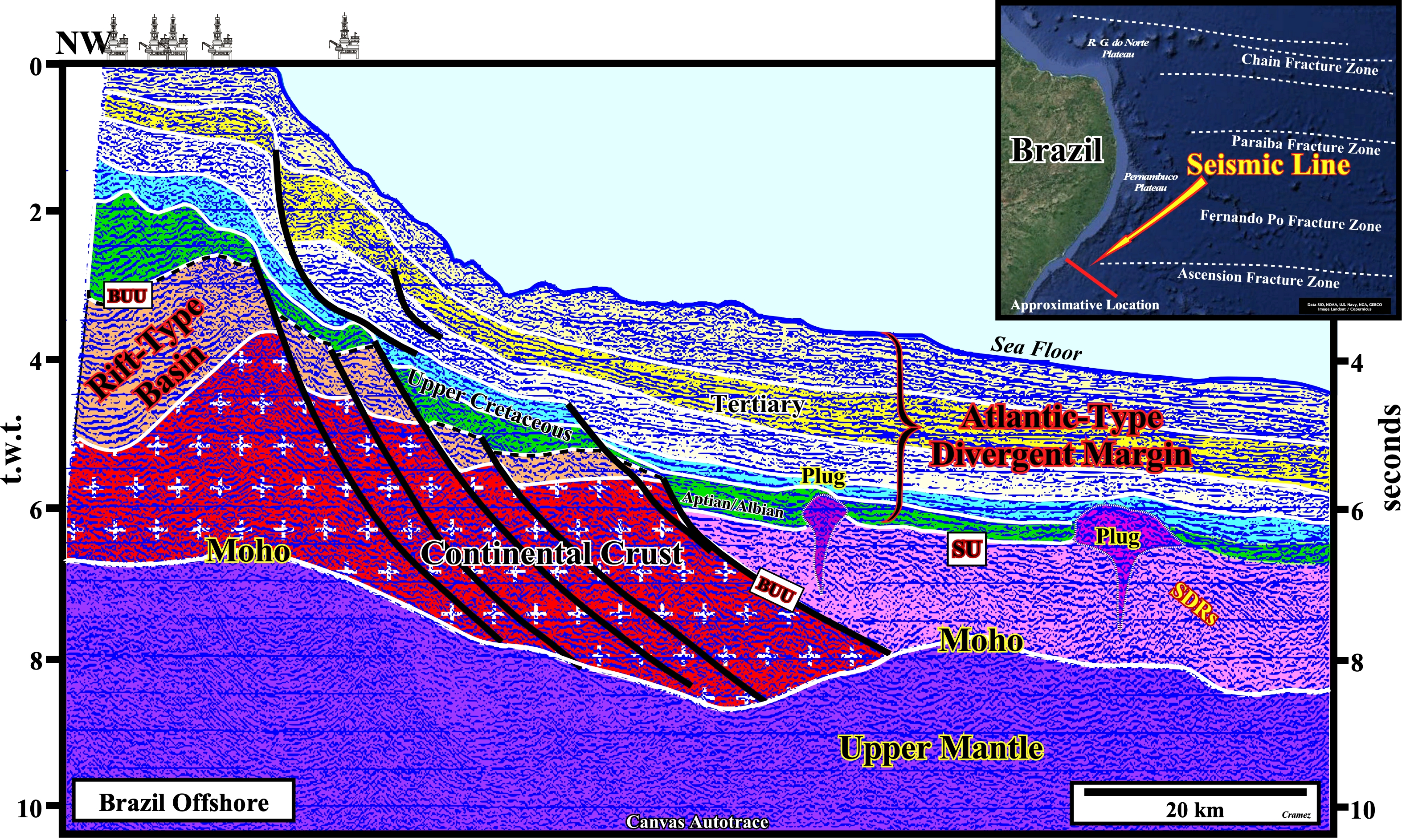
Before trying to falsify this tentative geological interpretation, it is important to take into account the seismic pitfall induced by the abrupt change in the water depth. In a depth version of the original seismic line, the seaward tilting of the Atlantic-type margin sediments observed on this time version disappear almost completely. In fact the distal seismic horizons are, if not sub-horizontal, dip continentward. Above the Moho discontinuity, on the western part of the autotrace, where the lava-flows (SDRs) do not reach the rift-type basins of the lengthened Gondwana continental crust, the stratigraphic column is conventional: (i) Basement ; (ii) Rift-type Basins ; (iii) Breakup unconformity and (iv) Clastic sector of the Atlantic type divergent margin. On the eastern part of the autotrace, above the Moho, just the Atlantic-type divergent margin sediments are deposited. The lava-flows or SDRs, which form the volcanic sector of the margin and the sediments of the clastic sector, that is to say, the Gondwana continental crust and the sediments of the rift-type basins are not present.
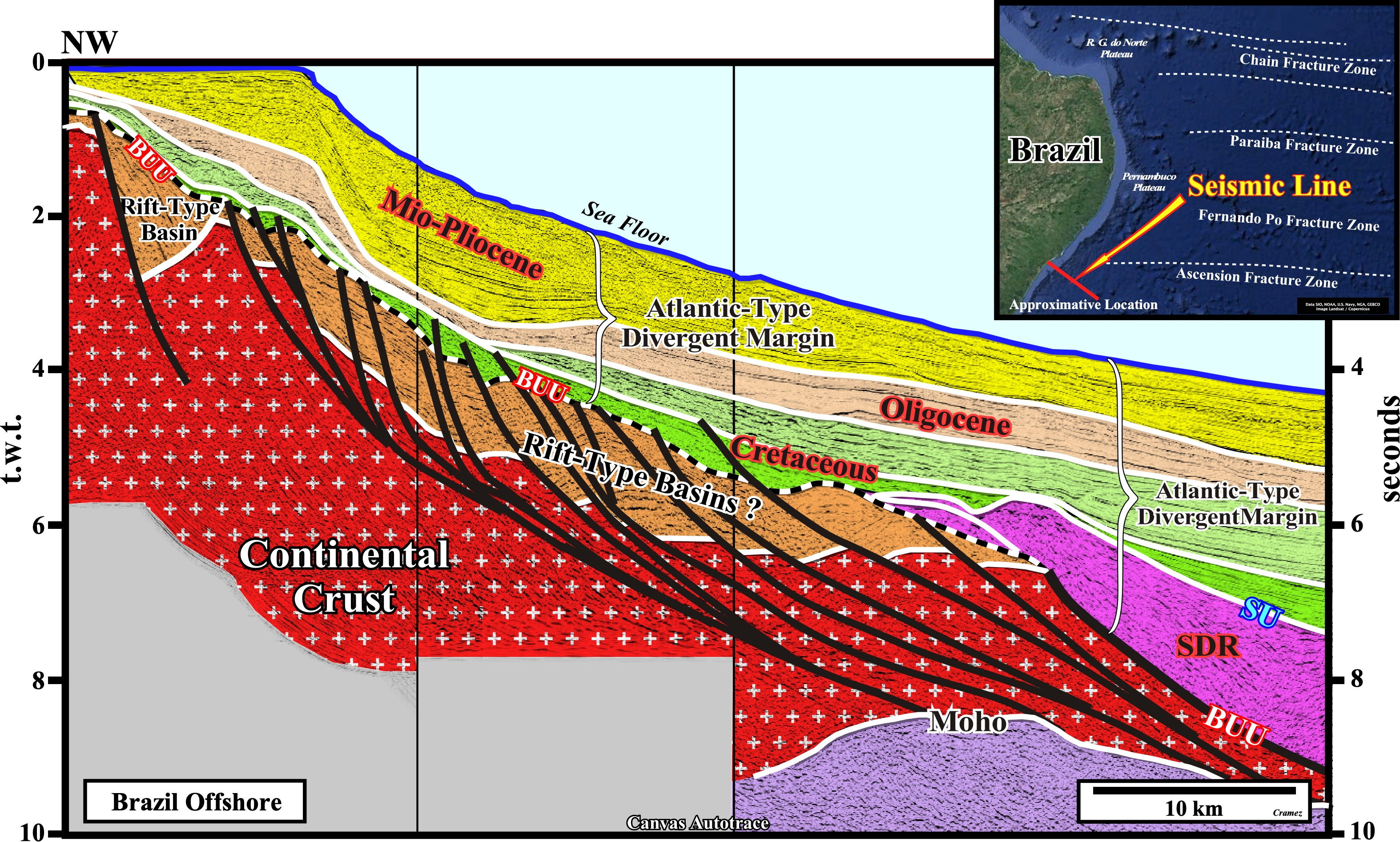
This tentative geological interpretation of a Canvas autotrace of a seismic line shot in the same area than the previous autotrace, seems to corroborate the interpretation conjectures advanced previously, particularly the abrupt contact (faulted) between the lava-flows, which postdate the lengthening and thinning of Gondwana continental crust, i.e., the breakup unconformity (BUU), during which the rift-type basins are developed. Notice that in geology, just the development of normal faults can, mechanically, extend rocks. Since the breakup of a supercontinent, the continental crust is, mainly, accreted by volcanic crust (initially sub-aerial and then by oceanic) but not more lengthened and thinned.

![]()
![]()
Send E-mails to carlos.cramez@bluewin.ch with comments and suggestions to improve this atlas.
Copyright © 2001 CCramez
Last update:
2022
![]()