
Bight Geographic Basin
Duntroon Geographic Sub-Basin
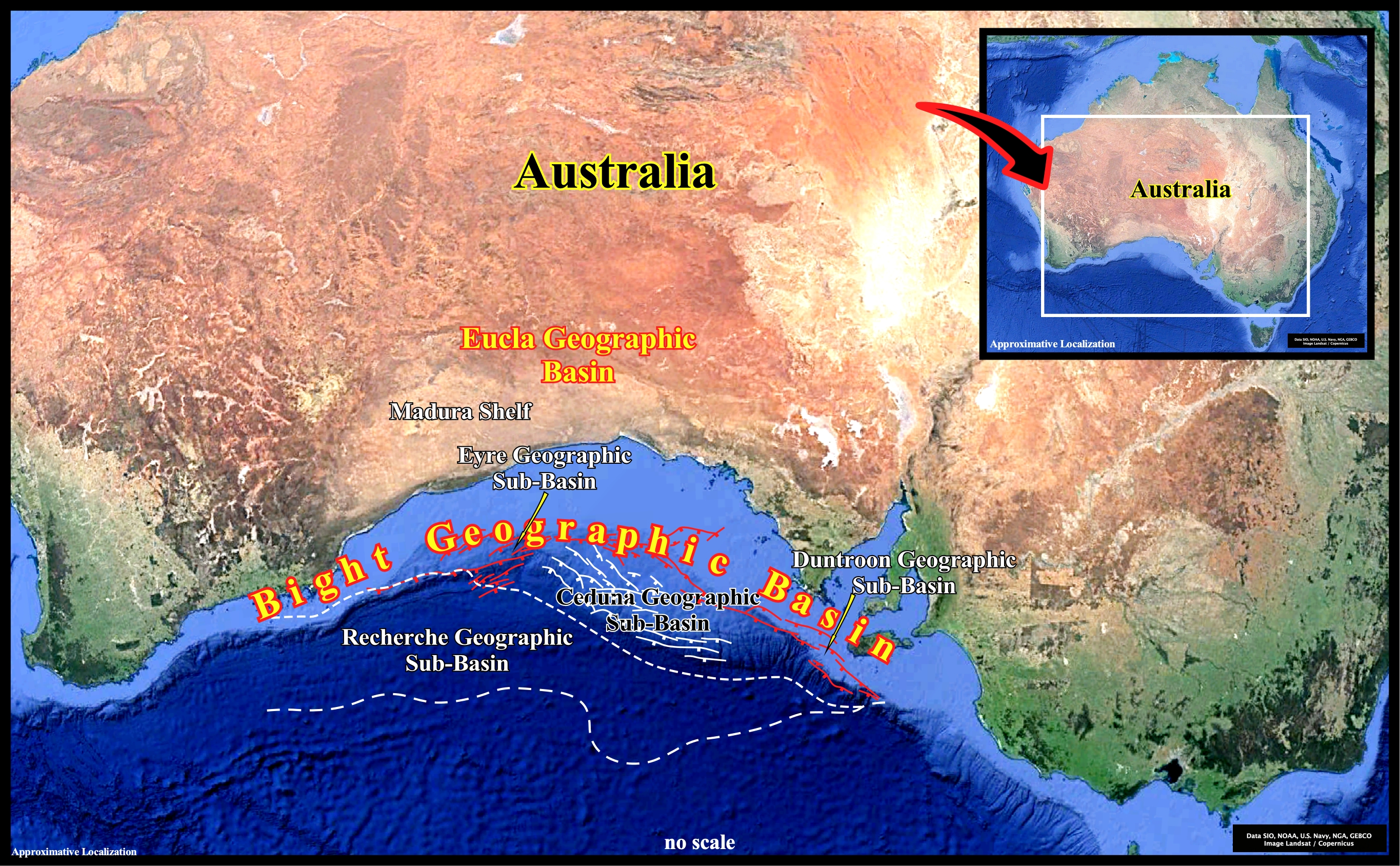
The Bight geographic basin was formed during the lengthening of the lithosphere and subsequent sea floor spreading . Rift-type basins are created before the break-up of the Eastern Gondwana small supercontinent in the Late Jurassic and the Atlantic-type divergent margin, during the sub-aerial and oceanic expansion. In fact, according the plate tectonics paradigm, since large slabs of the Earth's lithosphere split apart from each other (breakup unconformity), probably due to the heat carried via the mantle convection currents, sea floor spreading (sub-aerial and then oceanic), progressively, creates new crust, balancing, roughly, the consumption of the old oceanic crust along the B-type subduction zones. Geological speaking, the Bight geographic basin, correspond to the stacking of rift-type basins, developed during the lengthening of the Pangea lithosphere and the Atlantic-type divergent margin (post-Pangea continental encroachment stratigraphic cycle) developed since the breakup unconformity, i.e., during the oceanic expansion (sea floor). It extends for more or less 2000 km along the Australian southern margin and it comprises a series of sedimentary depocenters as Denmark, Bremer, Eyre, Recherche and Ceduna geographic sub-basins.
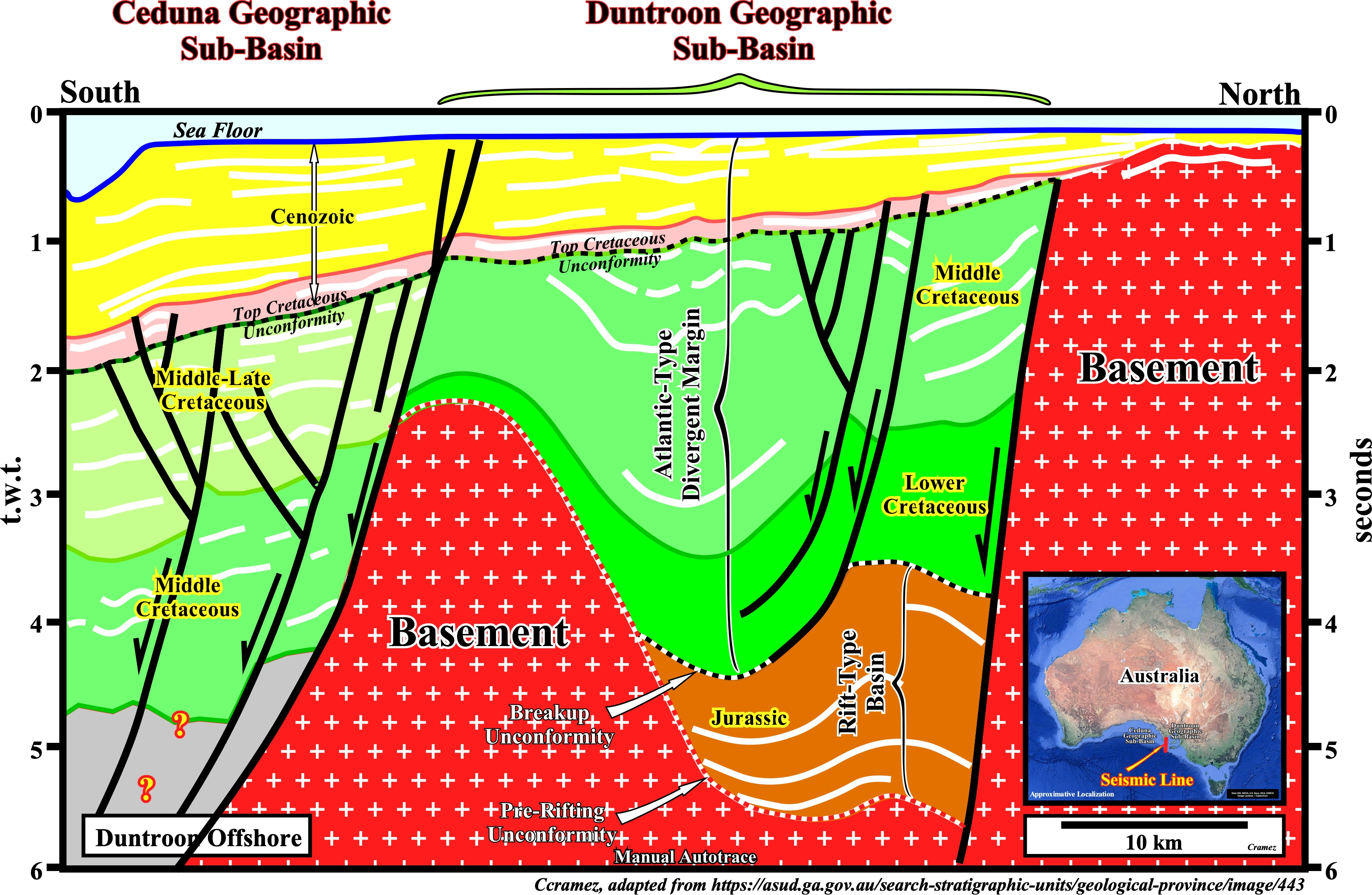
As illustrated on this tentative geological interpretation of a manual autotrace of a conventional offshore seismic line of South Australia offshore (Bight geographic basin), the Duntroon and Ceduna geographic sub-basins are individualized, easily. They are separated by a buried hill of the basement (pre-rifting rocks). In Bally & Snelson's sedimentary basins classification (1980), both sub-basins correspond to the stacking of two different types of sedimentary basins characterized by different realms of subsidence : (i) Differential Subsidence Realm, associated with the lengthening of the lithosphere and (ii) Thermal Subsidence Realm, associated with the breakup of the lithosphere and subsequent sea floor spreading. However, as illustrated on this tentative interpretation, just the Duntroon geographic sub-basin is depicted completely. At the bottom of this geographic sub-basin, there is a Jurassic-Early Cretaceous rift-type basin, comprising fluvial to paralic sediments, which are overlain by an Atlantic-type divergent margin formed by near-shore marine to non-marine Cretaceous sediments covered discordantly a thin Cenozoic package (see next Canvas autotrace).
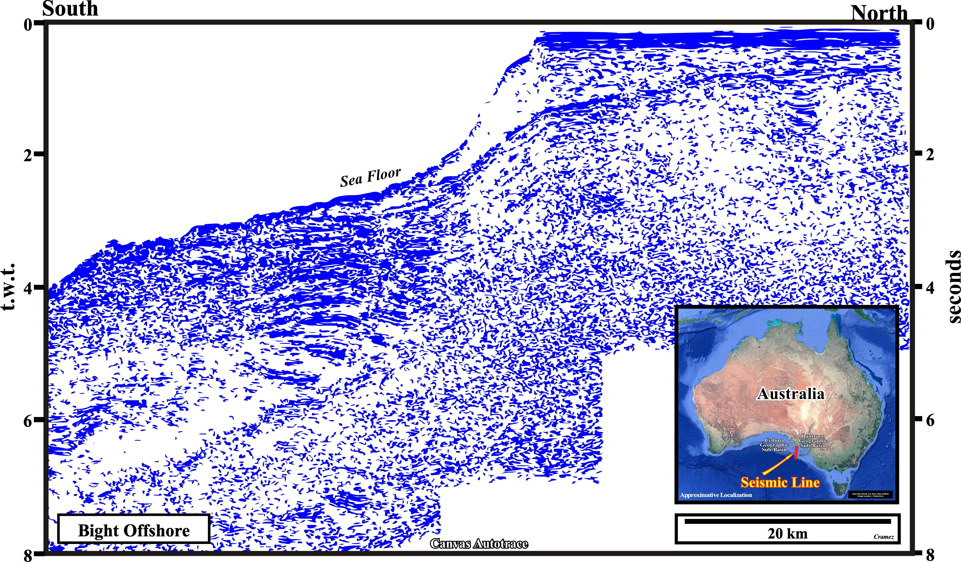
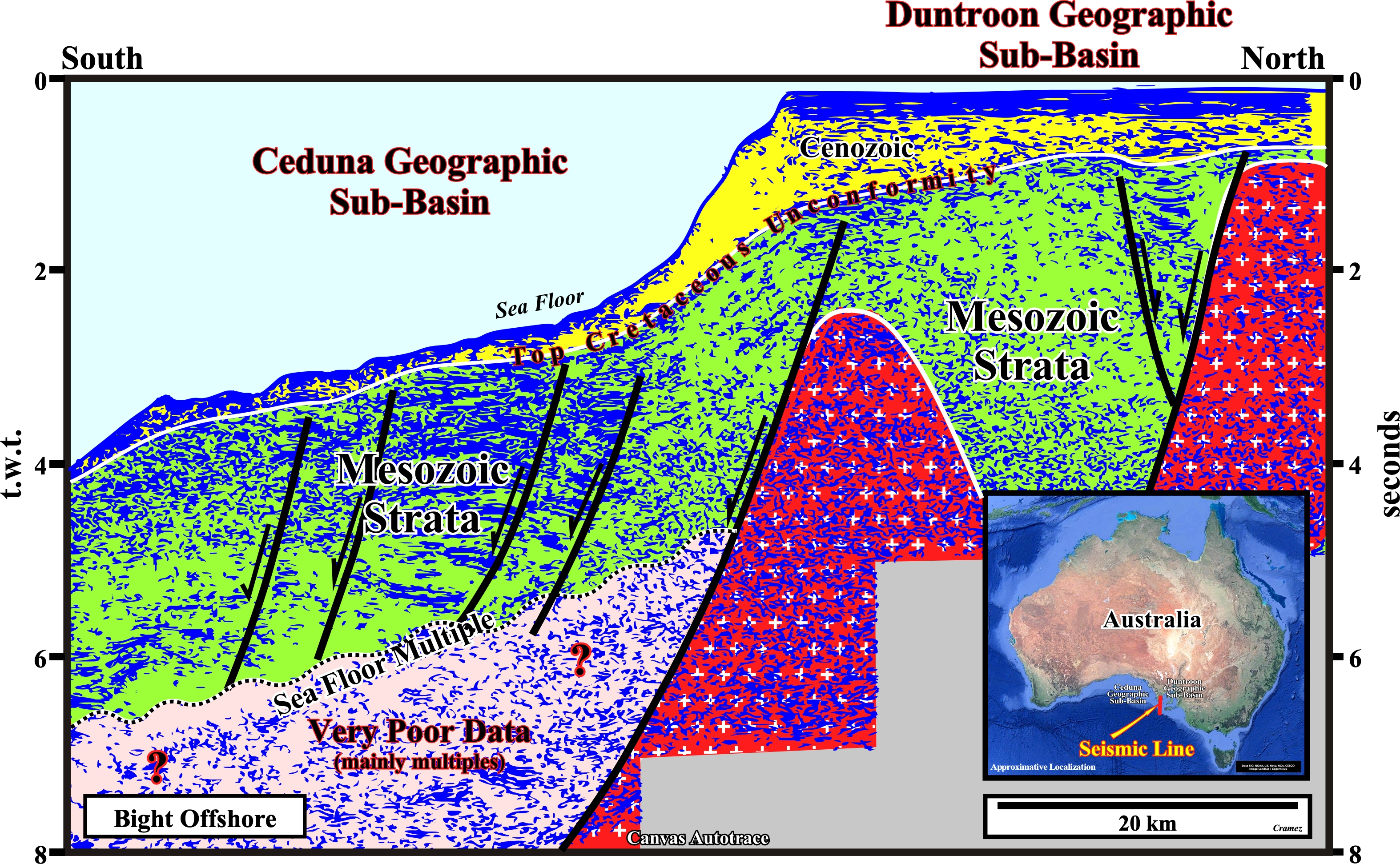
In spite of the poor quality of the original seismic line knowing its approximative location and the geology of the area depicted on the previous manual autotrace, it is possible to recognize the architecture the Ceduna and Duntroon geographic sub-basin, which area well individualized by a buried hill of the substratum (basement or pre-rifting rocks). As depicted above an important Early-Late Cretaceous delta systems with distinctive sediment load driven growth faults seems to be developed in the Ceduna geographic basins. Certain geoscientists, as H. Griffiths, consider that this syn-sedimentary fault system is pervasive throughout the Cenomanian and Turonian deltaic section dying on decollement surface (See Page 9, Ceduna geographic sub-basin) just above the Jurassic rift-type basins forming during the lengthening of the lithosphere, which predates the the separation of Australia from Antarctica (Middle Jurassic).

![]()
![]()
Send E-mails to carlos.cramez@bluewin.ch with comments and suggestions to improve this atlas.
Copyright © 2001 CCramez
Last update:
2022![]()