
Spain Offshore
Gulf of Biscaya
Spain Offshore
Gulf of Biscaya
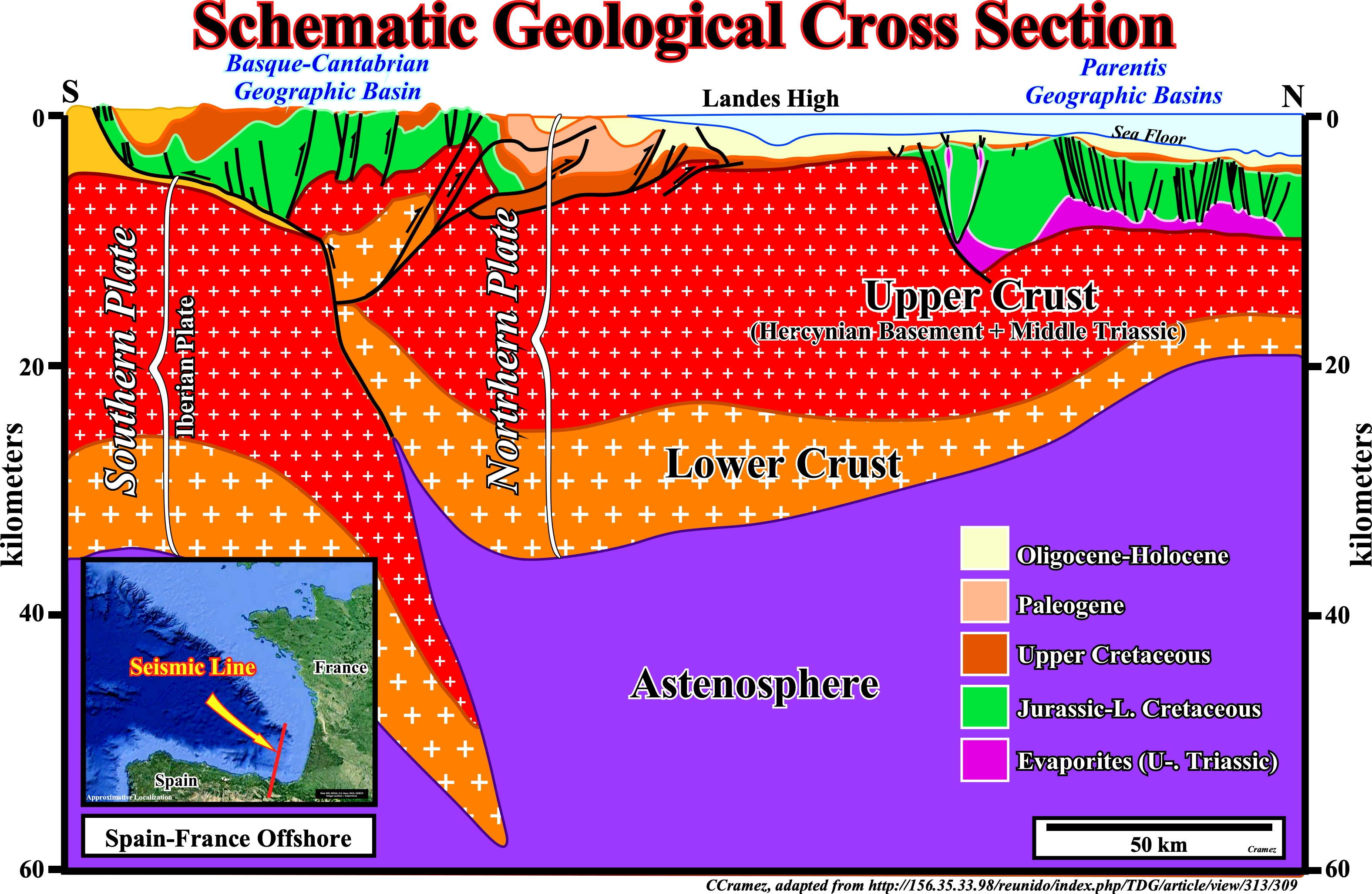
The geological context of the present Iberia-France offshore has nothing to see with a typical that of an Atlantic-type divergent margin. An A-type (Ampferer) subduction zone is, easily, recognized below the Basque-Cantabrian geographic basin. The plunging lithospheric plate (southern plate or Iberian plate) and the overriding lithospheric plate (northern plate are, easily, recognized on this schematic geological cross section. Similarly, northward of the Landes High, an evaporitic depocenter (Parentis geographic basin) is also recognized without difficulty. An advocate of volcanic continental margins can always advance the hypothesis that there are not SDRs (post breakup lava-flows) in this area because they had been sucked down by the subduction zone, what it is difficult to refute, but refutation is not synonym of validation. In fact, taking into account the tectonic context, one cannot refute the conjecture that SDRs were present, as it seems to be the case in the Armorican offshore (see Page 45), but disappeared (sucked down) along the A-subduction, in which associated folded belt and foredeep are recognized on the majority of the seismic lines of North Iberian Margin.
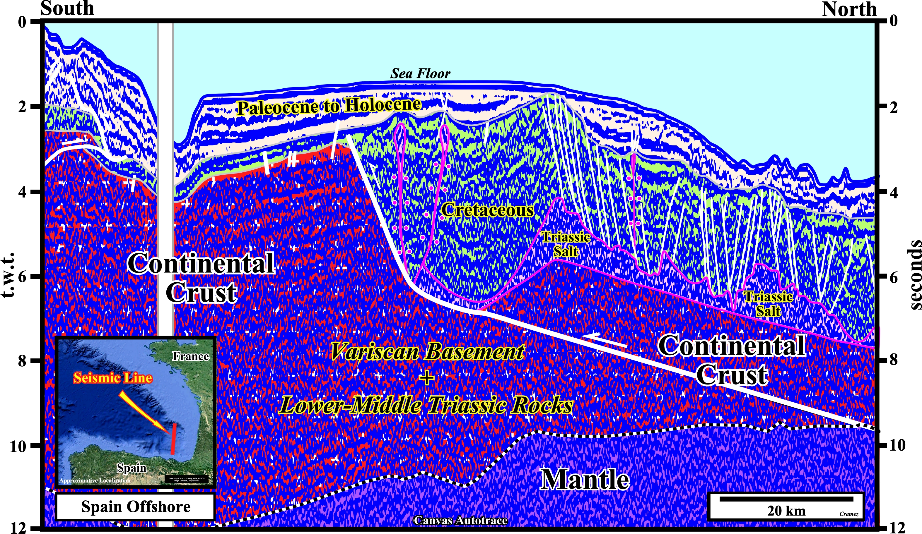
The Parentis geographic basin illustrated by this autotrace, located between an A-type subduction (continental collision boundary) at the south and the Armorican margin in the north, can be considered, in the Bally and Snelson basins' classification, as a Mesozoic perisutural basin fossilized by Paleocene to Holocene sediments. The particularity of this basin, as illustrated on this Canvas autotrace is the presence, at the bottom of the basin, of a Triassic evaporitic layer, which halokinesis creates in the Cretaceous overburden a lot of extensional structures.
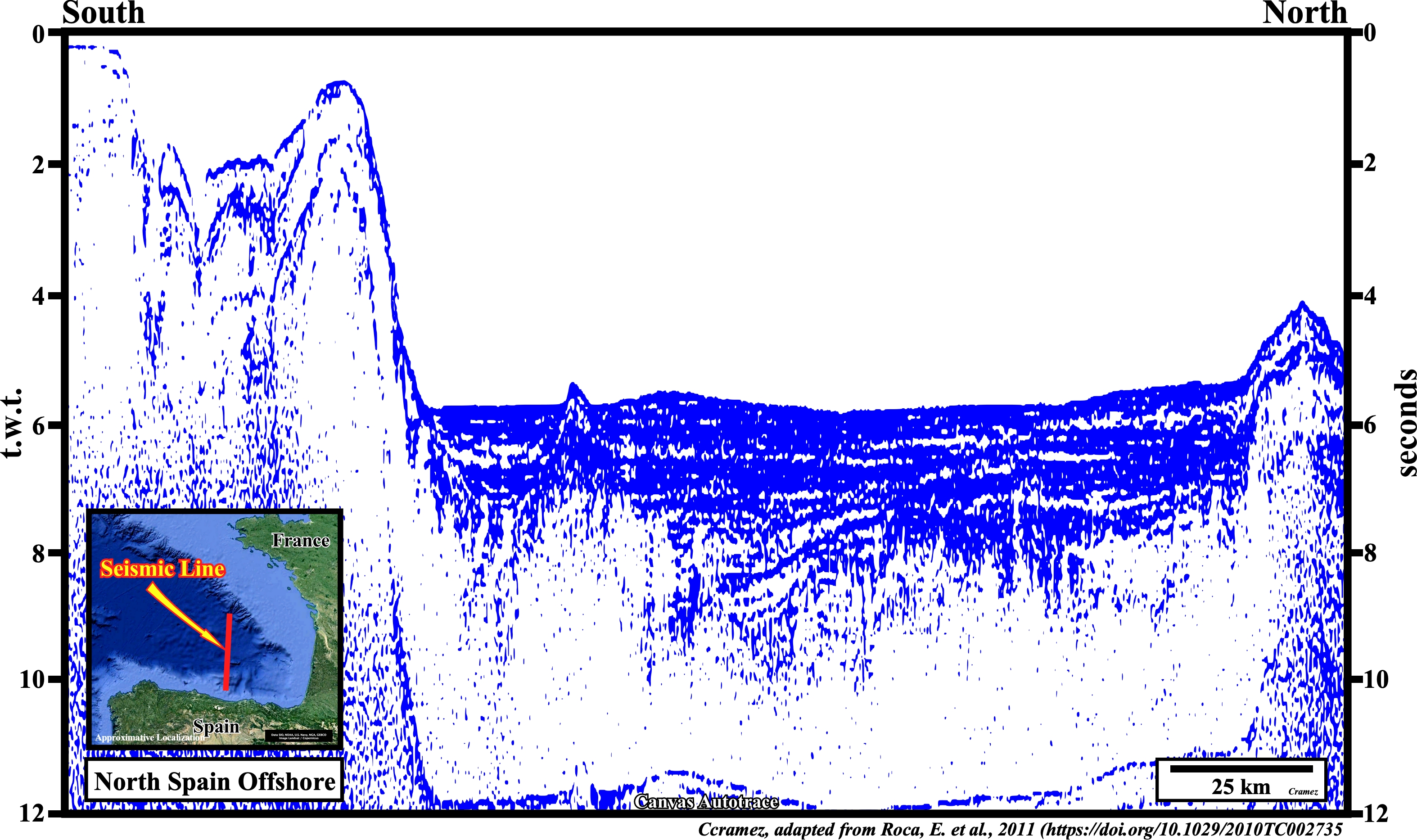
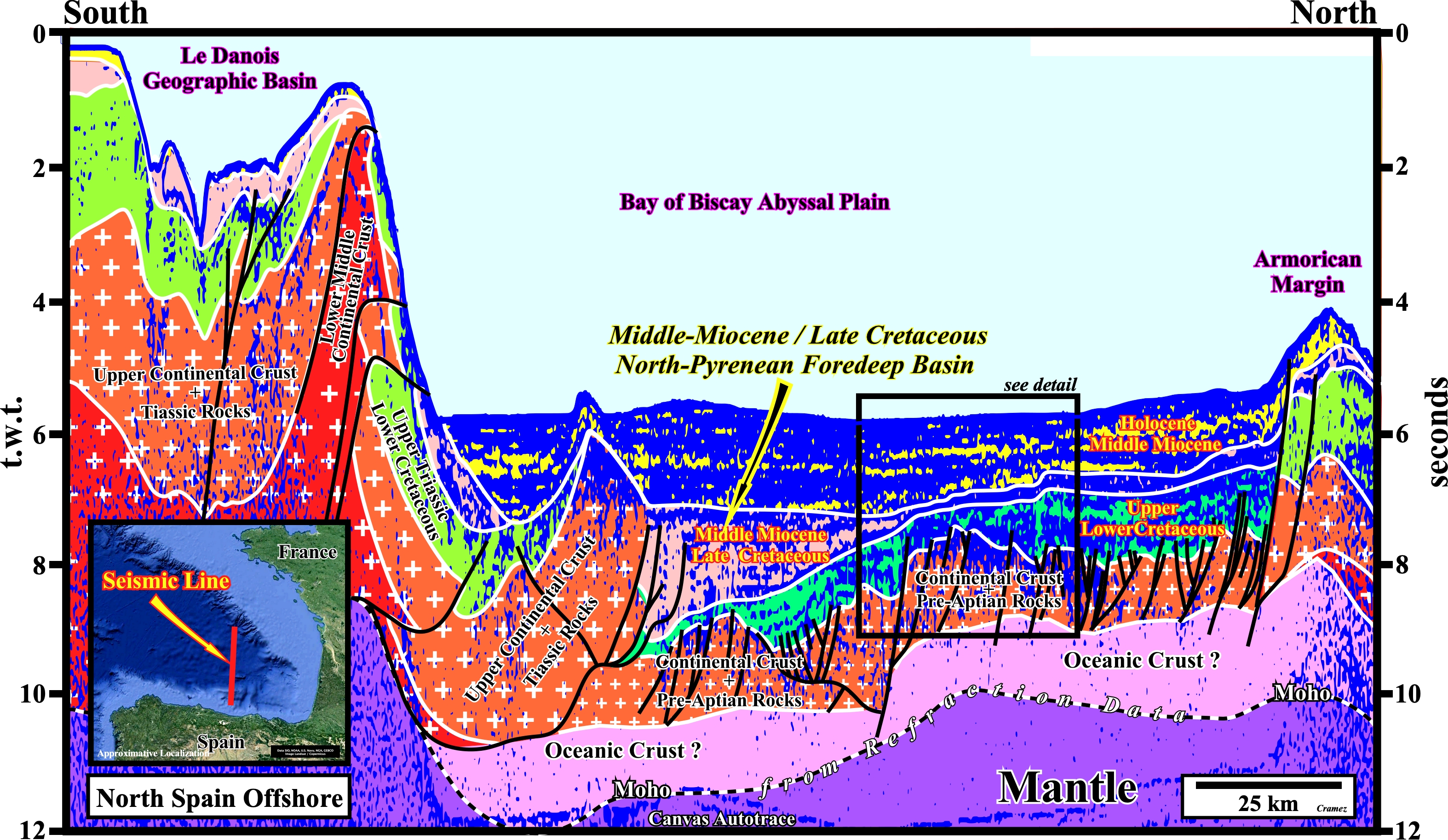
On this tentative geological interpretation of a N-S seismic line shot in Gulf of Gascogne, between the "Le Danois" geographic basin and the Armorican Margin, recognizes the Bay of Biscay abyssal plain, below which is developed a Middle Miocene / Late Cretaceous North Pyrenean Foredeep basin in onlapping above Lower-Upper Cretaceous sediments as illustrated below on the autotrace of a seismic detail.
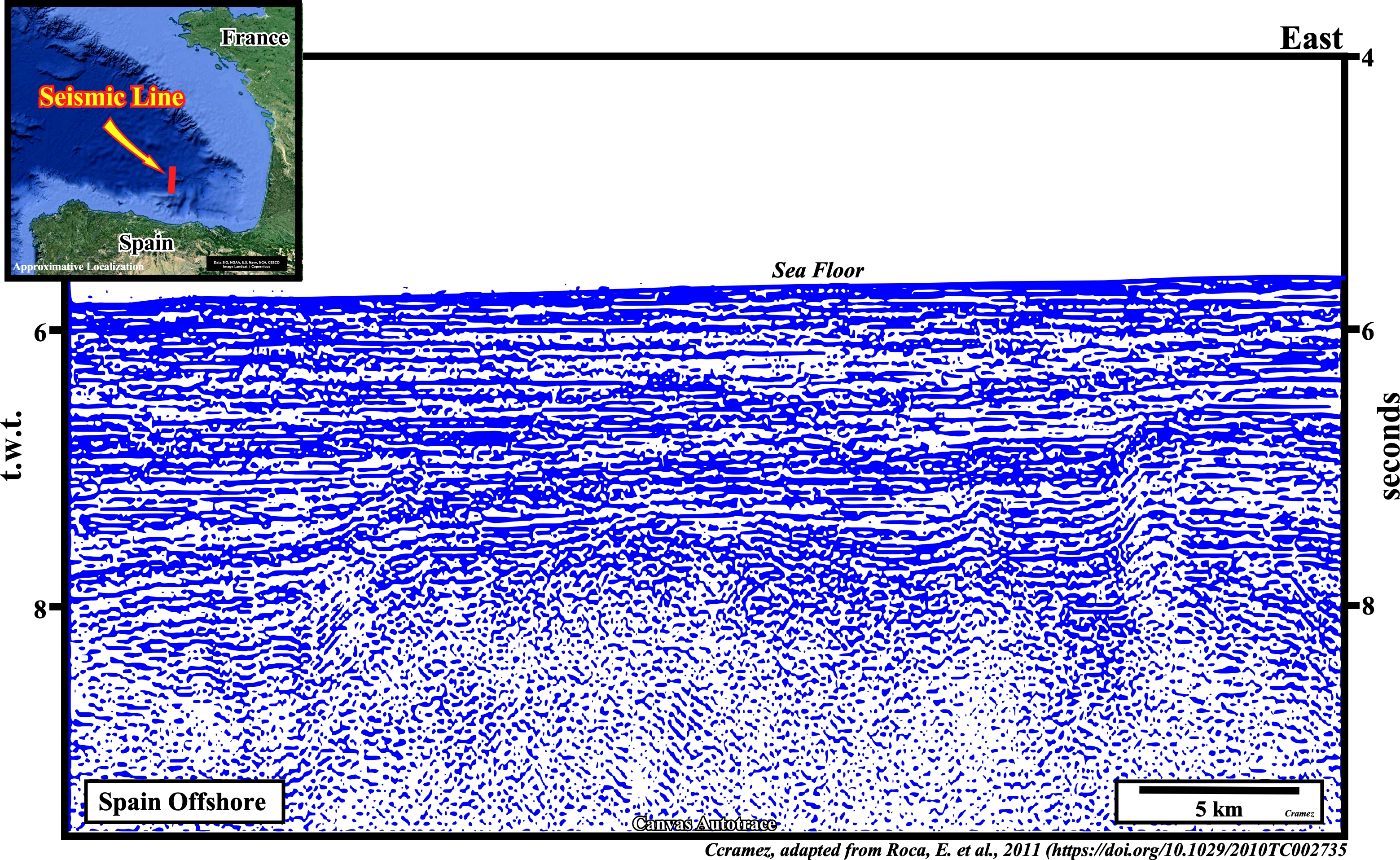
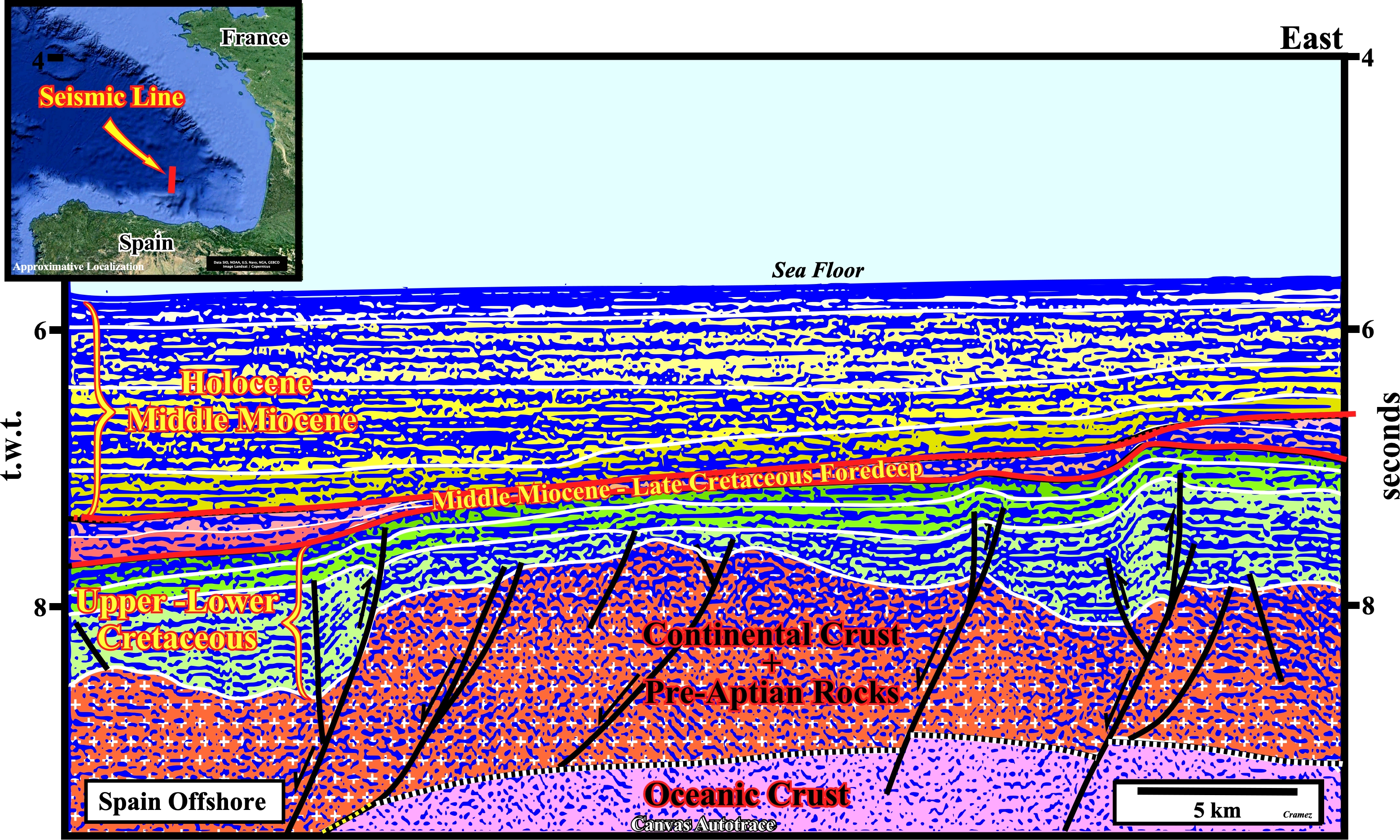
On this tentative interpretation, the onlapping of the foredeep basin sediments (Middle Miocene to Late Cretaceous) is, clearly, visible between the abyssal plain Holocene/Middle Miocene sediments and the Upper-Lower Cretaceous sediments, on the middle left part of the autotrace. The foredeep sediments are bounded by two unconformities (erosional surfaces) highlighted by an onlap (lower unconformity) and a toplap (upper unconformity) seismic surfaces.

![]()
![]()
Send E-mails to carlos.cramez@bluewin.ch with comments and suggestions to improve this atlas.
Copyright © 2001 CCramez
Last update:
2022
![]()