.jpg)
Somalia Offshore
Mogadishu Deep Geographic Basin
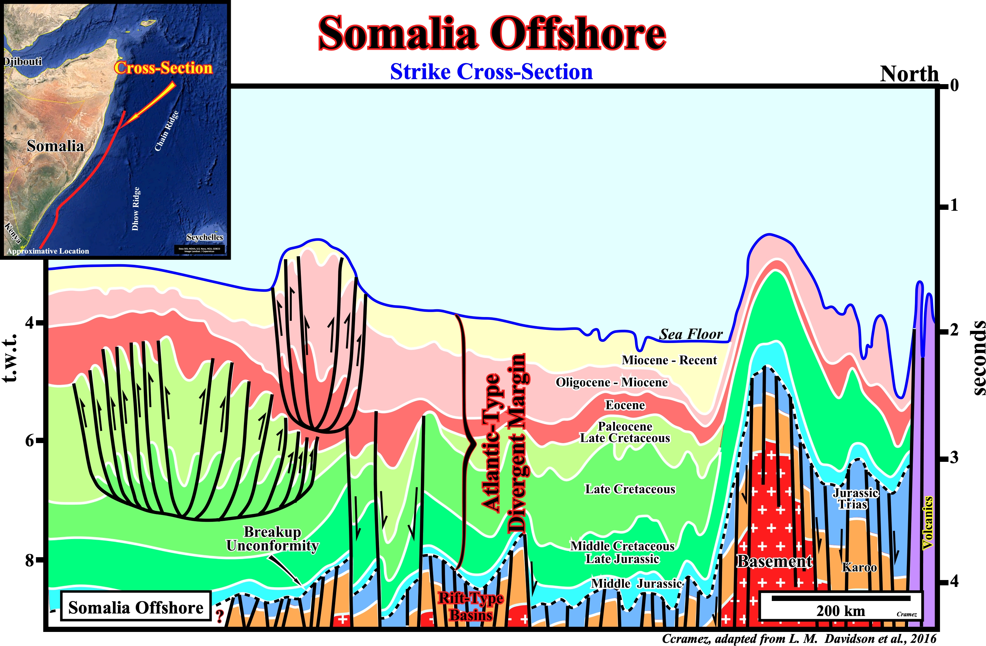
On this time geological cross-section of the Somalia offshore, based on a tentative geological interpretation of a composite strike seismic line, the breakup unconformity, which emphasizes the breakdown of the thinned Gondwana lithosphere, is recognized, quite well, by the abrupt change in the subsidence mechanism: differential subsidence, during the formation of the rift-type basins, which age ranges from Permo-Trias to Early Jurassic and thermal subsidence, during the overlying Atlantic -type divergent margin. Two complex set of listric faults (gravity collapse up-dip and local compressional folded belt down-dip) at different levels are also, easily, recognized on the southern part of the cross-section. The lower level folded belt is know as Kismaayo folded-belt and the upper one as Baraawe folded-belt (see also Page 41 of Kenya offshore). A basement structural high is, also recognized easily, in the northern part of the cross-section. These geological features allow geoscientists two subdivide this offshore int three sectors: (i) Jubba Deep in southern part ; (ii) Middle Mogadishu Deep in the central part and (iii) Middle Somalia high in the northern area. A rifted controlled Karoo (non-marine sediments mainly shales, red beds, silt-stones and great quantities of volcanics, appearing to record a gradual climatic shift toward ever-increasing aridity (www.britannica.com/place/Karoo-System) and Early Jurassic rift-type basins developed during the rifting (lengthening) of the Gondwana small supercontinent that seem to begin in Late Carboniferous and continued until Early Jurassic. The breakup of the Gondwana lithosphere induced the separation of East Antarctica from East India and a coeval development of an oblique rift valley between Somalia and the Madagascar- Seychelles-India, which western sector is illustrated by the next Canvas autotrace.


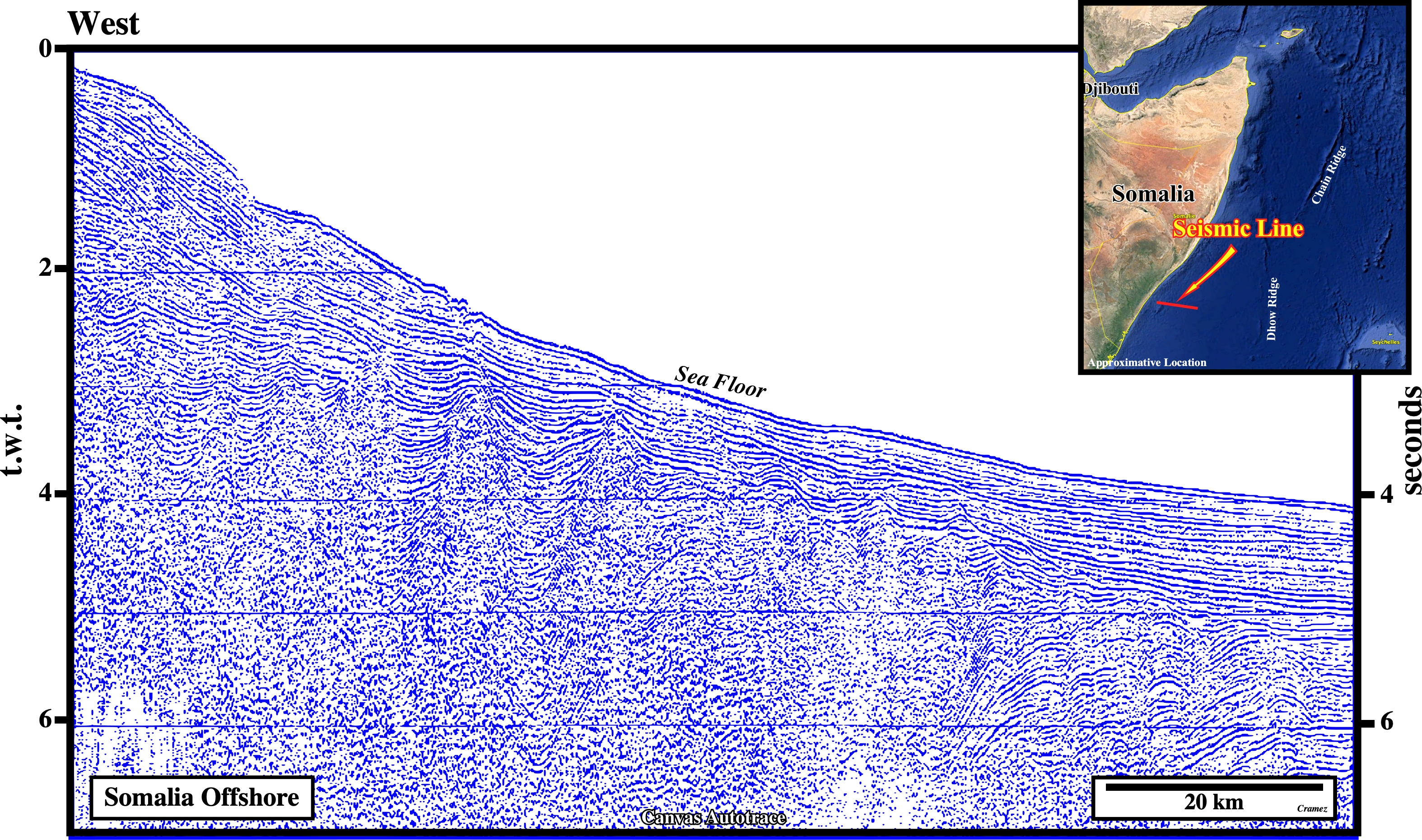
On this Canvas autotrace of a Somalia offshore seismic line, located, slightly, northward of the one illustrated on Page 67, the upper gravitational folded-belt starts to be recognized, however it is much better developed in other seismic lines as illustrate on the next Canvas autotrace and on Page 41 (Kenya offshore). The interesting geological features depicted on this tentative interpretation are that certain Jurassic-Trias rifting faults were reactivated, in extension, during the Middle-Late Cretaceous (eastern part of the autotrace) and others were reactivated as reverse faults, as the fault located on the lower left corner of the autotrace. In fact, such a fault suggests a Late Cretaceous - Tertiary compressional tectonic regime (σ1 horizontal and σ3 vertical), which shortened and uplift the sediments. Probably, it was the sedimentary uplift of the upper slope sediments that induced the down-dip gravitational movement of the sediments that created, in the deep part of the basin, a lower folded-belt (Kismaayo folded-belt). As locally, the sedimentary uplift seems to continue till the late Tertiary, an upper folded-belt (Baraawe folded-belt) was formed to balance the up-dip gravitational extension induced by the late sedimentary uplift.
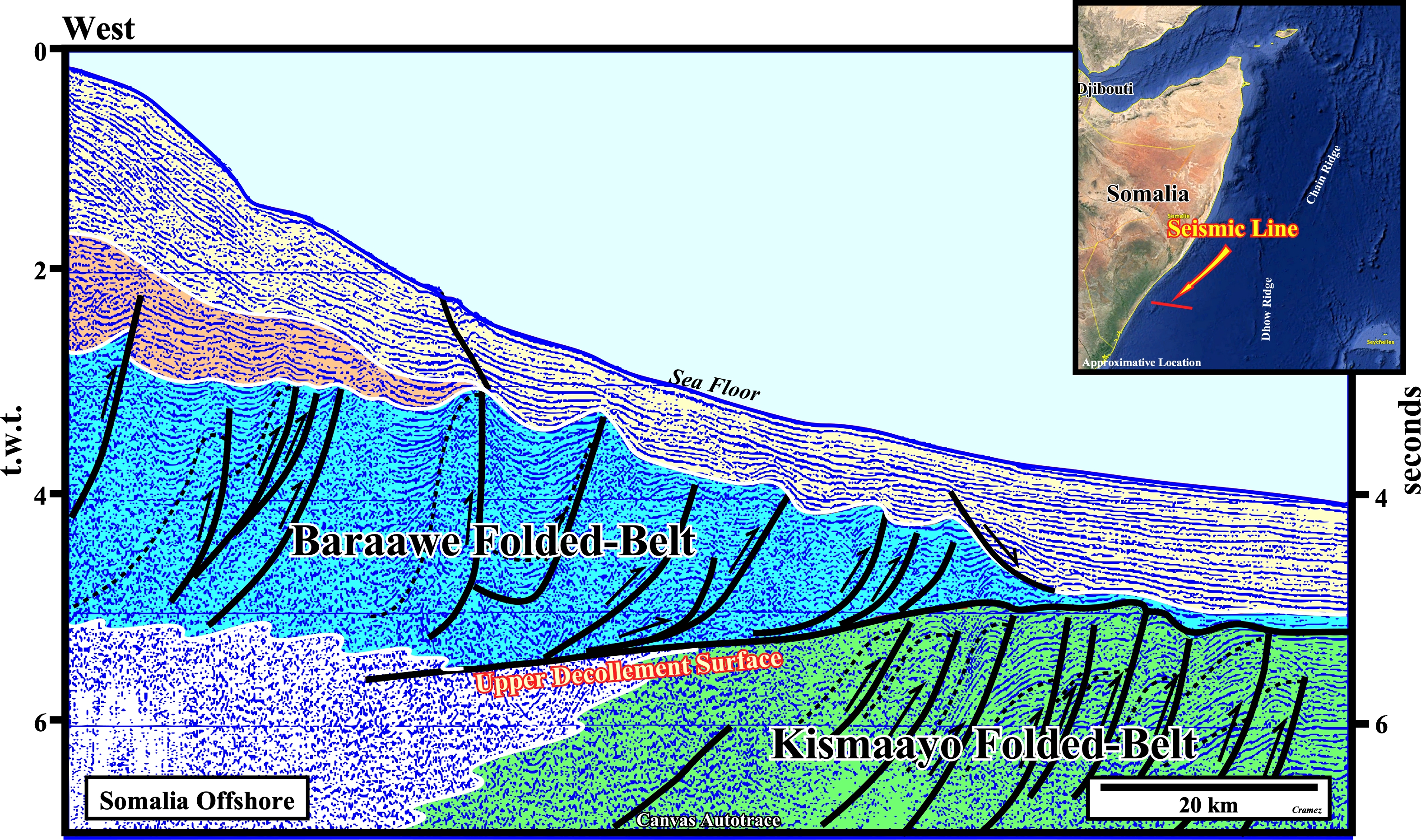
The two gravitational fold belts well visible on this Canvas autotraces. The upper decollementt plane, well recognized, is the lower limit of the the Baraawe folded-belt. The lower decollement plane is not visible on this autotrace by its predicatively is quit simple, in other words the base of the Kismaayo folded-belt is not visible. Notice than in both folded-belts just the distal sectors, i.e the compressional sectors (shortening) are visible. The central (translation plus diapirism) and proximal (lengthening) sectors lie westward of the autotrace.
![]()
![]()
Send E-mails to carlos.cramez@bluewin.ch with comments and suggestions to improve this atlas.
Copyright © 2001 CCramez
Last update:
2022
![]()