

Rocks that solidified from molten or partly molten material, that is to say, from a magma.
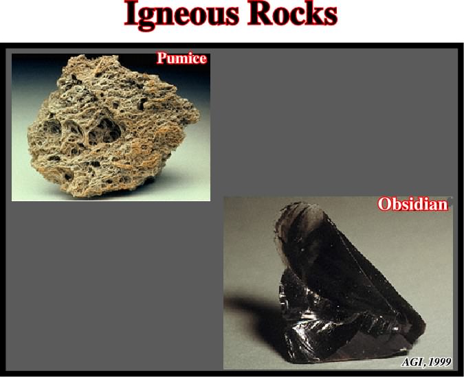
Igneous rocks constituting one of the three main classes into which rocks are divided, the others being metamorphic and sedimentary.
Inclined Simple Shear Restorations
One of the two restoration methods. Indeed, there are two available methods in restoration programs: (i) inclined simple shear and (ii) flexural slip. The former is used in extensional fault restorations that do not retain constant bed lengths. The second is used in contractional thrust belts so that constant bed lengths are retained in constant-area deformations. Thus shear and flexural slip methods are used in salt restorations, shear where the style is dominated by extension and salt withdrawal and the flexural slip where contraction is dominant.
A downward-facing antiformal syncline surrounded by a skirt. It is a type of crescentic fold.
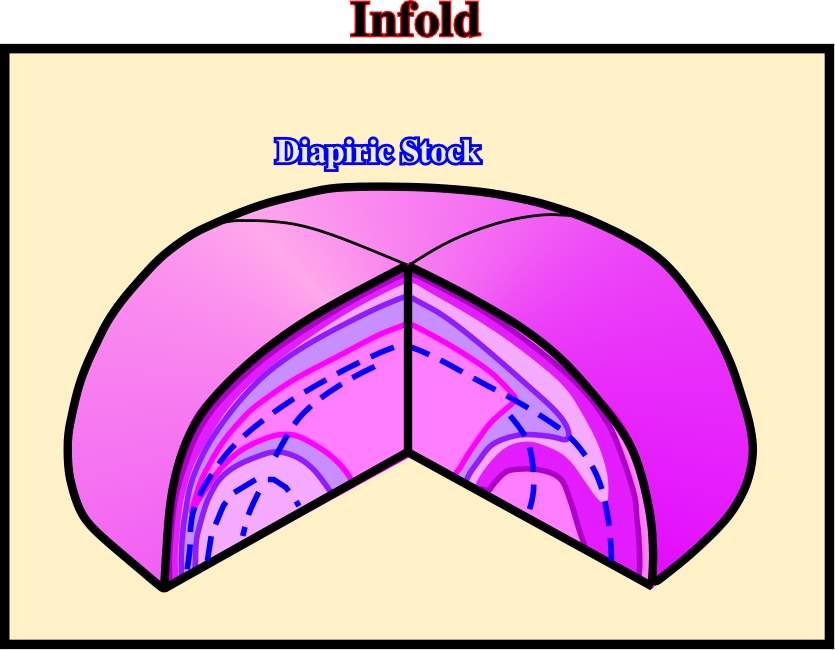
Infolds have been recognized mainly in Kavir desert (Iran) and in few salt diapiric outcropping in North Africa.
Infrastructure (in Salt Tectonics)
The sub-salt strata overlying the basement.
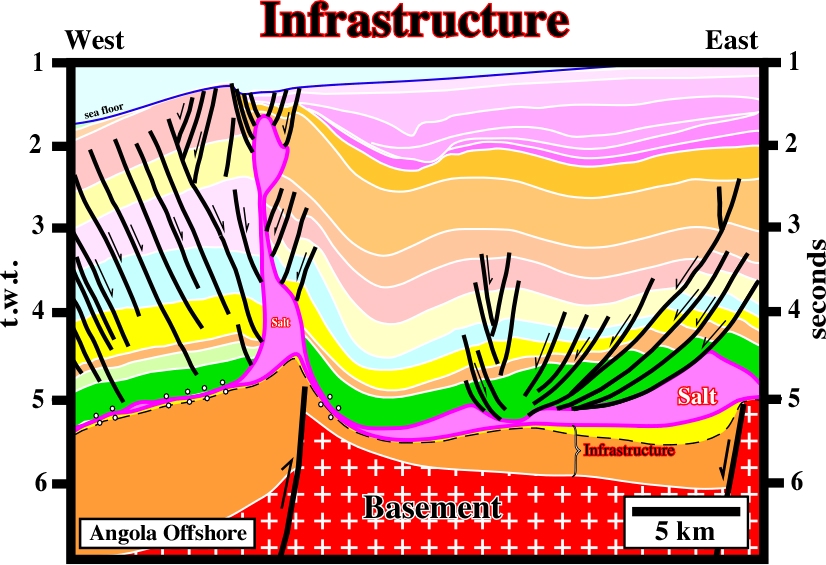
On this seismic, one can say the infrastructure is limited between the salt and the basement. The infrastructure is here composed by rift-type basin sediments and the basal sediments of the margin. A major unconformity occurs within the infrastructure, that is to say, the breakup unconformity.
Folding when the beds have different strength. Stille (1925) considered two kind of folding: (i) harmonious, when the beds have a similar strength and (ii) inharmonious when the beds have different strength, particularly one an high mobile layer is interbedded. The different geometries of both foldings are illustrated below.
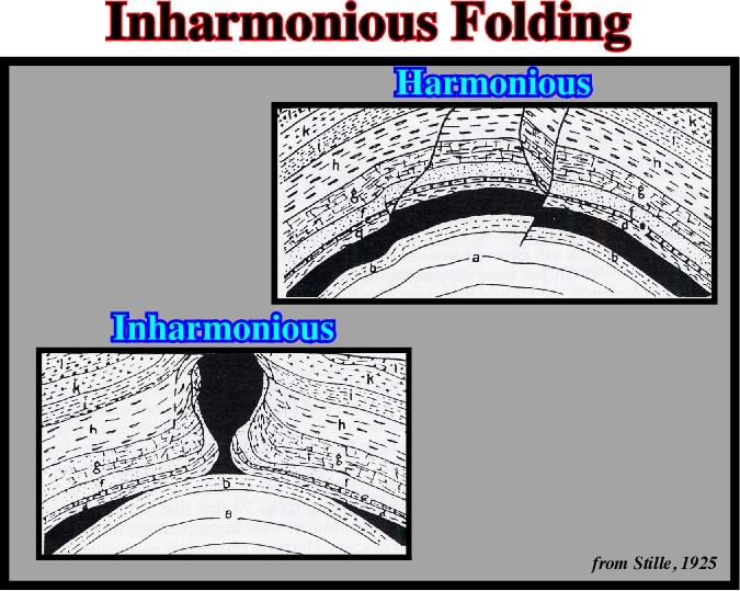
As depicted, Stille was one of the first geologists to recognize the harmonious and disharmonious folding as well as the existence of diapiric stems, verticalled pinch-off diapirs and lateral pinched-off source layers.
The lateral downdip movement versus time. Salt laccoliths and salt sills are emplaced as thin sheets between strata a few meters, or less, below surface sediments. Each basal cutoff marks the advancing position of the leading edge of the spreading salt tongue at successive stratigraphic times.
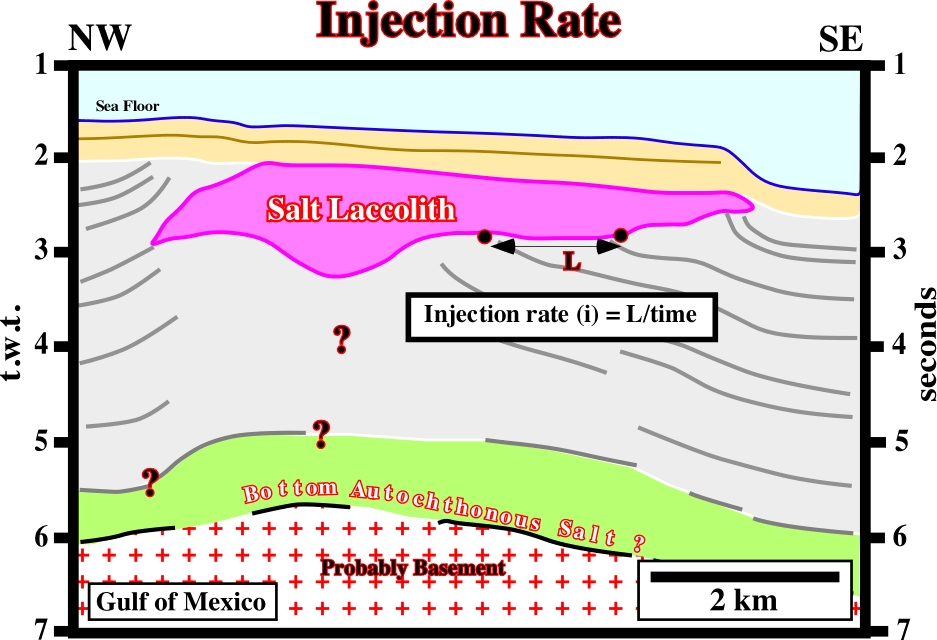
The injection rate, i.e., spreading versus time, is easily assessed when basal cutoffs are recognized on seismic lines interpreted in terms of sequence stratigraphy.
Structure in which skirts are contained entirely within the diapir and thus surround antiformal, infolded synclines of evaporites.
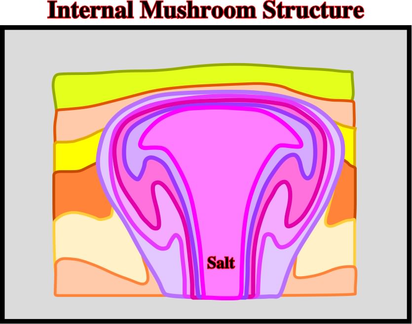
This kind of diapiric structure was mainly recognized on the ground in the Kavir Desert. Presently, seismic acquisition and seismic reprocessing do not allow, in the majority of the cases, to recognize on the seismic line such a salt structure.
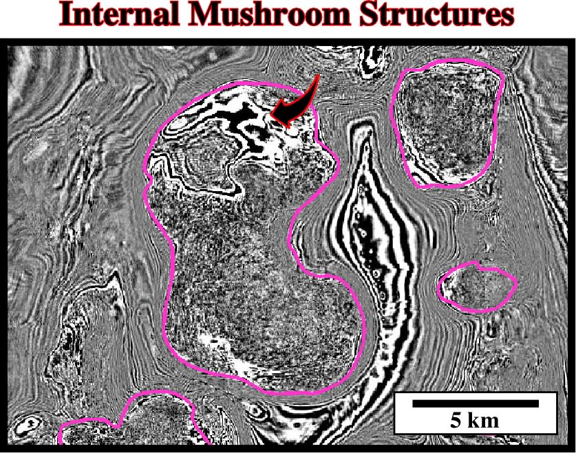
Time slices, performed in quite new data, allow, often, to recognize, in certain salt structures, potential internal mushroom structures, as those illustrated on this line.
Synonym of salt expulsion basin or mini-basin.
Zone within a diapir comprising only sheared evaporites. It contrasts with a boundary shear zone, which contains screens or clast trains of country rock.
Synonym of active piercement or upbuilding.
Depth point emphasizing a density inversion between salt and sediments. Below the inversion point, the density of the sediments is higher than the density of the salt. On the contrary, above the inversion point, the density of the salt is higher than the density of the sediments.
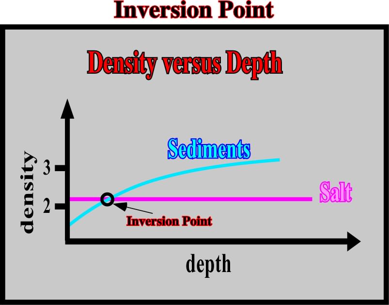
The assessment of the inversion point is quite important. At higher depths, the sediments being denser than the salt, the salt has a tendency to flow upward. Contrariwise, above the inversion point, the salt being denser than the sediments, the salt flows laterally. The pressure than the salt exert against the sediments is not balanced by the sediments.
An imaginary line on a land surface or geological map along which all points are at the same vertical distance above or below sea level, or a line in a map or chart connecting points with the same depth.
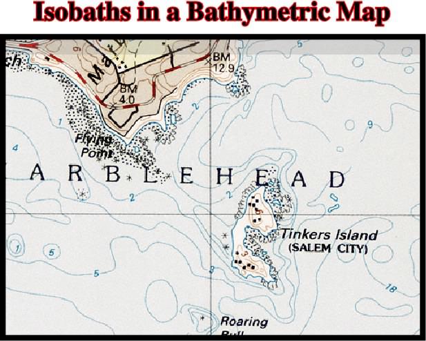
In salt tectonics and particularly in salt basins with allochthonous salt, the morphologic interpretation of bathymetric maps is an useful tool to approach the location and geometry of the salt bodies (see below).
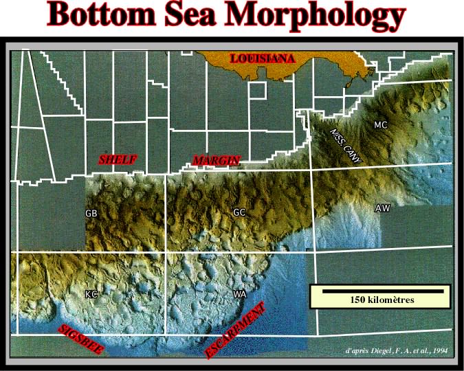
On this artificial illumination of the sea floor of the Gulf of Mexico (NOAA multibeam bathymetric survey), the geometry of the superficial salt structures is easily recognized (vertical exaggeration is 10 x).
Mass transfer of salt over time, resulting in an obvious change in salt area in cross section by unchanged volume flow within the plane of section but beyond the ends of the cross section. Reduction culminates in formation of salt welds or fault welds.
Isometric System (McNeill, L. et al., 1999)
One of the six crystal systems, characterized by four threefold axes of symmetry as body diagonals in a cubic unite cell of the lattice. It comprises five crystal classes or point groups: (i) hexagonal system, (ii) tetragonal system, (iii) orthorhombic system, (iv) monoclinic system and (v) triclinic system. It is synonym of cubic system.
Synonym of Prekinematic layer.
A medium whose properties are the same in all directions.